


Hochheim am Main, Germany
Hochheim am Main is a town of 17,027 people in Hesse, Germany.
Why visit Hochheim am Main
Townapedia lists 55 museums and landmarks, 42 parks and trails, 176 places to eat, 15 places to stay and 11 attractions in and around town.
Highlights include Eisenbaum, Hofladen Fam. Bersch/Mähn, Hochheimer Kunstsammlung and Mausoleum der Opel Familie.
Weather in Hochheim am Main
Forecast from MET Norway (CC BY 4.0). Full forecast
About Hochheim am Main
Hochheim am Main (German pronunciation: [ˈhoːxhaɪm ʔam ˈmaɪn] , lit. 'Hochheim on the Main'; Old English: Hockamore) is a town in the Main-Taunus district of the German state of Hesse. It is located near the right bank of the river Main three miles above its confluence with the Rhine, as well as on the German Timber-Frame Road.
From the Wikipedia article Hochheim am Main (this version), under CC BY-SA 4.0.
Things to do11


Hofladen Fam. Bersch/Mähn
Farm and orchard · 4.1 km
44, Bischofsheim
Mo,Tu,Th,Fr 09:00-12:00,16:00-18:00; We,Sa 09:00-12:00; Su,PH off


Theodor Heuss Bridge
Bridge · 5.4 km
Bridge between Mainz and Wiesbaden


Museums and landmarks55

Hochheimer Kunstsammlung
Museum · 0.6 km
Kunst des 20. Jahrhunderts
23 Mainzer Straße, Hochheim am Main
We,Su 15:00-17:00; Fr 17:00-19:00

Mausoleum der Opel Familie
Monument and historic site · 4.1 km
71 Mainzer Straße, Rüsselsheim am Main

Castellum Mattiacorum
Monument and historic site · 5.0 km
Archaeological site in Mainz-Kastel, Germany

Drususstein
Monument and historic site · 6.1 km
An ancient marble building in Germany

Gutenberg memorial
Monument and historic site · 6.0 km
Memorial in Mainz, Germany


Martinsburg
Monument and historic site · 5.9 km
Fortress which was demolished in 1809

Mogontiacum
Monument and historic site · 6.0 km
The Roman fort at the present location of the German city of Mainz
Museum im Alten Rathaus Bischofsheim
Museum · 2.8 km
2 Darmstädter Straße, Bischofsheim
Oct-Apr Su[1] 14:00-18:00; Oct-Apr Su[2,4] 14:00-18:00 "mit...
43 more on the map.
Parks, trails and playgrounds42





30 more on the map.
Restaurants and cafes176

Weingut Preis
Restaurant · Regional
Telefon Gutsausschank: 06146-9674
17 Rathausstraße, Hochheim am Main
We,Th,Fr,Sa 17:00+; PH,Su 12:00+; Mo,Tu off
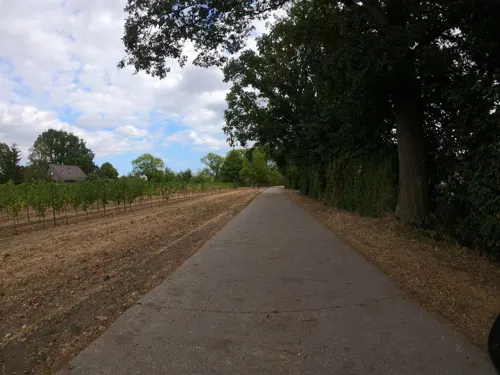
Weingut Schreiber
Brewery and winery · 1.6 km
Familienbetrieb, Ausschank, Weinproben
2 Johanneshof, Hochheim am Main
Tu-Fr 10:00-19:00; Sa 10:00-16:00
China Restaurant Mayflower
Restaurant · Chinese · 3.8 km
8 Uthmannstraße, Wiesbaden
PH,Tu-Su 11:30-15:00,17:30-23:00; Mo off
Das Mangold
Restaurant · Regional, German · 3.4 km
1 A Im Attich, Bischofsheim
Mo off; Tu-Fr 11:30-14:30, 17:00-22:00; Sa 17:00-22:00; Su 12:00-20:00
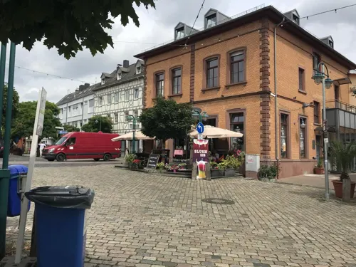
Eis & More
Cafe · Ice Cream
2 Kirchstraße, Hochheim am Main
Mo 12:00-20:00; Tu-Th 10:30-20:00; Fr 10:30-21:00; Sa 09:00-21:00;...
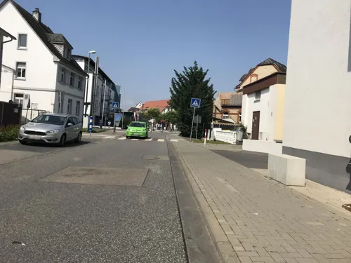

Flörsheimer Warte
Bar and pub · 3.7 km
An der Warte, Flörsheim am Main
Apr-Sep: Tu-Fr 14:00+; Sa-Su 12:00+; Oct-Mar: Fr 14:00+; Sa-Su 12:00+
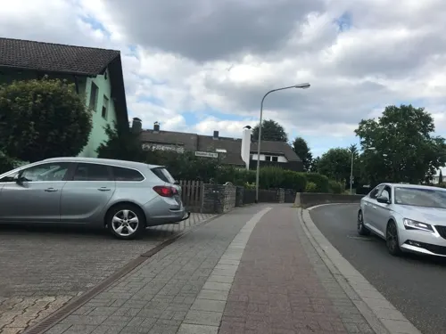
Gutsschänke Pfaff "Zum Kamin"
Restaurant · German · 0.6 km
13 Dresdener Ring, Hochheim am Main
Fr,Sa 17:00+; PH,Su 16:00+
Gutsschänke Scherbaum
Restaurant · German · 2.9 km
28 Heßlerweg, Wiesbaden
Th 17:00-21:00; Fr 17:00-22:00; Sa 16:00-22:00; Su 12:00-21:00; Mo-We off
Göllner's Kulinarium
Restaurant · Regional, Mediterranean, Mittagstisch · 2.9 km
2 Rheinstraße, Bischofsheim
We,Th 12:00-14:00, 17:00-21:30; Fr,Sa 12:00-14:00, 17:00-22:00; Su...


La Grotta
Restaurant · Italian
2 Am Plan, Hochheim am Main
Mo off; Tu-Fr,Su 11:30-14:30,17:30-22:00; Sa 18:00-22:00
164 more on the map.
History
There is a historical reference to Hochheim in the chronicles as early as the 7th century. Hochheim is the site of an Austrian military victory over the French Empire on 7 November 1813.
From the History section of Hochheim am Main on Wikipedia, under CC BY-SA 4.0.
Where to stay15
Churches and places of worship36
Sankt Katharina
Church · Roman Catholic · 4.1 km
5 Kirchstraße, Flörsheim am Main
Evangelische Kirche
Church · Lutheran · 2.8 km
3 Darmstädter Straße, Bischofsheim
Evangelische Kirchengemeinde
Church · Protestant · 3.0 km
65 Darmstädter Landstraße, Ginsheim-Gustavsburg
Shopping32
Gas and EV charging16
Schools, colleges and libraries18
Healthcare15
Sonnenapotheke
Clinic and pharmacy · 2.9 km
72 Darmstädter Landstraße, Ginsheim-Gustavsburg
Map of Hochheim am Main
250 places. The map loads OpenStreetMap tiles when you open it.
Getting there and nearby towns
Wiesbaden Army Airfield (WIE) is the nearest airport with scheduled flights listed in OpenStreetMap, 4 km away.
- Bischofsheim 3 km southeast, about 3 min by car
- Ginsheim-Gustavsburg 5 km south, about 5 min by car
- Rüsselsheim am Main 6 km southeast, about 6 min by car
- Mainz 6 km southwest, about 6 min by car
- Raunheim 7 km east, about 7 min by car
- Königstädten 9 km southeast, about 9 min by car
- Wiesbaden 11 km northwest, about 11 min by car
- Hofheim am Taunus 11 km northeast, about 11 min by car
- Trebur 11 km south, about 11 min by car
- Nauheim 11 km southeast, about 11 min by car
Drive times are estimates from straight-line distance, not routes.
Local news
Headlines from INDB.
Reviews, tips and questions
Loading what members have shared...
Sources and licences
- GeoNames (CC BY 4.0): population, coordinates, regions and time zone
- Mapillary (see each image): photos
- OpenStreetMap contributors (ODbL 1.0): places, airports, map data
- Wikidata (CC0 1.0): elevation, founding date, time zone, website, landmarks and historic places
- Wikimedia Commons (see each image): photos
- Wikipedia (CC BY-SA 4.0): overview and history text
Photo credits
- HochheimSilhouetteSO, Brühl, Public domain
- Stolpersteinlage, 2, Blumengasse 2, Hochheim am Main, Main-Taunus-Kreis, GeorgDerReisende, CC BY-SA 4.0
- Stolperstein Salomon Frohwein, 1, Blumengasse 2, Hochheim am Main, Main-Taunus-Kreis, GeorgDerReisende, CC BY-SA 4.0
- Stolperstein Alice Frohwein, 1, Blumengasse 2, Hochheim am Main, Main-Taunus-Kreis, GeorgDerReisende, CC BY-SA 4.0
- Stolpersteinlage, 1, Blumengasse 2, Hochheim am Main, Main-Taunus-Kreis, GeorgDerReisende, CC BY-SA 4.0
- Stolperstein Lea Frohwein, 1, Blumengasse 2, Hochheim am Main, Main-Taunus-Kreis, GeorgDerReisende, CC BY-SA 4.0
- Stolperstein Ludwig Frohwein, 1, Blumengasse 2, Hochheim am Main, Main-Taunus-Kreis, GeorgDerReisende, CC BY-SA 4.0
- Stolperstein Arnold Frohwein, 1, Blumengasse 2, Hochheim am Main, Main-Taunus-Kreis, GeorgDerReisende, CC BY-SA 4.0
- Blumengasse 2, 1, Hochheim am Main, Main-Taunus-Kreis, GeorgDerReisende, CC BY-SA 4.0
- Hochheim am Main, the Kirchstraße, Dguendel, CC BY 3.0
- Madonnenfigur, Hochheim am Main, January 2023, Mathieu Chollet - MChollet, CC BY-SA 4.0
- Hochheim am Main, half-timbered houses on the Kirchstraße, Dguendel, CC BY 3.0
- Hochheim am Main - Breslauer Ring L3028 - geo.hlipp.de - 27430, Lewis Clarke on geo.hlipp.de, CC BY-SA 2.0
- Hochheim am Main - Breslauer Ring L3028 - geo.hlipp.de - 27429, Lewis Clarke on geo.hlipp.de, CC BY-SA 2.0
- Kaiserbruecke Mainz01, User:Kandschwar, CC BY-SA 3.0
- Suedbruecke Mainz, Felix.matheis, Public domain
- Mainz-Theodor-Heuss-Bruecke-2005-05-16a, Unknown author, CC BY-SA 3.0
- Drususstein Gesamt 2011, Martin Bahmann, CC BY-SA 3.0
- Gutenberg monument, Vitold Muratov, CC BY-SA 3.0
- Gutenberg-Museum Mainz 585-vh, Pedelecs, CC BY-SA 3.0
- LandesmuseumMainzRoss, User:Kandschwar, CC BY-SA 3.0
- Martinsburg Mainz, Matthaeus Merian, Public domain
- Mainz St. Quintin BW 2012-08-18 11-49-27, Berthold Werner, CC BY-SA 3.0
- Cathedral (Mainz) 2, Michiel1972, CC BY-SA 3.0
- Mainz Luftbild Christuskirche zu Mainz auf der Kaiserstraße Foto 2008 Wolfgang Pehlemann Wiesbaden IMG 0077, Wolfgang Pehlemann Wiesbaden Germany, CC BY-SA 3.0 de
- Kirche in Hochheim am Main, Peter, CC BY 2.0
- Burg Lichtspiele, Joho345, CC BY-SA 4.0
- Bürgerpark Gustavsburg, Joho345, CC BY-SA 3.0
- Opel-mausoleum-2010-ruesselsheim-091, Dontworry, CC BY-SA 3.0
- Bait ul-Ghafur (Ginsheim), Ceddyfresse, Public domain
- FlörsheimWiesnmühleStAnnaKapelle, Brühl, Public domain
- FlörsheimWickerKathKircheS, Brühl, Public domain
- NSG Hochheimer Mainufer1, BBjoern78, CC BY-SA 4.0
- Massenheimer Kiesgruben03, Middla23, CC BY-SA 3.0
- NSG Wickerbachaue von Flörsheim und Hochheim2, BBjoern78, CC BY-SA 4.0
- Flörsheimer Warte, Brühl, Public domain
- Eisenbaum 2, Muck, CC BY-SA 4.0
- Bischofsheim evangelische Kirche 20110505, Rudolf Stricker, Attribution
- Basketballbereich der HvB aus Hochheim, Marvin26757, CC BY-SA 4.0
- Gustavsburg evangelische Kirche 20110519, Rudolf Stricker, Attribution
- Gustavsburg katholische Herz-.Jesu-Kirche 20110519, Rudolf Stricker, Attribution
- Mogontiacum Plan, Martin Bahmann, CC BY-SA 3.0
- 45847 Hochheim - Burgeffstraße 5 ev Pfarrkirche a, Oliver Abels ( SBT ), CC BY-SA 3.0
- Aussichtskanzel Vogelnest 1, Muck, CC BY-SA 4.0
- Street-level photo, tmka, CC BY-SA 4.0
- Street-level photo, miguel_andrade, CC BY-SA 4.0
- Street-level photo, miguel_andrade, CC BY-SA 4.0
- Street-level photo, miguel_andrade, CC BY-SA 4.0
- Street-level photo, miguel_andrade, CC BY-SA 4.0
- Street-level photo, miguel_andrade, CC BY-SA 4.0
- Street-level photo, miguel_andrade, CC BY-SA 4.0
- Street-level photo, miguel_andrade, CC BY-SA 4.0
- Street-level photo, miguel_andrade, CC BY-SA 4.0
- Street-level photo, miguel_andrade, CC BY-SA 4.0
- Street-level photo, miguel_andrade, CC BY-SA 4.0
- Street-level photo, miguel_andrade, CC BY-SA 4.0
- Street-level photo, miguel_andrade, CC BY-SA 4.0
- Street-level photo, miguel_andrade, CC BY-SA 4.0
- Street-level photo, b166er, CC BY-SA 4.0
- Street-level photo, miguel_andrade, CC BY-SA 4.0
- Street-level photo, miguel_andrade, CC BY-SA 4.0
- Street-level photo, b166er, CC BY-SA 4.0
- Street-level photo, miguel_andrade, CC BY-SA 4.0
- Street-level photo, tmka, CC BY-SA 4.0
- Street-level photo, miguel_andrade, CC BY-SA 4.0
- Street-level photo, miguel_andrade, CC BY-SA 4.0


Page built November 8, 2026. Spotted a mistake? Tell us or suggest a place.