


Hofheim am Taunus, Germany
Hofheim am Taunus is a town of 37,750 people in Hesse, Germany.
Why visit Hofheim am Taunus
Townapedia lists 60 museums and landmarks, 53 parks and trails, 218 places to eat, 14 places to stay and 25 attractions in and around town.
Highlights include Meisterturm, Kapellenberg, Stadtmuseum Hofheim and Wegkreuz.
Weather in Hofheim am Taunus
Forecast from MET Norway (CC BY 4.0). Full forecast
About Hofheim am Taunus
Hofheim am Taunus (German pronunciation: [ˈhoːfhaɪm ʔam ˈtaʊnʊs], lit. 'Hofheim on the Taunus'), commonly known as Hofheim, is the administrative centre of the Main-Taunus-Kreis district, in the south of the German state of Hesse. Its population in September 2020 was 39,946.
From the Wikipedia article Hofheim, Hesse (this version), under CC BY-SA 4.0.
Photos of Hofheim am Taunus


Things to do25



Hofladen der Schlocker-Stiftung
Farm and orchard · 3.3 km
25 Dürerstraße, Hattersheim
Tu-Fr 10:00-18:00


Schule für Clowns, Komik und Comedy
Cinema and theater · 3.6 km
3 Hofheimer Straße, Hofheim am Taunus
Hofladen Mönchhof Obst Theis
Farm and orchard · 2.3 km
Mo-Fr 09:00-13:00,16:00-18:30; Sa 09:00-14:00
Pusteblume
Farm and orchard · 4.6 km
Mo-Fr 08:00-12:00,15:00-18:00; Sa 08:30-13:00
13 more on the map.
Museums and landmarks60

Stadtmuseum Hofheim
Museum
11 Burgstraße, Hofheim am Taunus
Mo off; Tu 11:00-13:00,14:00-17:00; We-Fr 14:00-17:00; Sa-Su 11:00-18:00




Heimatmuseum Kriftel
Museum · 1.3 km
2 Schulstraße, Kriftel
Su[1] 10:00-12:00 || "nach telefonischer Absprache"
Grube Steinberg
Monument and historic site · 4.0 km
Stollen, Zugang mit Erde verfüllt
48 more on the map.
Parks, trails and playgrounds53







Parkbad
Sports field and stadium · 1.2 km
Mo 08:00-20:00; Tu 10:00-20:00, We-Fr 08:00-20:00, Sa 08:00-21:00,...
41 more on the map.
Restaurants and cafes218
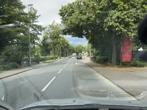
Spice Tandoori
Restaurant · Indian · 3.3 km
Dienstags exklusiv für Gruppen und besondere Anlässe nach vorheriger Reservierung geöffnet.
33 Mainzer Landstraße
Mo, We-Sa 11:30-14:30, 17:00-22:30; Su, PH 12:00-22:30
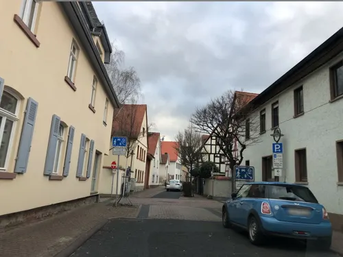
1811 Carmelo Riccardo Cali
Restaurant · Fine Dining, Italian
24 Pfarrgasse
Tu-Sa 12:00-14:00, 18:00-22:00
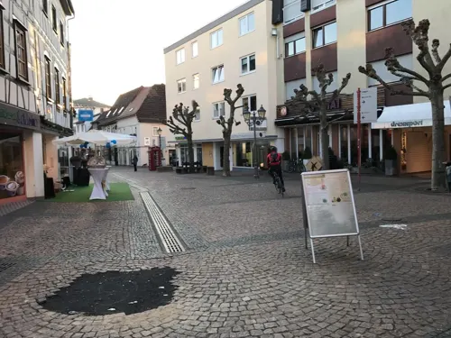
Backhaus Heislitz
Cafe · Coffee Shop · 1.4 km
39-41 Kapellenstraße
Mo-Fr 06:00-19:00; Sa 06:00-18:00; Su 07:00-18:00
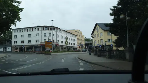
Cafe Paparazzi
Restaurant · Italian, Pizza, Ice Cream · 0.7 km
1 Wilhelmstraße, Hofheim am Taunus
Mo,Tu,Th-Sa 09:30-22:30; Su 10:00-22:30
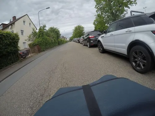
Da Angelo
Restaurant · Italian · 4.1 km
24 Lenzenbergstraße, Frankfurt am Main
Tu-Su 17:00-22:15; Mo,PH off
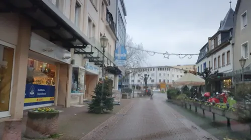
Eiscafé Venezia
Ice cream · Ice Cream
65 Hauptstraße, Hofheim am Taunus
Tu-Sa 09:30-22:30; Su 11:00-22:00

Restaurant Viehweide
Restaurant · International · 2.4 km
Durchgehend warme Küche
1 Viehweide, Hofheim am Taunus
Mo off; Tu-Su,PH 11:00-22:00
Ristorante Luna Bianca
Restaurant · Italian · 2.8 km
Nach Schließung des Restaurantgs La Carafa (alt: Hattersheiner Kanne) Neueröffnung 2021
1a Ladislaus-Winterstein-Ring, Hattersheim
Tu-Su 11:00-22:30
Burkartsmühle - Indian Tandoor House
Restaurant · Indian · 1.2 km
Mit Biergarten
Mo-Fr 11:00-14:30,17:00-22:30; Tu off; Sa,Su 12:00-22:00
206 more on the map.
History
The oldest traces of human life in the area around Hofheim date back to the Palaeolithic period, with the oldest find dating back to around 40,000 B.C. From the Neolithic period from around 5000 B.C. onwards, settlement areas on the banks of the Schwarzbach, on both sides of today's Schmelzweg and on the Kapellenberg have been identified. Especially the Michelsberg culture around 4400 to 3500 B.C. is shown by numerous traces of settlements and finds on the Kapellenberg (Ringwallanlage). Around 30/40 A.D., the area was settled by the Romans, who built the Hofheim fort here as a two-phase complex - first an earth fort and from 75 A.D. under Emperor Vespasian also a stone fort, which existed until 110 A.D. - in order to secure the Wetterau region, to protect the route between Mainz and Nida in today's Frankfurt-Heddernheim, and to protect the Limes triangle, among other things. The fort was built by the Romans as a two-phase complex.
Read more of the history
The first documented mention was in 1254 under the name Hoveheim, but the suffix -heim indicates a much earlier Frankish foundation. Hofheim belonged to Count Philipp VI the Elder of Falkenstein, when Emperor Charles IV granted the town a charter. This document gave the lords of Hofheim the right to build walls, gates and bridges, to erect a gallows, to hold court, to conduct crafts and to hold a market. In the imperial war against Philip the Elder of Falkenstein (Falkenstein Feud), the town was conquered by the Electorate of Mainz in 1366, to which it was subject until 1418. This was followed by the rule of the Counts of Eppstein-Königstein until the extinction of the dynasty in 1535. During this time, the first Jews were recorded in Hofheim. Within the 16th century, the owners changed only twice. From 1535 to 1574 the dominion of Eppstein-Königstein belonged to Count Ludwig von Stolberg, who introduced the Reformation in Hofheim in 1540, and from 1574 to 1581 to Christoph von Stolberg. But already in 1559 Elector and Archbishop Daniel Brendel von Homburg had redeemed an old pledge and thus regained Eppstein and Hofheim. After the death of Christoph von Stolberg, the rest of the county of Königstein also went to the Electorate of Mainz in 1581.
Under the reign of Wolfgang von Dalberg, Archbishop and Elector of Mainz, and his successor Johann Adam von Bicken, the witch trials in the Electorate of Mainz reached their peak in the period from 1588 to 1602 in both the Höchst and Hofheim districts. From the remains of old court records, the Aschaffenburg archive remains, 23 women could be identified who were accused of witchcraft, 15 of them found death at the stake. On 3 November 2010 the town council of Hofheim am Taunus decided to rehabilitate the citizens convicted of witchcraft.
Until the beginning of 1603, Protestantism was still the predominant religion among the inhabitants despite the town's affiliation with the Catholic Electorate of Mainz. It was not until June that year that the Protestant pastor was replaced by a Catholic one. During the Thirty Years' War, Spanish, Bavarian, Swedish and French troops occupied, plundered and devastated the town and its present-day districts. Inhabitants were tortured into revealing the hiding places of cattle, horses and household goods. In addition to famine, epidemics broke out again and again, and in 1635 the plague spread through the region. In Hofheim, the number of men (burghers) dropped from 76 and 13 widows to 27 within four years in 1635 (no subdivision into men and widows). Finally, at the end of the Thirty Years' War in 1648, there were 40 men and 4 widows. Children, women and bystanders were not recorded in counts as a matter of principle. From 1665 on, the plague raged in Mainz and Frankfurt as well as in the region of today's Main-Taunus district.
The following year Hofheim was still free of the plague, and on 3 July 1666 Pastor Gleidener led the inhabitants in a procession to the "Rabberg" (today's Kapellenberg) to take a vow: If the town was spared from the plague, a chapel should be built on this spot in honor of the Blessed Virgin Mary. The chapel was built in 1667 and replaced by a successor building in 1774.
Hoffheim [Hofheim]. a small town; surrounded by walls; located on very fertile soil, a mile from the renowned Höchst; two miles from Franckfurt [Frankfurt]; and also as much from Mäyntz [Mainz]. Has next to the city wall; two small castles; surrounded by good moats, one of which is completely burned; but the other stands vacant. Ten years ago; due to a blacksmith's neglect; the majority of this place was destroyed by fire; as reported on 22 August 1643 from Franckfurt.
With the beginning of the French Revolution in 1789, a 26-year period of peace ended for Hofheim. The population had come to a modest prosperity and had grown to a thousand inhabitants. With the occupation of the city of Mainz by French Revolutionary troops and finally of the city of Frankfurt in 1792, Hofheim residents began years of suffering. Alternating troop marches and quarterings brought looting, famine, and epidemics.
In the Reichsdeputationshauptschluss of 1803, Hofheim fell to the principality of Nassau-Usingen. In 1806, it was united with the principality of Nassau-Weilburg. Together they formed the Duchy of Nassau. In 1866 this was annexed by Prussia and from then on existed as the province of Hesse-Nassau. After Hofheim had long been sidelined in terms of transportation, the town was connected to the railroad network from 1874 to 1877 with the construction of the Main-Lahn Railway between Frankfurt and Limburg. A renewed economic upswing began. Hofheim had also become interesting for Taunus tourists from Frankfurt thanks to the rail connection.
From the History section of Hofheim, Hesse on Wikipedia, under CC BY-SA 4.0.
More about Hofheim am Taunus
Geography
The town is located on the south side of the Taunus hills, 17 km west of Frankfurt and 17 km east of both Wiesbaden and Mainz; Frankfurt Airport is 12 km to the southeast.
Hofheim is located in the Rhine Main Area, one of the fastest-growing regions in Germany in terms of population and also in regard to economic productivity. Unemployment is the second lowest in the state of Hesse and one of the lowest in Germany.
It is mainly surrounded by forest and open country. The highest point of Hofheim is the mountain Judenkopf in the Lorsbach district, with a height of 410 metres. As well as being the administrative centre of the Main-Taunus-Kreis, Hofheim is its economic hub.
Education
There are a number of primary and secondary schools in Hofheim:
Montessori Center Hofheim (private elementary school and private integrated comprehensive school with upper secondary level including the Montessori nest for age groups from 11 months to 3 years)
Gesamtschule Am Rosenberg (cooperative comprehensive school with all-day school)
Friedrich von Bodelschwingh School (school for special education)
Brühlwiesenschule (vocational school; vocational high school, technical college, vocational school)
In addition, the town of Hofheim has an adult education centre, the Volkshochschule Main-Taunus-Kreis; a library; and a museum.
From the Wikipedia article Hofheim, Hesse, under CC BY-SA 4.0.
Notable people from Hofheim am Taunus
 Jürgen HardtGerman politicianPhoto: Sven Teschke, CC BY-SA 3.0 de
 Markolf NiemzGerman physicist and biophysicistPhoto: Pianomark, CC BY-SA 4.0
 Montego MaassenGerman racing driver (born 2007)Photo: Mitchea99, CC0
- Cem KaracaTurkish association football player (born 1976)
- Ruth ZiesakGerman singer
- Antje RehaagGerman rower
- Berthold FaustGerman draughtsman (1935-2016)
- Ivica ŽuljevićCroatian footballer
- Michael HaselGerman conductor and church musician
- Karin SchauppAustralian musician
Born in Hofheim am Taunus, according to Wikidata (CC0). Each name links to its Wikipedia article.
Where to stay14
Churches and places of worship41
Evangelische Kirche Sindlingen
Church · Protestant · 4.9 km
46 Sindlinger Bahnstraße, Frankfurt am Main
Ev. Kirche Lorsbach
Church · Protestant · 3.7 km
8 Kirchstraße, Hofheim am Taunus
Evangelische Kirche
Church · Protestant · 3.8 km
35 Casteller Straße, Diedenbergen
Herz-Jesu-Kirche
Church · Roman Catholic · 3.6 km
11 Brückenstraße, Hofheim am Taunus
Evangelische Pfarrkirche Liederbach
Church · Protestant · 4.5 km
5 Alt Oberliederbach, Liederbach am Taunus
Shopping55
Gas and EV charging26
Aldi West-Höchster Str. 50
EV charging · 3.9 km
50 West-Höchster Straße, Frankfurt am Main
Schools, colleges and libraries37
International School Frankfurt Rhein-Main
School · 3.9 km
33 Straße zur Internationalen Schule, Frankfurt am Main
Healthcare22
Tagesklinik Hofheim und Ärztezentrum
Clinic and pharmacy · 0.8 km
6 Reifenberger Straße, Hofheim am Taunus
Map of Hofheim am Taunus
250 places. The map loads OpenStreetMap tiles when you open it.
Getting there and nearby towns
Frankfurt Airport (FRA) is the nearest airport with scheduled flights listed in OpenStreetMap, 10 km away.
- Kriftel 2 km southeast, about 2 min by car
- Liederbach 5 km northeast, about 5 min by car
- Kelsterbach 7 km southeast, about 7 min by car
- Bad Soden am Taunus 7 km northeast, about 7 min by car
- Eppstein 7 km northwest, about 7 min by car
- Nordenstadt 8 km west, about 8 min by car
- Raunheim 9 km south, about 9 min by car
- Igstadt 9 km west, about 9 min by car
- Schwalbach am Taunus 9 km northeast, about 9 min by car
- Königstein im Taunus 10 km north, about 10 min by car
Drive times are estimates from straight-line distance, not routes.
Towns near Hofheim am Taunus


Keep exploring
Local news
Headlines from INDB.
Reviews, tips and questions
Loading what members have shared...
Sources and licences
- GeoNames (CC BY 4.0): population, coordinates, regions and time zone
- Mapillary (see each image): photos
- OpenStreetMap contributors (ODbL 1.0): places, airports, map data
- Wikidata (CC0 1.0): elevation, founding date, time zone, website, landmarks and historic places
- Wikimedia Commons (see each image): photos
- Wikipedia (CC BY-SA 4.0): overview and history text
Photo credits
- Hofheim Altes Rathaus 20091008, Rudolf Stricker, Attribution
- Hofheim am Taunus - Mauergasse - geo.hlipp.de - 27570, Lewis Clarke on geo.hlipp.de, CC BY-SA 2.0
- Hofheim am Taunus - Car Park - geo.hlipp.de - 27593, Lewis Clarke on geo.hlipp.de, CC BY-SA 2.0
- Hofheim am Taunus - Langasse - geo.hlipp.de - 27572, Lewis Clarke on geo.hlipp.de, CC BY-SA 2.0
- Hattersheim, Kirche, Karsten Ratzke, CC0
- Meisterturm 1a, Muck, CC BY-SA 4.0
- Diedenbergen evangelische Kirche 20110811, Rudolf Stricker, Attribution
- Kapellenberg (Taunus), Muck, CC BY-SA 4.0
- Hofheim, Burgstraße 11, Karsten Ratzke, CC0
- Internationale Schule Frankfurt Rhein-Main, ISF Marketing Department. Uploaded by Zabadab 10:56, 4 October 2006 (UTC), CC BY-SA 3.0
- House of Worship Germany 2007, Michael Paul Gollmer ( Mipago ), CC BY-SA 3.0
- Lorsbach, Kirche Herz Jesu, Karsten Ratzke, CC0
- Hofheim, Main-Taunus-Schule, Karsten Ratzke, CC0
- Hofheim am Taunus De Merian Hassiae, Unknown author, Public domain
- Hofheim, Peter und Paul, Karsten Ratzke, CC0
- Langenhain, Evangelische Kirche, Karsten Ratzke, CC0
- Ev. Kirche Lorsbach IMG 4423, Matthias Spahn, CC BY-SA 3.0
- Marxheim Katholische Kirche 20110811, Rudolf Stricker, Attribution
- Wegkreuz-Kriftel-Frankfurter Strasse, Schuppi, CC BY-SA 3.0
- Feucht und Trockenbiotop, Seefan2012, CC BY-SA 4.0
- Wald unter blauem Himmel, Iman2308, CC BY-SA 4.0
- Montessori-Zentrum Hofheim, Sodentus, CC0
- Evangelische Kirche Sindlingen Süd, S. Kasten, CC BY-SA 3.0
- St. Bonifatius, 2, Marxheim, Hofheim am Taunus, Main-Taunus-Kreis, GeorgDerReisende, CC BY-SA 4.0
- Elisabethenschule Hintereingang, Meister des Holy Getränks, CC0
- Stadtmuseum Hofheim am Taunus, Gesch1406ave, CC BY-SA 4.0
- Regionalpark-Turm 1, Muck, CC BY-SA 4.0
- Hofheim Taunus - TV Hofheim 1860 (1 09.2015), Oliver Abels, CC BY-SA 4.0
- Hofheim Taunus - Hauptstraße 21 (KD.HE 46049 1 09.2015), Oliver Abels, CC BY-SA 4.0
- Hofheim Taunus - Hauptstraße 22 (KD.HE 46050 1 09.2015), Oliver Abels, CC BY-SA 4.0
- Hofheim Taunus - Am Obertor 32 (KD.HE 46023 2 09.2015), Oliver Abels, CC BY-SA 4.0
- Hofheim Taunus - Am Obertor 32 (KD.HE 46023 1 09.2015), Oliver Abels, CC BY-SA 4.0
- Hofheim Taunus - Pfarrgasse 15 (KD.HE 46101 1 09.2015), Oliver Abels, CC BY-SA 4.0
- Hofheim - A House - geo.hlipp.de - 26839, Lewis Clarke on geo.hlipp.de, CC BY-SA 2.0
- Hofheim Taunus - Krankenhaus (1 09.2015), Oliver Abels, CC BY-SA 4.0
- Hofheim Taunus - Pfarrgasse 2 (KD.HE 46097 1 09.2015), Oliver Abels, CC BY-SA 4.0
- Hofheim Taunus - Langgasse 23 (KD.HE 46092 1 09.2015), Oliver Abels, CC BY-SA 4.0
- Hofheim Taunus - Bärengasse 12 Stadtmauerreste (KD.HE 46028 1 09.2015), Oliver Abels, CC BY-SA 4.0
- Hofheim Taunus - Wasserwerk von 1902 (1 09.2015), Oliver Abels, CC BY-SA 4.0
- Hofheim Taunus - Mauergasse 15 (KD.HE 46095 1 09.2015), Oliver Abels, CC BY-SA 4.0
- Street-level photo, robffm, CC BY-SA 4.0
- Street-level photo, b166er, CC BY-SA 4.0
- Street-level photo, b166er, CC BY-SA 4.0
- Street-level photo, chuck, CC BY-SA 4.0
- Street-level photo, miguel_andrade, CC BY-SA 4.0
- Street-level photo, miguel_andrade, CC BY-SA 4.0
- Street-level photo, miguel_andrade, CC BY-SA 4.0
- Street-level photo, teddy73, CC BY-SA 4.0
- Street-level photo, miguel_andrade, CC BY-SA 4.0
- Street-level photo, b166er, CC BY-SA 4.0
- Street-level photo, rb61, CC BY-SA 4.0
- Street-level photo, rb61, CC BY-SA 4.0
- Street-level photo, wegavision, CC BY-SA 4.0
- Street-level photo, Senfkorn, CC BY-SA 4.0
- Street-level photo, mfa, CC BY-SA 4.0
- Street-level photo, miguel_andrade, CC BY-SA 4.0
- Street-level photo, chuck, CC BY-SA 4.0
- Street-level photo, b166er, CC BY-SA 4.0
- Street-level photo, miguel_andrade, CC BY-SA 4.0
- Street-level photo, miguel_andrade, CC BY-SA 4.0


Page built November 9, 2026. Spotted a mistake? Tell us or suggest a place.