


Rüsselsheim am Main, Germany
Rüsselsheim am Main is a town of 59,730 people in Hesse, Germany.
Why visit Rüsselsheim am Main
Townapedia lists 40 museums and landmarks, 52 parks and trails, 230 places to eat, 29 places to stay and 11 attractions in and around town.
Highlights include Eisenbaum, Südbrücke, Stadt- und Industriemuseum and Heimatmuseum.
Weather in Rüsselsheim am Main
Forecast from MET Norway (CC BY 4.0). Full forecast
About Rüsselsheim am Main
Rüsselsheim am Main (German pronunciation: [ˈrʏsl̩sˌhaɪm ʔam ˈmaɪn], lit. 'Rüsselsheim on the Main') is the largest city in the Groß-Gerau district in the Rhein-Main region of Germany. It is one of seven special status cities (implementing several functions that counties normally provide) in Hessen and is located on the Main, between Frankfurt and Mainz, only a few kilometres from its mouth in Mainz. The suburbs of Bauschheim and Königstädten are included in Rüsselsheim. Rüsselsheim has attained international recognition through the presence of the German car company Opel.
From the Wikipedia article Rüsselsheim am Main (this version), under CC BY-SA 4.0.
Travel tips from other travellers: Rüsselsheim am Main on Wikivoyage (CC BY-SA 4.0).
Photos of Rüsselsheim am Main


Things to do11



Hofladen Fam. Bersch/Mähn
Farm and orchard · 3.7 km
44, Bischofsheim
Mo,Tu,Th,Fr 09:00-12:00,16:00-18:00; We,Sa 09:00-12:00; Su,PH off

Heinrich Press Halle
Cinema and theater · 3.1 km
Veranstaltungshalle des TSV Raunheim
53 Mainzer Straße, Raunheim
OSCAR Studi-Kino
Cinema and theater
Studentenkino der Hochschule RheinMain in Raum A038
Während des Semesters meistens jeden zweiten Donnerstag ab 18:00...


Museums and landmarks40

Stadt- und Industriemuseum
Museum · 1.1 km
Ausstellung zur industriellen Entwicklung der Firma Opel und der Stadt Rüsselsheim
4 Hauptmann-Scheuermann-Weg, Rüsselsheim am Main
Tu-Fr 09:00-13:00, 14:00-17:00; Sa,Su 10:00-17:00


Opelvillen
Museum · 1.1 km
Zwei historische Industriellenvillen mit modernem Zwischenbau und Garten
9 Ludwig-Dörfler-Allee, Rüsselsheim am Main
Tu,Th-Su 10:00-18:00; We 10:00-20:00

Mausoleum der Opel Familie
Monument and historic site · 1.6 km
71 Mainzer Straße, Rüsselsheim am Main


Erste Werkstatt Adam Opels
Monument and historic site · 0.8 km
Eine Platte mit weiteren Infoschildern, die in ihren Grundmaßen die erste Werkstatt Adam Opels, dem Firmengründers der Firma Opel zeigt....



28 more on the map.
Parks, trails and playgrounds52



Pinta Beach
Sports field and stadium · 4.6 km
2 Aschaffenburger Straße, Raunheim
Mo-Fr 10:00-20:00; Sa,Su 08:00-20:00
Waldschwimmbad
Sports field and stadium · 2.3 km
Am Waldschwimmbad, Rüsselsheim am Main
May-Sep: Mo-Fr 10:00-20:00; Sa,Su,PH 08:00-20:00


Spielplatz Kohlseestraße
Playground · 3.9 km
Spielplatz mit Meeting Point, Kletterburg, Schaukel, Rutsche für groß und Klein und Picknick Bänke.


40 more on the map.
Restaurants and cafes230
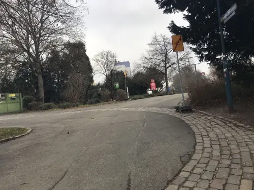
Flörsheimer Bootshaus
Restaurant · German · 2.5 km
1 Dr.-Georg-von-Opel-Anlage, Flörsheim am Main
Su-Fr,PH 11:30+; Sa 14:00+; We off

Flörsheimer Warte
Bar and pub · 3.6 km
An der Warte, Flörsheim am Main
Apr-Sep: Tu-Fr 14:00+; Sa-Su 12:00+; Oct-Mar: Fr 14:00+; Sa-Su 12:00+
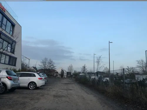
Freeway American Restaurant
Restaurant · Burger, American · 2.4 km
6 Lise-Meitner-Straße, Rüsselsheim am Main
Mo-Th 16:30-00:00, Fr-Sa 16:30-01:00, Su 12:00-23:00
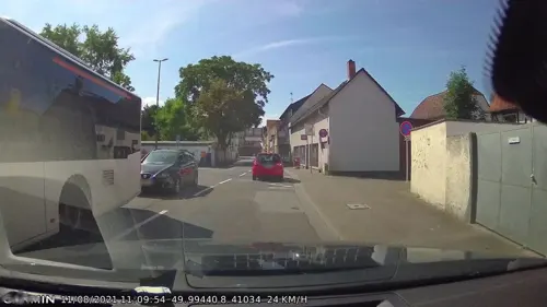
Hacibey Kebap & Baklava
Restaurant · Turkish · 1.1 km
18 Mainzer Straße, Rüsselsheim am Main
Mo-Fr 08:30-22:00; Sa-Su 09:00-22:00
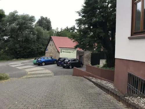
Horlachschänke
Restaurant · Croatian · 1.9 km
66 Hessenring, Rüsselsheim am Main
Tu-Su 11:30-14:30,17:30-24:00

Rüsseler Flames
Restaurant · Indian · 1.7 km
Original indisch-pakistanisches Tandoori Restaurant
10 Stahlstraße, Rüsselsheim am Main
Mo-Fr 11:30-14:30,17:30-22:30; Tu off; Sa,Su 10:00-14:30,18:30-22:30
Das Mangold
Restaurant · Regional, German · 4.4 km
1 A Im Attich, Bischofsheim
Mo off; Tu-Fr 11:30-14:30, 17:00-22:00; Sa 17:00-22:00; Su 12:00-20:00
Delicato
Restaurant · Italian · 1.0 km
5 Marktstraße, Rüsselsheim am Main
Mo-Sa 11:30-14:40,17:30-23:00
Gaststätte Turnerheim
Restaurant · German · 3.1 km
30 Stockstraße, Rüsselsheim am Main
Mo-Fr 18:00-24:00; We off; Su 10:00-20:00
Göllner's Kulinarium
Restaurant · Regional, Mediterranean, Mittagstisch · 4.4 km
2 Rheinstraße, Bischofsheim
We,Th 12:00-14:00, 17:00-21:30; Fr,Sa 12:00-14:00, 17:00-22:00; Su...
Imbiss Golla
Restaurant · German · 3.8 km
10 Kelsterbacher Straße, Raunheim
Mo-Fr 10:00-20:00, Sa 10:00-15:00
218 more on the map.
History
Rüsselsheim's foundation goes back to a Frankish colony in the first half of the 5th century. The first written mention of "Rucilesheim", or "the house of Rucile", is in an inventory of royal hunting rights around the year 840. Rüsselsheim emerged from a settlement of the Count of Katzenelnbogen.
Over time, the name of the city evolved from Rucilesheim to the current Rüsselsheim:
In the year 1435 the high noble Count John IV of Katzenelnbogen was the first to cultivate Riesling in Rüsselsheim. Annual reports record that his administrator bought new vines for 22 Schilling. In the following years riesling grapes were planted down the river Rhine and up the river Mosel. In the 18th and 19th centuries, Rüsselsheim made a new contribution to the history of wine when famous wine-growing estates in the Rheingau recultivated their vineyards with vines from the Rüsselsheim and Flörsheim Area (Allendorf, Rheingauer Weinbauverband EV 1980). After the First World War viticulture disappeared in Rüsselsheim. In 1980 the mayor of Rüsselsheim Dr. Karl-Heinz Storsberg set up a museum-vineyard near the castle which celebrates 550 Years of Riesling.
Read more of the history
The town's population reached 1,422 by 1829, then doubled between 1875 and 1914 from 3,500 to 8,000. At the beginning of the Second World War, 16,000 people lived in Rüsselsheim; only 9,500 remained at the conflict's end. The population reached a new record of 63,000 inhabitants in 1978, with rapid post-war reconstruction fed first by refugees from the former German territories in Eastern Europe (Heimatvertriebene), then by immigrants attracted by the Opel factories. The proportion of people born overseas was 23% on 31 June 2014.
From the History section of Rüsselsheim am Main on Wikipedia, under CC BY-SA 4.0.
More about Rüsselsheim am Main
Economy
The car manufacturer Opel and the ideal transportation location with many motorway connections and direct train connections from Rüsselsheim station to Mainz, Frankfurt am Main, Wiesbaden and Darmstadt have resulted in the establishment of many businesses and the attraction of many commuters in Rüsselsheim.
Above all, Rüsselsheim is known for its car manufacturer Opel. The founder, Adam Opel, began as a trainee mechanic and founded a sewing machine factory. The first cars were built in 1899, after Opel's death, when the company was owned and operated by Opel's widow and their five sons.
The European Centre of the Korean car manufacturer Hyundai was inaugurated in 2003.
The German centre of the outsourcing division of Hewlett-Packard (formerly EDS) was located in Rüsselsheim.
San Jose, CA, USA-based lidar technology company Velodyne Lidar has its European office in Rüsselsheim.
Rüsselsheim am Main is served by Frankfurt Airport which is located 17 km (11 mi) east of the city. The airport is also Germany's busiest airport by passenger traffic and the eleventh-busiest in Europe.
From the Wikipedia article Rüsselsheim am Main, under CC BY-SA 4.0.
Notable people from Rüsselsheim am Main
 Klaus FuchsGerman-born British theoretical physicist and atomic spy (1911-1988)Photo: The National Archives UK, Public domain
 Adam Opelfounder of the German automobile company Adam Opel AG (1837–1895)Photo: Unknown author Unknown author, Public domain
 Wilhelm von OpelGerman industrialist and Nazi party member (1871-1948)Photo: Unknown author Unknown author, Public domain
 Britta Beckerfield hockey playerPhoto: Sven Mandel, CC BY-SA 4.0
 Oliver HartmannGerman singerPhoto: S. Bollmann, CC BY-SA 4.0
 MeroTurkish-German rapper (born 2000)Photo: CLUB SUMMER GARDEN Alanya, CC BY 3.0
- Carl von OpelGerman entrepreneur (1869–1927)Photo: Unknown author Unknown author, Public domain
- Carlos MarínSpanish singer (1968-2021)
- Fritz von OpelGerman engineer (1899–1971)
- Norbert BlümGerman politician and minister, CDU (1935–2020)
- Andrea YpsilantiGerman politician
- Peter Krausfield hockey player (1941–2024)
Born in Rüsselsheim am Main, according to Wikidata (CC0). Each name links to its Wikipedia article.
Where to stay29
DORMERO Hotel Rüsselsheim Airport-Frankfurt
Motel and hotel · 1.3 km
54 Eisenstraße, Rüsselsheim am Main
Churches and places of worship44
Sankt Katharina
Church · Roman Catholic · 4.5 km
5 Kirchstraße, Flörsheim am Main
Dreifaltigkeitskirche
Church · Catholic · 2.5 km
3 An der Wied, Rüsselsheim am Main
Shopping60
Gas and EV charging27
Schools, colleges and libraries40
Healthcare28
Michaelis Apotheke
Clinic and pharmacy · 1.6 km
18 Feuerbachstraße, Rüsselsheim am Main
Map of Rüsselsheim am Main
250 places. The map loads OpenStreetMap tiles when you open it.
Getting there and nearby towns
Wiesbaden Army Airfield (WIE) is the nearest airport with scheduled flights listed in OpenStreetMap, 10 km away.
- Raunheim 3 km northeast, about 3 min by car
- Königstädten 4 km southeast, about 4 min by car
- Bischofsheim 4 km west, about 4 min by car
- Nauheim 5 km southeast, about 5 min by car
- Hochheim am Main 6 km northwest, about 6 min by car
- Ginsheim-Gustavsburg 6 km west, about 6 min by car
- Trebur 7 km south, about 7 min by car
- Groß-Gerau 9 km southeast, about 9 min by car
- Mainz 10 km west, about 10 min by car
- Bodenheim 9 km southwest, about 9 min by car
Drive times are estimates from straight-line distance, not routes.
Towns near Rüsselsheim am Main


Keep exploring
Local news
Headlines from INDB.
Reviews, tips and questions
Loading what members have shared...
Sources and licences
- GeoNames (CC BY 4.0): population, coordinates, regions and time zone
- Mapillary (see each image): photos
- OpenStreetMap contributors (ODbL 1.0): places, airports, map data
- Wikidata (CC0 1.0): elevation, founding date, time zone, website, landmarks and historic places
- Wikimedia Commons (see each image): photos
- Wikipedia (CC BY-SA 4.0): overview and history text
Photo credits
- Ruesselsheim Luftbild, Toksave, CC BY-SA 3.0
- Bahnhof Rüsselsheim, 3, Rüsselsheim am Main, Landkreis Groß-Gerau, GeorgDerReisende, CC BY-SA 4.0
- Bahnhof Rüsselsheim, 2, Rüsselsheim am Main, Landkreis Groß-Gerau, GeorgDerReisende, CC BY-SA 4.0
- Bahnhof Rüsselsheim, 1, Rüsselsheim am Main, Landkreis Groß-Gerau, GeorgDerReisende, CC BY-SA 4.0
- Christmas ornament, Rüsselsheim am Main (P1070806), Matti Blume, CC BY-SA 4.0
- Bus station, Rüsselsheim am Main ( 1070817), Matti Blume, CC BY-SA 4.0
- Dr. Fritz Opel (Rüsselsheim am Main), Niklas Fitzek, CC BY-SA 4.0
- Pyramideneiche, Rüsselsheim am Main, Niklas Fitzek, CC BY-SA 4.0
- Erste Werkstatt Adam Opels, Rüsselsheim am Main (2), Niklas Fitzek, CC BY-SA 4.0
- Wohnhaus Ferdinand Stuttmann, Rüsselsheim am Main, Niklas Fitzek, CC BY-SA 4.0
- Eiche im Hinterhof der Altentagesstätte, Rüsselsheim am Main, Niklas Fitzek, CC BY-SA 4.0
- 2017-06-18 Hessentag 2017 Umzug, Marktplatz, Rüsselsheim am Main, Niklas Fitzek, CC BY-SA 4.0
- Manufaktur Hasenhaar-Schneiderei Stein (Informationstafel), Rüsselsheim am Main (Auschnitt Belegschaft der Hasenhaarschneiderei Schildge), Niklas Fitzek, CC BY-SA 4.0
- Manufaktur Hasenhaar-Schneiderei Stein, Rüsselsheim am Main, Niklas Fitzek, CC BY-SA 4.0
- Manufaktur Hasenhaar-Schneiderei Stein (Informationstafel), Rüsselsheim am Main, Niklas Fitzek, CC BY-SA 4.0
- Kurbelwellenschmied, Rüsselsheim am Main, Niklas Fitzek, CC BY-SA 4.0
- Rüsselsheim am Main, de evangelische Stadtkirche Dm IMG 1357 2024-05-25 14.04, Michielverbeek, CC BY 4.0
- Suedbruecke Mainz, Felix.matheis, Public domain
- Floersheim-Kirche2, R. Duchmann, Hochheim, CC BY-SA 2.5
- RüsselsheimMainMarktstrOpelHauptportalAdamOpel, Brühl, Public domain
- Bauschheim evangelische Kirche 20110407, Rudolf Stricker, Attribution
- Festung Ruesselsheim 05, Alexander Fiebrandt. The original uploader was Alecconnell at German Wikipedia ., CC BY 2.0
- Immanuel-Kant-Schule (Haupteingang), Niklas Fitzek, CC BY-SA 4.0
- Opel-mausoleum-2010-ruesselsheim-091, Dontworry, CC BY-SA 3.0
- GPR Klinikum, Jan Hagelskamp1, CC BY 4.0
- FlörsheimWiesnmühleStAnnaKapelle, Brühl, Public domain
- FlörsheimWickerKathKircheS, Brühl, Public domain
- NSG Hochheimer Mainufer1, BBjoern78, CC BY-SA 4.0
- See an der Merschheimer Lache bei Trebur, Ulrich Hoecker, CC BY-SA 4.0
- Wüster Forst bei Rüsselsheim 06, Jennifer Köthe, CC BY-SA 3.0
- NSG Wickerbachaue von Flörsheim und Hochheim2, BBjoern78, CC BY-SA 4.0
- Flörsheimer Warte, Brühl, Public domain
- Eisenbaum 2, Muck, CC BY-SA 4.0
- Raunheim Martin-Luther-Kirche 20110408, Rudolf Stricker, Attribution
- Ata-Moschee (Flörsheim), Ceddyfresse, CC BY-SA 4.0
- St. Josef Rüsselsheim, Carl Möller, CC BY-SA 4.0
- Lutherkirche Rüsselsheim, Carl Möller, CC BY-SA 4.0
- Adam-Opel-Statue, Detail (2008-08-28), Lothar Spurzem, CC BY-SA 2.0 de
- Königin Victoria Denkmal Hochheim am Main, Frank Winkelmann, CC BY 3.0
- MaxPlanckGymnasium, Frank Murmann, CC BY 3.0
- Museum Rüsselsheim, Stefan Oemisch, CC BY-SA 4.0
- Erste Werkstatt Adam Opels, Rüsselsheim am Main (1), Niklas Fitzek, CC BY-SA 4.0
- Raunheim Heimatmuseum 20110408, Rudolf Stricker, Attribution
- Opelvillen Festung mit Museum RP RheinMain, Michfaber, CC BY 4.0
- Street-level photo, curtisnewton, CC BY-SA 4.0
- Street-level photo, miguel_andrade, CC BY-SA 4.0
- Street-level photo, mfa, CC BY-SA 4.0
- Street-level photo, miguel_andrade, CC BY-SA 4.0
- Street-level photo, geobrother, CC BY-SA 4.0
- Street-level photo, curtisnewton, CC BY-SA 4.0
- Street-level photo, rsch, CC BY-SA 4.0
- Street-level photo, teddy73, CC BY-SA 4.0
- Street-level photo, teddy73, CC BY-SA 4.0
- Street-level photo, curtisnewton, CC BY-SA 4.0
- Street-level photo, chuck, CC BY-SA 4.0
- Street-level photo, miguel_andrade, CC BY-SA 4.0
- Street-level photo, chuck, CC BY-SA 4.0
- Street-level photo, miguel_andrade, CC BY-SA 4.0
- Street-level photo, miguel_andrade, CC BY-SA 4.0
- Street-level photo, curtisnewton, CC BY-SA 4.0
- Street-level photo, chuck, CC BY-SA 4.0
- Street-level photo, miguel_andrade, CC BY-SA 4.0
- Street-level photo, teddy73, CC BY-SA 4.0
- Street-level photo, chuck, CC BY-SA 4.0
- Street-level photo, miguel_andrade, CC BY-SA 4.0
- Street-level photo, miguel_andrade, CC BY-SA 4.0
- Street-level photo, b166er, CC BY-SA 4.0
- Street-level photo, robffm, CC BY-SA 4.0


Page built November 9, 2026. Spotted a mistake? Tell us or suggest a place.