


Hohenlockstedt, Germany
Hohenlockstedt is a town of 6,224 people in Schleswig-Holstein, Germany.
Why visit Hohenlockstedt
Townapedia lists 15 museums and landmarks, 4 parks and trails, 16 places to eat, 4 places to stay and 1 attraction in and around town.
Highlights include Biohof Springhoe, Wasserturm Hohenlockstedt, Heimatmuseum Hohenlockstedt and Rathauspark.
Weather in Hohenlockstedt
Forecast from MET Norway (CC BY 4.0). Full forecast
About Hohenlockstedt
Hohenlockstedt is a municipality in the district of Steinburg, in Schleswig-Holstein, Germany. It is situated approximately 8 km northeast of Itzehoe. Hohenlockstedt was formerly known as Lockstedter Lager and was used as a training area in Holstein until 1927.
From the Wikipedia article Hohenlockstedt (this version), under CC BY-SA 4.0.
Photos of Hohenlockstedt


Things to do1

Museums and landmarks15

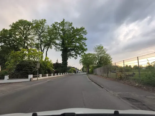
Denkmal zur Schleswig-Holsteinische Erhebung
Monument and historic site · 1.1 km
Denkmal zur Schleswig-Holsteinische Erhebung



Ehemalige Bahnstrecke Wrist–Itzehoe
Monument and historic site · 2.5 km
Ehrenmal Oelixdorf
Monument and historic site · 6.0 km
Das Gemeindedenkmal für die Gefallenen des 1. Weltkrieges
3 more on the map.
Parks, trails and playgrounds4


Freibadanlage der Gemeinde Hohenlockstedt
Park · 1.5 km
Vor ort sind Schilder die den Aufenthalt Nachts zwischen 23 und 5 uhr verbieten.
05:00-23:00

Restaurants and cafes16
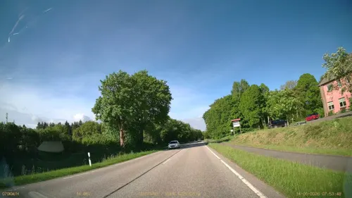
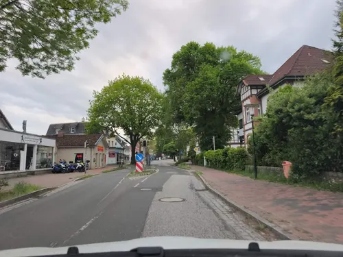
Sushi König
Restaurant · 0.6 km
Mo 16:00-22:00; We 16:00-22:00; Th 16:00-22:00; Fr-Su 15:00-22:00
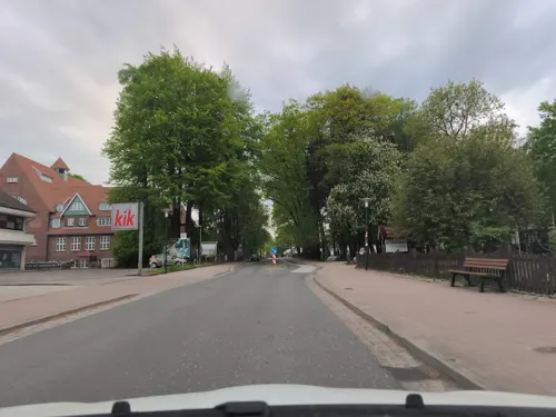

Bankers
Restaurant
76 Kieler Straße, Hohenlockstedt
Mo off;Tu-Th 12:00-14:00,18:00-23:00;Fr-Sa 18:00-23:00;Su 18:00-22:00

Tower-Bistro
Cafe · 4.0 km
18 Towerstraße, Hohenlockstedt
Mo-Th 08:00-18:00; Fr 08:00-22:00; Sa 08:00-16:30; Su 08:00-18:00
Gasthof Unter den Linden
Restaurant · Regional · 5.6 km
36 Oberstraße, Oelixdorf
Tu-Fr 11:00-14:00, Tu-Su 17:00-24:00; Su 11:00-24:00



4 more on the map.
History
Hohenlockstedt, formerly known as Lockstedter Lager military camp, was founded in 1872 as a training ground for the IX. Army Corps of the German army. In 1900, the German troop contingent for the mission against the Boxer Rebellion in China was set up, under the leadership of Alfred von Waldersee. A small wooded ridge nearby bears the name Waldersee-Höhe.
The military training area reached its greatest extent at the beginning of the First World War, when it covered an area of about 60 km², on which up to 18,000 soldiers were stationed.
From 1915, Finnish volunteers in the Jäger Movement were trained as soldiers at the Lockstedter Lager, and would later form the core of a new Finnish army. Finland was then part of the Russian Empire as a Grand Duchy. In 1917, Finland was able to gain independence, among other things with the help of these volunteers, who formed the elite core of the White army in the Finnish Civil War.
From 1927, it was made into a parish of the same name. During the Weimar Republic, the camp grounds were a rallying point of various far-right groups, including Freikorps groups and Nazis. The place was considered the cradle of the Schleswig-Holstein SA.
Because of its bad reputation, the community changed its name to Hohenlockstedt in 1956.
From the History section of Hohenlockstedt on Wikipedia, under CC BY-SA 4.0.
Where to stay4
Churches and places of worship6
Shopping9
Hinst Eisenwaren GmbH
Hardware store · 5.8 km
58 Overndorfer Straße, Kellinghusen
Gas and EV charging3
Schools, colleges and libraries4
Healthcare2
Map of Hohenlockstedt
64 places. The map loads OpenStreetMap tiles when you open it.
Getting there and nearby towns
Hungriger Wolf (IZE) is the nearest airport with scheduled flights listed in OpenStreetMap, 4 km away.
- Kellinghusen 7 km east, about 7 min by car
- Itzehoe 9 km southwest, about 9 min by car
- Hohenwestedt 14 km north, about 14 min by car
- Bad Bramstedt 18 km east, about 18 min by car
- Elmshorn 25 km south, about 25 min by car
- Glückstadt 24 km southwest, about 24 min by car
- Neumünster 27 km northeast, about 27 min by car
- Kaltenkirchen 27 km southeast, about 27 min by car
- Nortorf 27 km northeast, about 27 min by car
- Tornesch 31 km south, about 31 min by car
Drive times are estimates from straight-line distance, not routes.
Towns near Hohenlockstedt


Keep exploring
Local news
Headlines from INDB.
Reviews, tips and questions
Loading what members have shared...
Sources and licences
- GeoNames (CC BY 4.0): population, coordinates, regions and time zone
- Mapillary (see each image): photos
- OpenStreetMap contributors (ODbL 1.0): places, airports, map data
- Wikidata (CC0 1.0): elevation, founding date, time zone, website, landmarks and historic places
- Wikimedia Commons (see each image): photos
- Wikipedia (CC BY-SA 4.0): overview and history text
Photo credits
- Hohenlockstedt, Germany - Kommandantenhaus, heute Rathaus, user:Nightflyer, CC BY-SA 3.0
- Schleswig-Holstein, Hohenlockstedt, Wolkenschiff (Skulptur von Walter Arno) NIK 1303, Nightflyer, CC BY-SA 4.0
- Schleswig-Holstein, Hohenlockstedt, Wolkenschiff (Skulptur von Walter Arno) NIK 1305, Nightflyer, CC BY-SA 4.0
- Schleswig-Holstein, Hohenlockstedt, Wolkenschiff (Skulptur von Walter Arno) NIK 1307, Nightflyer, CC BY-SA 4.0
- Schleswig-Holstein, Hohenlockstedt, Wolkenschiff (Skulptur von Walter Arno) NIK 1299, Nightflyer, CC BY-SA 4.0
- Schleswig-Holstein, Hohenlockstedt, Wolkenschiff (Skulptur von Walter Arno) NIK 1301, Nightflyer, CC BY-SA 4.0
- Schleswig-Holstein, Hohenlockstedt, Ehrenhain NIK 9174, Nightflyer ( talk ) 20:47, 18 September 2014 (UTC), CC BY 3.0
- Schleswig-Holstein, Hohenlockstedt, Ehrenhain NIK 9169, Nightflyer ( talk ) 20:45, 18 September 2014 (UTC), CC BY 3.0
- Schleswig-Holstein, Hohenlockstedt, Ehrenhain NIK 4031, Nightflyer, CC BY-SA 4.0
- Schleswig-Holstein, Hohenlockstedt, Ehrenhain NIK 9162, Nightflyer ( talk ) 20:36, 18 September 2014 (UTC), CC BY 3.0
- Schleswig-Holstein, Hohenlockstedt, Ehrenhain NIK 9185, Nightflyer ( talk ) 21:02, 18 September 2014 (UTC), CC BY 3.0
- Schleswig-Holstein, Hohenlockstedt, Ehrenhain NIK 9178, Nightflyer ( talk ) 20:54, 18 September 2014 (UTC), CC BY 3.0
- Schleswig-Holstein, Hohenlockstedt, Ehrenhain NIK 9167, Nightflyer ( talk ) 20:43, 18 September 2014 (UTC), CC BY 3.0
- Schleswig-Holstein, Hohenlockstedt, Ehrenhain NIK 9183, Nightflyer ( talk ) 20:56, 18 September 2014 (UTC), CC BY 3.0
- Schleswig-Holstein, Hohenlockstedt, Denkmal für Bismarck, Roon, Moltke NIK 2337, Nightflyer, CC BY 4.0
- Schleswig-Holstein, Hohenlockstedt, Friedhof NIK 7378, Nightflyer, CC BY 4.0
- Schleswig-Holstein, Hohenlockstedt, Friedhof NIK 9216, Nightflyer ( talk ) 21:29, 23 November 2014 (UTC), CC BY 3.0
- Schleswig-Holstein, Hohenlockstedt, Friedhof NIK 7376, Nightflyer, CC BY 4.0
- Schleswig-Holstein, Hohenlockstedt, Friedhof NIK 7375, Nightflyer, CC BY 4.0
- Schleswig-Holstein, Hohenlockstedt, Friedhof NIK 7374, Nightflyer, CC BY 4.0
- Schleswig-Holstein, Hohenlockstedt, Naturdenkmal NIK 6847, Nightflyer ( talk ) 20:40, 15 June 2014 (UTC), CC BY 3.0
- Schleswig-Holstein, Hohenlockstedt, Naturdenkmal NIK 6846, Nightflyer ( talk ) 20:37, 15 June 2014 (UTC), CC BY 3.0
- Schleswig-Holstein, Hohenlockstedt, Friedhof NIK 7371, Nightflyer, CC BY 4.0
- Schleswig-Holstein, Hohenlockstedt, Naturdenkmal NIK 6848, Nightflyer ( talk ) 20:42, 15 June 2014 (UTC), CC BY 3.0
- Schleswig-Holstein, Hohenlockstedt, Naturdenkmal NIK 6851, Nightflyer ( talk ) 20:45, 15 June 2014 (UTC), CC BY 3.0
- Schleswig-Holstein, Hohenlockstedt, Friedhof NIK 7370, Nightflyer, CC BY 4.0
- Schleswig-Holstein, Hohenlockstedt, Friedhof NIK 7369, Nightflyer, CC BY 4.0
- Schleswig-Holstein, Hohenlockstedt, Friedhof NIK 9188, Nightflyer ( talk ) 20:45, 23 November 2014 (UTC), CC BY 3.0
- Schleswig-Holstein, Hohenlockstedt, Naturdenkmal NIK 6844, Nightflyer ( talk ) 20:35, 15 June 2014 (UTC), CC BY 3.0
- Schleswig-Holstein, Hohenlockstedt, Naturdenkmal NIK 6856, Nightflyer ( talk ) 20:47, 15 June 2014 (UTC), CC BY 3.0
- Schleswig-Holstein, Hohenlockstedt, Naturdenkmal NIK 6858, Nightflyer ( talk ) 20:50, 15 June 2014 (UTC), CC BY 3.0
- Schleswig-Holstein, Hohenlockstedt, Friedhof NIK 9192, Nightflyer ( talk ) 20:49, 23 November 2014 (UTC), CC BY 3.0
- Schleswig-Holstein, Hohenlockstedt, Friedhof NIK 7367, Nightflyer, CC BY 4.0
- Schleswig-Holstein, Hohenlockstedt, Friedhof NIK 7365, Nightflyer, CC BY 4.0
- Schleswig-Holstein, Hohenlockstedt, Friedhof NIK 7573, Nightflyer, CC BY 4.0
- Schleswig-Holstein, Hohenlockstedt, Friedhof NIK 7570, Nightflyer, CC BY 4.0
- Schleswig-Holstein, Hohenlockstedt, Friedhof NIK 7557, Nightflyer, CC BY 4.0
- Schleswig-Holstein, Hohenlockstedt, Friedhof NIK 7549, Nightflyer, CC BY 4.0
- Schleswig-Holstein, Hohenlockstedt, Friedhof NIK 7547, Nightflyer, CC BY 4.0
- Itzehoe Stadtkirche St. Laurentii Img 6813, Nightflyer, CC BY-SA 3.0
- Hohenlockstedt, Germany - Dreifaltigkeitskirche IMG 3075, Nightflyer, CC BY-SA 3.0
- Hohenlockstedt Rathausgarten IMG 1416, Nightflyer, CC BY 3.0
- Hohenlockstedt Wasserturm-02, Radler59 ( talk ), CC BY-SA 4.0
- Hohenlockstedt Bismarck-Denkmal August-2010 SL275151, C. Löser, CC BY 3.0 de
- Street-level photo, hotteliene, CC BY-SA 4.0
- Street-level photo, DruideBizeps, CC BY-SA 4.0
- Street-level photo, hotteliene, CC BY-SA 4.0
- Street-level photo, hotteliene, CC BY-SA 4.0
- Street-level photo, hotteliene, CC BY-SA 4.0
- Street-level photo, hotteliene, CC BY-SA 4.0
- Street-level photo, DruideBizeps, CC BY-SA 4.0
- Street-level photo, hotteliene, CC BY-SA 4.0
- Street-level photo, hotteliene, CC BY-SA 4.0
- Street-level photo, hotteliene, CC BY-SA 4.0


Page built November 9, 2026. Spotted a mistake? Tell us or suggest a place.