


Glückstadt, Germany
Glückstadt is a town of 12,121 people in Schleswig-Holstein, Germany, founded in 1617.
Why visit Glückstadt
Townapedia lists 23 museums and landmarks, 4 parks and trails, 42 places to eat, 10 places to stay and 14 attractions in and around town.
Highlights include HanseGarnelen Hofladen, Hofladen Schilling, Museumsstellwerk Glückstadt and Wasserturm.
Weather in Glückstadt
Forecast from MET Norway (CC BY 4.0). Full forecast
About Glückstadt
Glückstadt (German pronunciation: [ˈɡlʏkˌʃtat] ; Danish: Lykstad) is a town in the Steinburg district of Schleswig-Holstein, Germany. It is located on the right bank of the Lower Elbe at the confluence of the small Rhin river, about 45 km (28 mi) northwest of Altona. Glückstadt is part of the Hamburg Metropolitan Region (Metropolregion Hamburg).
From the Wikipedia article Glückstadt (this version), under CC BY-SA 4.0.
Travel tips from other travellers: Glückstadt on Wikivoyage (CC BY-SA 4.0).
Things to do14

HanseGarnelen Hofladen
Farm and orchard · 1.2 km
6 Herrenweide, Glückstadt
Th 10:00-14:00; Fr 08:00-12:00
Hofladen Schilling
Farm and orchard · 4.1 km
99 Am Altendeich, Blomesche Wildnis
Mo-Fr 08:00-12:00,13:30-18:00; Sa 08:00-12:00; PH off

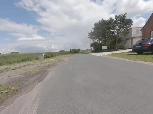
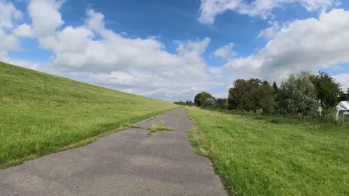
German Ferry Road
Monument and historic site · 1.6 km
Scenic route in Northern Germany
Anna’s Gärtnerei
Farm and orchard · 3.9 km
187 Am Neuendeich, Blomesche Wildnis
Th-Sa 09:00-18:00


Seismann
Farm and orchard · 4.0 km
197 Am Neuendeich, Blomesche Wildnis
Mo-Sa 09:00-18:00

2 more on the map.
Museums and landmarks23

Museumsstellwerk Glückstadt
Museum
25 Christian-IV-Straße, Glückstadt
May-Oct: Su[1] 14:00-17:00 || "nach Vereinbarung"

Wasserturm
Monument and historic site
Ehemaliger Wasserturm Bohnstr. 1 in Glückstadt
1 Bohnstraße, Glückstadt




11 more on the map.
Parks, trails and playgrounds4




Restaurants and cafes42
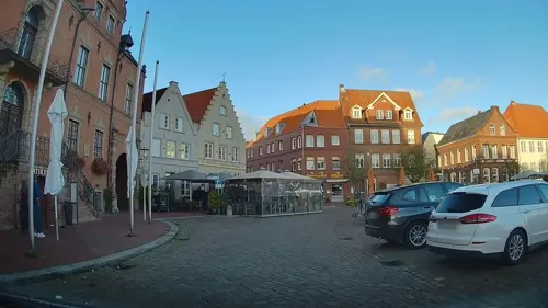

Nettchen Bistro & Café
Restaurant · Regional
1A Am Hafen, Glückstadt
Tu-Fr 11:00-22:00; Mo off; Sa,Su 10:00-22:00


Bäckerei Balzer
Bakery
13 Am Markt, Glückstadt
Mo-Fr 06:00-18:00; Sa,Su 06:00-12:00
30 more on the map.
History
Glückstadt was founded in 1617 on the marsh lands along the Elbe by the Duke of Holstein, King Christian IV of Denmark, who had levees and fortifications built as well as a ducal residence. Its name translates to English literally as "Luck City" or "Fortune City". As Christian IV promised the settlers tax exemption and freedom of religion, Glückstadt soon became an important trading centre, intended to compete with the Imperial city of Hamburg, located upstream on the Elbe. Calvinists, Remonstrants and Mennonites (Anabaptists) from the Netherlands settled here, as well as Sephardic Jews and Catholics.
After the king had interfered in the Thirty Years' War, the town in 1627/28 was besieged for fifteen weeks by the united Imperial and Catholic troops under the command of Albrecht von Wallenstein and Count Tilly, though without success.
In 1649 Christian’s son and successor King Frederik III of Denmark had the seat of the Holstein administration moved to Glückstadt, whereafter the duchy became known as Holstein-Glückstadt. In 1773 the town became the capital of all Holstein lands, when the lands of the Holstein-Gottorp line were finally incorporated. During the War of the Sixth Coalition in 1814 Glückstadt was blockaded by the allies and capitulated, whereupon its fortifications were demolished. In 1830 it was made a free port.
From the History section of Glückstadt on Wikipedia, under CC BY-SA 4.0.
Where to stay10
Churches and places of worship5
Shopping8
Gas and EV charging4
Schools, colleges and libraries5
Healthcare5
Map of Glückstadt
120 places. The map loads OpenStreetMap tiles when you open it.
Getting there and nearby towns
Hungriger Wolf (IZE) is the nearest airport with scheduled flights listed in OpenStreetMap, 25 km away.
- Drochtersen 9 km south, about 9 min by car
- Itzehoe 16 km north, about 16 min by car
- Uetersen 19 km southeast, about 19 min by car
- Tornesch 22 km southeast, about 22 min by car
- Hansestadt Stade 22 km south, about 22 min by car
- Pinneberg 28 km southeast, about 28 min by car
- Wedel 29 km southeast, about 29 min by car
- Rellingen 31 km southeast, about 31 min by car
- Quickborn 33 km east, about 33 min by car
- Halstenbek 32 km southeast, about 32 min by car
Drive times are estimates from straight-line distance, not routes.
Local news
Headlines from INDB.
Reviews, tips and questions
Loading what members have shared...
Sources and licences
- GeoNames (CC BY 4.0): population, coordinates, regions and time zone
- Mapillary (see each image): photos
- OpenStreetMap contributors (ODbL 1.0): places, airports, map data
- Wikidata (CC0 1.0): elevation, founding date, time zone, website, landmarks and historic places
- Wikimedia Commons (see each image): photos
- Wikipedia (CC BY-SA 4.0): overview and history text
Photo credits
- Luftaufnahmen Nordseekueste 2012-05-by-RaBoe-460, © Ra Boe / Wikipedia, CC BY-SA 3.0 de
- Stadtkirche Glückstadt, Turm, PodracerHH, CC BY-SA 3.0
- Glückstadt, das Rathaus, Dguendel, CC BY 3.0
- 2016-08-25 Glückstadt Stadtkirche und Kandelaber, Eduard47, CC BY-SA 4.0
- Glückstadt Marktplatz - panoramio, hh oldman, CC BY 3.0
- Glückstadt, auf dem Marktplatz, Blick zur Stadtkirche, Dguendel, CC BY 3.0
- Glückstadt, die Häuser Am Markt 5 und 6, Dguendel, CC BY 3.0
- Glückstadt Christmas Market, Thomas Dahlstrøm Nielsen, CC BY-SA 4.0
- 2016-08-25 Glückstadt Stadtkirche und Kandelaber (2), Eduard47, CC BY-SA 4.0
- Stadtkirche Glückstadt - panoramio, hh oldman, CC BY 3.0
- Stadtkirche Glückstadt, Christian Alexander Otto, CC BY 4.0
- Glückstadt, Am Fleth, Christian Alexander Otto, CC BY 4.0
- Marktplatz Glückstadt mit Stadtkirche, Christian Alexander Otto, CC BY 4.0
- Glückstadt, Rossmann, Christian Alexander Otto, CC BY 4.0
- Glückstadt, die Stadtkirche, Dguendel, CC BY 3.0
- Schleswig-Holstein, Glückstadt, Rathaus NIK 3579, -- Nightflyer ( talk ) 22:25, 18 December 2016 (UTC), CC BY 4.0
- Gesamtaufnahme der Stadtkirche Glückstadt, Kirchenfloh, CC BY-SA 4.0
- Glückstadt, die Große Kremper Straße, Dguendel, CC BY 3.0
- 2016-08-25 Glückstadt Einkaufsstraße, Eduard47, CC BY-SA 4.0
- 25348 Glückstadt, Germany - panoramio (64), hh oldman, CC BY 3.0
- Glückstadt, Am Markt 9, Wohnhaus mit Rückflügel DSC00316, Nightflyer, CC BY-SA 3.0
- Glückstadt, das Denkmal von Christian IV, Dguendel, CC BY 3.0
- Gaststätte “Der kleine Heinrich” Glückstadt, Walkuraxx, CC BY-SA 4.0
- 25348 Glückstadt, Germany - panoramio (76), hh oldman, CC BY 3.0
- Glückstadt, Häuserzeile am Kirchplatz, Dguendel, CC BY 3.0
- Glückstadt, die Häuser Am Kirchplatz 1 und 2, Pfarramt, Dguendel, CC BY 3.0
- Glückstadt, Am Kirchplatz, Dguendel, CC BY 3.0
- Marktplatz Glückstadt, Bushaltestelle, Christian Alexander Otto, CC BY 4.0
- 25348 Glückstadt, Germany - panoramio (77), Baden de, CC BY 3.0
- Marktplatz Glückstadt, Pension und Hotel, Christian Alexander Otto, CC BY 4.0
- Marktplatz Glückstadt, arko und Der kleine Heinrich, Christian Alexander Otto, CC BY 4.0
- Stadtkirche Glückstadt, 2022, Thomas Dahlstrøm Nielsen, CC BY-SA 4.0
- Am Fleth 64, Glückstadt, Christian Alexander Otto, CC BY 4.0
- Schleswig-Holstein, Glückstadt, Stele an der Kirche NIK 5109, Nightflyer, CC BY-SA 4.0
- Deutsche Faehrstrasse, Wusel007, CC BY-SA 3.0
- Wiebeke-Kruse-Turm, PodracerHH, CC BY-SA 3.0
- Palais Quasi non Possidentes, PodracerHH, CC BY-SA 3.0
- Glückstadt Stadtkirche 2, Christian der Vierte, CC BY-SA 4.0
- Glückstadt Lighthouse (2257402264), Charles Hutchins from London, United Kingdom, CC BY 2.0
- Unterfeuer Krautsand (5065272824), Torsten Behrens from Tarbek - Segeberg - Schleswig-Holstein., Deutschland, CC BY 2.0
- Borsfleth NIK 3009, Nightflyer, CC BY 3.0
- Kirche Herzhorn, Stuenie, CC BY-SA 3.0
- Glückstadt, das Hotel Brückenhaus, Dguendel, CC BY 3.0
- Museums Stellwerk - panoramio, hh oldman, CC BY 3.0
- Glückstadt, das Detlefsen-Museum, Dguendel, CC BY 3.0
- Glückstadt Oberfeuer, Radler59 ( talk ), CC BY-SA 4.0
- Glueckstadt Leuchtturm, Oberlausitzerin64, CC BY-SA 4.0
- Überfahrt mit der Elbfähre Wischhafen-Glückstadt-3440, Raimond Spekking, CC BY-SA 4.0
- Krautsand Unterfeuer, Radler59 ( talk ), CC BY-SA 4.0
- Glueckstadt Ehem Wasserturm-03, Radler59 ( talk ), CC BY-SA 4.0
- Stolperstein Lea Laura Selcke - Schlachterstraße 6 - Glückstadt, NordNordWest, CC BY-SA 3.0 de
- Stolperstein Magda Levy - Schlachterstraße 7 - Glückstadt, NordNordWest, CC BY-SA 3.0 de
- Stolperstein Paula Meyer - Schlachterstraße 3 - Glückstadt, NordNordWest, CC BY-SA 3.0 de
- Elbfähre Glückstadt–Wischhafen NIK 3107, Nightflyer, CC BY 3.0
- Infotafel Gießhaus, Königstraße 41, Glückstadt, Pauli-Pirat, CC BY-SA 4.0
- Fortuna-Bad Glückstadt, Pauli-Pirat, CC BY-SA 4.0
- Street-level photo, hendel, CC BY-SA 4.0
- Street-level photo, hendel, CC BY-SA 4.0
- Street-level photo, DruideBizeps, CC BY-SA 4.0
- Street-level photo, abmap, CC BY-SA 4.0
- Street-level photo, changchun1, CC BY-SA 4.0
- Street-level photo, ramap, CC BY-SA 4.0
- Street-level photo, changchun1, CC BY-SA 4.0
- Street-level photo, changchun1, CC BY-SA 4.0
- Street-level photo, changchun1, CC BY-SA 4.0
- Street-level photo, itsinthegame, CC BY-SA 4.0
- Street-level photo, ramap, CC BY-SA 4.0
- Street-level photo, frankvival, CC BY-SA 4.0
- Street-level photo, changchun1, CC BY-SA 4.0
- Street-level photo, DruideBizeps, CC BY-SA 4.0
- Street-level photo, ramap, CC BY-SA 4.0
- Street-level photo, robffm, CC BY-SA 4.0
- Street-level photo, veloroute_hamburg, CC BY-SA 4.0
- Street-level photo, changchun1, CC BY-SA 4.0
- Street-level photo, changchun1, CC BY-SA 4.0


Page built November 8, 2026. Spotted a mistake? Tell us or suggest a place.