


Horb am Neckar, Germany
Horb am Neckar is a town of 25,651 people in Baden-Wurttemberg, Germany.
Why visit Horb am Neckar
Townapedia lists 78 museums and landmarks, 28 parks and trails, 106 places to eat, 17 places to stay and 11 attractions in and around town.
Highlights include Neckar Viaduct, Weitingen, Hofladen Straubhof, Berthold-Auerbach-Museum and Steinener Geschichtsgarten der Stadt Horb am Neckar.
Weather in Horb am Neckar
Forecast from MET Norway (CC BY 4.0). Full forecast
About Horb am Neckar
Horb am Neckar (German pronunciation: [ˈhɔʁp ʔam ˈnɛkaʁ] , lit. 'Horb on the Neckar') is a town in the southwest of the German state of Baden-Württemberg. It is located on the Neckar river, between Offenburg to the west (about 56 kilometres (35 mi) away) and Tübingen to the east (about 29 kilometres (18 mi) away). It has around 25,000 inhabitants, of whom about 6,000 live in the main town of Horb, and the remainder in 18 associated villages and districts which form part of the same municipality. If the entire municipality is counted, it is the largest town in the District of Freudenstadt.
From the Wikipedia article Horb am Neckar (this version), under CC BY-SA 4.0.
Things to do11


Hofladen Straubhof
Farm and orchard · 1.3 km
1 Auchtert, Horb am Neckar
We,Sa 09:00-12:00; Fr 09:00-12:00, 15:00-19:00

Museums and landmarks78





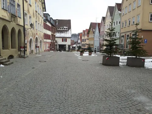
Ihlinger Tor
Monument and historic site
77 Neckarstraße, Horb am Neckar


66 more on the map.
Parks, trails and playgrounds28



Piraten-Spielplatz
Playground
Oct-Mar Mo-Su 08:00-12:00, 14:00-dusk; Apr-Sep Mo-Su 08:00-12:00,...

Neckarbad Horb
Sports field and stadium · 0.9 km
86 Mühlener Straße, Horb am Neckar
Spielplatz Feuerwehr am Rathaus
Playground · 6.5 km
Thema "Feuerwehr Wiesenstetten"


16 more on the map.
Restaurants and cafes106
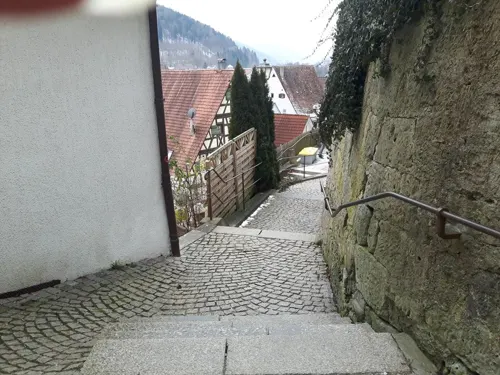

Biergarten - Aussichtsplatte Rauschbart
Restaurant · Bavarian, Regional · 1.2 km
1 Rauschbart, Horb am Neckar
Tu-Sa 11:00-22:00; Su,PH 10:00-21:00
Gleis Süd
Restaurant · Burger, German, Italian
1 Bahnhofplatz, Horb am Neckar
Mo,Tu 16:00+; We-Su 11:00+
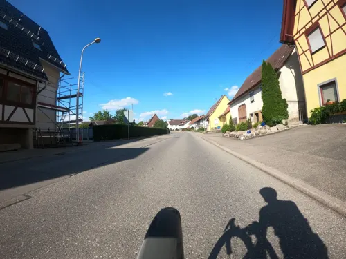
Landgasthof Mohren
Restaurant · German · 8.1 km
12 Alemannenstraße, Nagold
Mo off; Tu-Th 11:30-14:30, 17:00-21:30; Fr 11:30-14:30,...
Morgenland
Restaurant · Arab
3 Altheimer Straße, Horb am Neckar
Mo 17:00-22:00; Tu-Fr 11:00-14:00, 17:00-22:00; Sa-Su,PH 11:00-22:00

Rock-Café Horb
Bar and pub · Regional, Salad, Cake
72 Altheimer Straße, Horb am Neckar
Fr,Sa 18:00-05:00; Mo-Th,Su,PH off
Succulent
Restaurant · Chinese
8 Bahnhofplatz, Horb am Neckar
We-Mo,PH 11:30-15:00,17:30-22:30; Tu off



94 more on the map.
History
Horb was first documented as horv or horva, meaning "swamp" in Old High German, in 1090. But since Old High German was nearly extinct at that time, it is assumed that Horb is even older than that.
The swampy land along the Neckar forced the builders of the town to lay it out among the foothills of the mountain called Schütteberg. Today the townscape is characterised by the location of the whole historic city on top of a hill, making it visible from any direction.
Horb was first documented as a town in 1228, and the first references to a mayor (Schultheiß) and a market are to be found in 1244 and 1277, respectively. Until 1305, Horb belonged to the counts palatine of Tübingen, and later to the counts of Hohenberg. In 1381, Horb came into the possession of Austria (Further Austria) and served as an administrative seat for the local Vogt. Later, in 1806, Horb became part of the Kingdom of Württemberg, and a year it was made into an administrative center, Oberamt Horb. Its borders had changed several times in the following years, and in 1938 it was reorganized as a rural district, Landkreis Horb.
From the History section of Horb am Neckar on Wikipedia, under CC BY-SA 4.0.
Where to stay17
Churches and places of worship66
Kirche St. Johannes Baptist
Church · Catholic · 3.2 km
15 Kirchstraße, Horb am Neckar
Pfarrkirche St. Cyriakus
Church · Roman Catholic · 3.4 km
27 Neuneckstraße, Horb am Neckar
Remigiuskirche
Church · Protestant · 3.2 km
5 Remigiusstraße, Horb am Neckar
St. Gallus
Church · Roman Catholic · 5.5 km
5 Graf-Gerold-Straße, Horb am Neckar
St. Gallus
Church · Roman Catholic · 8.2 km
18 Von-Neuneck-Straße, Sulz am Neckar
Shopping20
Gas and EV charging12
Schools, colleges and libraries23
GWRS Horb-Altheim - Außenstelle Grünmettstetten
School · 5.4 km
40 Killbergstraße, Horb am Neckar
Grund- und Werkrealschule Horb-Altheim
School · 5.3 km
53 Hindenburgstraße, Horb am Neckar
Healthcare8
Map of Horb am Neckar
250 places. The map loads OpenStreetMap tiles when you open it.
Getting there and nearby towns
Manfred Rommel Airport Stuttgart (STR) is the nearest airport with scheduled flights listed in OpenStreetMap, 47 km away.
- Sulz am Neckar 10 km southwest, about 10 min by car
- Nagold 12 km north, about 12 min by car
- Wildberg 20 km north, about 20 min by car
- Tübingen 28 km east, about 28 min by car
- Mössingen 27 km east, about 27 min by car
- Rottweil 31 km south, about 31 min by car
- Holzgerlingen 32 km northeast, about 32 min by car
- Schramberg 33 km southwest, about 33 min by car
- Sindelfingen 37 km northeast, about 37 min by car
- Reutlingen 38 km east, about 38 min by car
Drive times are estimates from straight-line distance, not routes.
Local news
Headlines from INDB.
Reviews, tips and questions
Loading what members have shared...
Sources and licences
- GeoNames (CC BY 4.0): population, coordinates, regions and time zone
- Mapillary (see each image): photos
- OpenStreetMap contributors (ODbL 1.0): places, airports, map data
- Wikidata (CC0 1.0): elevation, founding date, time zone, website, landmarks and historic places
- Wikimedia Commons (see each image): photos
- Wikipedia (CC BY-SA 4.0): overview and history text
Photo credits
- Horb am Neckar 2011, Felix König, CC BY 3.0
- Horb am Neckar 2018 by-RaBoe 014, © Ra Boe / Wikipedia, CC BY-SA 3.0 de
- Beim 366 km langen Neckartalradweg, Belle Arti (Ristorante Eiscafe Bar), Horb am Neckar - panoramio, qwesy qwesy, CC BY 3.0
- Horb am Neckar 2018 by-RaBoe 375, © Ra Boe / Wikipedia, CC BY-SA 3.0 de
- Horb am Neckar 2018 by-RaBoe 023, © Ra Boe / Wikipedia, CC BY-SA 3.0 de
- Horb am Neckar 2018 by-RaBoe 016, © Ra Boe / Wikipedia, CC BY-SA 3.0 de
- Horb am Neckar 2018 by-RaBoe 021, © Ra Boe / Wikipedia, CC BY-SA 3.0 de
- Horb am Neckar 2018 by-RaBoe 018, © Ra Boe / Wikipedia, CC BY-SA 3.0 de
- Horb am Neckar 2018 by-RaBoe 025, © Ra Boe / Wikipedia, CC BY-SA 3.0 de
- Horb am Neckar 2018 by-RaBoe 027, © Ra Boe / Wikipedia, CC BY-SA 3.0 de
- Horb am Neckar 2018 by-RaBoe 029, © Ra Boe / Wikipedia, CC BY-SA 3.0 de
- Horb am Neckar 2018 by-RaBoe 031, © Ra Boe / Wikipedia, CC BY-SA 3.0 de
- Horb am Neckar Burgstall 12 (1), Windharp, CC BY-SA 4.0
- Horb am Neckar Burgstall 12 (Mosaik), Windharp, CC BY-SA 4.0
- Horb am Neckar Burgstall 12 (2), Windharp, CC BY-SA 4.0
- Horb am Neckar 2018 by-RaBoe 368, © Ra Boe / Wikipedia, CC BY-SA 3.0 de
- Horb am Neckar 2018 by-RaBoe 371, © Ra Boe / Wikipedia, CC BY-SA 3.0 de
- Horb am Neckar 2018 by-RaBoe 369, © Ra Boe / Wikipedia, CC BY-SA 3.0 de
- Horb am Neckar 2018 by-RaBoe 367, © Ra Boe / Wikipedia, CC BY-SA 3.0 de
- Horb am Neckar 2018 by-RaBoe 370, © Ra Boe / Wikipedia, CC BY-SA 3.0 de
- Horb am Neckar 2018 by-RaBoe 372, © Ra Boe / Wikipedia, CC BY-SA 3.0 de
- Horb am Neckar 2018 by-RaBoe 033, © Ra Boe / Wikipedia, CC BY-SA 3.0 de
- Horb am Neckar 2018 by-RaBoe 373, © Ra Boe / Wikipedia, CC BY-SA 3.0 de
- Horb am Neckar 2018 by-RaBoe 374, © Ra Boe / Wikipedia, CC BY-SA 3.0 de
- Horb am Neckar Burgstall 20+22, Windharp, CC BY-SA 4.0
- Horb am Neckar Burgstall 20, Windharp, CC BY-SA 4.0
- Horb am Neckar Burgstall 22, Windharp, CC BY-SA 4.0
- Horb am Neckar 2018 by-RaBoe 341, © Ra Boe / Wikipedia, CC BY-SA 3.0 de
- Horb am Neckar Marktstraße 12 (1), Windharp, CC BY-SA 4.0
- Horb am Neckar 2018 by-RaBoe 364, © Ra Boe / Wikipedia, CC BY-SA 3.0 de
- Horb am Neckar 2018 by-RaBoe 363, © Ra Boe / Wikipedia, CC BY-SA 3.0 de
- Horb am Neckar 2018 by-RaBoe 362, © Ra Boe / Wikipedia, CC BY-SA 3.0 de
- Horb am Neckar 2018 by-RaBoe 361, © Ra Boe / Wikipedia, CC BY-SA 3.0 de
- Horb am Neckar 2018 by-RaBoe 366, © Ra Boe / Wikipedia, CC BY-SA 3.0 de
- Horb am Neckar - geo.hlipp.de - 25262, Colin Smith on geo.hlipp.de, CC BY-SA 2.0
- Horb am Neckar 2018 by-RaBoe 365, © Ra Boe / Wikipedia, CC BY-SA 3.0 de
- Neckartalbrücke Weitingen, Stefan Karl, CC BY-SA 4.0
- Auerbach Museum, Thomoesch, CC BY-SA 3.0 de
- HorbSchurkenturm, Mussklprozz, CC BY-SA 3.0
- Rittergut Eutinger Tal, Erbaut in der Mitte des 13. Jahrhunderts, Wiederaufgebaut 1354 durch Böcklin von Eutingertal und z. B. 1818 wurde die Burg abgebrochen und mit dem Material eine Papierfabrik..., qwesy qwesy, CC BY 3.0
- Ruine frundeck mauer, UlrichClassen (as Sailor272 ), CC BY-SA 3.0
- Burgruine Hohendießen-9741, DKrieger, CC BY-SA 4.0
- Urnburg Rohrdorf EutingenImGaeu, Cactus26, CC BY-SA 3.0
- Ansichten von Fischingen (Sulz am Neckar) 01, Giftzwerg 88, CC BY-SA 3.0
- NSG Osterhalde, Friedi13, CC0
- Horb am Neckar 2017 (MTheiler) 4827 Ihlinger-Tor Luzifer-Turm, ( MTheiler ), CC BY-SA 4.0
- Karstwasserrinne NSG-Diessener-Tal Neckar-Tributar-Diessen, Ustill, CC BY-SA 3.0 de
- Glatt Kirche, Ikar.us ( talk ), CC BY 3.0 de
- Sankt Cyriakus in Dettensee 24-08-2009 II, eagle1effi Bearbeitung (Helligkeit, Tonwert, Farben angepasst): Christoph Waghubinger ( Lewenstein ), CC BY 2.0
- St. Georg in Rohrdorf (Eutingen im Gäu) 03, Giftzwerg 88, CC BY-SA 3.0
- Sankt Konrad in Grünmettstetten, Außenansicht 08, Giftzwerg 88, CC BY-SA 3.0
- Kapelle Rexingen 10, Giftzwerg 88, CC BY-SA 3.0
- Ansichten von Rexingen 02, Giftzwerg 88, CC BY-SA 3.0
- Steinerner Geschichtsgarten Horb am Neckar I, Reutlingendorf, CC BY-SA 4.0
- Landappbw 131122 1820 Jakobuskirche Horb-Ihlingen, BerndP, CC0
- Empfingen Church, Empfingerbua, Public domain
- Landappbw 157626 1820 Remigiuskirche Mühlen (Radwege- und Pilgerkirche) Remigiusstr. 3 72160 Horb- Mühlen, Evangelische Kirchengemeinde Mühlen, CC0
- Mühringen katholische Kirche, Schlaier, CC BY 3.0
- Ahldorf, St. Konrad (01), Subbass1, CC BY-SA 4.0
- Street-level photo, changchun1, CC BY-SA 4.0
- Street-level photo, tasmaniadevil, CC BY-SA 4.0
- Street-level photo, plexi32, CC BY-SA 4.0
- Street-level photo, mfa, CC BY-SA 4.0
- Street-level photo, mfa, CC BY-SA 4.0
- Street-level photo, tasmaniadevil, CC BY-SA 4.0
- Street-level photo, tasmaniadevil, CC BY-SA 4.0
- Street-level photo, ramap, CC BY-SA 4.0
- Street-level photo, mfa, CC BY-SA 4.0
- Street-level photo, tasmaniadevil, CC BY-SA 4.0
- Street-level photo, tasmaniadevil, CC BY-SA 4.0
- Street-level photo, mfa, CC BY-SA 4.0
- Street-level photo, changchun1, CC BY-SA 4.0
- Street-level photo, mfa, CC BY-SA 4.0
- Street-level photo, bct, CC BY-SA 4.0
- Street-level photo, wegavision, CC BY-SA 4.0
- Street-level photo, tasmaniadevil, CC BY-SA 4.0
- Street-level photo, tasmaniadevil, CC BY-SA 4.0
- Street-level photo, voschix, CC BY-SA 4.0


Page built November 8, 2026. Spotted a mistake? Tell us or suggest a place.