


Rottweil, Germany
Rottweil is a town of 25,510 people in Baden-Wurttemberg, Germany, founded in 1140.
Why visit Rottweil
Townapedia lists 77 museums and landmarks, 43 parks and trails, 177 places to eat, 17 places to stay and 23 attractions in and around town.
Highlights include TK Elevator Testturm, Central-Kino, Lorenzkapelle and Dominikanermuseum.
Weather in Rottweil
Forecast from MET Norway (CC BY 4.0). Full forecast
About Rottweil
Rottweil (German: [ˈʁɔtvaɪl] ; Alemannic: Rautweil) is a town in southwest Germany in the state of Baden-Württemberg. Rottweil was a free imperial city for nearly 600 years.
From the Wikipedia article Rottweil (this version), under CC BY-SA 4.0.
Travel tips from other travellers: Rottweil on Wikivoyage (CC BY-SA 4.0).
Things to do23

TK Elevator Testturm
Scenic view · 1.3 km
Besucher können in 30 Sekunden nach oben - 230m -fahren. Tolle Aussicht (hinter Glas) auf Rottweil und Umgebung. Eintrittskarten am...
PH,Fr,Su 10:00-18:00; Sa 10:00-18:00; Dec 24-25 off; Jan 01 off;...


Hofladen Obergfell
Farm and orchard · 6.9 km
Regiomat, Hofladen August 2020 nur vormittags geöffnet
Tu 09:00-12:30,15:00-19:00; Th-Fr 09:00-12:30,15:00-19:00; Sa 09:00-12:30
Kramer´s Hofladen
Farm and orchard · 6.3 km
Aus eigener Herstellung: Eier, Nudeln, Suppenhühner, Geflügelfleisch, Hähnchen, Wurstwaren, Schweinefleisch, Honig, Brot Zugekaufte...
4 Hochwaldstraße, Zimmern ob Rottweil
Fr 14:00-18:00, Sa 08:30-12:00

Hochturm
Scenic view
Leihschlüssel in der Tourist-Information oder dem Dominikanermuseum erhältlich. Aufgrund von Bauarbeiten zur Zeit nicht zugänglich!

Aulich's Hoflädele
Farm and orchard · 4.3 km
Frischmilch-Automat (Selbstbedienung) mit Flaschen zum Abfüllen, sowie einem Verkaufsautomaten mit Eiern, Wurst, Käse und mehr.
24/7
Wildensteiner Hofladen
Farm and orchard · 5.3 km
Mo-Tu 09:00-18:00; Th-Fr 09:00-18:00; Sa 09:00-13:00
Biohof Mutschler
Farm and orchard · 4.6 km
6/1 Schwabenstraße, Rottweil
Dissenhorn
Scenic view · 2.9 km
Sehr schöner Ausblick über Göllsdorf und Rottweil
Hofladenautomat Moritzhof
Farm and orchard
Freilandeier, Nudeln, Dosenwurst, Saft....
11 more on the map.
Museums and landmarks77




Neckarline
Monument and historic site
Fußgängerhängebrücke
Jan-Mar: Mo-Su 09:00-16:30; Apr: Mo-Su 09:00-19:30; May-Oct: Mo-Su...

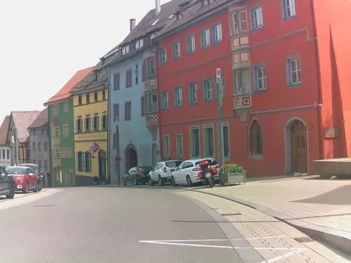
Puppen- und Spielzeugmuseum
Museum
49 Hauptstraße, Rottweil
We-Fr 10:00-12:30,14:00-17:30; Sa 10:00-12:30; Su 14:00-17:00


Burgruine Hohenstein
Monument and historic site · 4.5 km
Nur 3x hohe Mauernreste zusehen und 1x klein. Wege sind mit Ästen zugewachsen. Keine Aussichtspunkte vorhanden.

Schloss Wellendingen
Monument and historic site · 6.0 km
1 Schloßplatz, Wellendingen
65 more on the map.
Parks, trails and playgrounds43

Freilichtmuseum Römerbad
Sports field and stadium · 1.1 km
Das Römerbad ist eine der größten antiken Badeanlagen Südwestdeutschlands. Erbaut um 75 n. Chr. in einem Legionskastell, bestand die...

Hofgerichtsstätte
Park
Das 1299 erstmals erwähnte Kaiserliche Hofgericht war ein bedeutendes Zivilgericht, dessen Zuständigkeitsbereich bis Köln und in die...

Sportverein Zimmern 1905 e.V.
Sports field and stadium · 3.8 km
43 Flözlinger Straße, Zimmern ob Rottweil




31 more on the map.
Restaurants and cafes177
Der Genießerhof
Restaurant · Regional · 4.6 km
Schlemmerbox beim Friedhof Hofladen-Automat
1 Stauchestraße, Dietingen
Th-Su 11:30-20:00

Kleingärtnerheim
Restaurant · German, Regional · 1.7 km
Vereinsheim der Gartenfreunde Rottweil e.V. mit Gastronomie.
10 In der Schmälze, Rottweil
Sa 15:00-22:00; Su 10:00-21:00
Natur-Gasthaus Bettlinsbad
Restaurant · German · 3.5 km
Für Gruppen auf Anfrage für Mo-Mit.
1, Rottweil
Th,Sa 14:00-19:00, Fr 14:00-22:00, Su 12:00-19:00
Badhaus- Kulinarische Küche
Restaurant · German · 1.5 km
167 Neckartal, Rottweil
Mo off; Tu-Sa 11:00-24:00; Su 10:00-19:00
Café Lehre
Restaurant · German
5 Waldtorstraße, Rottweil
Tu-Fr 12:00-14:30,17:30-22:30; Sa 11:00-22:30; Su 10:00-22:30; Mo off
Gasthaus Adler
Restaurant · Greek · 4.6 km
2 Zinkenstraße, Dietingen
We-Sa 17:30-22:00; Su 11:30-14:00, 17:30-21:00

Shanghai
Restaurant · Chinese, Mongolian · 2.0 km
58 Tuttlinger Straße, Rottweil
Mo-Sa 11:30-14:30,17:30-22:00; Su 11:30-23:00
Siedlerheim
Restaurant · Regional · 1.2 km
Restaurant des Siedlerheims
39 Schwarzwaldstraße, Rottweil
Fr 17:00+; Sa 16:00+; Su 10:00+


165 more on the map.
History
Rottweil was founded by the Romans in AD 73 as Arae Flaviae and became a municipium, but there are traces of human settlement going back to 2000 BC. Roman baths and an Orpheus mosaic of c. AD 180 date from the time of Roman settlement. The present town became a ducal and a royal court before 771 and in 1268 it became a free imperial city.
In 1463 Rottweil joined the Swiss Confederacy under the pretence of a temporary alliance. In 1476 the Rottweilers fought on the Swiss side against Charles the Bold in the Battle of Morat. In 1512, Pope Julius II gave the city a valuable "Julius banner" for its services in the 1508–1510 "Great Pavier Campaign" to expel the French. In 1519, the Rottweilers left the old Swiss alliance. They joined a new one in which their membership was extended indefinitely – the so-called "Eternal Covenant".
Rottweil thus became a centre of the Swiss Confederation. The relations between the Swiss Confederation and Rottweil cooled rapidly during the Protestant Reformation. When Rottweil was troubled by wars, however, it still asked the Confederates for help.
In the Rottweil Witch Hunts from 1546 to 1661, 266 so-called witches, wizards and magicians were executed in the imperial city of Rottweil. On April 15, 2015, they were given a posthumous pardon. An official apology was given by the City Council about 400 years after their violent deaths.
From the History section of Rottweil on Wikipedia, under CC BY-SA 4.0.
Where to stay17
Churches and places of worship59
Ehemalige Synagoge (bis 1938)
Place of worship
6 Kameralamtsgasse, Rottweil
Evangelische Kirche
Church · Lutheran · 7.1 km
3 Kirchweg, Zimmern ob Rottweil
Shopping34
Gas and EV charging19
BAT / Rastanlage Neckarburg West
Gas station · 4.3 km
1 Neckarburg West, Dietingen
Freie Tankstelle Oel Heimburger
Gas station · 0.8 km
40 Schramberger Straße, Rottweil
Schools, colleges and libraries26
Healthcare11
Map of Rottweil
250 places. The map loads OpenStreetMap tiles when you open it.
Getting there and nearby towns
Lahr Airport (LHA) is the nearest airport with scheduled flights listed in OpenStreetMap, 63 km away.
- Trossingen 10 km south, about 10 min by car
- Spaichingen 13 km southeast, about 13 min by car
- Villingen-Schwenningen 15 km southwest, about 15 min by car
- Schramberg 19 km west, about 19 min by car
- Sulz am Neckar 22 km north, about 22 min by car
- St. Georgen im Schwarzwald 22 km west, about 22 min by car
- Tuttlingen 25 km southeast, about 25 min by car
- Titisee-Neustadt 43 km southwest, about 43 min by car
- Stockach 45 km southeast, about 45 min by car
- Singen 48 km south, about 48 min by car
Drive times are estimates from straight-line distance, not routes.
Local news
Headlines from INDB.
Reviews, tips and questions
Loading what members have shared...
Sources and licences
- GeoNames (CC BY 4.0): population, coordinates, regions and time zone
- Mapillary (see each image): photos
- OpenStreetMap contributors (ODbL 1.0): places, airports, map data
- Wikidata (CC0 1.0): elevation, founding date, time zone, website, landmarks and historic places
- Wikimedia Commons (see each image): photos
- Wikipedia (CC BY-SA 4.0): overview and history text
Photo credits
- Germany Rottweil Main Street, Rebecca Kennison, CC BY 2.5
- 20260122 Friedrichsplatz 2, Rottweil - A7301886, Zinnmann, CC BY-SA 4.0
- Hauptstraße 32, Rottweil, Dezember 2025, Kürschner ( talk ) 08:32, 31 December 2025 (UTC), CC0
- Rottweil-Fasnet-Federahannes0014, Rainer Halama, CC BY-SA 3.0
- Rottweil, Kameleck Retusche, File:Rottweil, Kameleck.jpg : Nina Eger derivative work: Zinnmann, CC BY-SA 4.0
- 20260122 Kameleck, Rottweil - A7301885, Zinnmann, CC BY-SA 4.0
- Rottweil, Kameleck, Nina Eger, CC BY-SA 4.0
- Rottweil Ladenschild (5513996117), dierk schaefer, CC BY 2.0
- Rottweil Hauptstraße Fußgängerzone - panoramio - Augenstein (2), Augenstein, CC BY-SA 3.0
- Hauptstraße 41, Friedrichsplatz 1, 3, Rottweil, Dezember 2025, Kürschner ( talk ) 08:35, 31 December 2025 (UTC), CC0
- Rottweil - panoramio (5), qwesy qwesy, CC BY 3.0
- Rottweil - panoramio (4), qwesy qwesy, CC BY 3.0
- Rottweil Narrenzunft Feb 21, 2012, 9-061 edit (32546447642), F Delventhal from Outside Washington, D.C., US, CC BY 2.0
- Rottweil Narrenzunft Feb 21, 2012, 9-062 edit (32546460632), F Delventhal from Outside Washington, D.C., US, CC BY 2.0
- Rottweil Narrenzunft Feb 21, 2012, 9-057 edit (32692315365), F Delventhal from Outside Washington, D.C., US, CC BY 2.0
- Rottweil Narrenzunft Feb 21, 2012, 9-31 AM.15 (1) edit (31856976464), F Delventhal from Outside Washington, D.C., US, CC BY 2.0
- Rottweil Narrenzunft Feb 21, 2012, 9-067 edit (32577103211), F Delventhal from Outside Washington, D.C., US, CC BY 2.0
- Rottweil Narrenzunft Feb 21, 2012, 9-072 edit (32577425991), F Delventhal from Outside Washington, D.C., US, CC BY 2.0
- Rottweil Narrenzunft Feb 21, 2012, 9-28 AM edit (32546453462), F Delventhal from Outside Washington, D.C., US, CC BY 2.0
- Rottweil Narrenzunft Feb 21, 2012, 9-29 AM edit (32320252250), F Delventhal from Outside Washington, D.C., US, CC BY 2.0
- Rottweil Narrenzunft Feb 21, 2012, 9-064 edit (32320256570), F Delventhal from Outside Washington, D.C., US, CC BY 2.0
- Rottweil Narrenzunft Feb 21, 2012, 9-073 edit (32320599740), F Delventhal from Outside Washington, D.C., US, CC BY 2.0
- Rottweil (5513998315), dierk schaefer, CC BY 2.0
- Rottweil-Fasnet-Benner Rössle0020, Rainer Halama, CC BY-SA 3.0
- Rottweil-Fasnet-Biss0033, Rainer Halama, CC BY-SA 3.0
- Rottweil-Fasnet-Bajasse0013, Rainer Halama, CC BY-SA 3.0
- Rottweil-Fasnet-Schantle0026, Rainer Halama, CC BY-SA 3.0
- Rottweil-Fasnet-Schantle0034, Rainer Halama, CC BY-SA 3.0
- Rottweil-Fasnet-Federahannes0038, Rainer Halama, CC BY-SA 3.0
- Rottweil-Fasnet-Schantle0029, Rainer Halama, CC BY-SA 3.0
- Rottweil-Fasnet-Biss0032, Rainer Halama, CC BY-SA 3.0
- Rottweil-Fasnet-Biss0030, Rainer Halama, CC BY-SA 3.0
- Rottweil-Fasnet-Narrenengel0012, Rainer Halama, CC BY-SA 3.0
- Rottweil-Fasnet-Fransenkleidle0023, Rainer Halama, CC BY-SA 3.0
- Rottweil-Fasnet-Kapelle-Trommler0011, Rainer Halama, CC BY-SA 3.0
- Rottweil-FasnetSchiermaiers Guller0003, Rainer Halama, CC BY-SA 3.0
- Rottweil-Fasnet-Federahannes0028, Rainer Halama, CC BY-SA 3.0
- Rottweil-Fasnet-Benner Rössle0019, Rainer Halama, CC BY-SA 3.0
- Rottweil-Fasnet-Benner Rössle und Narrenengel0012, Rainer Halama, CC BY-SA 3.0
- Rottweil-Fasnet-Biss mit jungem Fransenkleidle0007, Rainer Halama, CC BY-SA 3.0
- Gedenkstaette Eckerwald, Sigurd Betschinger, CC BY-SA 3.0
- Heilig-Kreuz-Kirche Rottweil, Waithamai, CC BY-SA 3.0
- Rottweil kapellenkirche, Ackerboy at de.wikipedia, Public domain
- Dominican Church Rottweil 003, Gryffindor, CC BY-SA 3.0
- Beim 366 km langen Neckartalradweg, Vinzenz von Paul Hospital - panoramio (4), qwesy qwesy, CC BY 3.0
- Evangelische Kirche in Zimmern-Flözlingen, Tragopogon, CC BY-SA 3.0
- Synagoge Rottweil panoramic, Synagoge_Rottweil_003.JPG : Gryffindor Synagoge_Rottweil_002.JPG : Gryffindor derivative work: Justass ( talk ), CC BY-SA 3.0
- Talbogen und Wacholderhänge NSG Neckarburg, Peter Löffelhardt, CC BY-SA 3.0
- Am Linsenbergweiher 03, Wolfgangkuehnert, CC BY-SA 3.0
- Rottweil Dominikanermuseum, Photo: Andreas Praefcke, CC BY 3.0
- Rottweil Kino Central 1, Photo: Andreas Praefcke, CC BY 3.0
- Salinenmuseum Rottweil (1), Stefan Karl, CC BY-SA 4.0
- Stadtmuseum Rottweil, Donautalbahner, CC BY-SA 3.0
- Hochturm (Rottweil)-01, Muck, CC BY-SA 4.0
- Römerbad Rottweil 04, Mogadir, CC BY-SA 3.0
- Rottweil-0584, DKrieger, CC BY-SA 4.0
- Hochturmkapelle Rottweil 01, Mogadir, CC BY-SA 3.0
- Saint Lawrence chapel in Rottweil 02, Krzysztof Golik, CC BY-SA 4.0
- Kirche St Martin Zimmern-Horgen, Tragopogon, CC BY-SA 3.0
- 2 Linden vor der Kirche, Martin Rust, CC BY-SA 3.0
- Burgruine Hohenstein, Stefan Karl, CC BY-SA 3.0
- Schloss Wellendingen (Ldkr. Rottweil) - heute Rathaus 1, File:Schloss Wellendingen (Ldkr. Rottweil) - heute Rathaus.jpg : Nina Eger derivative work: Regi51, CC BY-SA 4.0
- Hofgerichtsstuhl von 1781 (Kopie) an der Königsstraße, Gregor Julien Straube, CC BY-SA 3.0
- Street-level photo, ramap, CC BY-SA 4.0
- Street-level photo, changchun1, CC BY-SA 4.0
- Street-level photo, ramap, CC BY-SA 4.0
- Street-level photo, rausk, CC BY-SA 4.0
- Street-level photo, voschix, CC BY-SA 4.0
- Street-level photo, ramap, CC BY-SA 4.0
- Street-level photo, ramap, CC BY-SA 4.0
- Street-level photo, ramap, CC BY-SA 4.0
- Street-level photo, ramap, CC BY-SA 4.0
- Street-level photo, ramap, CC BY-SA 4.0
- Street-level photo, ramap, CC BY-SA 4.0
- Street-level photo, ramap, CC BY-SA 4.0
- Street-level photo, rausk, CC BY-SA 4.0
- Street-level photo, voschix, CC BY-SA 4.0
- Street-level photo, ramap, CC BY-SA 4.0
- Street-level photo, tasmaniadevil, CC BY-SA 4.0
- Street-level photo, tasmaniadevil, CC BY-SA 4.0
- Street-level photo, changchun1, CC BY-SA 4.0
- Street-level photo, ramap, CC BY-SA 4.0


Page built November 8, 2026. Spotted a mistake? Tell us or suggest a place.