


Horstmar, Germany
Horstmar is a town of 6,822 people in North Rhine-Westphalia, Germany.
Why visit Horstmar
Townapedia lists 83 museums and landmarks, 32 parks and trails, 43 places to eat, 10 places to stay and 4 attractions in and around town.
Highlights include Hof Elies, Schöppinger Berg, Altes Rathaus and Grete Eichenwald.
Weather in Horstmar
Forecast from MET Norway (CC BY 4.0). Full forecast
About Horstmar
Horstmar (German pronunciation: [ˈhɔʁstmaʁ] ; Low German: Huorsmer) is a German town, located in North Rhine-Westphalia in the Steinfurt district, approx. 25 km (16 mi) north-west of Münster.
From the Wikipedia article Horstmar (this version), under CC BY-SA 4.0.
Things to do4


Hofladen Oskamp
Farm and orchard · 5.5 km
We-Fr 09:00-12:30,14:30-18:00; Sa 09:00-13:00; Su,PH off || "Nach...

Museums and landmarks83

Altes Rathaus
Monument and historic site · 4.8 km
29 Hauptstraße, Schöppingen





71 more on the map.
Parks, trails and playgrounds32


Steinfurter Bagno
Park · 7.5 km
Park near Burgsteinfurt in North Rhine-Westphalia




20 more on the map.
Restaurants and cafes43

Sasse Feinbrennerei
Brewery and winery · 5.2 km
20 Düsseldorfer Straße, Schöppingen
Mo-Fr 09:00-17:00; Sa 10:00-17:00; Su,PH off
Da Amici
Restaurant · Italian
6 Schöppinger Straße, Horstmar
We,Th,Su 17:00-22:00; Mo,Tu off; Fr,Sa 17:00-23:00
Eiszeit
Ice cream · Ice Cream · 4.6 km
Nov - Feb Kuchenzeit
1 Gildestraße, Schöppingen
Mar-Oct Mo-Fr 13:00-21:00; Mar-Oct Sa 12:00-21:00; Mar-Oct PH,Su...

Holskenbänd
Restaurant
12-14 Schulstraße, Horstmar
Mo 18:00+; We-Sa 17:00+; 09:00-14:30, 17:00+; Tu off
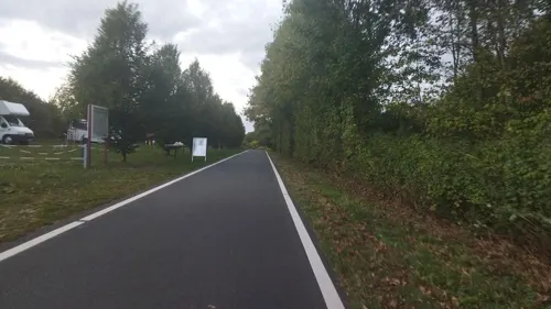
Bahnhofscafé
Cafe · 1.9 km
39 Am Bahnhof, Horstmar
Apr-May: Sa 14:00-17:00; Apr-May: Su 11:00 -18:00; May-Oct: Mo-Sa...

Jägerheim
Restaurant · 5.4 km
9 Höpingen, Rosendahl
Th-We 17:00-22:00; Sa, Su, PH 11:30-15:00, 17:00-22:00
Noah's Treff
Restaurant · Regional, Pizza, Kebab
2b Eichendorffstraße, Horstmar
Mo-Su 12:00-14:30,17:00-23:00
Pizzeria Napoli
Restaurant · Pizza
2 Schöppinger Straße, Horstmar
Tu-Sa 16:00-21:30; Su 15:00-21:00
Backhaus Ebbinghoff
Cafe
2 Holskenhok, Horstmar
Mo-Fr 06:00-13:00; Su,PH 07:30-12:00


Eiscafe Le Delizie
Ice cream · 4.6 km
11 Hohe Straße, Laer
Tu-Su 12:00-19:00; Mo off
31 more on the map.
History
Its castle was built as early as the 9th century; the first mention of Horstmar is as early as the early 11th century. The city of Horstmar was built to the south of this castle. During the Thirty Years' War the castle was destroyed by order of the Hessian lieutenant Carl von Rabenhaupt.
From the History section of Horstmar on Wikipedia, under CC BY-SA 4.0.
Where to stay10
WohnmobilstellplatzAltdeutsche Schänke Smeddinck
Campground · 4.8 km
43 Münsterdamm, Laer
Wohnmobilstellplatz am Horstmarer Bahnhof
Campground · 1.9 km
39 Am Bahnhof, Horstmar
Churches and places of worship17
Sankt Gertrudis
Church · Roman Catholic
1 Schöppinger Straße, Horstmar
Marienkirche
Church · Roman Catholic · 4.6 km
3 Marienplatz, Schöppingen
Ss. Cosmas und Damian
Church · Catholic · 3.7 km
3 Leer-Kirchplatz, Horstmar
Shopping12
Gas and EV charging7
Schools, colleges and libraries8
Healthcare4
Map of Horstmar
220 places. The map loads OpenStreetMap tiles when you open it.
Getting there and nearby towns
Münster Osnabrück Airport (FMO) is the nearest airport with scheduled flights listed in OpenStreetMap, 27 km away.
- Laer 5 km southeast, about 5 min by car
- Schöppingen 5 km northwest, about 5 min by car
- Steinfurt 8 km north, about 8 min by car
- Metelen 9 km northwest, about 9 min by car
- Billerbeck 11 km south, about 11 min by car
- Nordwalde 12 km east, about 12 min by car
- Havixbeck 13 km southeast, about 13 min by car
- Wettringen 14 km north, about 14 min by car
- Legden 15 km west, about 15 min by car
- Ochtrup 16 km northwest, about 16 min by car
Drive times are estimates from straight-line distance, not routes.
Local news
Headlines from INDB.
Reviews, tips and questions
Loading what members have shared...
Sources and licences
- GeoNames (CC BY 4.0): population, coordinates, regions and time zone
- Mapillary (see each image): photos
- OpenStreetMap contributors (ODbL 1.0): places, airports, map data
- Wikidata (CC0 1.0): elevation, founding date, time zone, website, landmarks and historic places
- Wikimedia Commons (see each image): photos
- Wikipedia (CC BY-SA 4.0): overview and history text
Photo credits
- Horstmar, St.-Gertrud-Kirche -- 2014 -- 2511, Dietmar Rabich, CC BY-SA 4.0
- Stolperstein Horstmar Gossenstraße 1 Doris Steinweg, Tomtom10, CC BY-SA 4.0
- Stolperstein Horstmar Gossenstraße 1 Bilba Steinweg, Tomtom10, CC BY-SA 4.0
- Stolperstein Horstmar Kappenbergerstraße 5 Fritz Nathan, Tomtom10, CC BY-SA 4.0
- Stolperstein Horstmar Königstraße 8 Grete Eichenwald, Tomtom10, CC BY-SA 4.0
- Stolperstein Horstmar Königstraße 8 Erwin Eichenwald, Tomtom10, CC BY-SA 4.0
- Stolperstein Horstmar Stadtstiege 22 Ernst Eichenwald, Tomtom10, CC BY-SA 4.0
- Stolperstein Horstmar Stadtstiege 22 Edith Eichenwald, Tomtom10, CC BY-SA 4.0
- Stolperstein Horstmar Kappenbergerstraße Marianne Löwenstein, Tomtom10, CC BY-SA 4.0
- Stolperstein Horstmar Kappenbergerstraße Hans Löwenstein, Tomtom10, CC BY-SA 4.0
- Stolpersteinlage Horstmar Kappenbergerstraße Haus Beiring, Tomtom10, CC BY-SA 4.0
- Stolpersteine Horstmar Kappenbergerstraße Haus Beiring, Tomtom10, CC BY-SA 4.0
- Stolperstein Horstmar Kappenbergerstraße Moritz Löwenstein, Tomtom10, CC BY-SA 4.0
- Stolpersteine Horstmar Kappenbergerstraße 5, Tomtom10, CC BY-SA 4.0
- Stolpersteinlage Horstmar Kappenbergerstraße 5, Tomtom10, CC BY-SA 4.0
- Stolperstein Horstmar Kappenbergerstraße 5 Heinz Nathan, Tomtom10, CC BY-SA 4.0
- Stolperstein Horstmar Kappenbergerstraße 5 Kurt Nathan, Tomtom10, CC BY-SA 4.0
- Stolperstein Horstmar Kappenbergerstraße 5 Henny Nathan, Tomtom10, CC BY-SA 4.0
- Stolperstein Horstmar Königstraße 8 Karl Eichenwald, Tomtom10, CC BY-SA 4.0
- Stolperstein Horstmar Königstraße 8 Samuel Eichenwald, Tomtom10, CC BY-SA 4.0
- Stolpersteine Horstmar Königstraße 8, Tomtom10, CC BY-SA 4.0
- Stolperstein Horstmar Königstraße 8 Helmut Eichenwald, Tomtom10, CC BY-SA 4.0
- Stolpersteinlage Horstmar Stadtstiege 22, Tomtom10, CC BY-SA 4.0
- Stolpersteinlage Horstmar Königstraße 8, Tomtom10, CC BY-SA 4.0
- Stolperstein Horstmar Stadtstiege 22 Selma Eichenwald, Tomtom10, CC BY-SA 4.0
- Stolpersteine Horstmar Stadtstiege 22, Tomtom10, CC BY-SA 4.0
- Stolperstein Horstmar Stadtstiege 22 Grete Eichenwald, Tomtom10, CC BY-SA 4.0
- Stolperstein Horstmar Stadtstiege 22 Helga Eichenwald, Tomtom10, CC BY-SA 4.0
- Stolpersteine Horstmar Gossenstraße 1, Tomtom10, CC BY-SA 4.0
- Stolperstein Horstmar Gossenstraße 1 Louis Steinweg, Tomtom10, CC BY-SA 4.0
- Stolperstein Horstmar Gossenstraße 1 Kurt Steinweg, Tomtom10, CC BY-SA 4.0
- Stolperstein Horstmar Gossenstraße 1 Pauline Cohn, Tomtom10, CC BY-SA 4.0
- Stolperstein Horstmar Gossenstraße 1 Rosa Steinweg, Tomtom10, CC BY-SA 4.0
- Stolperstein Horstmar Gossenstraße 1 Lotte Levin, Tomtom10, CC BY-SA 4.0
- Stolperstein Horstmar Gossenstraße 1 Liesel Steinweg, Tomtom10, CC BY-SA 4.0
- Stolperstein Horstmar Gossenstraße 1 Walter Steinweg, Tomtom10, CC BY-SA 4.0
- Stolperstein Horstmar Gossenstraße 1 Grete Steinweg, Tomtom10, CC BY-SA 4.0
- Burgsteinfurt, Denkmal -Erster Weltkrieg- -- 2014 -- 2438, Dietmar Rabich, CC BY-SA 4.0
- Borghorst Kirche Villa Fleiter Musikschule Marienschule, Derburgimwalder, CC BY-SA 3.0
- Schöppingen, das Alte Rathaus foto18 2012-04-30 13.40, Michielverbeek, CC BY-SA 3.0
- EggerodePfarrkircheNordseite, Netzhering, CC BY-SA 3.0
- 20160417 St. Brictius, Schöppingen (04806), Günter Seggebäing, Coesfeld, CC BY-SA 3.0
- Laer Pfarrkirche St Bartholomäus 4438, Rüdiger Wölk, CC BY-SA 2.5
- Leer St Cosmas und Damian 01, Jan-Herm Janßen, CC BY-SA 3.0
- Horstmar, Kirche St. Gertrud, Südseite, Rauenstein, CC BY-SA 2.0
- Stolperstein Horstmar Neustraße 5 Ella Slanowitsch, Tomtom10, CC BY-SA 4.0
- Stolperstein Horstmar Schöppinger Straße 7 Bernhard Löwenstein, Tomtom10, CC BY-SA 4.0
- Bürgerpark Horstmar, R.Zylberstein, CC BY-SA 4.0
- Steinfurt - Dumte - Dumter Wegekapelle 06 ies, Frank Vincentz, CC BY-SA 3.0
- Altes-rathaus-schoeppingen, Dr.mb-2008, CC BY 3.0
- Schöppingen Naturschutzgebiet Vechte IMG 1277 02 Brüningmühle, Muehlenbernd, CC BY-SA 4.0
- Paters Damm (1), Planeman, CC BY-SA 4.0
- SchoeppingerBergDenkmal1, Skraemer, CC BY-SA 3.0
- Antoniuskapelle Horstmar, Saemmi, CC BY 4.0
- Street-level photo, zuse, CC BY-SA 4.0
- Street-level photo, commodoortje, CC BY-SA 4.0
- Street-level photo, changchun1, CC BY-SA 4.0
- Street-level photo, heetENkoel, CC BY-SA 4.0
- Street-level photo, descilla, CC BY-SA 4.0
- Street-level photo, commodoortje, CC BY-SA 4.0
- Street-level photo, descilla, CC BY-SA 4.0
- Street-level photo, descilla, CC BY-SA 4.0
- Street-level photo, descilla, CC BY-SA 4.0
- Street-level photo, commodoortje, CC BY-SA 4.0
- Street-level photo, zuse, CC BY-SA 4.0
- Street-level photo, descilla, CC BY-SA 4.0
- Street-level photo, descilla, CC BY-SA 4.0
- Street-level photo, poxonline, CC BY-SA 4.0
- Street-level photo, poxonline, CC BY-SA 4.0
- Street-level photo, commodoortje, CC BY-SA 4.0
- Street-level photo, descilla, CC BY-SA 4.0
- Street-level photo, descilla, CC BY-SA 4.0


Page built November 9, 2026. Spotted a mistake? Tell us or suggest a place.