


Billerbeck, Germany
Billerbeck is a town of 11,699 people in North Rhine-Westphalia, Germany.
Why visit Billerbeck
Townapedia lists 143 museums and landmarks, 55 parks and trails, 80 places to eat, 15 places to stay and 16 attractions in and around town.
Highlights include Freilichtbühne Billerbeck, Reinerts Milchtankstelle, Baumberger-Sandstein- Museum and Kolvenburg.
Weather in Billerbeck
Forecast from MET Norway (CC BY 4.0). Full forecast
About Billerbeck
Billerbeck (German pronunciation: [ˈbɪlɐbɛk]; Westphalian: Billerbiëk) is a town in the district of Coesfeld in North Rhine-Westphalia in Germany.
From the Wikipedia article Billerbeck (this version), under CC BY-SA 4.0.
Things to do16



Longinus Tower
Monument and historic site · 5.4 km
Tower near Nottuln




4 more on the map.
Museums and landmarks143


Kolvenburg
Museum · 0.6 km
3 An der Kolvenburg, Billerbeck
Tu-Sa 13:00-18:00; PH Su 10:00-13:00,13:30-17:30




Schloss Varlar
Monument and historic site · 7.8 km
70 Varlar, Rosendahl


Wald ARTelier - Atelier für Bildhauerei
Monument and historic site · 6.7 km
Bildhauerkurse für Laien und Fortgeschrittene, Bildhauerkurse für Kinder, Segwaytouren + Bildhauerkurse auf den Spuren des Baumberger...
43 Lasbeck, Havixbeck
131 more on the map.
Parks, trails and playgrounds55

Freibad Billerbeck
Sports field and stadium · 0.8 km
27 Osterwicker Straße, Billerbeck
May-Sep Mo-Fr 14:00-20:00; May-Sep PH,Sa,Su 10:00-20:00; May-Sep...




43 more on the map.
Restaurants and cafes80

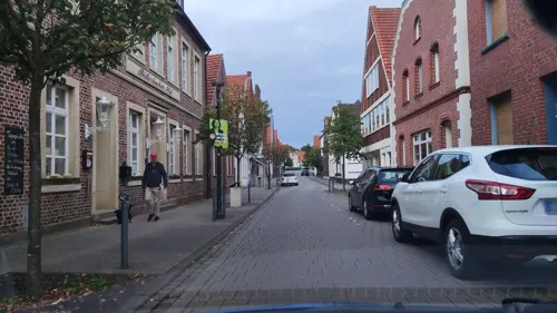
Billerbecker Hof
Restaurant · German
20 Schmiedestraße, Billerbeck
Mo-Sa 12:00-14:30,18:00-21:30; Su 12:00-18:00

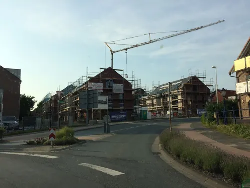
Ebbing
Cafe · 7.1 km
1 Appelhülsener Straße, Nottuln
Mo-Fr 06:00-18:30; Sa 06:30-17:30; Su 07:00-17:00
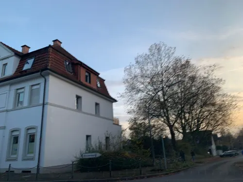
Essmanns Backstube
Cafe · Cake
28 Münsterstraße, Billerbeck
Mo-Th 07:00-18:30; Fr 06:00-18:30; Sa 06:00-18:00; Su, PH 07:00-11:00
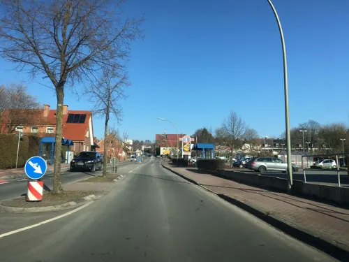
Zum Coesfelder Berg
Cafe · Cake · 7.8 km
51 Bergallee, Coesfeld
Tu-Th,Su,PH 14:30-21:00; Fr,Sa "by appointment"
18|97 Café am Longinusturm
Restaurant · German · 5.4 km
4 Baumberg, Nottuln
Apr-Sep We-Sa 14:00-18:00; Su 12:30-18:00; Oct-Mar Fr,Sa...
Billerbäcker
Cafe · Cake
6-10 Ludgeristraße, Billerbeck
Mo-Fr 05:00-13:00; Sa 05:00-11:00; Su, PH 06:00-11:00; "zusätzlich...


Café Pannkokenhus Teitekerl
Restaurant · Pancake, Potato, Cake, Pastry · 6.7 km
43 Lasbeck, Havixbeck
We-Mo 11:00-20:00; Tu off
68 more on the map.
Where to stay15
Annette-von-Droste-Hülshoff-DJH Jugendherberge Nottuln
Motel and hotel · 7.2 km
6 Sankt-Amand-Montrond-Straße, Nottuln
Churches and places of worship17
Johannis-Kirche
Church · Roman Catholic
Johannikirchplatz, Billerbeck
Ss. Fabian und Sebastian
Church · Catholic · 7.0 km
Fabianus-Kirchplatz, Rosendahl
Shopping24
Gas and EV charging7
Schools, colleges and libraries14
Healthcare9
Map of Billerbeck
250 places. The map loads OpenStreetMap tiles when you open it.
Getting there and nearby towns
Münster Osnabrück Airport (FMO) is the nearest airport with scheduled flights listed in OpenStreetMap, 32 km away.
- Nottuln 6 km southeast, about 6 min by car
- Havixbeck 9 km east, about 9 min by car
- Coesfeld 9 km southwest, about 9 min by car
- Dülmen 16 km south, about 16 min by car
- Steinfurt 19 km north, about 19 min by car
- Gescher 20 km west, about 20 min by car
- Münster 23 km east, about 23 min by car
- Velen 23 km southwest, about 23 min by car
- Greven 24 km northeast, about 24 min by car
- Lüdinghausen 26 km southeast, about 26 min by car
Drive times are estimates from straight-line distance, not routes.
Local news
Headlines from INDB.
Reviews, tips and questions
Loading what members have shared...
Sources and licences
- GeoNames (CC BY 4.0): population, coordinates, regions and time zone
- Mapillary (see each image): photos
- OpenStreetMap contributors (ODbL 1.0): places, airports, map data
- Wikidata (CC0 1.0): elevation, founding date, time zone, website, landmarks and historic places
- Wikimedia Commons (see each image): photos
- Wikipedia (CC BY-SA 4.0): overview and history text
Photo credits
- 20140412 125114 Fotoflug Münsterland (DSC00381), Günter Seggebäing, Coesfeld, CC BY-SA 3.0
- Ludgerusdom, Billerbeck (00312), Günter Seggebäing, Coesfeld, CC BY-SA 3.0
- Billerbeck, Baudenkmal 46 Wohnhaus Schmiedestr. 7, W.Strickling, CC BY-SA 4.0
- St. Ludgerus Billerbeck Innenraum 02, H.Helmlechner, CC BY-SA 4.0
- St. Ludgerus Billerbeck Innenraum 03, H.Helmlechner, CC BY-SA 4.0
- St. Ludgerus Billerbeck Innenraum 04, H.Helmlechner, CC BY-SA 4.0
- St. Ludgerus Billerbeck Innenraum 01, H.Helmlechner, CC BY-SA 4.0
- Billerbeck, St. Ludgerus, 2011-10 CN-04, kaʁstn Disk / Cat, CC BY-SA 3.0 de
- Billerbeck, St. Ludgerus, 2011-11 CN-01, kaʁstn Disk / Cat, CC BY-SA 3.0 de
- Propsteikirche St. Ludgerus Billerbeck 100 5873, Stahlkocher, CC BY-SA 3.0
- Billerbeck Orgel, Tibia Plena 8', CC BY-SA 4.0
- Billerbeck-Kriegerehrenmal-1-Asio, Asio otus, CC BY-SA 3.0
- Billerbeck, St. Ludgerus, 2011-10 CN-03, Steffen Schmitz, CC BY-SA 3.0 de
- Billerbeck-StLudgerus-1-Asio, Asio otus, CC BY-SA 3.0
- ChororgelBillerbeck 01, Tibia Plena 8', CC BY-SA 4.0
- Billerbeck, St. Ludgerus, 2011-11 CN-03, kaʁstn Disk / Cat, CC BY-SA 3.0 de
- Sankt Ludgerus Billerbeck 02, H.Helmlechner, CC BY-SA 4.0
- Billerbeck, St. Ludgerus, 2011-10 CN-01, Steffen Schmitz ( more photos ), CC BY-SA 3.0 de
- Billerbeck, St. Ludgerus, 2011-10 CN-02, kaʁstn Disk / Cat, CC BY-SA 3.0 de
- Billerbeck, Propsteikirche St. Ludgerus -- 2020 -- 0268, Dietmar Rabich, CC BY-SA 4.0
- Billerbeck St. Ludgerus Orgel Spieltisch 01, Tibia Plena 8', CC BY-SA 4.0
- Billerbeck, Propsteikirche St. Ludgerus -- 2020 -- 0270, Dietmar Rabich, CC BY-SA 4.0
- St. Ludgerus Billerbeck 03, H.Helmlechner, CC BY-SA 4.0
- Billerbeck St.Ludgerus 01, Tibia Plena 8', CC BY-SA 4.0
- Billerbeck, Propsteikirche St. Ludgerus -- 2020 -- 0266, Dietmar Rabich, CC BY-SA 4.0
- Billerbeck, Rathaus, 2011-10 CN-02, kaʁstn Disk / Cat, CC BY-SA 3.0 de
- Rathaus, Billerbeck (00311), Günter Seggebäing, Coesfeld, CC BY-SA 3.0
- Billerbeck, Rathaus, 2011-10 CN-01, kaʁstn Disk / Cat, CC BY-SA 3.0 de
- Billerbeck-StLudgerus-3-Asio, Asio otus, CC BY-SA 3.0
- Billerbeck-StLudgerus-2-Asio, Asio otus, CC BY-SA 3.0
- Billerbeck, Baudenkmal 72 Geschaeftshaus Markt 2, W.Strickling, CC BY-SA 4.0
- Billerbeck, Propsteikirche St. Ludgerus -- 2020 -- 0264, Dietmar Rabich, CC BY-SA 4.0
- Sankt Ludgerus Billerbeck 01, H.Helmlechner, CC BY-SA 4.0
- Billerbeck, St. Ludgerus, 2011-11 CN-02, kaʁstn Disk / Cat, CC BY-SA 3.0 de
- Billerbeck, Baudenkmal 37 Ackerbuergerhaus Lange Str. 1, W.Strickling, CC BY-SA 4.0
- Billerbeck, Baudenkmal 87 Giebel und Kamin Muensterstr. 16, W.Strickling, CC BY-SA 4.0
- Billerbeck, Baudenkmal 06a Haus Muensterstr 2, W.Strickling, CC BY-SA 4.0
- Billerbeck, Lange Straße, Türscharnier -- 2020 -- 0271, Dietmar Rabich, CC BY-SA 4.0
- Billerbeck, Lange Straße, Türscharnier -- 2020 -- 0271 (bw), Dietmar Rabich, CC BY-SA 4.0
- Ludgerusdom, Billerbeck (00308), Günter Seggebäing, Coesfeld, CC BY-SA 3.0
- Darfeld Schloss, Corradox, CC BY-SA 3.0
- Freilichtbuehne billerbeck die wilden huehner 2008, Heinz-Guenter Kapalla, CC BY-SA 3.0
- 20140412 124917 Kolvenburg, Billerbeck (DSC00372), Günter Seggebäing, Coesfeld, CC BY-SA 3.0
- Landschaft am Westerberg, Günter Seggebäing, CC BY-SA 3.0
- Nottuln, Darup, St. Fabian und Sebastian, 2011-10 CN-05, kaʁstn Disk / Cat, CC BY-SA 3.0 de
- St. Fabian und Sebastian Osterwick, Günter Seggebäing, CC BY-SA 3.0
- Schloss Varlar, Rosendahl (00654), Günter Seggebäing, Coesfeld, CC BY-SA 3.0
- Darfeld, Goofy50, CC BY-SA 3.0
- Nottuln, St.-Martinus-Kirche -- 2014 -- 3996 -- Ausschnitt, Dietmar Rabich, CC BY-SA 4.0
- Havixbeck, Bruder-Klaus-Kapelle -- 2020 -- 6282, Dietmar Rabich, CC BY-SA 4.0
- Billerbeck, Gut Möltgen und Haus Homoet -- 2014 -- 9378 -- Ausschnitt, Dietmar Rabich, CC BY-SA 4.0
- Nottuln, Kirche -Unter dem Kreuz- -- 2014 -- 3988 -- Ausschnitt, Dietmar Rabich, CC BY-SA 4.0
- Billerbeck, Kapelle Aulendorf -- 2014 -- 9376 -- Ausschnitt, Dietmar Rabich, CC BY-SA 4.0
- Nottuln, Monument Geschw.-Scholl-Hauptschule 2020-04-08 3968, W.Strickling, CC BY-SA 4.0
- LonginusturmMuensterland01, NatiSythen, CC BY-SA 3.0
- Wassermühle Schulze Westerath, Nottuln (DSC01854), Günter Seggebäing, Coesfeld, CC BY-SA 3.0
- Billerbeck, Johannikirchplatz, 2011-10 CN-05, kaʁstn Disk / Cat, CC BY-SA 3.0 de
- Poppenbecker Kreuz, Havixbeck (DSC00007), Günter Seggebäing, Coesfeld, CC BY-SA 3.0
- Mühlenteich Haus Hameren, Billerbeck (03256), Günter Seggebäing, Coesfeld, CC BY-SA 3.0
- Nottuln, Baumberge -- 2016 -- 1477, Dietmar Rabich, CC BY-SA 4.0
- 20151031 Westerberg, Nottuln (04090), Günter Seggebäing, Coesfeld, CC BY-SA 3.0
- Billerbeck, St. Johannes der Täufer, 2011-10 CN-01, kaʁstn Disk / Cat, CC BY-SA 3.0 de
- Dreilindenhöhe Coesfeld (09107), Günter Seggebäing, Coesfeld, CC BY-SA 3.0
- Street-level photo, hotteliene, CC BY-SA 4.0
- Street-level photo, kalla, CC BY-SA 4.0
- Street-level photo, descilla, CC BY-SA 4.0
- Street-level photo, ziltoidium, CC BY-SA 4.0
- Street-level photo, hotteliene, CC BY-SA 4.0
- Street-level photo, hotteliene, CC BY-SA 4.0
- Street-level photo, poxonline, CC BY-SA 4.0
- Street-level photo, descilla, CC BY-SA 4.0
- Street-level photo, descilla, CC BY-SA 4.0
- Street-level photo, mpw, CC BY-SA 4.0
- Street-level photo, descilla, CC BY-SA 4.0
- Street-level photo, hotteliene, CC BY-SA 4.0
- Street-level photo, poxonline, CC BY-SA 4.0
- Street-level photo, descilla, CC BY-SA 4.0
- Street-level photo, mpw, CC BY-SA 4.0


Page built November 8, 2026. Spotted a mistake? Tell us or suggest a place.