


Why visit Ochtrup
Townapedia lists 53 museums and landmarks, 51 parks and trails, 72 places to eat, 9 places to stay and 6 attractions in and around town.
Highlights include Hof Janning-Volbert, Bad Bentheim, Töpfereimuseum and Böhm'scher Rundbau.
Weather in Ochtrup
Forecast from MET Norway (CC BY 4.0). Full forecast
About Ochtrup
Ochtrup (German: [ˈɔxtʁʊp] ) is a town in the district of Steinfurt, in North Rhine-Westphalia, Germany. It is situated approximately 20 km west of Rheine and 20 km east of Enschede.
From the Wikipedia article Ochtrup (this version), under CC BY-SA 4.0.
Things to do6



Museums and landmarks53

Töpfereimuseum
Museum
12a;12 Töpferstraße, Ochtrup
Tu-Fr 09:00-12:00,15:00-17:00; Su 15:00-17:00; Mo,Sa off





Altes Pastorsgebäude
Monument and historic site · 4.6 km
1 Capellestraße, Ochtrup
41 more on the map.
Parks, trails and playgrounds51

Bergfreibad Ochtrup
Sports field and stadium · 1.6 km
3 Am Freibad, Ochtrup
May 01-Sep 15: Mo 12:30-20:00; Tu-Fr 06:00-20:00; Sa-Su,PH 08:00-18:00



39 more on the map.
Restaurants and cafes72

Bäckerei Voss
Cafe · Breakfast, Pastry, Pasta, Coffee Shop · 2.4 km
1 Teupenhook, Ochtrup
Mo-Fr 06:00-18:00; Sa-Su 07:00-17:00
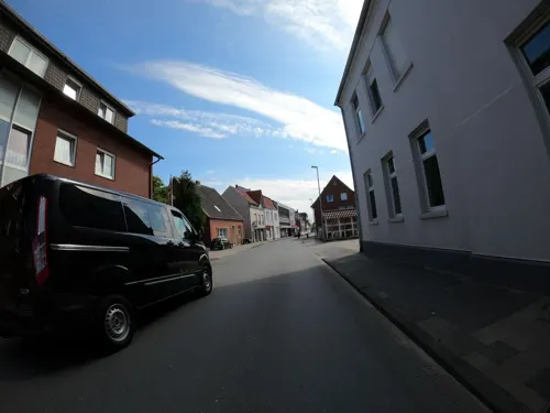
Hotel & Restaurant Brinckwirth
Restaurant · German · 0.7 km
41 Bahnhofstraße, Ochtrup
Mo-We,Su 12:00-14:00,17:30-22:00; Fr-Sa 12:00-14:00,17:30-23:00; Th off
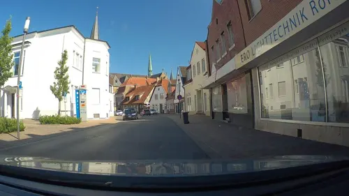
Larin Food
Restaurant · Pizza
10 Bergstraße, Ochtrup
Mo-Tu 11:00-23:00; Th 11:00-23:00; Fr 11:00-23:30; Sa 12:00-23:30;...

Mira Holzkohlegrill
Restaurant · Oriental, Turkish · 1.9 km
1B Am Langenhorster Bahnhof, Ochtrup
Mo off; Tu-Su 16:00-23:00
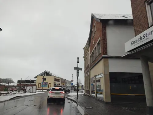
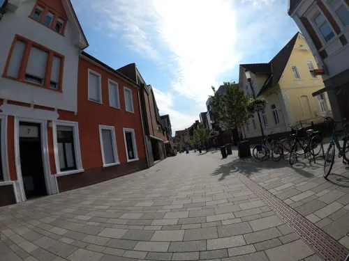
Bäckerei Bäumer
Bakery · 0.7 km
38 Bentheimer Straße, Ochtrup
Mo-Fr 05:30-18:00; Sa 05:30-12:00; Su 07:00-11:00

Bäckerei Bäumer
Bakery · 1.8 km
86 Dietrich-Bonhoeffer-Straße, Ochtrup
Mo-Fr 05:30-18:00; Sa 05:30-14:00; Su 07:00-11:00
Bäckerei Bäumer
Bakery · 3.5 km
28 Hauptstraße, Ochtrup
Mo-Fr 05:30-18:00; Sa 05:30-12:00; Su 07:00-11:00


60 more on the map.
History
An early mention of the town was „Ohtepe“ (the eastern Epe or Ostepe) in the year 1143. A Christian church was established there in 1203.
Between November 25 and November 30, 2005, the town was often off the German power grid, and was the topic of national news. The cause was a heavy snow storm with very wet snow. The power poles and cables between Gronau and Ochtrup were encrusted with a thick layer of ice. Due to the increased weight and the heavy storm most power poles toppled. Emergency generators from all regions of Germany were installed and operated in the following days and weeks. Dairy farmers were economically impacted as were other companies in the area. The collapse of the power poles, even today, is not completely understood. Some were 65 years old and rusted, but some were newer and constructed with special steel. Politicians in North Rhine-Westphalia blamed the power company, RWE for failure to replace older poles.
From the History section of Ochtrup on Wikipedia, under CC BY-SA 4.0.
Where to stay9
Churches and places of worship11
Shopping18
Gas and EV charging12
Schools, colleges and libraries10
Healthcare6
Map of Ochtrup
248 places. The map loads OpenStreetMap tiles when you open it.
Getting there and nearby towns
Münster Osnabrück Airport (FMO) is the nearest airport with scheduled flights listed in OpenStreetMap, 35 km away.
- Steinfurt 12 km southeast, about 12 min by car
- Schüttorf 13 km north, about 13 min by car
- Rheine 19 km northeast, about 19 min by car
- Stadtlohn 30 km southwest, about 30 min by car
- Vreden 31 km southwest, about 31 min by car
- Wietmarschen 34 km north, about 34 min by car
- Neuenhaus 35 km northwest, about 35 min by car
- Velen 38 km south, about 38 min by car
- Münster 41 km southeast, about 41 min by car
- Recke 40 km northeast, about 40 min by car
Drive times are estimates from straight-line distance, not routes.
Local news
Headlines from INDB.
Reviews, tips and questions
Loading what members have shared...
Sources and licences
- GeoNames (CC BY 4.0): population, coordinates, regions and time zone
- Mapillary (see each image): photos
- OpenStreetMap contributors (ODbL 1.0): places, airports, map data
- Wikidata (CC0 1.0): elevation, founding date, time zone, website, landmarks and historic places
- Wikimedia Commons (see each image): photos
- Wikipedia (CC BY-SA 4.0): overview and history text
Photo credits
- Ochtrup, St.-Lamberti-Kirche -- 2014 -- 9478, Dietmar Rabich, CC BY-SA 4.0
- Bentheim pano, Arch, Public domain
- LangenhorstAußenansicht, Netzhering, CC BY-SA 3.0
- Haus Rothenberge in Wettringen01, Chala123, CC BY-SA 3.0
- Metelen, kerk foto2 2007-04-12 13.22, Michielverbeek, CC BY-SA 3.0
- OchtrupLambertikirche, Torbenbrinker, CC BY-SA 3.0
- Wasserburg Haus Welbergen, Sharps, CC BY 2.5
- Stolperstein Metelen Schilden 15 Emmy Löwenberg, Gmbo 2013, CC0
- Stolperstein Metelen Schilden 15 Johanna Horn, Gmbo 2013, CC0
- Stolperstein Metelen Schilden 15 Ruth Marx, Gmbo 2013, CC0
- Staedtisches-Gymnasium-Ochtrup, Heiner Kippelt, CC BY-SA 3.0 de
- Eisenbahnmuseum Metelen Land, Unknown author, CC BY-SA 3.0
- Bilk-St-Michael, Zumthie, Public domain
- FOC Ochtrup, Denkmalnr. 41 - Rundbau Gebrüder Laurenz, Dominikus Böhm - 1, Elke Wetzig, CC BY-SA 3.0
- Welbergen, St. Dionysius, Westerdam, CC BY-SA 3.0 de
- St. Dionysius, Welbergen, Westerdam, CC BY-SA 4.0
- Ochtrup, Naturschutzgebiet -Am Waldhof- -- 2014 -- 9436, Dietmar Rabich, CC BY-SA 4.0
- 20150501 mk harskamp 03, Kaiserm123, CC BY-SA 3.0
- Ochtrup St. Lamberti Kirche, Timmel2019, CC BY-SA 4.0
- Metelen, St.-Cornelius-und-Cyprian-Kirche -- 2014 -- 2410 -- Ausschnitt, Dietmar Rabich, CC BY-SA 4.0
- 20160327 Haus Welbergen, Welbergen, Ochtrup (04404), Günter Seggebäing, Coesfeld, CC BY-SA 3.0
- Ochtrup, Welbergen, St.-Dionysius-Kirche -- 2014 -- 9448 -- Ausschnitt, Dietmar Rabich, CC BY-SA 4.0
- Street-level photo, thetornado76, CC BY-SA 4.0
- Street-level photo, poxonline, CC BY-SA 4.0
- Street-level photo, poxonline, CC BY-SA 4.0
- Street-level photo, VIA_KK, CC BY-SA 4.0
- Street-level photo, poxonline, CC BY-SA 4.0
- Street-level photo, VIA_KK, CC BY-SA 4.0
- Street-level photo, poxonline, CC BY-SA 4.0
- Street-level photo, poxonline, CC BY-SA 4.0
- Street-level photo, VIA_KK, CC BY-SA 4.0
- Street-level photo, poxonline, CC BY-SA 4.0
- Street-level photo, VIA_KK, CC BY-SA 4.0
- Street-level photo, VIA_KK, CC BY-SA 4.0
- Street-level photo, poxonline, CC BY-SA 4.0
- Street-level photo, poxonline, CC BY-SA 4.0
- Street-level photo, thetornado76, CC BY-SA 4.0
- Street-level photo, poxonline, CC BY-SA 4.0
- Street-level photo, poxonline, CC BY-SA 4.0
- Street-level photo, deleted_user, CC BY-SA 4.0
- Street-level photo, deleted_user, CC BY-SA 4.0
- Street-level photo, possum3832, CC BY-SA 4.0


Page built November 8, 2026. Spotted a mistake? Tell us or suggest a place.