


Steinfurt, Germany
Steinfurt is a town of 34,601 people in North Rhine-Westphalia, Germany, founded in January 1, 1975.
Why visit Steinfurt
Townapedia lists 232 museums and landmarks, 70 parks and trails, 121 places to eat, 9 places to stay and 9 attractions in and around town.
Highlights include Biohofladen Overesch, Warenautomat, Old Town Hall and Eisenbahnmuseum Metelen Land.
Weather in Steinfurt
Forecast from MET Norway (CC BY 4.0). Full forecast
About Steinfurt
Steinfurt (German: [ˈʃtaɪnfʊʁt] ; Westphalian: Stemmert) is a city in North Rhine-Westphalia, Germany. It is the capital of the district of Steinfurt. From c. 1100–1806, it was the capital of the County of Steinfurt.
From the Wikipedia article Steinfurt (this version), under CC BY-SA 4.0.
Photos of Steinfurt


Things to do9
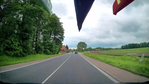
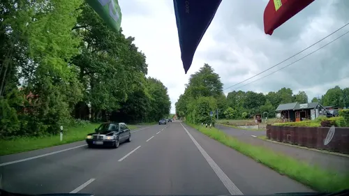
Warenautomat
Farm and orchard · 7.1 km
Tiefgekühltes Fleisch von unseren Bentheimer Landschweinen, frische Freilandeier, Eierlikör, Eiernudeln, Saisonware (siehe Website)
4 Dorfbauerschaft, Neuenkirchen
24/7



Museums and landmarks232
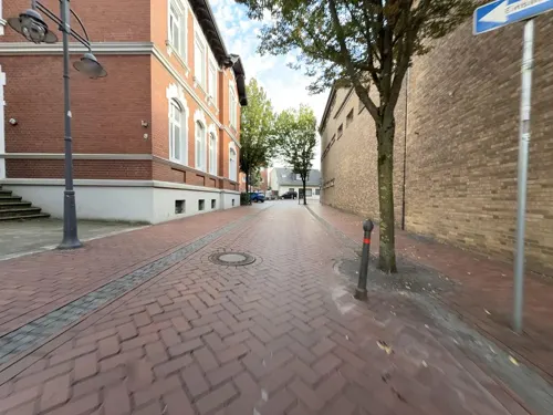

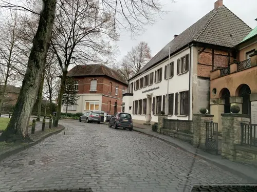


220 more on the map.
Parks, trails and playgrounds70


Steinfurter Bagno
Park · 1.8 km
Park near Burgsteinfurt in North Rhine-Westphalia


Kombibad Borghorst
Sports field and stadium · 5.7 km
13 Gräfin-Bertha-Straße, Steinfurt
Mo 13:00-19:45; Tu 06:30-08:00,09:15-10:15,13:00-19:45; We...


58 more on the map.
Restaurants and cafes121
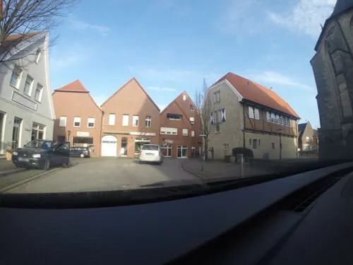
Da Amici
Restaurant · Italian · 8.1 km
6 Schöppinger Straße, Horstmar
We,Th,Su 17:00-22:00; Mo,Tu off; Fr,Sa 17:00-23:00
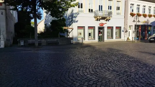
Café am Markt
Cafe
Shop in Shop - hier können Sie die Dekoartikel und Möbel käuflich erwerben
11 Markt, Steinfurt
Mo-Tu 09:30-17:30; Fr-Su 09:30-17:30
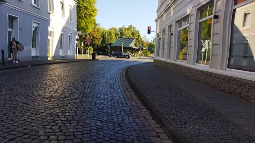
Machina Milch- und Kaffeewerkstatt
Cafe · Coffee Shop
14 Wasserstraße, Steinfurt
Tu,Fr 10:00-18:00; Th 12:30-18:00; Sa,Su 12:30-18:00; Mo,We off
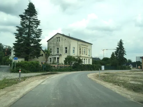
Bäckerei Bäumer
Bakery · 8.6 km
28 Hauptstraße, Ochtrup
Mo-Fr 05:30-18:00; Sa 05:30-12:00; Su 07:00-11:00

Bäckerei Voss
Bakery
1 Tecklenburger Straße, Steinfurt
Mo-Fr 06:00-18:00; Sa 06:00-17:00, Su 07:30-17:00


Gaststätte Sandmann
Restaurant · Burger, Regional, Cake, Sausage, Soup, Chicken, Fries, Salad, German, Breakfast, Mexican, Coffee Shop, Tea, Juice, Pastry, Brunch · 8.0 km
9 Dorfstraße, Ochtrup
"Biergartensaison" Mo off; Tu-Fr 14:00-22:00; Sa-Su 10:00-24:00;...
109 more on the map.
History
Predominantly influenced by Protestants, it is home to one of the oldest academies of continuing education in Westphalia. The city harbours moated castles. These landmarks distinguish Steinfurt from the neighbouring countryside. There is the Bagno in Burgsteinfurt, a forested amusement park which dates back to the 18th century with one of the oldest free-standing European concert halls.
The origins of Burgsteinfurt are unknown. It is assumed different circumstances led to its foundation, in particular farming, the river Aa and the Order of Saint John
The farming communities Hollich, Sellen and Veltrup are significantly older than Burgsteinfurt. The centre of Burgsteinfurt developed around the main farm of "Veltrup," which already existed in 890 as "villa veliun." Probably "villa veliun" was the main homestead of a small settlement, which was located on the territory of today's inner castle ward. Back then there was a market square at the current castle's entrance, which later developed into the "Old Town" of today.
Read more of the history
Another settlement not dated back precisely yet was found in the course of archeological excavations in the area of the contemporary "Steintorfeldmark." All three farming communities had their own sanctuaries in pre-Christian time. After the era of Christianization they built a church in honour of Irish missionaries, which was the predecessor of today's Great Protestant Church. The farming communities celebrate their own feasts and customs with their own special atmosphere up to now although they were incorporated into the city in 1939.
Steinfurt's name originates from an old stone passage (or "ford") across the river "Aa." This passage was probably located at today's crossways of "Wasserstraße" and "Europaring." Being a part of a military formation connecting east and west, it offered one of only few possibilities to cross the river with coaches. The authority controlling the "ford" was powerful, authorised to charge tolls, and fords were also places of commerce. In a document from 1129 there is the first reference to two noblemen "de Steinvorde" (of Steinfurt). They probably had a moated castle built in the place of the main farm of Veltrup near the "ford" in order to control it.
The first rival was the Ascheberg clan living in a castle near today's road to Emsdetten, the old road of army and commerce to Münster and other eastern Germanic areas. There was a permanent war between the House of Ascheberg and the House of Steinfurt. In 1164 the Ascheberg clan is said to have destroyed the castle of the Steinfurt clan while the latter were on a trip to Cologne. After their return to Steinfurt they satisfied their desire for revenge and destroyed the castle of Ascheberg.
The noblemen of Steinfurt put forward a liberal settlement policy offering tradesmen, craftsmen and other citizens favourably situated houses near the "ford." In return they had to provide currency, wax or poultry and the old farming community "Villa Veliun" turned into a market square. In a document from 1338 the settlement is named "unse Stat to Stenvorde" (our city of Stenvorde). From 1816 up to the administrational reform in 1975 the city was called "Burgsteinfurt" and now there is just the city of "Steinfurt" uniting the two parts – Burgsteinfurt and Borghorst.
The Knights of St. John of Jerusalem was a religious and military order of striking importance for Steinfurt, which came to Burgsteinfurt sometime in the 13th century. The knights were given several manors around Steinfurt. Next to the major church the "Knights" founded their settlement called "Kommende" in 1244 of which most of the old buildings have survived until today.
From the 12th century on there was another settlement developed in the neighbourhood of the "Kommende," which is now the district of Burgsteinfurt called "Friedhof" (free area).
The wealth of the Order of St. John grew continuously. The noblemen gave them authority to supervise the major church, including the prerogative to appoint clergymen and to manage its funds. Additionally they accepted donations of several rich farms as well as possessions in the surrounding area. The settlement of the Knights of St. John of Jerusalem in Steinfurt, which was the first settlement of the order in Westphalia, became the biggest one in the region. In Münster they also founded a branch settlement. The Knights of St. John and the "Friedhof" (cemetery)-district formed an important unity. The "Friedhof" (free zone)-district was an independent area outside Steinfurt with its own civil rights. The name "Friedhof" doesn't refer to a cemetery, but reminds the reader of a pre-Christian sanctuary, which was located in the place of today's "Great Church." A person reaching this holy place was free; even criminals could not be punished here. In 1347 Steinfurt was granted town privileges. A hundred years later the County of Steinfurt was integrated into the community of counties immediate to the Empire, so that Steinfurt was only subordinate to the Emperor of Germany. Nevertheless, the ambitions of Münster kept growing. The self-government of Steinfurt had always annoyed the bishop of Münster.
But Steinfurt prepared itself. The citizens built walls, ramparts, ditches and so on at their own expense. A complete wall around the city was put up. This fortification consisted of the city wall, the inner moat, the rampart, the outer moat and a forward wall. The course of this fortification can be traced in today's cityscape. It develops around the old city centre from the "Schüttenwall" via the "Wilhelmsplatz," the "Kalkwall," the "Stampenwall" and the "Neuen Wall." The small lanes "Türkei," "Löffelstraße," "An der Stadtmauer," "Drepsenhoek" and "Viefhoek" run parallel to the old city wall.
From the History section of Steinfurt on Wikipedia, under CC BY-SA 4.0.
More about Steinfurt
Geography
Steinfurt is situated north-west of Münster, North Rhine-Westphalia. Its name, roughly meaning “stony ford”, came into being in 1975 when the two hitherto independent towns Borghorst and Burgsteinfurt amalgamated. Borghorst became a prosperous city due to its flourishing textile industry, whereas Burgsteinfurt has always rather been characterized by culture and administration. Tourists of the 19th century passing Burgsteinfurt praised the city as the "Paradise of Westphalia" and "Royal Diamond" (Königsdiamant) because of its 75 monumental buildings and moated castle.
Steinfurt borders Ochtrup, Wettringen, Neuenkirchen, Emsdetten, Nordwalde, Altenberge, Laer, Horstmar and Metelen.
Steinfurt consists of Borghorst and Burgsteinfurt, each with three attached farming communities:
Education
In Steinfurt there are a variety of schools and colleges, including two secondary schools, one of which is the "Gymnasium Arnoldinum," a descendant of the "Hohe Schule."
The engineering faculties of the University of Applied Sciences Münster (Fachhochschule Münster) are based in Steinfurt.
From the Wikipedia article Steinfurt, under CC BY-SA 4.0.
Notable people from Steinfurt
 Mikael ForssellFinnish footballerPhoto: Struway, Public domain
 Jannine WeigelThai singer, actress, modelPhoto: Sry85, CC BY-SA 4.0
 Prince William of Hesse-Philippsthal-BarchfeldGerman counter admiral (1831–1890)Photo: anonymous, Public domain
 Christian LeitzGerman archaeologist and Egyptologist (born 1960)Photo: Djehouty, CC BY-SA 4.0
 Paul GauselmannGerman businessmanPhoto: Jan Herrmann, CC BY-SA 4.0
 Johann Friedrich BöckelmannGerman juristPhoto: Johann Heinrich Roos (Maler), Johann..., Public domain
 Fritz KiehnGerman entrepreneur and politician (NSDAP), MdR (1885–1980)Photo: Trossingen1, Public domain
- Alexis, Landgrave of Hesse-Philippsthal-BarchfeldLandgrave of Hesse-Philippsthal-Barchfeld (1829–1905)
- Chlodwig, Landgrave of Hesse-Philippsthal-BarchfeldGerman noble (1876-1954)
- Alexius, 2nd Prince of Bentheim and SteinfurtGerman nobleman (1781-1866)
- Levin Ludwig SchückingGerman anglicist (1878–1964)
- Tatjana DollGerman painter (1970)
Born in Steinfurt, according to Wikidata (CC0). Each name links to its Wikipedia article.
Where to stay9
Churches and places of worship25
Sankt Gertrudis
Church · Roman Catholic · 8.2 km
1 Schöppinger Straße, Horstmar
St. Nikomedes
Church · Roman Catholic · 5.0 km
2 Kirchplatz, Steinfurt
Ss. Cosmas und Damian
Church · Catholic · 4.9 km
3 Leer-Kirchplatz, Horstmar
Shopping42
Gas and EV charging15
Schools, colleges and libraries34
Healthcare15
Map of Steinfurt
250 places. The map loads OpenStreetMap tiles when you open it.
Getting there and nearby towns
Münster Osnabrück Airport (FMO) is the nearest airport with scheduled flights listed in OpenStreetMap, 24 km away.
- Wettringen 7 km north, about 7 min by car
- Horstmar 8 km south, about 8 min by car
- Metelen 8 km west, about 8 min by car
- Schöppingen 9 km southwest, about 9 min by car
- Neuenkirchen 11 km north, about 11 min by car
- Laer 11 km south, about 11 min by car
- Ochtrup 12 km northwest, about 12 min by car
- Emsdetten 13 km east, about 13 min by car
- Nordwalde 12 km southeast, about 12 min by car
- Altenberge 14 km southeast, about 14 min by car
Drive times are estimates from straight-line distance, not routes.
Towns near Steinfurt


Keep exploring
Local news
Headlines from INDB.
Reviews, tips and questions
Loading what members have shared...
Sources and licences
- GeoNames (CC BY 4.0): population, coordinates, regions and time zone
- Mapillary (see each image): photos
- OpenStreetMap contributors (ODbL 1.0): places, airports, map data
- Wikidata (CC0 1.0): elevation, founding date, time zone, website, landmarks and historic places
- Wikimedia Commons (see each image): photos
- Wikipedia (CC BY-SA 4.0): overview and history text
Photo credits
- Am Markt. Rathaus in Burgsteinfurt - geo.hlipp.de - 10185, Udo und Joan Fugel, CC BY-SA 2.0
- 20140720 122247 Schloss Burgsteinfurt, Steinfurt (DSC04810), Günter Seggebäing, Coesfeld, CC BY-SA 3.0
- 20140720 122248 Schloss Burgsteinfurt, Steinfurt (DSC04811), Günter Seggebäing, Coesfeld, CC BY-SA 3.0
- Burgsteinfurt Sallandtsches Haus 04, J.-H. Janßen, CC0
- Burgsteinfurt Sallandtsches Haus 03, Jan-Herm Janßen, CC BY-SA 3.0
- Burgsteinfurt Sallandtsches Haus 01, J.-H. Janßen, CC BY-SA 3.0
- Burgsteinfurt Sallandtsches Haus 02, Jan-Herm Janßen, CC BY-SA 3.0
- Burgsteinfurt Hubertshaus 02, Jan-Herm Janßen, CC BY-SA 3.0
- Burgsteinfurt Graf Arnold Brunnen 01, J.-H. Janßen, CC0
- Burgsteinfurt Graf Arnold Brunnen 02, J.-H. Janßen, CC0
- Burgsteinfurt Graf Arnold Brunnen 03, J.-H. Janßen, CC0
- Stolperstein Florentine Buchheimer (Steinfurt), Gmbo 2013 , edited by Cookroach, CC BY-SA 4.0
- Stolperstein Selig Wertheim (Steinfurt), GeorgDerReisende , edited by Cookroach, CC BY-SA 4.0
- Burgsteinfurt Hubertshaus 04, Jan-Herm Janßen, CC0
- Amtsgericht Steinfurt, Mirkur, CC BY-SA 4.0
- Burgsteinfurt Wasserstrasse 02, Jan-Herm Janßen, CC BY-SA 3.0
- Burgsteinfurt Wasserstrasse 03, Jan-Herm Janßen, CC BY-SA 3.0
- Burgsteinfurt Hubertshaus 01, Jan-Herm Janßen, CC BY-SA 3.0
- Burgsteinfurt Altes Rathaus 01, J.-H. Janßen, CC BY-SA 3.0
- Burgsteinfurt Altes Rathaus 02, J.-H. Janßen, CC BY-SA 3.0
- Steinfurt, Altes Rathaus, 2011-11 CN-01, kaʁstn Disk / Cat, CC BY-SA 3.0 de
- 20140720 122252 Schloss Burgsteinfurt, Steinfurt (DSC04812), Günter Seggebäing, Coesfeld, CC BY-SA 3.0
- Burgsteinfurt, Evangelische Grosse Kirche -- 2014 -- 2428, Dietmar Rabich, CC BY-SA 4.0
- Burgsteinfurt Haus Pieter van der Swaagh 04, J.-H. Janßen, CC0
- Burgsteinfurt Haus Lindemann Haus Pieter van der Swaagh 01, J.-H. Janßen, CC BY-SA 3.0
- Burgsteinfurt Stadtmuseum Stadtarchiv 01, J.-H. Janßen, CC BY-SA 3.0
- Burgsteinfurt Hohe Schule 07, J.-H. Janßen, CC BY-SA 3.0
- Burgsteinfurt Beamtenhaus Goddaeus 02, J.-H. Janßen, CC BY-SA 3.0
- Burgsteinfurt Weinhaus 02, Jan-Herm Janßen, CC BY-SA 3.0
- Burgsteinfurt Haus Pieter van der Swaagh 01, J.-H. Janßen, CC BY-SA 3.0
- Burgsteinfurt Markt 01, J.-H. Janßen, CC BY-SA 3.0
- Burgsteinfurt Beamtenhaus Kestering 02, J.-H. Janßen, CC BY-SA 3.0
- Burgsteinfurt Weinhaus 03, J.-H. Janßen, CC0
- Burgsteinfurt Haus Lindemann 01, J.-H. Janßen, CC BY-SA 3.0
- Burgsteinfurt Geisthaus 01, J.-H. Janßen, CC BY-SA 3.0
- Burgsteinfurt Beamtenhaus Kestering 03, J.-H. Janßen, CC0
- Burgsteinfurt Markt 02, J.-H. Janßen, CC BY-SA 3.0
- Burgsteinfurt Beamtenhaus Kestering 01, J.-H. Janßen, CC BY-SA 3.0
- Burgsteinfurt Haus Lindemann 04, J.-H. Janßen, CC0
- Burgsteinfurt, Denkmal -Erster Weltkrieg- -- 2014 -- 2438, Dietmar Rabich, CC BY-SA 4.0
- Borghorst Kirche Villa Fleiter Musikschule Marienschule, Derburgimwalder, CC BY-SA 3.0
- Fachhochschulzentrum der FH Münster, FH Münster, CC BY-SA 4.0
- Arnold-Janssen-Gymnasium-2008, Zumthie, CC BY-SA 3.0
- Elefanten-Apotheke Steinfurt, Mirkur, CC BY-SA 4.0
- Große Kirche 48565 Steinfurt-Burgsteinfurt III, Derburgimwalder, CC BY-SA 3.0
- 20140720 122302 Schloss Burgsteinfurt, Steinfurt (DSC04815), Günter Seggebäing, Coesfeld, CC BY-SA 3.0
- Leer St Cosmas und Damian 01, Jan-Herm Janßen, CC BY-SA 3.0
- Horstmar, Kirche St. Gertrud, Südseite, Rauenstein, CC BY-SA 2.0
- Catholic Church Burgsteinfurt, NordhornerII, CC BY-SA 3.0
- Stolperstein Horstmar Königstraße 8 Grete Eichenwald, Tomtom10, CC BY-SA 4.0
- Stolperstein Horstmar Schöppinger Straße 7 Bernhard Löwenstein, Tomtom10, CC BY-SA 4.0
- Bürgerpark Horstmar, R.Zylberstein, CC BY-SA 4.0
- Eisenbahnmuseum Metelen Land, Unknown author, CC BY-SA 3.0
- Welbergen, St. Dionysius, Westerdam, CC BY-SA 3.0 de
- Stolperstein Anna Hirsch, 1, Drepsenhoek 6, Burgsteinfurt, Steinfurt, Landkreis Steinfurt, GeorgDerReisende, CC BY-SA 4.0
- Stolperstein Grete Zilversmit, 1, Drepsenhoek 6, Burgsteinfurt, Steinfurt, Landkreis Steinfurt, GeorgDerReisende, CC BY-SA 4.0
- Stolperstein Hans Hirsch, 1, Drepsenhoek 6, Burgsteinfurt, Steinfurt, Landkreis Steinfurt, GeorgDerReisende, CC BY-SA 4.0
- Stolperstein Paula Hirsch, 1, Drepsenhoek 6, Burgsteinfurt, Steinfurt, Landkreis Steinfurt, GeorgDerReisende, CC BY-SA 4.0
- Stolperstein Ruth Hirsch, 1, Drepsenhoek 6, Burgsteinfurt, Steinfurt, Landkreis Steinfurt, GeorgDerReisende, CC BY-SA 4.0
- Stolperstein Willy Hirsch, 1, Drepsenhoek 6, Burgsteinfurt, Steinfurt, Landkreis Steinfurt, GeorgDerReisende, CC BY-SA 4.0
- Burgsteinfurt Naturschutzgebiet Am Bagno Buchenberg 01, J.-H. Janßen, CC BY-SA 3.0
- Ochtrup, Naturschutzgebiet -Am Waldhof- -- 2014 -- 9436, Dietmar Rabich, CC BY-SA 4.0
- Grafensteiner-See-Natur-2, Zumthie, Public domain
- SchoeppingerBergDenkmal1, Skraemer, CC BY-SA 3.0
- Street-level photo, PetrRakete, CC BY-SA 4.0
- Street-level photo, commodoortje, CC BY-SA 4.0
- Street-level photo, descilla, CC BY-SA 4.0
- Street-level photo, changchun1, CC BY-SA 4.0
- Street-level photo, changchun1, CC BY-SA 4.0
- Street-level photo, hotteliene, CC BY-SA 4.0
- Street-level photo, descilla, CC BY-SA 4.0
- Street-level photo, descilla, CC BY-SA 4.0
- Street-level photo, VIA_KK, CC BY-SA 4.0
- Street-level photo, hotteliene, CC BY-SA 4.0
- Street-level photo, PetrRakete, CC BY-SA 4.0
- Street-level photo, schmidt91, CC BY-SA 4.0
- Street-level photo, kalcaaro, CC BY-SA 4.0
- Street-level photo, descilla, CC BY-SA 4.0
- Street-level photo, VIA_KK, CC BY-SA 4.0
- Street-level photo, kalcaaro, CC BY-SA 4.0
- Street-level photo, possum3832, CC BY-SA 4.0
- Street-level photo, deleted_user, CC BY-SA 4.0
- Street-level photo, PetrRakete, CC BY-SA 4.0
- Street-level photo, descilla, CC BY-SA 4.0
- Street-level photo, commodoortje, CC BY-SA 4.0


Page built November 9, 2026. Spotted a mistake? Tell us or suggest a place.