


Why visit Ilsede
Townapedia lists 43 museums and landmarks, 29 parks and trails, 95 places to eat, 7 places to stay and 7 attractions in and around town.
Highlights include B.E.N. Hofladen, Stadttheater Peiner Festsäle, Bismarckturm Oberg and Burg Steinbrück.
Weather in Ilsede
Forecast from MET Norway (CC BY 4.0). Full forecast
About Ilsede
Ilsede (German pronunciation: [ˈɪlzədə]) is a municipality in the district of Peine, in Lower Saxony, Germany. It is situated on the river Fuhse, approx. 7 km south of Peine, and 20 km west of Braunschweig.
From the Wikipedia article Ilsede (this version), under CC BY-SA 4.0.
Things to do7


Hofladen Payers
Farm and orchard · 6.2 km
14 Alte Landstraße, Peine
Th,Fr 08:00-18:00; Sa 07:00-13:00; Su 08:00-11:00

Museums and landmarks43




Kugelwasserturm
Monument and historic site · 1.2 km
Kugelwasserturm von 1921 der Ilseder Hütte, Zum Wasserturm 34 in Ilsede.

Rittergut Rosenthal
Monument and historic site · 4.7 km
Besichtigungen nur nach Absprache
8 Kirchstraße, Peine


Frieda Gorski, geb. Winn
Monument and historic site · 6.8 km
Stolperstein für Frieda Gorski, geb.Winn

Wasserturm
Monument and historic site · 5.8 km
Wasserturm, Alte Krugstraße 3 in Peine OT Schwicheldt
3 Alte Krugstraße, Peine
Wasserturm
Monument and historic site · 6.4 km
Der Turm hat keine Funktion mehr.
Friedrich-Ebert-Platz, Peine


Wasserturm
Monument and historic site · 6.5 km
Verwaltungsbau mit Eckturm und Erker und einen steinsichtigen Wasserturm von Emil Lorenz im Jahr 1919-1922, Gerhard-Lucas-Meyer-Straße...
31 more on the map.
Parks, trails and playgrounds29


P3 Hallenbad Badehaus Freibad Peine
Sports field and stadium · 5.9 km
11 Neustadtmühlendamm, Peine
Mo-Su 06:00-20:00


Wassersport Club Peine
Marina and boat launch · 5.0 km
Stege nur bis 1,5t. und 20m und Krananlage

17 more on the map.
Restaurants and cafes95
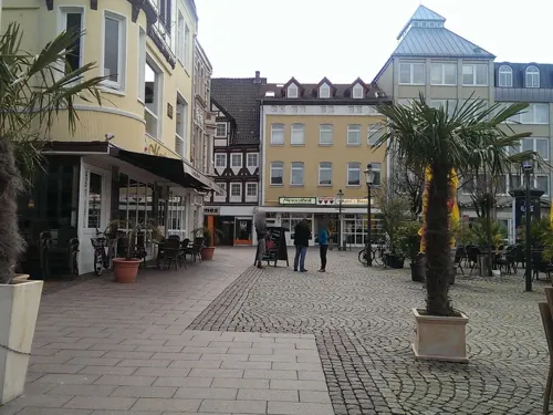
Cafe Couture
Restaurant · Lebanese, Burger · 6.9 km
22 Am Markt, Peine
Tu-Th 11:30-15:00,17:00-22:00; Fr 11:30-15:00,17:00-23:00; Fr...
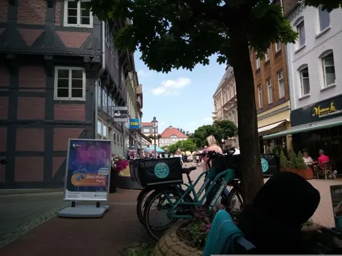
Madame Le - Sushi & Panasiatisch
Restaurant · Sushi · 6.9 km
3 Breite Straße, Peine
Mo-Sa 11:00-21:00; Su 13:00-21:00

Theaterrestaurant Peiner Festsäle
Restaurant · Regional · 6.3 km
12 Friedrich-Ebert-Platz, Peine
Tu-Su 17:00-23:00; Su,PH 12:00-14:00
Bistro-Restaurant Weiße Taube
Restaurant · 5.7 km
3 Marktstraße, Söhlde
Tu-Th 11:30-22:00; Fr,Sa 11:30-22:30; Su 12:00-21:30
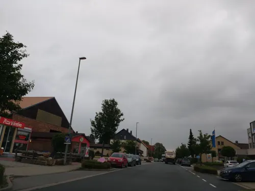
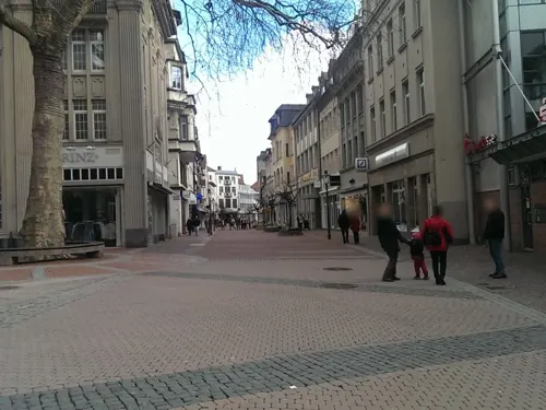
Café Mitte Peine GmbH
Cafe · Burger, German, Regional, Ice Cream · 6.8 km
48 Breite Straße, Peine
Mo-Su 08:30-18:00
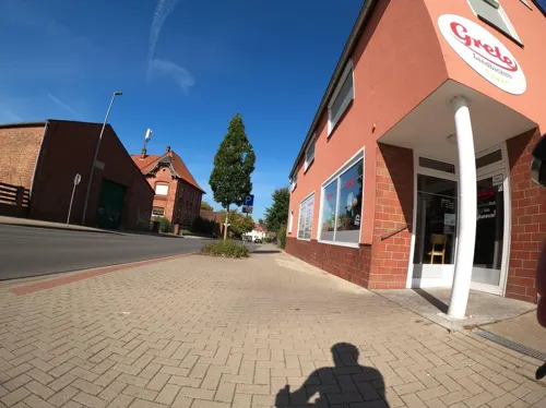
Landbäckerei Grete
Bakery · 3.2 km
18a Breite Straße, Ilsede
Mo-Fr 05:00-13:00; Sa 05:00-12:00; Su 07:00-10:30
Zur Hollandsmühle
Restaurant · German, Italian · 5.1 km
4 Hollandsmühle, Peine
Tu-Sa 17:00-21:00; We off
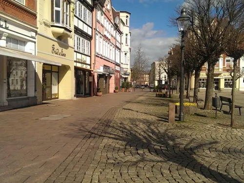


Eiscafe Venezia
Cafe · Ice Cream · 6.9 km
1 Am Markt, Peine
Mo-Su 09:00-23:00
83 more on the map.
History
In the area of the municipality Ilsede one finds the most accessible burial mounds in the southwest area of the Bülten wood. They are just a few steps away from the path that leads from Groß Bülten to Rosenthal. A small forest path leads directly to the old grave field. Although mighty trees have grown on the burial mounds in the meantime, the graves are still clearly visible.
At the edge of the forest, an erratic boulder with the inscription "Grave field of the Bronze Age, approx. 1000 BC. BC ”to the historic cemetery. The site is one of the protected archaeological cultural monuments in the district of Peine in the Heers (this is the neighboring, northwest forest section) and in Gräwig (northeast of the village of Klein Ilsede).
During the witch persecution, from 1564 to 1621, 22 people from the Ilsede municipality got into witch trials, 17 of them from Gadenstedt (nine were burned, four died under torture). Three people from Groß Ilsede were burned and a woman from Lafferde died under torture. The fate of a girl from Lahstedt is unknown.
From the History section of Ilsede on Wikipedia, under CC BY-SA 4.0.
Where to stay7
Churches and places of worship44
Shopping29
Gas and EV charging10
Schools, colleges and libraries21
Healthcare11
Map of Ilsede
250 places. The map loads OpenStreetMap tiles when you open it.
Getting there and nearby towns
Forschungsflughafen Braunschweig-Wolfsburg (BWE) is the nearest airport with scheduled flights listed in OpenStreetMap, 25 km away.
- Peine 7 km north, about 7 min by car
- Lengede 10 km southeast, about 10 min by car
- Vechelde 11 km east, about 11 min by car
- Wendeburg 15 km northeast, about 15 min by car
- Sehnde 17 km west, about 17 min by car
- Harsum 17 km west, about 17 min by car
- Salzgitter 19 km southeast, about 19 min by car
- Lehrte 19 km northwest, about 19 min by car
- Hildesheim 21 km southwest, about 21 min by car
- Braunschweig 22 km east, about 22 min by car
Drive times are estimates from straight-line distance, not routes.
Local news
Headlines from INDB.
Reviews, tips and questions
Loading what members have shared...
Sources and licences
- GeoNames (CC BY 4.0): population, coordinates, regions and time zone
- Mapillary (see each image): photos
- OpenStreetMap contributors (ODbL 1.0): places, airports, map data
- Wikidata (CC0 1.0): elevation, founding date, time zone, website
- Wikimedia Commons (see each image): photos
- Wikipedia (CC BY-SA 4.0): overview and history text
Photo credits
- Heilig-Geist-Kirche Groß Bülten IMG 4685, losch, Attribution
- Ilseder Hütte Gebläsehalle, Sebman81, CC BY-SA 3.0
- Ilseder Hütte Gebläsehalle Innenbereich, Sebman81, CC BY-SA 3.0
- Industriepark Ilsede in Ölsburg (Ilsede) IMG 4703, Losch, CC BY 3.0
- Industriepark Ilsede in Ölsburg (Ilsede) IMG 4708, Losch, CC BY 3.0
- Industriepark Ilsede in Ölsburg (Ilsede) IMG 4710, Losch, CC BY 3.0
- Industriepark Ilsede in Ölsburg (Ilsede) IMG 4704, Losch, CC BY 3.0
- Industriepark Ilsede in Ölsburg (Ilsede) IMG 4698, Losch, CC BY 3.0
- Industriepark Ilsede in Ölsburg (Ilsede) IMG 4705, Losch, CC BY 3.0
- Ilsede Eisenblöcke, TeWeBs, CC BY-SA 4.0
- Ilsede Schlackenpfannenwagen, TeWeBs, CC BY-SA 4.0
- Ilsede Pfannenwagen, TeWeBs, CC BY-SA 4.0
- Ilsede Schlackenpfannenwagen 2, TeWeBs, CC BY-SA 4.0
- Ilsede Wasserturm Kugel, TeWeBs, CC BY-SA 4.0
- Ilsede Kugelwasserturm-03, Radler59 ( talk ), CC BY-SA 4.0
- Ilsede Kugelwasserturm-01, Radler59 ( talk ), CC BY-SA 4.0
- Ilsede Kugelwasserturm, Radler59 ( talk ), CC BY-SA 4.0
- Ilsede Denkmallokomotive, TeWeBs, CC BY-SA 4.0
- Rauhreif am Auflandeteich - panoramio, Andreas Schoring, CC BY 3.0
- St-urban-klein-ilsede2, jojeska, GFDL
- Equord Kirche 01, Rabanus Flavus, Public domain
- St.-Jakobi-Kirche von 1899 in Peine IMG 2557, Losch, CC BY-SA 3.0
- Gross Lafferde Wasserturm, Clemensfranz, CC BY-SA 3.0
- Burg Steinbrück Kehrwiederkirche Frühjahr, Clemensfranz, CC BY-SA 4.0
- Klinikum Peine 2020, Emtheee, CC BY-SA 4.0
- Kirche „Johannes der Täufer“ in Oberg (Ilsede) IMG 6135, Losch, CC BY 3.0
- St. Pancratii-Kirche rIMG 4680, losch, Attribution
- St. Nikolai-Kirche in Groß Ilsede (Ilsede) IMG 6201, Losch, CC BY 3.0
- Oedelum, Kirche, Hilmschen, CC BY-SA 4.0
- Bismarckturm Lahstedt Oberg center left, Sebman81, CC BY-SA 3.0
- Kugelwasserturm Ilsede, Joezie, CC BY-SA 3.0
- Gorski, Frieda - Dorotheenstr. 34, Bebato2021, CC BY-SA 4.0
- Schwicheldt Wasserturm-01, Radler59 ( talk ), CC BY-SA 4.0
- Graetz, Ruth - Theodor-Heuss-Str. 21, Bebato2021, CC BY-SA 4.0
- Peine Träger GmbH Verwaltungsbau Wasserturm, Radler59 ( talk ), CC BY-SA 4.0
- Groß Ilsede Kirche kath, Kirchenfan, CC0
- Peine Kirche kath, Kirchenfan, CC0
- Dungelbeck Kirche kath, Kirchenfan, CC0
- Burg Steinbrück Seitenansicht, Axel Hindemith, CC BY-SA 3.0
- Kapelle Stedum, F. Hoffmann, CC BY-SA 3.0 de
- Herrenhaus des Rittergut Oberg von 1855 in Oberg (Ilsede) IMG 6139, Losch, CC BY-SA 4.0
- Street-level photo, almica, CC BY-SA 4.0
- Street-level photo, aceini, CC BY-SA 4.0
- Street-level photo, aceini, CC BY-SA 4.0
- Street-level photo, Langfahrer, CC BY-SA 4.0
- Street-level photo, thetornado76, CC BY-SA 4.0
- Street-level photo, thetornado76, CC BY-SA 4.0
- Street-level photo, aceini, CC BY-SA 4.0
- Street-level photo, aceini, CC BY-SA 4.0
- Street-level photo, tryer23, CC BY-SA 4.0
- Street-level photo, thetornado76, CC BY-SA 4.0
- Street-level photo, aceini, CC BY-SA 4.0
- Street-level photo, aceini, CC BY-SA 4.0
- Street-level photo, Langfahrer, CC BY-SA 4.0
- Street-level photo, Langfahrer, CC BY-SA 4.0
- Street-level photo, thetornado76, CC BY-SA 4.0


Page built November 8, 2026. Spotted a mistake? Tell us or suggest a place.