


Why visit Kalefeld
Townapedia lists 27 museums and landmarks, 21 parks and trails, 17 places to eat, 3 places to stay and 32 attractions in and around town.
Highlights include Biohof Berner, Vogelsburg, Battle at the Harzhorn and Schloß Imbshausen.
Weather in Kalefeld
Forecast from MET Norway (CC BY 4.0). Full forecast
About Kalefeld
Kalefeld (German pronunciation: [ˈkaːləfɛlt]) is a municipality in the district of Northeim, in Lower Saxony, Germany. It is situated approximately 10 km north of Northeim. It comprises the villages of Dögerode, Eboldshausen, Echte, Kalefeld, Oldenrode, Oldershausen, Sebexen, Westerhof, Wiershausen, and Willershausen.
From the Wikipedia article Kalefeld (this version), under CC BY-SA 4.0.
Things to do32



20 more on the map.
Museums and landmarks27
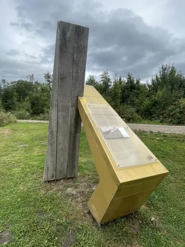
Battle at the Harzhorn
Monument and historic site · 6.1 km
235 battle between Roman and Germanic troops (c.235)

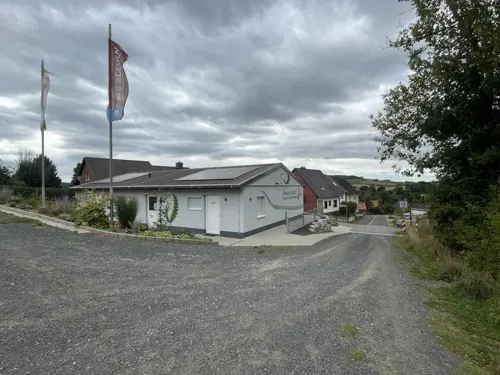
Geotop-Station Tongrube Willershausen
Museum · 5.7 km
8 Hinter den Höfen
Mar-Oct Su[-1] 09:30 - 10:00, "on demand"

Platz der Partnerschaft (Tafel und Bär)
Monument and historic site · 3.9 km
Platz zur Partnerschaft der Ortschaften Ahlshausen/Sievershausen mit der Marktgemeinde Petzenkirchen (Österreich)




15 more on the map.
Parks, trails and playgrounds21



Notrufbank EIN 82
Park · 6.0 km
Am Gebiss (Gehren) // ANFAHRT: Mittelstrasse/Am Zementwerk geradeaus berghoch in den Burgweg

9 more on the map.
Restaurants and cafes17

Auszeit
Restaurant · Pizza, Burger, Pasta, Barbecue · 7.6 km
12 Braunschweiger Straße, Bad Gandersheim
Tu-Fr 17:00-22:00; Sa,Su 11:00-22:00


Leinetaler Feinfischräucherei
Restaurant · Regional · 7.3 km
Tu-Fr 09:00-18:00, Sa 09:00-13:00
Ernst Tappe Gaststätte
Restaurant · German, Regional · 4.0 km
2 Schulstraße, Einbeck

Gasthaus Ernst Ludwig
Restaurant · German · 3.9 km
13 Ahlshäuser Endestraße, Einbeck

5 more on the map.
Where to stay3
Churches and places of worship36
Dorfkirche Seboldshausen
Church · Lutheran · 7.3 km
4 Eternastraße, Bad Gandersheim
Kapelle Hachenhausen
Church · Lutheran · 7.4 km
Hachenhausen, Bad Gandersheim
Shopping9
Gas and EV charging3
Raiffeisen Tankstelle Kalefeld
Gas station · 1.0 km
5 Neue Bahnhofstraße, Kalefeld
Schools, colleges and libraries7
Healthcare2
Map of Kalefeld
157 places. The map loads OpenStreetMap tiles when you open it.
Getting there and nearby towns
Kassel Airport (KSF) is the nearest airport with scheduled flights listed in OpenStreetMap, 61 km away.
- Kreiensen 8 km northwest, about 8 min by car
- Bad Gandersheim 8 km north, about 8 min by car
- Northeim 11 km south, about 11 min by car
- Einbeck 11 km west, about 11 min by car
- Windhausen 12 km east, about 12 min by car
- Seesen 14 km northeast, about 14 min by car
- Moringen 16 km southwest, about 16 min by car
- Nörten-Hardenberg 20 km south, about 20 min by car
- Clausthal-Zellerfeld 21 km east, about 21 min by car
- Dassel 24 km west, about 24 min by car
Drive times are estimates from straight-line distance, not routes.
Local news
Headlines from INDB.
Reviews, tips and questions
Loading what members have shared...
Sources and licences
- GeoNames (CC BY 4.0): population, coordinates, regions and time zone
- Mapillary (see each image): photos
- OpenStreetMap contributors (ODbL 1.0): places, airports, map data
- Wikidata (CC0 1.0): elevation, founding date, time zone, website, landmarks and historic places
- Wikimedia Commons (see each image): photos
- Wikipedia (CC BY-SA 4.0): overview and history text
Photo credits
- Kalefeld mitten, Gojo0030, CC BY-SA 4.0
- Harzhorn Ausgrabungsbereich, Axel Hindemith, CC BY 3.0
- Denkershaeuser Teich, Jan Stubenitzky ( Dehio ), CC BY-SA 3.0
- Seboldshausen, Werner Buzan, CC BY-SA 4.0
- Leineniederung Salzderhelden - 05, Muschelschubser, CC BY-SA 3.0
- Kreiensenholzminden, Pimvantend, CC BY-SA 3.0
- Oldershausen Gutskapelle, Axel Hindemith, CC BY 3.0
- Schloss Imbshausen Vorderseite, Axel Hindemith, CC BY-SA 3.0
- StJakobus Eboldshausen, Jan Stubenitzky ( Dehio ), CC BY-SA 3.0
- Hachenhausen, FrankBothe, CC BY-SA 3.0
- StMauritius Edesheim, Jan Stubenitzky ( Dehio ), CC BY-SA 3.0
- StNikolai Echte, Dehio, CC BY-SA 4.0
- Harriehausen Kirche mit Zaun, Gustl Rigga, CC BY-SA 4.0
- Kirche Willershausen, Kawimm, CC BY-SA 3.0 de
- Olxen - Panorama, flamenc, CC BY-SA 3.0
- Opperhausen Kirche Seite Eingang, Pzykrolb, CC BY-SA 4.0
- Stolperstein Bad Gandersheim Neue Straße 1 Alfred Rosenbaum, Gmbo 2013, CC0
- Harzhorn Grabungsschnitt von unten 1, Axel Hindemith, CC BY 3.0
- Denkershaeuser Teich A 13, User: Roehrigs, CC BY-SA 4.0
- Leineniederung Salzderhelden 01 bei Drueber, Kubrognug, CC BY-SA 4.0
- Vogelsburg in Vogelbeck Zangentor Nordosten Waldweg Infotafel, Axel Hindemith, CC BY-SA 3.0
- Kreiensen Empfangsgeb 01, Okki guzl, CC BY-SA 4.0
- Weissenwasserkirche, Máel Milscothach, CC BY-SA 4.0
- Liebfrauenkirche, die im Jahre 1870 erbaut wurde - panoramio, Dewi König, CC BY-SA 3.0
- Weissenwasserkirche im Gebiet des Kahlbergs,aus Jahre 1055 . - panoramio, Dewi König, CC BY-SA 3.0
- Gebiet des Kahlbergs - panoramio, Dewi König, CC BY-SA 3.0
- Echte 1000m mit VW Bus, Dr. Mirko Junge, CC BY-SA 3.0
- Die St. Martin Kirche in Sebexen wurde in ihren Grundfesten im Juli 1145 durch den Erzbischof Heinrich I. von Mainz geweiht - panoramio, Dewi König, CC BY-SA 3.0
- Fire-fighting-facility node-4426734294, bftomy, CC BY 2.0
- Fire-fighting-facility node-4426642959, bftomy, CC BY 2.0
- Fire-fighting-facility node-4426488539, bftomy, CC BY 2.0
- Street-level photo, Langfahrer, CC BY-SA 4.0
- Street-level photo, saschahaberkorn, CC BY-SA 4.0
- Street-level photo, surveyor99, CC BY-SA 4.0
- Street-level photo, surveyor99, CC BY-SA 4.0
- Street-level photo, Langfahrer, CC BY-SA 4.0
- Street-level photo, Langfahrer, CC BY-SA 4.0


Page built November 9, 2026. Spotted a mistake? Tell us or suggest a place.