


Why visit Northeim
Townapedia lists 42 museums and landmarks, 72 parks and trails, 125 places to eat, 18 places to stay and 49 attractions in and around town.
Highlights include Theater der Nacht, Neue Schauburg, Heimatmuseum and Gasometer Moringen.
Weather in Northeim
Forecast from MET Norway (CC BY 4.0). Full forecast
About Northeim
Northeim (German pronunciation: [ˈnɔʁthaɪm] ; Low German: Nuurten) is a town in Lower Saxony, Germany, seat of the district of Northeim, with a population of 27,522 as of 31 December 2023. It lies on the German Half-Timbered House Road.
From the Wikipedia article Northeim (this version), under CC BY-SA 4.0.
Photos of Northeim


Things to do49

Theater der Nacht
Cinema and theater
Figuren- und Maskentheater mit Stücken für Erwachsene und Kinder
1 Obere Straße, Northeim
Fr-Sa 14:00-18:00; Su 14:00-18:00
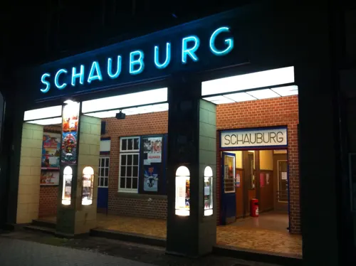
Neue Schauburg
Cinema and theater
10 Markt, Northeim
Mo 17:20-22:00; Tu,We 14:40-22:00; Sa 13:40-22:00; Su 10:40-22:00




37 more on the map.
Museums and landmarks42
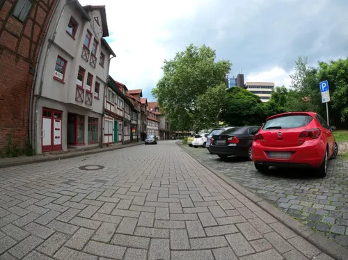




Platz der Partnerschaft (Tafel und Bär)
Monument and historic site · 9.8 km
Platz zur Partnerschaft der Ortschaften Ahlshausen/Sievershausen mit der Marktgemeinde Petzenkirchen (Österreich)
30 more on the map.
Parks, trails and playgrounds72


Polder I im Hochwasserrückhaltebecken Salzderhelden
Hiking and trails · 8.2 km

Naturschutzgebiet Wasservogelreservat Northeimer Seenplatte
Hiking and trails · 5.0 km
Das ca. 80 ha große Naturschutzgebiet umfasst mehrere aus dem Kiesabbau entstandene Baggerseen und dient dient als Lebensraum für an...


Freibad Sudheim
Sports field and stadium · 4.3 km
Oberes Tor, Northeim
Mo-Sa 07:00-09:00,12:00-19:00; Su,PH 11:00-19:00; Sep 5-May 5 off

60 more on the map.
Restaurants and cafes125
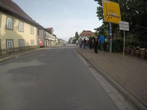
Delhi Palace
Restaurant · Indian
27 Untere Straße
Mo, We-Fr 11:30-14:30, 17:00-21:30; Sa-Su 12:00-22:00
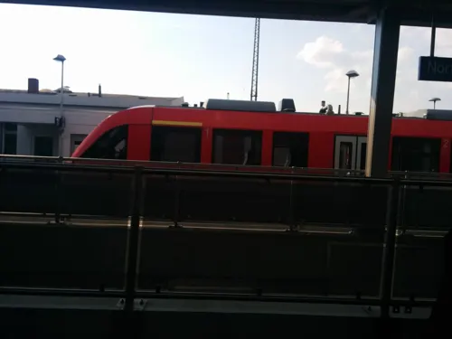
Bistro am Bahnhof
Cafe · 1.0 km
5 Güterbahnhofstraße, Northeim
Mo-Fr 06:00-21:00; Sa 08:00-21:00; Su 09:00-21:00
Bäckerei Beckmann
Bakery · 8.5 km
42 Mannenstraße, Moringen
Mo-Fr 06:00-18:00; Sa 06:00-16:30; Su 07:00-17:00

Delfi
Restaurant · Greek
20 Mühlenstraße, Northeim
Tu-Th 11:30-14:30,17:30-22:00; Fr-Sa 11:30-14:30,17:30-22:30;...
Dinx Gastro Autohof Northeim
Restaurant · International · 3.4 km
7 Westerlange
Tu-Sa 17:00-22:00; Su 12:00-22:00; Mo off

Mein Lieblingsplatz
Cafe · Breakfast, Cake · 2.9 km
13 Albert-Schweitzer-Weg, Northeim
Mo-Fr 08:00-18:00; Sa,Su 09:00-17:00
Pipapo Northeim
Restaurant · Pizza, Pasta, Fries, Salad · 1.1 km
2 Dörtalsweg, Northeim
Mo-Th 11:00-21:00; Fr 11:00-21:30; Sa 12:00-21:30; Su 12:00-21:00
113 more on the map.
History
Northeim is first mentioned in 800 in a document recording a property transfer by a Frankish nobleman to the Abbey of Fulda. In the 10th century the surrounding region became a county, administered by the Counts of Northeim. The first of them, Siegfried is mentioned in 982. From 1061 to 1070 Count Otto II held the stem duchy of Bavaria as an Imperial fief, but lost it again because of his involvement in the Saxon plot against King Henry IV.
The monastery of St. Blasius was founded around 1100. In 1252 Northeim obtained town rights, and from 1384 to 1554 it was a member of the Hanseatic League. When protestantism was introduced in 1532 all the churches were allocated to the protestants. The town became part of the Kingdom of Hanover.
A part of Northeim was devastated by a fire in 1832 when the representative town hall dating from the Middle Ages and more than 40 houses burnt down. Further damage was caused by a fire in 1892 which destroyed several historic buildings in the Market Place.
After the railway from Hanover to Göttingen had been inaugurated in 1854 Northeim gained in importance and became a railway junction. The South Harz Railway was opened in 1868 and the Solling Railway in 1878.
Read more of the history
During the Second World War Northeim was hit by bombs in September 1944, February 1945 and in March 1945. The railway station, five factories and 18 houses were completely destroyed and 80 houses were damaged. The historic centre did not suffer severe bomb damage.
Northeim, under the pseudonym of Thalburg, is the subject of William Sheridan Allen's book The Nazi Seizure of Power (ISBN 0-531-05633-3), a comprehensive study of the success of Nazism at town level. The book describes how the Nazis took over all social groups in the town and Nazified them, but failed to instill positive enthusiasm for the Nazi state. Instead, the population was "atomized" and deprived of the means to express group grievances. The book has been criticized for neglecting the role of the churches, which remained largely autonomous. However, even its critics say that the book is crucial to our understanding of Nazi Germany and has played a key role in shaping scholarship. Imbshausen, the site of a post-World War II British sector Displaced Persons camp, was incorporated into the town in 1974.
On 15 November 1992 an express train crashed into the wreckage of a derailed freight train near Northeim. Eleven people died and 52 were injured.
From the History section of Northeim on Wikipedia, under CC BY-SA 4.0.
More about Northeim
Arts and culture
The town has a town museum and archive. There is an outdoor stage outside the town. The town is also home to a puppet theatre, Theater der Nacht, which since 2001 has been housed in a redesigned fire station.
Some of the old town wall still stands, including a watchtower.
From the Wikipedia article Northeim, under CC BY-SA 4.0.
Notable people from Northeim
 August Eberhard MüllerGerman composerPhoto: Friedrich August Brückner, Public domain
 Johannes Fiebagwriter (1956–1999)Photo: Fiebag, CC BY-SA 3.0
 Friedrich DehnhardtGerman botanist (1787-1870)Photo: Roberto De Martino The original..., Public domain
 Michael KrieterGerman handball playerPhoto: JLKiel, CC BY-SA 3.0
 Frauke HeiligenstadtGerman SPD politicianPhoto: FraukeHeiligenstadt, CC BY-SA 4.0
 Jens KestnerGerman politicianPhoto: Olaf Kosinsky, CC BY-SA 3.0 de
- Reinhard RauballGermany politician (SPD)
- Hartmut HeinrichGerman climatologist at the Federal Maritime and Hydrographic Agency
- Georg DiederichsGerman politician (1900-1983)
- Otto EissfeldtGerman theologian (1887–1973)
- Georg Heinrich BodeGerman university teacher (1802-1846)
- Karlheinz WeißmannGerman author and historian
Born in Northeim, according to Wikidata (CC0). Each name links to its Wikipedia article.
Where to stay18
Churches and places of worship44
Evangelisch-freikirchliche Gemeinde Northeim – Baptisten
Church · Baptist · 0.6 km
3 Wolfshof, Northeim
Shopping38
Gas and EV charging15
Raiffeisen Tankstelle Kalefeld
Gas station · 9.8 km
5 Neue Bahnhofstraße, Kalefeld
Raiffeisen / Piening Heizöl
Gas station · 2.8 km
19 Robert-Bosch-Straße, Northeim
Schools, colleges and libraries29
Bundesfachschule für Betriebswirtschaft im Kraftfahrzeuggewerbe
School · 1.9 km
3 Am Gesundbrunnen, Northeim
Healthcare19
Universitätsmedizin Göttingen - Klinik für Strahlentherapie
Clinic and pharmacy · 2.9 km
6 Albert-Schweitzer-Weg, Northeim
Map of Northeim
250 places. The map loads OpenStreetMap tiles when you open it.
Getting there and nearby towns
Kassel Airport (KSF) is the nearest airport with scheduled flights listed in OpenStreetMap, 53 km away.
- Hillerse 4 km southwest, about 4 min by car
- Katlenburg-Lindau 7 km east, about 7 min by car
- Moringen 9 km west, about 9 min by car
- Nörten-Hardenberg 10 km southwest, about 10 min by car
- Kalefeld 11 km north, about 11 min by car
- Hardegsen 13 km southwest, about 13 min by car
- Eisdorf am Harz 14 km northeast, about 14 min by car
- Bovenden 14 km south, about 14 min by car
- Einbeck 15 km northwest, about 15 min by car
- Kreiensen 17 km north, about 17 min by car
Drive times are estimates from straight-line distance, not routes.
Towns near Northeim


Keep exploring
Local news
Headlines from INDB.
Reviews, tips and questions
Loading what members have shared...
Sources and licences
- GeoNames (CC BY 4.0): population, coordinates, regions and time zone
- Mapillary (see each image): photos
- OpenStreetMap contributors (ODbL 1.0): places, airports, map data
- Openverse (see each image): photos
- Wikidata (CC0 1.0): elevation, founding date, time zone, website
- Wikimedia Commons (see each image): photos
- Wikipedia (CC BY-SA 4.0): overview and history text
Photo credits
- Northeim-Muehlentor-Jul-2007, Simon-Martin, CC BY-SA 3.0
- Sts Fabian & Sebastian chapel in Northeim (1), Tournasol7, CC BY 4.0
- Alte Wache in Northeim (1), Tournasol7, CC BY-SA 4.0
- Alte Wache in Northeim (4), Tournasol7, CC BY-SA 4.0
- Alte Wache in Northeim (2), Tournasol7, CC BY-SA 4.0
- Mühlenstraße 1, 1, Northeim, Landkreis Northeim, GeorgDerReisende, CC BY-SA 4.0
- Mühlenstraße 2, 1, Northeim, Landkreis Northeim, GeorgDerReisende, CC BY-SA 4.0
- Markt 11 Northeim, Clemensfranz, CC BY-SA 3.0
- Northeim Stolperstein Jakob Dreifuss, Migebert, CC BY-SA 4.0
- Northeim Stolperstein Rosa Dreifuss, Migebert, CC BY-SA 4.0
- Mühlenstraße 1 Northeim, Clemensfranz, CC BY-SA 3.0
- Augenblickstein (Louis Niebuhr; Northeim) 1, Gerd Fahrenhorst, CC BY 4.0
- Muehlenstrasse 1 in Northeim (1), Tournasol7, CC BY 4.0
- Rathausgasse 11 in Northeim (1), Tournasol7, CC BY 4.0
- Augenblickstein (Louis Niebuhr; Northeim) 2, Gerd Fahrenhorst, CC BY 4.0
- Graf-Otto-Brunnen (Northeim) 1, Gerd Fahrenhorst, CC BY 4.0
- Graf-Otto-Brunnen (Northeim) 2, Gerd Fahrenhorst, CC BY 4.0
- Mühlenstraße 3, 1, Northeim, Landkreis Northeim, GeorgDerReisende, CC BY-SA 4.0
- Markt 9 Northeim, Clemensfranz, CC BY-SA 3.0
- Hinter der Kapelle 6, 1, Northeim, Landkreis Northeim, GeorgDerReisende, CC BY-SA 4.0
- Hinter der Kapelle 7, 1, Northeim, Landkreis Northeim, GeorgDerReisende, CC BY-SA 4.0
- Schauburg Northeim, herr.g, CC BY-SA 2.0
- Markt 18 Northeim, Clemensfranz, CC BY-SA 3.0
- Markt 19 Northeim, Clemensfranz, CC BY-SA 3.0
- Mühlenstraße 4, 1, Northeim, Landkreis Northeim, GeorgDerReisende, CC BY-SA 4.0
- Markt 20 Northeim, Clemensfranz, CC BY-SA 3.0
- Northeim, Alte Wache, 2013-08 CN-03, Steffen Schmitz, CC BY-SA 3.0 de
- Graf-Otto-Brunnen (Northeim) 3, Gerd Fahrenhorst, CC BY 4.0
- Markt 8 Northeim, Clemensfranz, CC BY-SA 3.0
- Mühlenstraße 5, 1, Northeim, Landkreis Northeim, GeorgDerReisende, CC BY-SA 4.0
- Stubenstrasse 12 in Northeim (1), Tournasol7, CC BY 4.0
- Stubenstraße, 1, Northeim, Landkreis Northeim, GeorgDerReisende, CC BY-SA 4.0
- Mühlenstraße 6, 1, Northeim, Landkreis Northeim, GeorgDerReisende, CC BY-SA 4.0
- Stubenstraße 12, 1, Northeim, Landkreis Northeim, GeorgDerReisende, CC BY-SA 4.0
- Mühlenstraße 8, 1, Northeim, Landkreis Northeim, GeorgDerReisende, CC BY-SA 4.0
- Markt 7 Northeim, Clemensfranz, CC BY-SA 3.0
- Markt 6 Northeim, Clemensfranz, CC BY-SA 3.0
- Markt 21 Northeim, Clemensfranz, CC BY-SA 3.0
- 09320-Northeim-1907-Gesundbrunnen-Brück & Sohn Kunstverlag, Brück & Sohn Kunstverlag Meißen, CC0
- 09319-Northeim-1907-Am Feuerteich-Brück & Sohn Kunstverlag, Brück & Sohn Kunstverlag Meißen, CC0
- Stronghold Noerten-Hardenberg 2b, Unknown author, CC BY-SA 3.0
- Gymnasium Corvinianum, Ichneumon, CC BY-SA 3.0
- Denkershaeuser Teich, Jan Stubenitzky ( Dehio ), CC BY-SA 3.0
- Northeim und Northeimer Seenplatte, Toksave, CC BY-SA 3.0
- Noerten Kirche Martin, Kirchenfan, CC0
- Northeim Kirche kath 2011, Kirchenfan, CC0
- Heimatmuseum Moringen-Eingang 2021-09-05, Sipalius, CC BY-SA 4.0
- Mannenstraße 62 Gaswerk Moringen, Clemensfranz, CC BY-SA 3.0
- Maeuseberg Eulenberg, Jan Stubenitzky ( Dehio ), CC BY-SA 3.0
- Husumer Bachtal 01, Jan Stubenitzky ( Dehio ), CC BY-SA 3.0
- Elvese, Jan Stubenitzky ( Dehio ), CC BY-SA 3.0
- Leineniederung Salzderhelden - 05, Muschelschubser, CC BY-SA 3.0
- Leisenberger Kirche 04, Jan Stubenitzky ( Dehio ), CC BY-SA 4.0
- Theater der Nacht Haus im Winter, Theater der Nacht (Northeim, Niedersachsen, BRD)., CC BY-SA 3.0
- BR 097 Blick auf Salzderhelden Hochstand Mai13 byMsLissome, MsLissome, CC BY-SA 3.0
- StSixti Northeim, Jan Stubenitzky ( Dehio ), CC BY-SA 3.0
- Alte Burg Bühle Turmhügel 2, Axel Hindemith, CC BY 3.0
- Schloss Imbshausen Vorderseite, Axel Hindemith, CC BY-SA 3.0
- Waldbuehne Northeim, Jan Stubenitzky ( Dehio ), CC BY-SA 3.0
- StJakobus Eboldshausen, Jan Stubenitzky ( Dehio ), CC BY-SA 3.0
- Hardenbergswarte, Jan Stubenitzky ( Dehio ), CC BY-SA 3.0 de
- Christuskirche Noerten, Jan Stubenitzky ( Dehio ), CC BY-SA 3.0
- StNikolai Echte, Dehio, CC BY-SA 4.0
- StJohannis Iber, Jan Stubenitzky ( Dehio ), CC BY-SA 3.0
- StNicolai Sudheim 01, Jan Stubenitzky ( Dehio ), CC BY-SA 3.0
- Alte Wache in Northeim (3), Tournasol7, CC BY-SA 4.0
- Neue Schauburg Northeim, herr.g, CC BY-SA 2.0
- Street-level photo, Langfahrer, CC BY-SA 4.0
- Street-level photo, bitnapper, CC BY-SA 4.0
- Street-level photo, hotteliene, CC BY-SA 4.0
- Street-level photo, mfa, CC BY-SA 4.0
- Street-level photo, Hightower-, CC BY-SA 4.0
- Street-level photo, Hightower-, CC BY-SA 4.0
- Street-level photo, Hightower-, CC BY-SA 4.0
- Street-level photo, Hightower-, CC BY-SA 4.0
- Street-level photo, Langfahrer, CC BY-SA 4.0
- Street-level photo, Hightower-, CC BY-SA 4.0
- Street-level photo, Hightower-, CC BY-SA 4.0
- Street-level photo, Langfahrer, CC BY-SA 4.0
- Street-level photo, Langfahrer, CC BY-SA 4.0
- Street-level photo, saschahaberkorn, CC BY-SA 4.0
- Street-level photo, Hightower-, CC BY-SA 4.0
- Street-level photo, tian, CC BY-SA 4.0
- Street-level photo, bitnapper, CC BY-SA 4.0
- Street-level photo, Hightower-, CC BY-SA 4.0
- Street-level photo, hotteliene, CC BY-SA 4.0
- Street-level photo, cageythree, CC BY-SA 4.0
- Street-level photo, hotteliene, CC BY-SA 4.0
- Street-level photo, cageythree, CC BY-SA 4.0
- Street-level photo, changchun1, CC BY-SA 4.0
- Street-level photo, mfa, CC BY-SA 4.0
- Street-level photo, mfa, CC BY-SA 4.0


Page built November 9, 2026. Spotted a mistake? Tell us or suggest a place.