


Why visit Dassel
Townapedia lists 54 museums and landmarks, 26 parks and trails, 26 places to eat, 12 places to stay and 55 attractions in and around town.
Highlights include Aulsberg, Bierberg, Blankschmiede Neimke and Grafschaft Dassel.
Weather in Dassel
Forecast from MET Norway (CC BY 4.0). Full forecast
About Dassel
Dassel (German pronunciation: [ˈdasl̩]) is a town in southern Lower Saxony, Germany, located in the district Northeim. It is located near the hills of the Solling mountains.
From the Wikipedia article Dassel (this version), under CC BY-SA 4.0.
Things to do55



43 more on the map.
Museums and landmarks54




Station Nr. 27 des Preußischen optischen Telegrafen
Monument and historic site · 7.0 km
Station Nr. 27 des preußischen optischen Telegrafen Berlin-Köln-Koblenz (1832 - 1849): „Holzberg“ Hainade


ehem. Gut Giesenberg
Monument and historic site · 8.3 km
Ehemaliges Gut Giesenberg (abgetragene Mauerreste am Eingang noch sichtbar)
Marienkapelle (entwidmet)
Monument and historic site · 5.7 km
8 Jacobiplatz, Dassel


42 more on the map.
Parks, trails and playgrounds26



Moore und Wälder im Hochsolling, Hellental
Hiking and trails · 7.4 km
Teiche am Erz- und Finkenbruch im Solling
Hiking and trails · 8.6 km



Stadion an der Lehmbreite
Sports field and stadium · 0.7 km
Lessingstraße, Dassel

14 more on the map.
Restaurants and cafes26

Zum Weißen Roß
Bar and pub · Sri Lankan, German · 7.4 km
Sri lankan (Ceylon food) only on special request several days in advance
1 Bruch, Wangelnstedt
Tu-Su 18:00+; Mo off
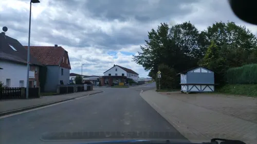
Gaststätte Deutsche Eiche
Restaurant · Regional · 5.3 km
3 Luthardstraße, Dassel
Mo off; Tu-Su 17:00-22:00

La Perla Markoldendorf
Restaurant · Italian, Greek, Indian, Thai · 5.5 km
20 Brückenstraße, Dassel
Mo 17:00-22:30; Tu-Sa 11:30-14:30,17:00-22:30; Su 11:30-22:30
Bartels Scheune
Restaurant · German · 4.3 km
6 Wannekamp, Dassel
We-Fr 17:00-22:00; Sa 11:00-14:00,17:00-22:00; Su 11:00-22:00
Waldgasthof Abbecke
Restaurant · 6.5 km
10 Abbecke, Dassel
Fr 17:30-20:00; Sa-Su 11:30-14:00,17:30-20:00
Eichenkrug
Restaurant · Greek · 4.2 km
30 Sollingtor, Dassel
Mo,Tu off; We-Su 16:30+
Eis-Café · Pizzeria Bella Calabria
Restaurant · Ice Cream, Pizza
1 Mackenser Straße, Dassel
Tu-Su 17:00-21:00
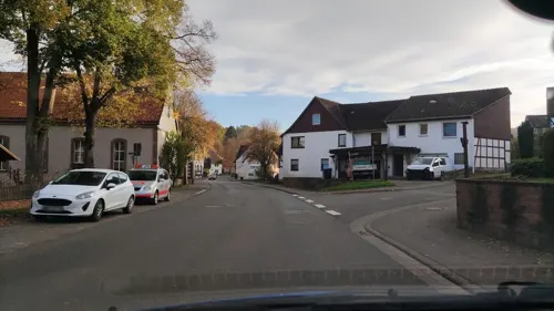
Mammut Restaurant
Restaurant · German, Burger · 8.7 km
Mammut Camping & Restaurant
41 Linnenkämper Straße, Stadtoldendorf
Meteora
Restaurant · Greek
14 Bahnhofstraße, Dassel
Tu-Su 18:00-22:00; Su 12:00-15:00, 18:00-22:00
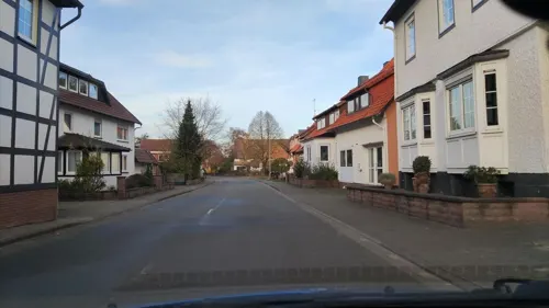


Zum Sollinger Wald
Restaurant · German · 6.3 km
We,Sa 17:00+; Th 18:00+; Fr 16:00+; Su 11:00-14:30,17:00+

Peter Taubenauer
Bakery
8 Burgstraße, Dassel
Tu-Fr 06:00-13:00, 15:00-18:00; Sa 06:00-13:00; Su 07:00-17:00
14 more on the map.
History
Dassel dates back to the year 860 when it was mentioned in a deed of the Imperial Abbey of Corvey. In 1022, Henry II, Holy Roman Emperor, in another deed referred to Dassel church. By about 1113, Dassel became a base of the counts of Dassel, whose name is derived from the name of the settlement. As the county of Dassel ceased to exist in 1310, Dassel was sold to Siegfried II, bishop of the diocese of Hildesheim. Shortly thereafter, in 1315, he provided his acquisition with town rights because the surrounding region belonged to the principality of Brunswick-Wolfenbüttel, thus to enemies of the bishop of Hildesheim.
From the History section of Dassel on Wikipedia, under CC BY-SA 4.0.
Where to stay12
Churches and places of worship20
Shopping8
Gas and EV charging4
Schools, colleges and libraries4
Healthcare3
Map of Dassel
212 places. The map loads OpenStreetMap tiles when you open it.
Getting there and nearby towns
Kassel Airport (KSF) is the nearest airport with scheduled flights listed in OpenStreetMap, 47 km away.
- Einbeck 13 km east, about 13 min by car
- Uslar 17 km south, about 17 min by car
- Holzminden 17 km west, about 17 min by car
- Höxter 21 km west, about 21 min by car
- Northeim 24 km southeast, about 24 min by car
- Bad Gandersheim 24 km east, about 24 min by car
- Salzhemmendorf 30 km north, about 30 min by car
- Göttingen 34 km southeast, about 34 min by car
- Seesen 35 km east, about 35 min by car
- Lügde 35 km northwest, about 35 min by car
Drive times are estimates from straight-line distance, not routes.
Local news
Headlines from INDB.
Reviews, tips and questions
Loading what members have shared...
Sources and licences
- GeoNames (CC BY 4.0): population, coordinates, regions and time zone
- Mapillary (see each image): photos
- OpenStreetMap contributors (ODbL 1.0): places, airports, map data
- Wikidata (CC0 1.0): elevation, founding date, time zone, website, landmarks and historic places
- Wikimedia Commons (see each image): photos
- Wikipedia (CC BY-SA 4.0): overview and history text
Photo credits
- An der Stadtmauer Dassel, Oftlamur, CC BY 3.0
- Pharmacy, Dassel (20260514-P1075280), Matti Blume, CC BY-SA 4.0
- Dassel St. Laurentius 01, ErwinMeier, CC BY-SA 4.0
- Dassel An der Kirche 10, Esther Westerveld, CC BY 2.0
- Dassel Kirchplatz 10 rear view, Esther Westerveld, CC BY 2.0
- Stadtmauer Dassel Reste, Clemensfranz, CC BY-SA 4.0
- St-Laurentius-Kirche Innen Dassel 04, Clemensfranz, CC BY-SA 4.0
- St-Laurentius-Kirche Innen Dassel 03, Clemensfranz, CC BY-SA 4.0
- St-Laurentius-Kirche Innen Dassel 05, Clemensfranz, CC BY-SA 4.0
- St-Laurentius-Kirche Innen Dassel 02, Clemensfranz, CC BY-SA 4.0
- St-Laurentius-Kirche Innen Dassel 06, Clemensfranz, CC BY-SA 4.0
- St-Laurentius-Kirche Innen Dassel 10, Clemensfranz, CC BY-SA 4.0
- St-Laurentius-Kirche Innen Dassel 09, Clemensfranz, CC BY-SA 4.0
- St-Laurentius-Kirche Innen Dassel 07, Clemensfranz, CC BY-SA 4.0
- St-Laurentius-Kirche Innen Dassel 01, Clemensfranz, CC BY-SA 4.0
- St-Laurentius-Kirche Innen Dassel 08, Clemensfranz, CC BY-SA 4.0
- Kriegerdenkmal Dassel, Clemensfranz, CC BY-SA 4.0
- Marktplatz 2 Dassel, Clemensfranz, CC BY-SA 4.0
- Dassel St. Laurentius 02, ErwinMeier, CC BY-SA 4.0
- Marptplatz 1 Stadtmühle Dassel 02, Clemensfranz, CC BY-SA 4.0
- Brunnenstraße 2 Dassel, Clemensfranz, CC BY-SA 4.0
- Brunnenstraße 4 Dassel, Clemensfranz, CC BY-SA 4.0
- Brunnenstraße 6 Dassel, Clemensfranz, CC BY-SA 4.0
- Brunnenstraße 8 Dassel, Clemensfranz, CC BY-SA 4.0
- Brunnenstraße 10 Dassel, Clemensfranz, CC BY-SA 4.0
- Brunnenstraße 12 Dassel, Clemensfranz, CC BY-SA 4.0
- Verkaufs-Pavillon, Dassel (20260514-P1075279), Matti Blume, CC BY-SA 4.0
- Brunnenstraße 14 Dassel, Clemensfranz, CC BY-SA 4.0
- Volksbank Dassel, PKautz, CC BY-SA 3.0
- Dassel Michael 2022-3, Kirchenfan, CC0
- Dassel Dachreiter, Kirchenfan, CC0
- Dassel Michael 1847, Kirchenfan, CC0
- Dassel Michael 2022-2, Kirchenfan, CC0
- Dassel Michael Portal, Kirchenfan, CC0
- Dassel Michael 2022-1, Kirchenfan, CC0
- Opel, Dassel (20260514-P1075284), Matti Blume, CC BY-SA 4.0
- Fredelsloh Klosterkirche Turmfront, Michael.chlistalla, CC BY-SA 3.0
- Hunnesrück Berge, Benutzer:AxelHH, Public domain
- Bierberg 1, reinaldd, CC BY-SA 3.0
- Dassel Museen 12, Henriettes, Public domain
- PGS Dassel 2013 Gebäudekomplex, sunchorale, CC BY-SA 3.0
- Grosse Bloesse Gipfelregion Winter, Uli Berxel Uli Berxel, Public domain
- Grosser Ahrensberg 01, Jan Stubenitzky ( Dehio ), CC BY-SA 3.0
- Heinade Heukenberg, Heynatter, CC BY-SA 3.0
- Laurentiuskirchturm Dassel 2, Sins laura, CC BY-SA 4.0
- Museum Grafschaft Dassel 01, Doug wyje, CC BY-SA 4.0
- Holzberg, Jan Stubenitzky ( Dehio ), CC BY-SA 3.0
- Hellental NSG 01, Jan Stubenitzky ( Dehio ), CC BY-SA 3.0
- Loewenburg Lauenberg, Jan Stubenizky ( Dehio ), CC BY-SA 3.0
- Mackensen Dorfkirche, Kimarkag, CC BY-SA 4.0
- Lauenberg Eichen Hudewald, Linda Laubing, CC0
- Sievershausen Kirche 2017, Ansgar17, CC BY-SA 4.0
- Dassenser Kirche 01, Jugovzl, CC BY-SA 4.0
- 2024-09-01 - Gedenktafel Altes Spritzenhaus Holtensen, Stahlmann, CC0
- Stadtmühle Dassel Marktplatz 1, Clemensfranz, CC BY-SA 4.0
- Street-level photo, hotteliene, CC BY-SA 4.0
- Street-level photo, hotteliene, CC BY-SA 4.0
- Street-level photo, hotteliene, CC BY-SA 4.0
- Street-level photo, hotteliene, CC BY-SA 4.0
- Street-level photo, hotteliene, CC BY-SA 4.0
- Street-level photo, hotteliene, CC BY-SA 4.0
- Street-level photo, hotteliene, CC BY-SA 4.0
- Street-level photo, hotteliene, CC BY-SA 4.0
- Street-level photo, hotteliene, CC BY-SA 4.0
- Street-level photo, cageythree, CC BY-SA 4.0
- Street-level photo, hotteliene, CC BY-SA 4.0
- Street-level photo, hotteliene, CC BY-SA 4.0


Page built November 8, 2026. Spotted a mistake? Tell us or suggest a place.