


Why visit Kirchhain
Townapedia lists 214 museums and landmarks, 44 parks and trails, 103 places to eat, 8 places to stay and 14 attractions in and around town.
Highlights include Hunburgturm, Vorratskammer, Burg Amöneburg and Burg Hunsgeweide.
Weather in Kirchhain
Forecast from MET Norway (CC BY 4.0). Full forecast
About Kirchhain
Kirchhain (German pronunciation: [ˈkɪʁçhaɪn] ) is a town in Marburg-Biedenkopf district in Hesse, Germany.
From the Wikipedia article Kirchhain (this version), under CC BY-SA 4.0.
Things to do14

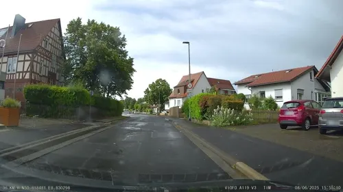



SB-Bio-Scheune
Farm and orchard · 1.7 km
Mo-Fr 08:00-18:00; Sa 08:00-18:00; Su off
2 more on the map.
Museums and landmarks214


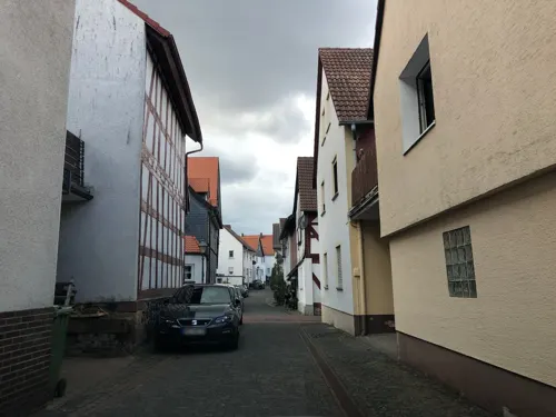
Heimatmuseum Amöneburg
Museum · 3.3 km
2 Schulgasse, Amöneburg
Mo-Th 08:00-12:00,14:00-16:00, Fr 08:00-12:00, Su[1,3] 14:00-18:00



Burg Schweinsberg
Monument and historic site · 7.0 km
1 Burg, Stadtallendorf

Hunburg
Monument and historic site · 6.8 km
Laut Wikipedia seit ca 1283 wüst. Heutzutage rein gar nichts mehr vorhanden. Einfach eine Kuhwiese.




202 more on the map.
Parks, trails and playgrounds44




Freibad Kirchhain
Sports field and stadium · 1.0 km
30 Am Schwimmbad, Kirchhain
"In der Freibadsaison von 10:00 - 20:00 Uhr"



Schutzgebiet für Bedrohte Arten Arzbach
Hiking and trails · 6.6 km
NABU-Schutzgebiet

32 more on the map.
Restaurants and cafes103

Brücker Mühle
Restaurant · Regional · 3.8 km
6 Am Friedenstein, Amöneburg
We-Sa 12:00-18:00; Su,PH 12:00-17:00
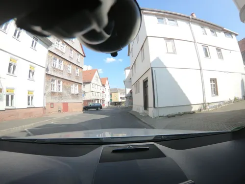
Café Noll
Cafe · German, Regional, Ice Cream, Breakfast, Cake, Salad, Pastry, Fries · 0.9 km
Warme Speisen von 11-14:30 Uhr und ab 17:00 Uhr
15 Brießelstraße
Mo off; Tu-Sa 09:00-19:00; Su,PH 11:00-19:00

Lindenhof
Restaurant · 5.7 km
63 Bahnhofstraße, Rauschenberg
Mo-Sa 07:00-22:00; Tu 17:00-22:00; Su 07:00-18:00
Ristorante Pizzeria Delizia
Restaurant · Italian · 0.9 km
16 Steinweg, Kirchhain
Mo-Su 11:30-14:00,17:00-22:30; Tu off

CLASSICO
Cafe · Ice Cream · 6.1 km
5 Niederkleiner Straße, Stadtallendorf
Mo-Th 08:00-22:00; Fr 08:00-24:00; Sa 00:00-02:00,10:00-24:00; Su...
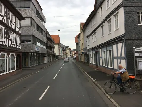
Gasthaus Zur Sonne
Restaurant · German · 0.8 km
Mo,Sa 16:30-24:00; Tu-Fr 11:00-14:00,16:30-24:00; Su 10:00-14:30
Pizzeria Adria
Restaurant · Italian · 0.9 km
Su 11:30-14:00,17:30-24:00, Tu-Fr 11:30-14:00,17:30-24:00; Sa 17:30-24:00
Schäfers Backstuben
Bakery · 0.6 km
9 Am Bahnhof, Kirchhain
Mo-Fr 05:30-17:00; Sa 07:00-13:00; Su 07:30-12:00

Schäfers Backstuben
Bakery · 5.9 km
6 Straße des 17. Juni, Stadtallendorf
Mo-Fr 08:00-21:00; Sa 08:00-21:00


Gasthaus Tiroler Stuben zur Inge
Restaurant · Italian · 5.0 km
2 Ohmstraße, Kirchhain
Tu-Sa 17:00-21:00; Su 11:30-14:00,17:00-21:00; Mo off
91 more on the map.
History
In prehistoric times a network of long-distance and connecting trails crossed back and forth over the area where the town of Kirchhain was later to be founded. Since the early New Stone Age, there is evidence of almost continuous settlement in the area through various epochs. The high point of the expansion of settlement was in the early Iron Age (5th century BC). The first territorial development however began only in the 12th century; in 1146 the settlement was first mentioned in a document under the name "Werphloh". The region belonged at that time to the landgravates of Thuringia and Hesse, whereas the neighbouring Amöneburg and vast parts of the surrounding lands belonged to the Archbishops of Mainz. Time and again, the Hessians and Mainzers came to blows over who had ascendancy over these lands. As of the 13th century, the landgraves of Hesse further upgraded Kirchhain as a Hessian bulwark against Mainz's centre of Amöneburg so that they could control the region. Kirchhain then developed into the economic centre of the Amöneburg Basin. Kirchhain was presumably given town rights before 1348, but without any earlier documentary proof, the year 1352 has come to be seen as the official year of the town's founding.
From the History section of Kirchhain on Wikipedia, under CC BY-SA 4.0.
Where to stay8
Milano
Motel and hotel · German · 6.4 km
7 Niederrheinische Straße, Stadtallendorf
Ringhotel Parkhotel Stadtallendorf
Motel and hotel · 5.9 km
1 Schillerstraße, Stadtallendorf
Churches and places of worship42
Stadtkirche
Church · Lutheran · 1.0 km
41 Hinterm Kirchhof, Kirchhain
Shopping27
Gas and EV charging12
Schools, colleges and libraries28
Berufliche Schulen des Landkreises Marburg-Biedenkopf in Kirchhain
School
18 Dresdener Straße, Kirchhain
Healthcare12
Albshäusertorstraße
Clinic and pharmacy · 6.5 km
2 Albshäusertorstraße, Rauschenberg
Abronsius-Apotheke
Clinic and pharmacy · 4.9 km
10a Schönbacher Straße, Kirchhain
Gesundheitszentrum Kirchhain
Clinic and pharmacy · 0.9 km
11 Mühlgasse, Kirchhain
Map of Kirchhain
250 places. The map loads OpenStreetMap tiles when you open it.
Getting there and nearby towns
Fritzlar Air Base (FRZ) is the nearest airport with scheduled flights listed in OpenStreetMap, 41 km away.
- Stadtallendorf 6 km east, about 6 min by car
- Marburg an der Lahn 11 km west, about 11 min by car
- Schwalmstadt 23 km northeast, about 23 min by car
- Alsfeld 26 km east, about 26 min by car
- Gladenbach 25 km west, about 25 min by car
- Grünberg 26 km south, about 26 min by car
- Lollar 25 km southwest, about 25 min by car
- Reiskirchen 26 km south, about 26 min by car
- Biedenkopf 29 km west, about 29 min by car
- Laubach 32 km south, about 32 min by car
Drive times are estimates from straight-line distance, not routes.
Local news
Headlines from INDB.
Reviews, tips and questions
Loading what members have shared...
Sources and licences
- GeoNames (CC BY 4.0): population, coordinates, regions and time zone
- Mapillary (see each image): photos
- OpenStreetMap contributors (ODbL 1.0): places, airports, map data
- Wikidata (CC0 1.0): elevation, founding date, time zone, website
- Wikimedia Commons (see each image): photos
- Wikipedia (CC BY-SA 4.0): overview and history text
Photo credits
- Kirchhain city hall, Andreas Trepte, CC BY-SA 2.5
- Bushaltestelle Röthestraße, 2, Kirchhain, Landkreis Marburg-Biedenkopf, GeorgDerReisende, CC BY-SA 4.0
- Bushaltestelle Röthestraße, 1, Kirchhain, Landkreis Marburg-Biedenkopf, GeorgDerReisende, CC BY-SA 4.0
- Niederrheinische Straße, 3, Kirchhain, Landkreis Marburg-Biedenkopf, GeorgDerReisende, CC BY-SA 4.0
- Niederreihnische Straße 31 (Kirchhain) II, Michael Kranewitter, CC BY-SA 3.0
- Ohmtalbahn, 1, Kirchhain, Landkreis Marburg-Biedenkopf, GeorgDerReisende, CC BY-SA 4.0
- Niederreihnische Straße 31 (Kirchhain) VI, Michael Kranewitter, CC BY-SA 3.0
- Amtsgericht Kirchhain, Hydro, CC BY-SA 4.0
- Stadtwappen Kirchhain Hessen 02, Frank Wagner – MeinKIRCHHAIN.de, Public domain
- Niederreihnische Straße 31 (Kirchhain) IV, Michael Kranewitter, CC BY-SA 3.0
- Bushaltestelle An der Ohmtalbahn, 1, Kirchhain, Landkreis Marburg-Biedenkopf, GeorgDerReisende, CC BY-SA 4.0
- Niederreihnische Straße 31 (Kirchhain) I, Michael Kranewitter, CC BY-SA 3.0
- Langensteiner Straße, 1, Kirchhain, Landkreis Marburg-Biedenkopf, GeorgDerReisende, CC BY-SA 4.0
- Niederreihnische Straße 31 (Kirchhain) VIII, Michael Kranewitter, CC BY-SA 3.0
- Niederrheinische Straße, 2, Kirchhain, Landkreis Marburg-Biedenkopf, GeorgDerReisende, CC BY-SA 4.0
- Bushaltestelle Tapetenfabrik, 1, Kirchhain, Landkreis Marburg-Biedenkopf, GeorgDerReisende, CC BY-SA 4.0
- Niederreihnische Straße 31 (Kirchhain) XV, Michael Kranewitter, CC BY-SA 3.0
- Niederreihnische Straße 31 (Kirchhain) XIV, Michael Kranewitter, CC BY-SA 3.0
- Langensteiner Straße, 2, Kirchhain, Landkreis Marburg-Biedenkopf, GeorgDerReisende, CC BY-SA 4.0
- Niederreihnische Straße 31 (Kirchhain) XII, Michael Kranewitter, CC BY-SA 3.0
- Niederreihnische Straße 31 (Kirchhain) VII, Michael Kranewitter, CC BY-SA 3.0
- Stettiner Straße, 2, Kirchhain, Landkreis Marburg-Biedenkopf, GeorgDerReisende, CC BY-SA 4.0
- Im Brand, 1, Kirchhain, Landkreis Marburg-Biedenkopf, GeorgDerReisende, CC BY-SA 4.0
- Stettiner Straße, 1, Kirchhain, Landkreis Marburg-Biedenkopf, GeorgDerReisende, CC BY-SA 4.0
- Niederreihnische Straße 31 (Kirchhain) V, Michael Kranewitter, CC BY-SA 3.0
- Amtsgericht, 1, Niederrheinische Straße 32, Kirchhain, Landkreis Marburg-Biedenkopf, GeorgDerReisende, CC BY-SA 4.0
- Bushaltestelle Langensteiner Straße, 1, Kirchhain, Landkreis Marburg-Biedenkopf, GeorgDerReisende, CC BY-SA 4.0
- Alsfelder Straße 2, 1, Kirchhain, Landkreis Marburg-Biedenkopf, GeorgDerReisende, CC BY-SA 4.0
- Niederreihnische Straße 31 (Kirchhain) IX, Michael Kranewitter, CC BY-SA 3.0
- Niederreihnische Straße 31 (Kirchhain) X, Michael Kranewitter, CC BY-SA 3.0
- Niederrheinische Straße 30, 1, Kirchhain, Landkreis Marburg-Biedenkopf, GeorgDerReisende, CC BY-SA 4.0
- Niederreihnische Straße 31 (Kirchhain) XIII, Michael Kranewitter, CC BY-SA 3.0
- Eisenbahnstraße 7, 1, Kirchhain, Landkreis Marburg-Biedenkopf, GeorgDerReisende, CC BY-SA 4.0
- Friedhofskapelle Kirchhain (2), Hydro, CC BY-SA 4.0
- Bushaltestelle Bahnhof, 3, Kirchhain, Landkreis Marburg-Biedenkopf, GeorgDerReisende, CC BY-SA 4.0
- Friedhofskapelle Kirchhain (1), Hydro, CC BY-SA 4.0
- Bushaltestelle Dresdener Straße, 1, Kirchhain, Landkreis Marburg-Biedenkopf, GeorgDerReisende, CC BY-SA 4.0
- Ballspielplatz, 1, Kirchhain, Landkreis Marburg-Biedenkopf, GeorgDerReisende, CC BY-SA 4.0
- Hindenburgstraße, 1, Kirchhain, Landkreis Marburg-Biedenkopf, GeorgDerReisende, CC BY-SA 4.0
- Am Friedensstein 2, Amöneburg, Flight89, CC BY-SA 3.0
- SchlossAmoeneburgwiki, Peter Voeth, CC BY-SA 3.0
- Burg Hundsbach (Ernsthausen) (0001), Gerold Rosenberg ( talk ) 23:15, 19 February 2017 (UTC), CC BY-SA 3.0
- Rauschenberg Schloss 3, Presse03, CC BY-SA 3.0
- Schweinsberg (Stadtallendorf) (05), Hydro, CC BY-SA 4.0
- Burgholz und Kellerwald von Amoeneburg, Elop, CC BY-SA 3.0
- Lageplan Hainmühle Hunburg, Cirdan, CC BY-SA 4.0
- Hunburg (Burgholz) (0001), Gerold Rosenberg ( talk ) 18:57, 19 February 2017 (UTC), CC BY-SA 3.0
- Stiftsschule St. Johann 2, Hydro, CC BY-SA 4.0
- Wenigenburg2wiki, Peter Voeth, Die silberlocke at de.wikipedia, CC BY-SA 3.0
- Amöneburg Lindaukapelle von SW, Heinrich Stürzl, CC BY-SA 4.0
- Kirche Stausebach 1, Hydro, CC BY-SA 4.0
- Kirche Kleinseelheim 2, Hydro, CC BY-SA 4.0
- Falk Oberdorf Schweinsberger Moor 3, Falk Oberdorf, Osterstr. 8, 32312 Lübbecke, CC BY-SA 3.0 de
- Naturschutzgebiet Saurasen Feldhase, Miosta, CC BY 4.0
- Basalt-2378, Hessen, Amöneburg, NSG 1534001, Erikottodamm, CC BY-SA 4.0
- Kirchhainer Erlensee (2) 2024-02-01 (Elop), User:Elop, CC BY-SA 3.0
- Stadtkirche Stadtallendorf2, Pazzee at German Wikipedia, CC BY-SA 3.0
- Hunburgturm Burgholz, Hydro, CC BY-SA 4.0
- Kirche Großseelheim 1, Hydro, CC BY-SA 4.0
- Kirche Himmelsberg (Kirchhain), Hydro, CC BY-SA 4.0
- Kirche Rüdigheim (Amöneburg) 3, Hydro, CC BY-SA 4.0
- Kirchhain church St Elisabeth, Andreas Trepte, CC BY-SA 2.5
- Mardorf Hessen Church, Andreas Trepte, CC BY-SA 2.5
- Lidar Burg Hunsgeweide und Umgebung, Commander-pirx, CC BY-SA 4.0
- Street-level photo, chuck, CC BY-SA 4.0
- Street-level photo, mfa, CC BY-SA 4.0
- Street-level photo, robffm, CC BY-SA 4.0
- Street-level photo, tim3003, CC BY-SA 4.0
- Street-level photo, bahnpirat, CC BY-SA 4.0
- Street-level photo, ramap, CC BY-SA 4.0
- Street-level photo, poxonline, CC BY-SA 4.0
- Street-level photo, poxonline, CC BY-SA 4.0
- Street-level photo, mfa, CC BY-SA 4.0
- Street-level photo, robffm, CC BY-SA 4.0
- Street-level photo, mfa, CC BY-SA 4.0
- Street-level photo, robffm, CC BY-SA 4.0
- Street-level photo, bahnpirat, CC BY-SA 4.0
- Street-level photo, chuck, CC BY-SA 4.0
- Street-level photo, ramap, CC BY-SA 4.0
- Street-level photo, poxonline, CC BY-SA 4.0
- Street-level photo, poxonline, CC BY-SA 4.0
- Street-level photo, tim3003, CC BY-SA 4.0


Page built November 8, 2026. Spotted a mistake? Tell us or suggest a place.