


Königs Wusterhausen, Germany
Königs Wusterhausen is a town of 32,513 people in Brandenburg, Germany, founded in 1320.
Why visit Königs Wusterhausen
Townapedia lists 67 museums and landmarks, 66 parks and trails, 190 places to eat, 24 places to stay and 34 attractions in and around town.
Highlights include Capitol - Das Kulturkino, Hortenberg, Neukölln-Mittenwalder Eisenbahn and Sender- und Funktechnikmuseum.
Weather in Königs Wusterhausen
Forecast from MET Norway (CC BY 4.0). Full forecast
About Königs Wusterhausen
Königs Wusterhausen (German pronunciation: [ˈkøːnɪçs vʊstɐˈhaʊ̯zn̩, ˈkøːnɪk-] ; Lower Sorbian: Parsk, pronounced [ˈparsk]) is a town in the Dahme-Spreewald district of the state of Brandenburg in Germany a few kilometers outside Berlin.
From the Wikipedia article Königs Wusterhausen (this version), under CC BY-SA 4.0.
Photos of Königs Wusterhausen


Things to do34

Capitol - Das Kulturkino
Cinema and theater
16 Bahnhofstraße, Königs Wusterhausen
"Je nach Vorstellung "



Hofladen Märkische Agrargenossenschaft
Farm and orchard · 7.1 km
Mo-Fr 07:00-18:00; Sa 08:00-13:00; PH off

Marktschwärmer Wildau
Farm and orchard · 2.1 km
Die Gemeinschaft aus Erzeugerinnen und Erzeugern ebenso wie Verbraucherinnen und Verbrauchern stellt wöchentlich einen...
1 Schwartzkopffstraße, Wildau
Th 17:00-18:30

Hofladen Zeesen
Farm and orchard · 2.2 km
Mo-Fr 08:00-18:00; Sa 08:00-12:00; PH off
22 more on the map.
Museums and landmarks67
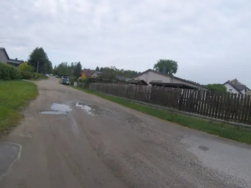

Sender- und Funktechnikmuseum
Museum · 0.9 km
20 Funkerberg, Königs Wusterhausen
Tu,Th,Sa,Su 13:00-17:00

Jagdschloss
Museum · 0.6 km
1 Schloßplatz, Königs Wusterhausen
Nov-Mar Sa-Su 10:00-16:00; Apr-Oct Tu-Su 10:00-17:30


Gutshaus Schenkendorf
Monument and historic site · 3.5 km
9 Freiherr-von-Loeben-Straße, Mittenwalde


Wasserturm
Monument and historic site · 1.0 km
Wasserturm auf dem Funkerberg in Königs Wusterhausen
3 Funkerberg, Königs Wusterhausen

55 more on the map.
Parks, trails and playgrounds66

Besmer Bootswerft
Marina and boat launch · 8.2 km
Marina, Bootsservice - Reparatur, Slipstelle
26c Wernsdorfer Straße, Berlin

Wildorado
Sports field and stadium · 2.2 km
Tu 06:30-18:45; We 06:30-19:00; Th 06:30-21:45; Fr 06:30-20:00;...
Bootscharter Bindowbrück
Marina and boat launch · 7.5 km
Shop: Grüne Trift 1 D 15754 Heidesee OT Bindow Bootsmotore, Bootsverleih, Bootsfahrschule, Shop
Bootshaus Roll
Marina and boat launch · 5.5 km
Dauer- und Gastliegeplätze. Strom, Wasser, WC, Duschen, Entsorgungsmöglichkeit für Chemie WC. Slippbahn.
Marineservice Niederlehme
Marina and boat launch · 2.0 km
Gastliegeplätze, Motorenservice, Werft, Eisdiele
Bootshaus Franz
Marina and boat launch · 5.8 km
Bootshaus Senzig
Marina and boat launch · 2.7 km
BunBo - das Bungalowboot / Standort Zernsdorf
Marina and boat launch · 3.8 km
54 more on the map.
Restaurants and cafes190
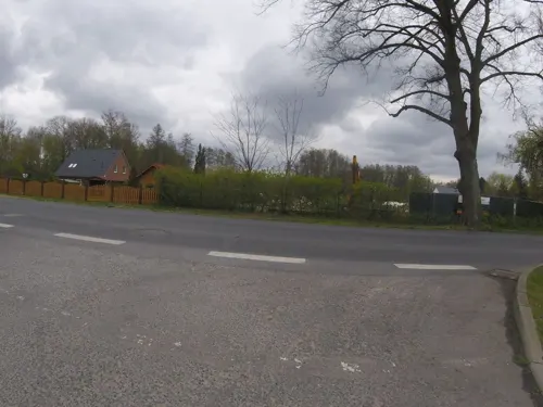
Bestwaner Hotel
Restaurant · German · 6.4 km
1 Franz-Künstler-Straße, Bestensee
Mo-Th 11:00-21:00; Fr-Su 12:00-22:00
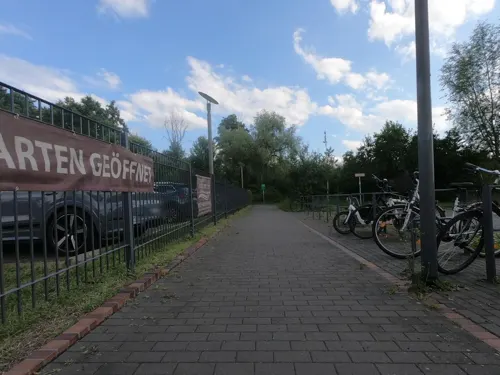
Biergarten Villa am See
Bar and pub · Regional · 2.4 km
1 Uferpromenade an der Dahme, Wildau
Th-Su 12:00-22:00
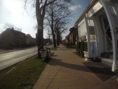
Eross
Restaurant · Greek · 3.1 km
151 Chausseestraße, Königs Wusterhausen
Mo-Sa 12:00-22:00; Su 12:00-21:00
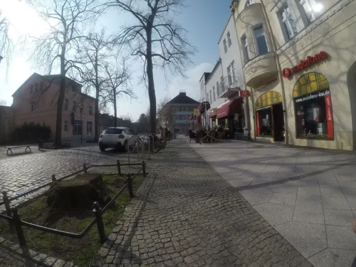
Herr Dang
Restaurant · Sushi, Vietnamese · 0.6 km
19 Bahnhofstraße, Königs Wusterhausen
Mo-Su 11:30-22:00
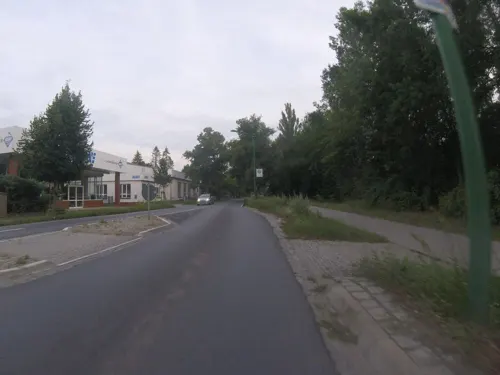
Ikaros
Restaurant · Greek · 2.0 km
1 Im Gewerbepark, Königs Wusterhausen
Mo-Th 12:00-22:30; Fr-Sa 12:00-23:00; Su 12:00-22:00
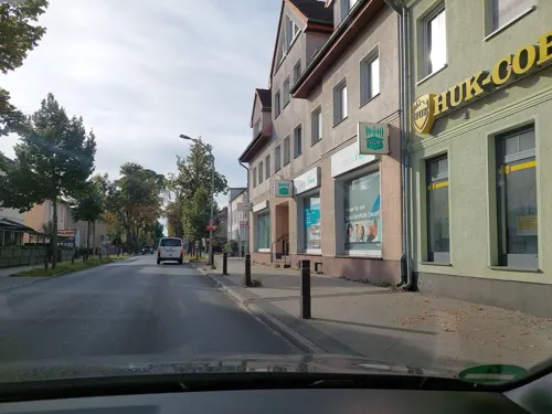
Osteria Forio
Restaurant · Italian · 0.9 km
50 Cottbuser Straße, Königs Wusterhausen
11:00-23:00; Fr,Sa 11:00-00:00
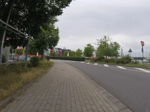
Redo XXL
Restaurant · German, International · 2.4 km
1 Chausseestraße, Wildau
Mo-Su 12:00-22:00; Fr,Sa 12:00-24:00
Seerestaurant Nicos Hafen
Restaurant · Croatian · 5.1 km
Kroatische Küche
123 Wernsdorfer Straße, Königs Wusterhausen
Mo-Su 11:30-22:00


Restaurant Biberblick
Restaurant · Regional, German, Breakfast, Cafe · 7.6 km
1g Schmöckwitzer Damm, Berlin
Th-Fr 17:00-22:00, Sa 12:00-22:00, Su 12:00-17:00
178 more on the map.
History
In 1320, in connection with an investiture on 19 September, the settlement ("hus to wosterhusen") and the castle received their first-known documentary mentions. By 1400, the two were both a fiefdom held by the noble family of Schlieben. In 1500 the estate of Wendisch Wusterhausen was verified for the first time by the Schenken (a noble title) of Landberg zu Teupitz.
On 14 October 1669 Privy Councillor Friedrich von Jena acquired the castle and the village of Wendisch Wusterhausen. In early July 1683, Kurprinz Friedrich, later (1688) Elector Friedrich III, and later still (1701) King Frederick I in Prussia, acquired the castle and the village. In 1698, Kurprinz Friedrich Wilhelm was given the castle along with the attached estate as a gift by his father. After his accession to the throne, King Frederick William I in Prussia, remodelled the castle into a hunting lodge, which his son Frederick II (Frederick the Great) despised. In 1718, the town, hitherto known as Wusterhausen, was given its current name, Königs Wusterhausen ("Königs" = "king's" in German).
In 1862, novelist and poet Theodor Fontane visited Königs Wusterhausen for his Wanderungen durch die Mark Brandenburg.
Since 1901, Königs Wusterhausen has been home to the Brandenburg School for the Blind and Visually Impaired (Brandenburgische Schule für Blinde und Sehbehinderte), endowed by the Hamburg merchant Hermann Schmidt.
Read more of the history
In 1920 came the launch of Germany's first radio transmitter, the Transmitter Königs Wusterhausen, and in 1935, Königs Wusterhausen was raised to town status. In 1937, Saint Elisabeth's Catholic Church was built and consecrated.
In 1938, the Berlin Autobahn ringroad – now Bundesautobahn 10 – was dedicated, and now serves cities and towns around Berlin, including Königs Wusterhausen. By now, the National Socialists were in power, and in 1944 they built a concentration camp for Jews and Poles at the railway goods station.
After the Second World War and until 1990, Königs Wusterhausen lay in the former East Germany.
In 1972, Germany's deadliest-ever aviation accident occurred when an Interflug passenger flight crashed near Königs Wusterhausen, killing 156 people. 1972 also saw the collapse of Königs Wusterhausen's central tower, which at 243 m tall was the most prominent structure at the radio transmission facility.
In Königs Wusterhausen, there is a Catholic parish as well as congregations of the Protestant church body named Evangelical Church of Berlin-Brandenburg-Silesian Upper Lusatia. The oldest church in town is the village Wehrkirche (a church whose architecture contains typically military elements) in Deutsch Wusterhausen, built in the 13th century. In 1998 the Evangelical Königs Wusterhausen deanery (German: Kirchenkreis) merged in the Berlin-Neukölln deanery. The Protestant congregations in Königs Wusterhausen (KW), Deutsch Wusterhausen, Niederlehme, Senzig, Zeesen, and Zernsdorf (all components of KW) as well as that in Schenkendorf (a component of Mittenwalde), today make up the ecclesiastical Region 9.
The Catholic parish belongs to the Deanship of Köpenick-Treptow of the Archdiocese of Berlin. Both communities have very active youth groups, the Evangelical Junge Gemeinde ("Young Community") and the Katholische Jugend ("Catholic Youth").
In January 2013, the Freie Baptistengemeinde Königs Wusterhausen was organized. They are located near the post office and hold weekly services as well as other Bible studies including "Jungschar" and a monthly "Jugendtreff".
From the History section of Königs Wusterhausen on Wikipedia, under CC BY-SA 4.0.
More about Königs Wusterhausen
Geography
Königs Wusterhausen – locally known as "KW" (German pronunciation: [ˈkaː ˈveː]) or "KWh" (German pronunciation: [ˈkaː ˈveː 'ha:])– lies on the Notte canal and the river Dahme southeast of Berlin. Much further away to the west lies the state capital Potsdam.
The abbreviation "KW" is also a reminder of the Königs Wusterhausen radio transmitter as "KW" is also the abbreviation for "Kilowatt" and "Kurzwelle" (German: "Shortwave").
Königs Wusterhausen is the biggest town in the Dahme-Spreewald district. The municipal reforms in 2003 brought about seven amalgamations, since which time the communities of Zeesen, Kablow, Diepensee, Niederlehme, Senzig, Wernsdorf and Zernsdorf have belonged to Königs Wusterhausen, the town's land area has grown sixfold, and its population has doubled.
Arts and culture
Königs Wusterhausen Hunting Lodge and Garden, known as Prussian King Frederick William's favourite place to stay. Today the castle is a museum of the Prussian Palaces and Gardens Foundation Berlin-Brandenburg. Numerous valuable objects of baroque paintings and handicrafts are on display, including paintings with connections to Frederick William and his family, many pieces of the original interior, as well as a large collection of portraits, mainly of officers, which the "soldier king" painted himself.
Kreuzkirche ("Cross Church"), begun in 1693, new glazing in 1949 with 3 choir windows and 4 ornamental round panes by Charles Crodel.
Neue Mühle ("New Mill") Canal lock (first documented in 1739), difference in levels 1.50 m
Watertower (begun 1910, shut down 1965), now a café with beer garden and exhibition areas
Königs Wusterhausen Transmission and Radio Technology Museum on the Funkerberg
From the Wikipedia article Königs Wusterhausen, under CC BY-SA 4.0.
Notable people from Königs Wusterhausen
 Judith ArndtGerman cyclistPhoto: Diliff, CC BY-SA 3.0
 Linda TeutebergGerman politicianPhoto: Olaf Kosinsky, CC BY-SA 3.0 de
 Marek KalbusGerman opera singerPhoto: No machine-readable author provided...., CC BY 2.5
 Jörg Schmidt-ReitweinGerman cinematographer (1939–2023)Photo: Tobias Schmidt-Reitwein, CC BY 4.0
 Halina WawzyniakGerman politician and lawyerPhoto: Foto-AG Gymnasium Melle, CC BY 3.0
 Claudia RehGerman light mural artistPhoto: Schwijker, CC BY-SA 4.0
- Heinrich MederowEast German rower
- Walter RiedelGerman rocket scientist (1902-1968)
- Sandra KellerGerman actress
- Sabine JüngerGerman politician
- Hans-Martin TillackGerman journalist
- Reiko FütingGerman composer
Born in Königs Wusterhausen, according to Wikidata (CC0). Each name links to its Wikipedia article.
Where to stay24
Churches and places of worship23
St.-Elisabeth-Kirche
Church · Roman Catholic · 0.8 km
24 Friedrich-Engels-Straße, Königs Wusterhausen
Dorfkirche Schenkendorf
Church · Protestant · 3.7 km
Freiherr-von-Loeben-Straße, Mittenwalde
Kirche Niederlehme
Church · Protestant · 2.2 km
75 Karl-Marx-Straße, Königs Wusterhausen
Shopping60
Gas and EV charging21
Total Mittenwalde Berliner Chaussee
Gas station · 7.3 km
22A Berliner Chaussee, Mittenwalde
Schools, colleges and libraries43
Brandenburg School for the Blind and Visual Impaired
School · 1.6 km
64 Luckenwalder Straße, Königs Wusterhausen
Healthcare23
Apotheke am Rathaus
Clinic and pharmacy · 7.5 km
3 Richard-Israel-Straße, Schulzendorf
Map of Königs Wusterhausen
250 places. The map loads OpenStreetMap tiles when you open it.
Getting there and nearby towns
Berlin Brandenburg Airport "Willy Brandt" (BER) is the nearest airport with scheduled flights listed in OpenStreetMap, 12 km away.
- Zeuthen 5 km north, about 5 min by car
- Schulzendorf 7 km north, about 7 min by car
- Bestensee 7 km south, about 7 min by car
- Eichwalde 7 km north, about 7 min by car
- Mittenwalde 8 km southwest, about 8 min by car
- Schönefeld 13 km northwest, about 13 min by car
- Dahlewitz 13 km west, about 13 min by car
- Rangsdorf 15 km west, about 15 min by car
- Blankenfelde-Mahlow 15 km west, about 15 min by car
- Zossen 16 km southwest, about 16 min by car
Drive times are estimates from straight-line distance, not routes.
Towns near Königs Wusterhausen


Keep exploring
Local news
Headlines from INDB.
Reviews, tips and questions
Loading what members have shared...
Sources and licences
- GeoNames (CC BY 4.0): population, coordinates, regions and time zone
- Mapillary (see each image): photos
- OpenStreetMap contributors (ODbL 1.0): places, airports, map data
- Wikidata (CC0 1.0): elevation, founding date, time zone, website, landmarks and historic places
- Wikimedia Commons (see each image): photos
- Wikipedia (CC BY-SA 4.0): overview and history text
Photo credits
- Cumulus mediocris clouds in Königs Wusterhausen, V.Boldychev, CC BY-SA 4.0
- Kreiskrankenhaus Königs Wusterhausen, Clemensfranz, CC BY-SA 3.0
- Königs Wusterhausen, Germany - panoramio (4), Jan Gumpinger, CC BY 3.0
- Feuerwehrgebäude Königs Wusterhausen, Clemensfranz, CC BY-SA 3.0
- Wasserturm Königs Wusterhausen 2021 02, Clemensfranz, CC BY-SA 4.0
- Königs Wusterhausen Wasserturm lub 2023-04-22, Lukas Beck, CC BY-SA 4.0
- Schlossplatz 5 Königs Wusterhausen, Clemensfranz, CC BY-SA 3.0
- Königs Wusterhausen Wasserturm lub 2024-07-06, Lukas Beck, CC BY 4.0
- Wasserturm Königs Wusterhausen 2021 01, Clemensfranz, CC BY-SA 4.0
- Koenigs Wusterhausen 08-13 Schloss, A.Savin, CC BY-SA 3.0
- Koenigs Wusterhausen kath Kirche, Clemensfranz, CC BY-SA 3.0
- KW Friedrich-Schiller-Gymnasium2, Xenomorphus, CC BY-SA 4.0
- "Der Turm" ehemaliger Wasserturm in Königs Wusterhausen (HDR) - panoramio, der_psycho_78, CC BY 3.0
- Kirche Niederlehme im Licht der Abendsonne 07-21, V.Boldychev, CC BY-SA 4.0
- Kreuzkirche KW, SteffenKahl, CC BY-SA 2.0 de
- Zeuthen Martin Luther Kirche, Clemensfranz, CC BY 2.5
- Neukoelln6 Mittenwalder Eisenbahn, Lienhard Schulz, CC BY 2.5
- Schenkendorf Toreinfahrt Schloss Wasserturm-01, Radler59 ( talk ), CC BY-SA 4.0
- Senderhaus 1 2021, V.Boldychev, CC BY-SA 4.0
- A10 Center Haupteingang 2011, Thomas Kohler from Waren , Deutschland, CC BY-SA 2.0
- Mittenwalde Heimatmuseum Salzmarkt 5, Assenmacher, CC BY-SA 3.0
- Zeuthen-Miersdorf Dorfkirche Nordostansicht, Assenmacher, CC BY-SA 4.0
- Kirche-Ragow-Mittenwalde, Ralfvieh, CC BY-SA 3.0
- Dorfkirche Schenkendorf - Germany - panoramio, Löwe 48, CC BY-SA 3.0
- Friedenskirche Wildau Südwestansicht, Assenmacher, CC BY-SA 4.0
- Kino-Capitol-KW, Saalebaer, CC0
- KW-Deutsch Wusterhausen Pennigsberg Blick nach Nordwesten, Assenmacher, CC BY-SA 4.0
- Koenigs Wusterhausen Schloss, Clemensfranz, CC BY-SA 3.0
- Jahn Denkmal Mittenwalde, Clemensfranz, CC BY-SA 3.0
- Heidesee-Dannenreich Ortsansicht 03, Assenmacher, CC BY-SA 4.0
- Sendemast Koenigswusterhausen, Joeopitz, CC BY-SA 3.0
- Mittenwalde Spitalkapelle, Clemensfranz, CC BY-SA 3.0
- St Moritz Kirche Mittenwalde, Clemensfranz, CC BY-SA 3.0
- Mittenwalde Schenkendorf Kirche, Clemensfranz, CC BY-SA 3.0
- Eichwalde kath kirche, Clemensfranz, CC BY-SA 3.0
- Schloss Schenkendorf Eingang 1998, OnkelJohn, CC BY-SA 3.0
- Zeuthen-Miersdorf Dorfkirche Südansicht, Assenmacher, CC BY-SA 4.0
- Dorfkirche Ragow, Steffen Kahl, CC BY-SA 2.0 de
- St.-Moritz-Kirche (Mittenwalde), Clemensfranz (shifted, cropped & recoloured by Rabanus Flavus ), CC BY-SA 4.0
- Th-wildau-campus-106, Synovali, CC BY-SA 4.0
- Königs Wusterhausen-Deutsch Wusterhausen Hortenberg Blick nach Osten, Assenmacher, CC BY-SA 4.0
- Street-level photo, rik, CC BY-SA 4.0
- Street-level photo, kartonage, CC BY-SA 4.0
- Street-level photo, kartonage, CC BY-SA 4.0
- Street-level photo, DBSEV_SBB, CC BY-SA 4.0
- Street-level photo, rik, CC BY-SA 4.0
- Street-level photo, carlheinz, CC BY-SA 4.0
- Street-level photo, carlheinz, CC BY-SA 4.0
- Street-level photo, rik, CC BY-SA 4.0
- Street-level photo, kartonage, CC BY-SA 4.0
- Street-level photo, rik, CC BY-SA 4.0
- Street-level photo, rik, CC BY-SA 4.0
- Street-level photo, carlheinz, CC BY-SA 4.0
- Street-level photo, rik, CC BY-SA 4.0
- Street-level photo, britiger, CC BY-SA 4.0
- Street-level photo, tordans, CC BY-SA 4.0
- Street-level photo, moenk, CC BY-SA 4.0
- Street-level photo, elgaard, CC BY-SA 4.0
- Street-level photo, eserte, CC BY-SA 4.0
- Street-level photo, rik, CC BY-SA 4.0
- Street-level photo, rik, CC BY-SA 4.0
- Street-level photo, DBSEV_SBB, CC BY-SA 4.0
- Street-level photo, rik, CC BY-SA 4.0
- Street-level photo, carlheinz, CC BY-SA 4.0


Page built November 9, 2026. Spotted a mistake? Tell us or suggest a place.