


Why visit Rangsdorf
Townapedia lists 15 museums and landmarks, 13 parks and trails, 41 places to eat, 4 places to stay and 21 attractions in and around town.
Highlights include Hofladen, Lindenberg, Gutshaus Jühnsdorf and Kriegerdenkmal.
Weather in Rangsdorf
Forecast from MET Norway (CC BY 4.0). Full forecast
About Rangsdorf
Rangsdorf is a municipality in the district of Teltow-Fläming in Brandenburg in Germany. It has an airfield [up to 1940 a genuine commercial airport] from where on 20 July 1944 Claus Schenk Graf von Stauffenberg took off on his fateful attempt to assassinate German leader Adolf Hitler at his military headquarters in East Prussia, the Wolfsschanze (Wolf's Lair).
From the Wikipedia article Rangsdorf (this version), under CC BY-SA 4.0.
Photos of Rangsdorf


Things to do21



9 more on the map.
Museums and landmarks15

Gutshaus Jühnsdorf
Monument and historic site · 2.6 km
22 Dorfstraße, Blankenfelde-Mahlow

Schule am Wald
Monument and historic site · 4.8 km
Jagdhaus, Inspektorenhaus, Wirtschaftsgebäude und Pavillion
8 Zossener Straße, Ludwigsfelde

Wasserturm
Monument and historic site · 3.7 km
Wasserturm der Gutsanlage, Dorfstraße 35 in Blankenfelde-Mahlow OT Dahlewitz

Dorfschmiede Blankenfelde
Monument and historic site · 4.5 km
Historische Dorfschmiede mit Inventar
14 Blankenfelder Dorfstraße, Blankenfelde-Mahlow


3 more on the map.
Parks, trails and playgrounds13




Seesportclub Rangsdorf
Marina and boat launch
Slippanlage und Kran bis 2 to http://sscra.de/
SG 53
Marina and boat launch · 0.6 km
Rangsdorfer Segelgemeinschaft 53 e.V. www.rangsdorfer-segelgemeinschaft.de
Tauentzienpark
Park · 3.8 km
In Entwicklung befinlidlicher Landschaftspark auf dem Areal der ehem. Tauentzien-Kaserne (ehem. Ausweichführungsstelle Blankenfelde der...

1 more on the map.
Restaurants and cafes41
Alter Dorfkrug
Restaurant · German · 5.0 km
19 Dorfaue, Ludwigsfelde
Th 17:00-21:00; Fr 17:00-22:00; Sa 12:00-22:00; Su 12:00-20:00
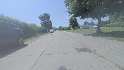
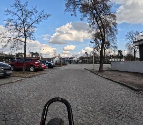
Knossos
Restaurant · Greek · 0.7 km
1 Goethestraße, Rangsdorf
Mo,We,Th 11:30-14:00; Fr 17:00-23:00; Sa,Su 11:30-23:00
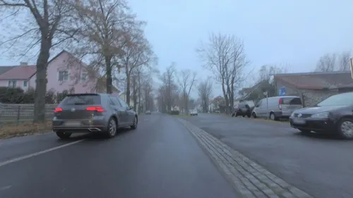
Pizza Musti
Restaurant · Italian, Pizza · 2.9 km
26 Dorfstraße, Blankenfelde-Mahlow
Tu-Fr 11:30-14:30; Tu-Su 16:00-21:00; Su 11:30-14:30

Dionysos
Restaurant · Greek · 4.9 km
35 Brandenburger Platz, Blankenfelde-Mahlow
Mo-Sa 12:00-22:30; Su 12:00-21:30

Philips Dang Restaurant
Cafe · Vietnamese, Sushi · 4.5 km
26 Zossener Damm, Blankenfelde-Mahlow
Mo-Su 11:00-22:30
Vierseithofcafé "land.wirt.schaft"
Cafe · 5.1 km
6 Dorfaue, Ludwigsfelde
"nach Vereinbarung, nur bei Veranstaltungen"
29 more on the map.
Where to stay4
Churches and places of worship11
Blankenfelder Dorfkirche
Church · Protestant · 4.8 km
50 Blankenfelder Dorfstraße, Blankenfelde-Mahlow
Dorfkirche Groß Schulzendorf
Church · Protestant · 5.0 km
32 Dorfaue, Ludwigsfelde
Evangelisch-Freikirchliche Gemeinde
Church · Baptist · 5.1 km
2 Dietmar-Klemt-Straße, Blankenfelde-Mahlow
Kirche Groß Kienitz
Church · Protestant · 4.8 km
14a Groß Kienitzer Dorfstraße, Blankenfelde-Mahlow
Shopping17
Gas and EV charging7
Schools, colleges and libraries10
Healthcare4
Map of Rangsdorf
143 places. The map loads OpenStreetMap tiles when you open it.
Getting there and nearby towns
Berlin Brandenburg Airport "Willy Brandt" (BER) is the nearest airport with scheduled flights listed in OpenStreetMap, 10 km away.
- Blankenfelde-Mahlow 5 km north, about 5 min by car
- Blankenfelde 5 km north, about 5 min by car
- Zossen 9 km south, about 9 min by car
- Ludwigsfelde 11 km west, about 11 min by car
- Schönefeld 12 km northeast, about 12 min by car
- Königs Wusterhausen 15 km east, about 15 min by car
- Schulzendorf 14 km northeast, about 14 min by car
- Teltow 15 km northwest, about 15 min by car
- Zeuthen 15 km northeast, about 15 min by car
- Trebbin 16 km southwest, about 16 min by car
Drive times are estimates from straight-line distance, not routes.
Towns near Rangsdorf


Keep exploring
Local news
Headlines from INDB.
Reviews, tips and questions
Loading what members have shared...
Sources and licences
- GeoNames (CC BY 4.0): population, coordinates, regions and time zone
- Mapillary (see each image): photos
- OpenStreetMap contributors (ODbL 1.0): places, airports, map data
- Wikidata (CC0 1.0): elevation, founding date, time zone, website
- Wikimedia Commons (see each image): photos
- Wikipedia (CC BY-SA 4.0): overview and history text
Photo credits
- Gutsanlage Groß Machnow, Engeser, CC BY-SA 3.0
- Evangelische Kirche Rangsdorf, Lukas Beck, Public domain
- Dorfkirche Rangsdorf - Germany - panoramio, Löwe 48, CC BY-SA 3.0
- Dorfkirche Rangsdorf Interieur, Lukas Beck, Public domain
- Dorfkirche Rangsdorf - Deutschland - panoramio, Löwe 48, CC BY-SA 3.0
- Dorfkirche Rangsdorf Altar, Lukas Beck, Public domain
- Dorfkirche Rangsdorf Innenraum, Lukas Beck, Public domain
- Dorfkirche Rangsdorf Kirchenschiff Südansicht, Assenmacher, CC BY-SA 4.0
- Dorfkirche Rangsdorf Denkmal Weltkriege rechte Seite, Assenmacher, CC BY-SA 4.0
- Dorfkirche Rangsdorf Ostansicht, Assenmacher, CC BY-SA 4.0
- Dorfkirche Rangsdorf Westturm Turmgeschoss, Assenmacher, CC BY-SA 4.0
- Dorfkirche Rangsdorf Denkmal Weltkriege Vorderseite, Assenmacher, CC BY-SA 4.0
- Dorfkirche Rangsdorf Denkmal Weltkriege linke Seite, Assenmacher, CC BY-SA 4.0
- Dorfkirche Rangsdorf Westturm Portal, Assenmacher, CC BY-SA 4.0
- Dorfkirche Rangsdorf Kirchenschiff Nordansicht Mittelfenster, Assenmacher, CC BY-SA 4.0
- Dorfkirche Rangsdorf Kirchenschiff Nordansicht, Assenmacher, CC BY-SA 4.0
- Dorfkirche Rangsdorf Westturm Nordansicht, Assenmacher, CC BY-SA 4.0
- Dorfkirche Rangsdorf Denkmal Weltkriege Rückseite, Assenmacher, CC BY-SA 4.0
- Dorfkirche Rangsdorf Südostansicht, Assenmacher, CC BY-SA 4.0
- Dorfkirche Rangsdorf Innen, Lukas Beck, Public domain
- Dorfkirche Rangsdorf Tür, Lukas Beck, Public domain
- Evangelische Kirche Rangsdorf in Brandenburg Teltow Fläming, Tom Koronowski, CC BY-SA 4.0
- Dorfkirche Rangsdorf, Lukas Beck, Public domain
- Denkmal Rangsdorf, Lukas Beck, CC BY-SA 4.0
- Rangsdorf - Denkmal 1.Weltkrieg - panoramio, Löwe 48, CC BY-SA 3.0
- Kircheweg Kirche Rangsdorf, Clemensfranz, CC BY-SA 3.0
- Seebadallee 59 Rangsdorf, Clemensfranz, CC BY-SA 3.0
- Rangssouci Rangsdorf 2022CF 02, Clemensfranz, CC BY-SA 4.0
- Rangssouci Rangsdorf 2022CF 01, Clemensfranz, CC BY-SA 4.0
- Kirche St. Albertus Magnus Rangsdorf, Lukas Beck, CC BY-SA 4.0
- Rangsdorf Kirche St. Albertus Magnus, Lukas Beck, CC BY-SA 4.0
- Puschkinstraße 3 kath Kirche Rangsdorf, Clemensfranz, CC BY-SA 3.0
- Am Strand Rangsdorf 2021-05-11 03, Leonhard Lenz, CC0
- Am Strand Rangsdorf 2021-05-11 02, Leonhard Lenz, CC0
- Dorfkirche Klein Kienitz 01, Engeser, CC BY-SA 3.0
- Dorfkirche Dahlewitz Suedostansicht, Assenmacher, CC BY-SA 4.0
- Glienick Weinberg Gipfel Hinweisschild, Assenmacher, CC BY-SA 4.0
- Dorfkirche Glienick - Deutschland - panoramio, Löwe 48, CC BY-SA 3.0
- Dorfkirche Jühnsdorf Südansicht August 2017, Assenmacher, CC BY-SA 4.0
- Dorfkirche Groß Schulzendorf Nordostansicht, Assenmacher, CC BY-SA 4.0
- Dorfkirche Groß Kienitz - panoramio, Löwe 48, CC BY-SA 3.0
- Kriegerdenkmal Dorfstraße Blankenfelde, Clemensfranz, CC BY-SA 4.0
- Blankenfelde Evangelisch-Freikirchliche Gemeinde lub 2023-06-17, Lukas Beck, CC BY-SA 4.0
- Juehnsdorf Gutshaus, Lienhard Schulz, CC BY-SA 3.0
- Blankenfelde-Mahlow Dahlewitz Wasserturm, Oberlausitzerin64, CC BY-SA 4.0
- Dorfschmiede Blankenfelde, Clemensfranz, CC BY-SA 3.0
- Dorfkirche Blankenfelde Dorfstrasse, Clemensfranz, CC BY-SA 3.0
- Juehnsdorf church, Lienhard Schulz, CC BY-SA 3.0
- Lindenberg - panoramio (4), frankabrut, CC BY-SA 3.0
- Street-level photo, britiger, CC BY-SA 4.0
- Street-level photo, britiger, CC BY-SA 4.0
- Street-level photo, alexander2010, CC BY-SA 4.0
- Street-level photo, britiger, CC BY-SA 4.0
- Street-level photo, britiger, CC BY-SA 4.0
- Street-level photo, britiger, CC BY-SA 4.0
- Street-level photo, mfa, CC BY-SA 4.0
- Street-level photo, moenk, CC BY-SA 4.0
- Street-level photo, alexander2010, CC BY-SA 4.0
- Street-level photo, moenk, CC BY-SA 4.0
- Street-level photo, mfa, CC BY-SA 4.0
- Street-level photo, bitnapper, CC BY-SA 4.0
- Street-level photo, britiger, CC BY-SA 4.0
- Street-level photo, britiger, CC BY-SA 4.0
- Street-level photo, britiger, CC BY-SA 4.0
- Street-level photo, britiger, CC BY-SA 4.0
- Street-level photo, britiger, CC BY-SA 4.0
- Street-level photo, britiger, CC BY-SA 4.0
- Street-level photo, jacobbraeutigam, CC BY-SA 4.0
- Street-level photo, britiger, CC BY-SA 4.0


Page built November 9, 2026. Spotted a mistake? Tell us or suggest a place.