


Kurl-Husen, Germany
Kurl-Husen is a town of 7,235 people in North Rhine-Westphalia, Germany.
Why visit Kurl-Husen
Townapedia lists 13 museums and landmarks, 9 parks and trails, 25 places to eat, 1 place to stay and 4 attractions in and around town.
Highlights include Hofladen Sprave, Fischers Hofladen, Kriegerdenkmal in Wickede, Gefallene 1870-1871 and ehem. Haus Kurl.
Weather in Kurl-Husen
Forecast from MET Norway (CC BY 4.0). Full forecast
Things to do4
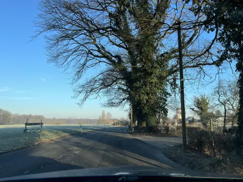
Hofladen Sprave
Farm and orchard · 1.3 km
131 Husener Straße, Dortmund
Mo 09:00-18:00; We-Fr 09:00-18:00; Sa 09:00-14:00; Tu,Su,PH off

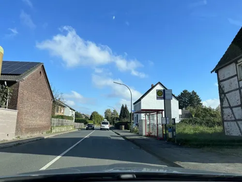
Museums and landmarks13




1 more on the map.
Parks, trails and playgrounds9





Restaurants and cafes25
Haus Lahr
Restaurant · Regional, Mediterranean
67 Husener Straße, Dortmund
We-Sa 17:00-22:00; Su 10:30-21:00
Mowwe Restaurant & Café
Restaurant · Cake, Regional · 1.6 km
185 Im Ostfeld, Dortmund
We-Su 11:00-23:00

Pizzeria Punto Alto
Restaurant · Pizza · 0.6 km
46 Flemerskamp, Dortmund
Tu-Th,Sa 13:00-21:00; Fr 16:00-21:00
Restaurant zum Turm
Restaurant · German, Mexican, Steak House · 1.8 km
1 Harkortstraße, Kamen
We-Sa 16:00-23:00; Su 10:30-22:00

Zur Loheide
Restaurant · Regional · 0.6 km
245 Wickeder Straße, Dortmund
Mo,Th,Fr 15:00-22:00; Sa; Su 12:30-22:00
Zur schönen Aussicht
Restaurant · Steak House · 2.5 km
289 Kurler Straße, Dortmund
Tu-Sa 11:30-14:30,17:00-22:30; Su 11:30-22:30; PH 11:30-22:30; Mo off



13 more on the map.
Where to stay1
Churches and places of worship7
St. Johannes Baptista
Church · Catholic · 1.0 km
8 Werimboldstraße, Dortmund
Sv. Kiril i Metodij
Church · Macedonian Orthodox
255 Husener Eichwaldstraße, Dortmund
Mazedonisch/Orthodoxe Kirchengemeinde St. Cyrill und Method
Church
253a Husener Eichwaldstraße, Dortmund
Shopping8
Gas and EV charging1
Schools, colleges and libraries6
Healthcare3
Map of Kurl-Husen
77 places. The map loads OpenStreetMap tiles when you open it.
Getting there and nearby towns
Dortmund Airport (DTM) is the nearest airport with scheduled flights listed in OpenStreetMap, 4 km away.
- Wickede 3 km southeast, about 3 min by car
- Lanstrop 3 km northwest, about 3 min by car
- Asseln 3 km south, about 3 min by car
- Brackel 5 km southwest, about 5 min by car
- Derne 5 km west, about 5 min by car
- Kamen 6 km northeast, about 6 min by car
- Unna 7 km east, about 7 min by car
- Holzwickede 7 km southeast, about 7 min by car
- Sölde 7 km south, about 7 min by car
- Bergkamen 8 km northeast, about 8 min by car
Drive times are estimates from straight-line distance, not routes.
Local news
Headlines from INDB.
Reviews, tips and questions
Loading what members have shared...
Sources and licences
- GeoNames (CC BY 4.0): population, coordinates, regions and time zone
- Mapillary (see each image): photos
- OpenStreetMap contributors (ODbL 1.0): places, airports, map data
- Wikidata (CC0 1.0): elevation, founding date, time zone, website
- Wikimedia Commons (see each image): photos
Photo credits
- Kurler Busch3, Biker69, CC BY-SA 3.0
- Katholische Kirche Kurl, Tbachner, CC BY-SA 3.0
- St.-Elisabeth-Krankenhaus Kurl 006, Helfmann, CC BY-SA 4.0
- IKG Dortmund neu, Dr. Volker Schmidt, CC BY-SA 4.0
- Stolperstein Kamen Robert-Koch-Straße 42 Kurt Rosenbaum, Gmbo 2013, CC0
- Auenwald, BinaFalcon, CC BY-SA 3.0
- Naturschutzgebiet Buschei 002, Tbachner, CC BY-SA 3.0
- ND-11 b - e, Stieleichen, 4, Lanstrop, Dortmund, GeorgDerReisende, CC BY-SA 4.0
- Naturschutzgebiet Buschei 001, Tbachner, CC BY-SA 3.0
- Alte Körne2, Itti, CC BY-SA 3.0 de
- DSC 7267-Haus-Kurl, Galerist, CC0
- Bushaltestelle Wicker Heck, 1, Kurl, Dortmund, GeorgDerReisende, CC BY-SA 4.0
- Linie 425, 1, Kurl, Dortmund, GeorgDerReisende, CC BY-SA 4.0
- Bushaltestelle Lohheide, 2, Kurl, Dortmund, GeorgDerReisende, CC BY-SA 4.0
- Körne, 1, Kurl, Dortmund, GeorgDerReisende, CC BY-SA 4.0
- Körne, 2, Kurl, Dortmund, GeorgDerReisende, CC BY-SA 4.0
- Husener Straße, 1, Kurl, Dortmund, GeorgDerReisende, CC BY-SA 4.0
- Wickeder Straße, 1, Husen, Dortmund, GeorgDerReisende, CC BY-SA 4.0
- Husener Straße, 2, Kurl, Dortmund, GeorgDerReisende, CC BY-SA 4.0
- Bushaltestelle Wickeder Straße, 2, Husen, Dortmund, GeorgDerReisende, CC BY-SA 4.0
- Bushaltestelle Husener Straße, 2, Husen, Dortmund, GeorgDerReisende, CC BY-SA 4.0
- Bushaltestelle Wickeder Straße, 1, Husen, Dortmund, GeorgDerReisende, CC BY-SA 4.0
- Bushaltestelle Wickeder Holz, 1, Kurl, Dortmund, GeorgDerReisende, CC BY-SA 4.0
- Bushaltestelle Husener Straße, 1, Husen, Dortmund, GeorgDerReisende, CC BY-SA 4.0
- Körne, 4, Kurl, Dortmund, GeorgDerReisende, CC BY-SA 4.0
- Körne, 6, Kurl, Dortmund, GeorgDerReisende, CC BY-SA 4.0
- Wickeder Holz, 1, Kurl, Dortmund, GeorgDerReisende, CC BY-SA 4.0
- Körne, 5, Kurl, Dortmund, GeorgDerReisende, CC BY-SA 4.0
- Bushaltestelle Wickeder Holz, 2, Kurl, Dortmund, GeorgDerReisende, CC BY-SA 4.0
- Husener Straße 63, 1, Husen, Dortmund, GeorgDerReisende, CC BY-SA 4.0
- Husener Straße 67, 2, Husen, Dortmund, GeorgDerReisende, CC BY-SA 4.0
- Husener Straße 67, 1, Husen, Dortmund, GeorgDerReisende, CC BY-SA 4.0
- LSG-4411-074, Körnebachtal, 2, Kamen, Kreis Unna, GeorgDerReisende, CC BY-SA 4.0
- LSG-4411-074, Körnebachtal, 1, Kamen, Kreis Unna, GeorgDerReisende, CC BY-SA 4.0
- Weichenantrieb IMGP9264, Smial, CC BY-SA 2.0 de
- Bahnhof, 2, Kurl, Dortmund, GeorgDerReisende, CC BY-SA 4.0
- Bushaltestelle Husen, 1, Husen, Dortmund, GeorgDerReisende, CC BY-SA 4.0
- Bushaltestelle Husen, 2, Husen, Dortmund, GeorgDerReisende, CC BY-SA 4.0
- Stolperstein Erich Meyer, 1, Husener Straße 63, Husen, Dortmund, GeorgDerReisende, CC BY-SA 4.0
- Stolperstein Kurt Meyer, 1, Husener Straße 63, Husen, Dortmund, GeorgDerReisende, CC BY-SA 4.0
- Street-level photo, flugyflay, CC BY-SA 4.0
- Street-level photo, ptks, CC BY-SA 4.0
- Street-level photo, ptks, CC BY-SA 4.0
- Street-level photo, ptks, CC BY-SA 4.0
- Street-level photo, ribuman, CC BY-SA 4.0
- Street-level photo, donortheast, CC BY-SA 4.0
- Street-level photo, mapchris, CC BY-SA 4.0
- Street-level photo, ptks, CC BY-SA 4.0
- Street-level photo, ptks, CC BY-SA 4.0
- Street-level photo, ptks, CC BY-SA 4.0
- Street-level photo, ptks, CC BY-SA 4.0
- Street-level photo, ptks, CC BY-SA 4.0
- Street-level photo, ptks, CC BY-SA 4.0
- Street-level photo, ptks, CC BY-SA 4.0
- Street-level photo, flugyflay, CC BY-SA 4.0
- Street-level photo, ptks, CC BY-SA 4.0
- Street-level photo, ptks, CC BY-SA 4.0
- Street-level photo, ptks, CC BY-SA 4.0
- Street-level photo, flugyflay, CC BY-SA 4.0
- Street-level photo, ptks, CC BY-SA 4.0
- Street-level photo, ptks, CC BY-SA 4.0
- Street-level photo, ptks, CC BY-SA 4.0


Page built November 9, 2026. Spotted a mistake? Tell us or suggest a place.