


Ladbergen, Germany
Ladbergen is a town of 6,414 people in North Rhine-Westphalia, Germany.
Why visit Ladbergen
Townapedia lists 7 museums and landmarks, 11 parks and trails, 24 places to eat, 11 places to stay and 2 attractions in and around town.
Highlights include Heimatmuseum, Feuchtwiese im Schinkenort and Feuchtwiese Kröner.
Weather in Ladbergen
Forecast from MET Norway (CC BY 4.0). Full forecast
About Ladbergen
Ladbergen (Westphalian: Ladbiärgen) is a municipality in the district of Steinfurt, in North Rhine-Westphalia, Germany. It is situated near the Dortmund-Ems Canal, approximately 25 km south-west of Osnabrück and 20 km north-east of Münster.
From the Wikipedia article Ladbergen (this version), under CC BY-SA 4.0.
Things to do2


Museums and landmarks7


Parks, trails and playgrounds11






Restaurants and cafes24

Hotel Gasthof Waldesruh
Restaurant · Regional · 4.6 km
85 Westladbergen, Saerbeck
Mo,We-Fr 17:30-21:00; Sa,Su 11:30-14:00,17:30-21:00

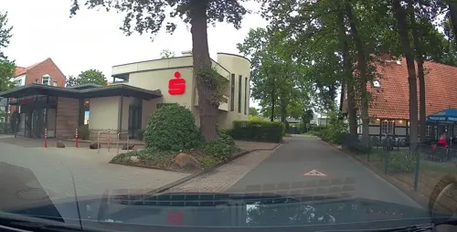
Bäckerei Blömker
Bakery · 0.8 km
9 Mühlenstraße, Ladbergen
Mo-Fr 06:30-18:00; Sa 06:30-12:30; Su 08:00-10:30; PH off
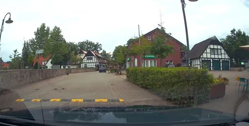
Waldhaus an de Miälkwellen
Restaurant · German · 1.7 km
43 Grevener Straße, Ladbergen
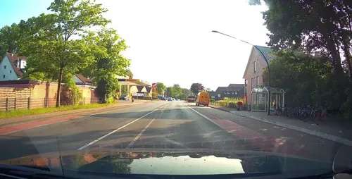
Werning Bäckerei & Konditorei
Bakery · 1.0 km
Mo-Fr 06:00-18:00; Sa 06:00-14:00; Su 07:00-12:00



12 more on the map.
History
Because of graves found, it is assumed that the territory of the municipality Ladbergen was already populated in the Bronze Age. Ladbergen got mentioned first in 950 in a certificate of the Freckenhorst monastery.
In the year 1149, the municipality was assigned as an independent parish by the Diocese of Münster. In 1170 the parish was taken over by the Diocese of Osnabrück.
In 1246 the Ladberger Marktbund (Ladbergen Marketfederation) was founded by representatives of the cities Münster, Osnabrück, Minden and Herford. This was a precursor of other forms of cooperation in Westphalia and the Hanseatic League.
Around 1400, the western parts of the community were lost to the Diocese of Münster.
As a result, the population of Ladbergen until after World War II remained religiously almost exclusively Protestant (Lutheranism).
In the year 1650 Ladbergen gained political autonomy for the first time. In 1707 Ladbergen with the entire Duchy of Tecklenburg got incorporated into the Kingdom of Prussia. After 1816 Ladbergen belonged to the Landkreis Münster and was later assigned to the Landkreis Tecklenburg.
In 1855 Ladbergen lost its political autonomy, and was administratively unified with the village Brochterbeck. This situation remained unchanged up to 1907, when Ladbergen was assigned to Tecklenburg.
From the History section of Ladbergen on Wikipedia, under CC BY-SA 4.0.
Where to stay11
Churches and places of worship4
Shopping5
Gas and EV charging8
Schools, colleges and libraries1
Healthcare1
Map of Ladbergen
74 places. The map loads OpenStreetMap tiles when you open it.
Getting there and nearby towns
Münster Osnabrück Airport (FMO) is the nearest airport with scheduled flights listed in OpenStreetMap, 5 km away.
- Lengerich 9 km northeast, about 9 min by car
- Saerbeck 9 km northwest, about 9 min by car
- Tecklenburg 11 km northeast, about 11 min by car
- Greven 12 km west, about 12 min by car
- Ostbevern 12 km southeast, about 12 min by car
- Emsdetten 16 km west, about 16 min by car
- Lienen 16 km east, about 16 min by car
- Telgte 17 km south, about 17 min by car
- Glandorf 18 km east, about 18 min by car
- Münster 21 km southwest, about 21 min by car
Drive times are estimates from straight-line distance, not routes.
Local news
Headlines from INDB.
Reviews, tips and questions
Loading what members have shared...
Sources and licences
- GeoNames (CC BY 4.0): population, coordinates, regions and time zone
- Mapillary (see each image): photos
- OpenStreetMap contributors (ODbL 1.0): places, airports, map data
- Wikidata (CC0 1.0): elevation, founding date, time zone, website
- Wikimedia Commons (see each image): photos
- Wikipedia (CC BY-SA 4.0): overview and history text
Photo credits
- Ladbergen Dorfstrasse 6, Francis Flinch, CC BY 3.0
- Ladbergen Evangelische Kirche 02, Jan-Herm Janßen, CC BY-SA 4.0
- Ladbergen, Motel Espenhof -- 2014 -- 9825, Dietmar Rabich, CC BY-SA 4.0
- Möllers Hof Mühlenstraße Ladbergen, Anonymous Unknown author, CC BY-SA 4.0
- Dorfstraße Ladbergen, Anonymous Unknown author, CC BY-SA 4.0
- Ladbergen Mühlenbach Friedenspark, Filori, CC BY 3.0
- Ladbergen Rathaus, Filori, CC BY 3.0
- Ladbergen Evangelische Kirche Ehrenmal 01, J.-H. Janßen, CC BY-SA 4.0
- Ladbergen Evangelische Kirche Ehrenmal 02, J.-H. Janßen, CC BY-SA 4.0
- Ladbergen Evangelische Kirche 03, J.-H. Janßen, CC BY-SA 4.0
- Ladbergen, Zentrum, Afrouper, Peterjohann, CC BY-SA 3.0
- Ladbergen, Bauernhof -- 2014 -- 9824, Dietmar Rabich, CC BY-SA 4.0
- Ladbergen, Dortmund-Ems-Kanal -- 2014 -- 9826, Dietmar Rabich, CC BY-SA 4.0
- Ladbergen, Dortmund-Ems-Kanal -- 2014 -- 9827, Dietmar Rabich, CC BY-SA 4.0
- Ladbergen, Motel Espenhof -- 2014 -- 9823, Dietmar Rabich, CC BY-SA 4.0
- St. Christopherus Kirche in Ladbergen, Philipp Jakob, CC BY-SA 4.0
- SchmedehausenZentrum, STBR, CC BY 2.5
- HuettruperHeide, STBR, CC BY 2.5
- Brochterbeck NSG In den Hiaerken 01, J.-H. Janßen, CC BY-SA 4.0
- Auferstehungskapelle Friedhof am Rott, Filori, CC BY 3.0
- Greven, Flughafen Münster-Osnabrück -- 2014 -- 9828, Dietmar Rabich, CC BY-SA 4.0
- Greven, Flughafen Münster-Osnabrück -- 2014 -- 9829, Dietmar Rabich, CC BY-SA 4.0
- Pferde im nördlichen Münsterland - panoramio, Muensterland, CC BY-SA 3.0
- Greven, Flughafen Münster-Osnabrück -- 2014 -- 9830, Dietmar Rabich, CC BY-SA 4.0
- Street-level photo, kgvx, CC BY-SA 4.0
- Street-level photo, kgvx, CC BY-SA 4.0
- Street-level photo, kgvx, CC BY-SA 4.0
- Street-level photo, heetENkoel, CC BY-SA 4.0
- Street-level photo, mjreaper, CC BY-SA 4.0
- Street-level photo, kgvx, CC BY-SA 4.0
- Street-level photo, kgvx, CC BY-SA 4.0
- Street-level photo, nesshof, CC BY-SA 4.0
- Street-level photo, kgvx, CC BY-SA 4.0
- Street-level photo, kgvx, CC BY-SA 4.0
- Street-level photo, kgvx, CC BY-SA 4.0
- Street-level photo, kgvx, CC BY-SA 4.0
- Street-level photo, kgvx, CC BY-SA 4.0
- Street-level photo, kgvx, CC BY-SA 4.0
- Street-level photo, kgvx, CC BY-SA 4.0
- Street-level photo, kgvx, CC BY-SA 4.0


Page built November 9, 2026. Spotted a mistake? Tell us or suggest a place.