


Why visit Arpke
Townapedia lists 14 museums and landmarks, 2 parks and trails, 8 places to eat, 3 places to stay and 2 attractions in and around town.
Highlights include Jürn's Hof, Antikriegshaus Sievershausen and Schlacht bei Sievershausen.
Weather in Arpke
Forecast from MET Norway (CC BY 4.0). Full forecast
About Arpke
Arpke is a village in the town of Lehrte in the district of Hanover, in Lower Saxony, Germany. It is situated approximately 30 km east of Hanover.
From the Wikipedia article Arpke (this version), under CC BY-SA 4.0.
Things to do2

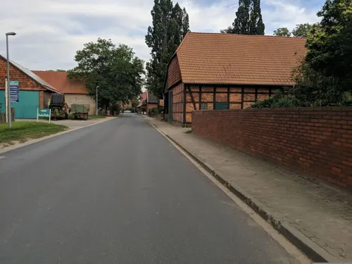
Museums and landmarks14



Grenzstein Nr. 20
Monument and historic site · 1.7 km
Der 1771 installierte, pfeilerförmige Monolith ist mit M und P beschrieben, und markierte die Grenze zwischen den Ämtern Meinersen und Peine.
Grenzstein Nr. 21
Monument and historic site · 1.8 km
Dieser Stein Markiert die Grenze zwischen den Ämtern Meinersen und Peine. Installiert wurde er im Jahre 1771.
Grenzstein Nr. 23
Monument and historic site · 1.8 km
Dieser Stein Markiert die Grenze zwischen den Ämtern Meinersen und Peine. Installiert wurde er im Jahre 1771.
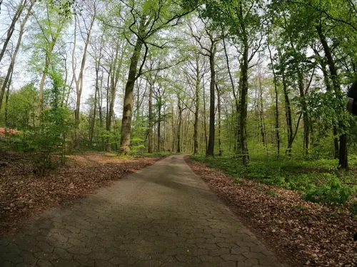

Gedenkstätte für den Waldarbeiter Fritz Rust
Monument and historic site · 2.0 km
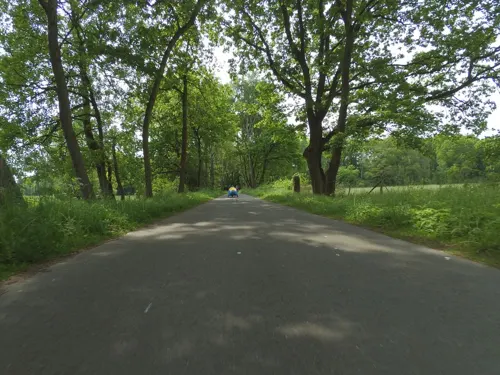
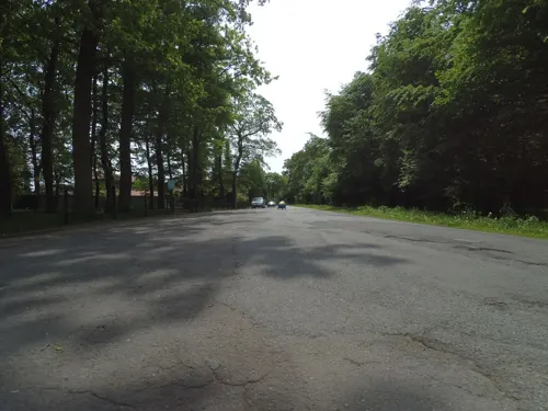
2 more on the map.
Parks, trails and playgrounds2

Waldbad
Sports field and stadium · 0.7 km
"Mo 14.00 bis 19.00, Di bis Fr 6.00 bis 9.30 Uhr und 14.00 bis...
Restaurants and cafes8
San Lorenzo gelati e cucina
Restaurant · Italian, Ice Cream · 2.8 km
2 Kampstraße, Lehrte
Tu-Su 17:00-21:00; Su 12:00-14:00

San Royani
Restaurant · Pizza, Pasta, Burger · 2.9 km
25 Am Fleith, Lehrte
Mo-Th 11:00-21:00, Fr-Su 12:00-22:30
Café an der Bockmühle
Cafe · 0.7 km
Sa 14:00-20:00; Su 11:00-20:00



Where to stay3
Churches and places of worship9
Shopping4
Gas and EV charging3
Schools, colleges and libraries4
Healthcare2
Map of Arpke
51 places. The map loads OpenStreetMap tiles when you open it.
Getting there and nearby towns
Hannover Airport (HAJ) is the nearest airport with scheduled flights listed in OpenStreetMap, 30 km away.
- Lehrte 8 km west, about 8 min by car
- Burgdorf 9 km northwest, about 9 min by car
- Peine 12 km southeast, about 12 min by car
- Hänigsen 11 km north, about 11 min by car
- Sehnde 12 km southwest, about 12 min by car
- Uetze 11 km northeast, about 11 min by car
- Hohenhameln 14 km south, about 14 min by car
- Ilsede 15 km southeast, about 15 min by car
- Wathlingen 17 km north, about 17 min by car
- Isernhagen Farster Bauerschaft 20 km northwest, about 20 min by car
Drive times are estimates from straight-line distance, not routes.
Local news
Headlines from INDB.
Reviews, tips and questions
Loading what members have shared...
Sources and licences
- GeoNames (CC BY 4.0): population, coordinates, regions and time zone
- Mapillary (see each image): photos
- OpenStreetMap contributors (ODbL 1.0): places, airports, map data
- Wikidata (CC0 1.0): elevation, founding date, time zone, website
- Wikimedia Commons (see each image): photos
- Wikipedia (CC BY-SA 4.0): overview and history text
Photo credits
- Arpke - Luftbild, A. Slomma, CC BY-SA 3.0
- 20111126 Apostelkirche Arpke 01, Hover dam, CC BY-SA 3.0
- Kirche zum Heiligen Kreuz in Arpke (Lehrte) IMG 7656, Losch, CC BY-SA 3.0
- Kirche Arpke 1, ClausNe, CC BY-SA 4.0
- Kirche Arpke 2, ClausNe, CC BY-SA 4.0
- Arpke - Dorfteich, C.Hartlep, Public domain
- 20111126 Evangelisch Freikirchliche Gemeinde Arpke 02, Hover dam, CC BY-SA 3.0
- 20111126 Evangelisch Freikirchliche Gemeinde Arpke 01, Hover dam, CC BY-SA 3.0
- D 31275 Lehrte - Arpke - panoramio, IsaHeinz, CC BY-SA 3.0
- 20111126 Apostelkirche Arpke 02, Hover dam, CC BY-SA 3.0
- Immensen-Arpke, Bahnstrecke nach Wolfsburg (Immensen-Arpke station, railway to Wolfsburg) (geo.hlipp.de 136487), Schlosser67, CC BY-SA 2.0
- Raiffeisen-Lagerhaus am Bahnhof Immensen-Arpke (Raiffeisen warehouse at Immensen-Arpke station) (geo.hlipp.de 136500), Schlosser67, CC BY-SA 2.0
- Bahnhofsschild Immensen-Arpke 2511141003, Clic, CC BY 4.0
- Saxonia Museum für saechsische Vaterlandskunde I 37, Eduard Sommer, Public domain
- Hämelerwald Katholische Kirche, Reise Reise, CC BY-SA 4.0
- St.Antoniuskirche Immensen IMG 3376, losch, Attribution
- St.-Martins-Kirche zu Sievershausen (Lehrte)IMG 6220, Losch at German Wikipedia, CC BY-SA 3.0
- Antikriegshaus Sievershausen, Hydro, CC BY-SA 4.0
- 20111126 Hl. Dreifaltigkeit Hämelerwald, Hover dam, CC BY-SA 3.0
- Sievershausen Schlacht, Unknown author Unknown author, Public domain
- Gelbe Riede 07, Puusterke, CC BY-SA 4.0
- Gelbe Riede 05, Puusterke, CC BY-SA 4.0
- Boxhoop 03, Puusterke, CC BY-SA 4.0
- Boxhoop 04, Puusterke, CC BY-SA 4.0
- Boxhoop 05, Puusterke, CC BY-SA 4.0
- Gelbe Riede 06, Puusterke, CC BY-SA 4.0
- Gelbe Riede 04, Puusterke, CC BY-SA 4.0
- Boxhoop 06, Puusterke, CC BY-SA 4.0
- Boxhoop 02, Puusterke, CC BY-SA 4.0
- Boxhoop 01, Puusterke, CC BY-SA 4.0
- Arpke - Zum Grafhorn - Eisenzeithaus 2015-12-21 15.07.23, Hover dam, CC BY 3.0
- Street-level photo, Langfahrer, CC BY-SA 4.0
- Street-level photo, Langfahrer, CC BY-SA 4.0
- Street-level photo, poxonline, CC BY-SA 4.0
- Street-level photo, changchun1, CC BY-SA 4.0
- Street-level photo, Langfahrer, CC BY-SA 4.0
- Street-level photo, live, CC BY-SA 4.0
- Street-level photo, Langfahrer, CC BY-SA 4.0
- Street-level photo, Langfahrer, CC BY-SA 4.0
- Street-level photo, tian, CC BY-SA 4.0
- Street-level photo, poxonline, CC BY-SA 4.0
- Street-level photo, UughoTh0, CC BY-SA 4.0
- Street-level photo, Langfahrer, CC BY-SA 4.0
- Street-level photo, Langfahrer, CC BY-SA 4.0
- Street-level photo, UughoTh0, CC BY-SA 4.0
- Street-level photo, Langfahrer, CC BY-SA 4.0
- Street-level photo, Langfahrer, CC BY-SA 4.0
- Street-level photo, peewee32, CC BY-SA 4.0
- Street-level photo, peewee32, CC BY-SA 4.0
- Street-level photo, carlheinz, CC BY-SA 4.0
- Street-level photo, Langfahrer, CC BY-SA 4.0
- Street-level photo, peewee32, CC BY-SA 4.0
- Street-level photo, aceini, CC BY-SA 4.0
- Street-level photo, poxonline, CC BY-SA 4.0
- Street-level photo, Langfahrer, CC BY-SA 4.0


Page built November 9, 2026. Spotted a mistake? Tell us or suggest a place.