


Why visit Lilienthal
Townapedia lists 89 museums and landmarks, 76 parks and trails, 219 places to eat, 22 places to stay and 12 attractions in and around town.
Highlights include Metalhenge, Bio-Hofmolkerei Dehlwes (Hofladen), Mühle Oberneuland and Botanika.
Weather in Lilienthal
Forecast from MET Norway (CC BY 4.0). Full forecast
About Lilienthal
Lilienthal (German pronunciation: [ˈliːliəntaːl]; Low German: Leendaal, Lelendaal) is a municipality in the administrative district of Osterholz, Lower Saxony, Germany. It borders Bremen (Free Hanseatic City of Bremen).
From the Wikipedia article Lilienthal, Lower Saxony (this version), under CC BY-SA 4.0.
Things to do12


Bio-Hofmolkerei Dehlwes (Hofladen)
Farm and orchard · 0.9 km
17 Trupe, Lilienthal
Mo-Fr 08:30-18:00; Sa 08:30-17:00

Theater am Goetheplatz
Cinema and theater · 9.7 km
Theater in Bremen, Germany
Hofladen Hof Stein
Farm and orchard · 2.8 km
159 Am Lehester Deich, Bremen
Fr,Su 13:00-16:00; Sa 10:00-13:00



Museums and landmarks89

Mühle Oberneuland
Monument and historic site · 6.6 km
Kulturdenkmal, siehe http://wiki.openstreetmap.org/wiki/Bremen/Kulturdenkm%C3%A4ler
34 Mühlenweg, Bremen
Su 10:00-17:00

Botanika
Museum · 5.5 km
Naturerlebniszentrum
40 Deliusweg, Bremen
Mo-Fr 09:00-18:00, Sa,Su 10:00-18:00

Focke-Museum
Museum · 6.1 km
Museum of history and the history of art for the city and state of Bremen
240 Schwachhauser Heerstraße, Bremen
Tu 10:00-17:00; We-Su 10:00-17:00

Aalto-Hochhaus
Monument and historic site · 6.7 km
Kulturdenkmal, siehe http://wiki.openstreetmap.org/wiki/Bremen/Kulturdenkm%C3%A4ler
9 Berliner Freiheit, Bremen

Gutshaus Hodenberg
Monument and historic site · 6.5 km
Kulturdenkmal, siehe http://wiki.openstreetmap.org/wiki/Bremen/Kulturdenkm%C3%A4ler
10 Hodenberger Straße, Bremen

Kaisen-Scheune
Monument and historic site · 3.0 km
Kulturdenkmal, siehe http://wiki.openstreetmap.org/wiki/Bremen/Kulturdenkm%C3%A4ler
9a Rethfeldsfleet, Bremen


Villa Borgward
Monument and historic site · 5.8 km
Kulturdenkmal, siehe http://wiki.openstreetmap.org/wiki/Bremen/Kulturdenkm%C3%A4ler
11 Horner Heerstraße, Bremen

Aussichtsturm
Monument and historic site · 6.0 km
Kulturdenkmal, siehe http://wiki.openstreetmap.org/wiki/Bremen/Kulturdenkm%C3%A4ler

Eichenhof
Monument and historic site · 6.2 km
Kulturdenkmal, siehe http://wiki.openstreetmap.org/wiki/Bremen/Kulturdenkm%C3%A4ler

Gut Landruhe
Monument and historic site · 4.8 km
Kulturdenkmal, siehe http://wiki.openstreetmap.org/wiki/Bremen/Kulturdenkm%C3%A4ler

Haus Mittelsbüren
Monument and historic site · 6.0 km
Kulturdenkmal, siehe http://wiki.openstreetmap.org/wiki/Bremen/Kulturdenkm%C3%A4ler
77 more on the map.
Parks, trails and playgrounds76

Muhles Park
Park · 5.6 km
Kulturdenkmal, siehe http://wiki.openstreetmap.org/wiki/Bremen/Kulturdenkm%C3%A4ler

Park Höpkens Ruh
Park · 5.5 km
Kulturdenkmal, siehe http://wiki.openstreetmap.org/wiki/Bremen/Kulturdenkm%C3%A4ler

Landesverband der Gartenfreunde Bremen e. V.
Park · 4.4 km
Geschäftsstelle mit Lehr- und Erlebnisgarten.
2 Johann-Friedrich-Walte-Straße, Bremen
Mo-Th 08:00-13:00,14:00-16:00; Fr 08:00-13:00




64 more on the map.
Restaurants and cafes219
Pingo Eis
Ice cream · Cafeteria · 7.1 km
Eisgeschäft mit Café- und Pizzeria
213 Schwachhauser Heerstraße, Bremen
Jun-Aug: Mo-Su 11:00-21:30; Sep-May: Mo-Su 11:00-22:00
ASIA modern
Restaurant · Chinese · 2.6 km
84 Falkenberger Landstraße, Lilienthal
PH,Su 12:00-22:00; Mo-Sa 12:00-15:00,17:00-22:00; Tu off
Agioneri
Restaurant · Greek · 2.7 km
384 Lilienthaler Heerstraße
We-Mo 11:30-14:30,17:00-23:00; Tu off

Bäckerei Rolf / Café Borchfelde
Cafe · Breakfast, Coffee Shop, Pastry · 1.9 km
7 Krögersweg, Bremen
Mo-Fr 06:30-18:00, Sa 07:00-17:00, Su 08:00-17:00

Crepes Suzette
Restaurant · Sandwich · 1.8 km
42b Borgfelder Heerstraße, Bremen
Mo,Tu,Th 12:00-21:00; Fr,Sa 12:00-21:00


207 more on the map.
Where to stay22
Churches and places of worship26
Shopping66
Gas and EV charging16
Schools, colleges and libraries50
Stadtbibliothek Vahr (Zweigstelle der Stadtbibliothek Bremen)
Library · 6.9 km
11 Berliner Freiheit, Bremen
Freie Evangelische Bekenntnisschule Bremen – Grundschule Vahr
School · Lutheran · 6.4 km
2 Otto-Braun-Straße, Bremen
Healthcare21
Map of Lilienthal
250 places. The map loads OpenStreetMap tiles when you open it.
Getting there and nearby towns
Bremen Airport (BRE) is the nearest airport with scheduled flights listed in OpenStreetMap, 13 km away.
- Bremen 10 km southwest, about 10 min by car
- Osterholz-Scharmbeck 12 km northwest, about 12 min by car
- Ritterhude 12 km west, about 12 min by car
- Oyten 12 km southeast, about 12 min by car
- Stuhr 16 km southwest, about 16 min by car
- Ottersberg 17 km east, about 17 min by car
- Schwanewede 23 km northwest, about 23 min by car
- Syke 26 km south, about 26 min by car
- Zeven 30 km northeast, about 30 min by car
- Verden 33 km southeast, about 33 min by car
Drive times are estimates from straight-line distance, not routes.
Local news
Headlines from INDB.
Reviews, tips and questions
Loading what members have shared...
Sources and licences
- GeoNames (CC BY 4.0): population, coordinates, regions and time zone
- Mapillary (see each image): photos
- OpenStreetMap contributors (ODbL 1.0): places, airports, map data
- Wikidata (CC0 1.0): elevation, founding date, time zone, website, landmarks and historic places
- Wikimedia Commons (see each image): photos
- Wikipedia (CC BY-SA 4.0): overview and history text
Photo credits
- Jan Reiners Bf Lilienthal2, bukk, CC BY-SA 3.0
- Lilienthal, Straßenbahn auf Hauptstraße, Geogast, CC BY 3.0
- Straßenbahn Lilienthal-Mitte am Tag der Einweihung, Geogast, CC BY 3.0
- Straßenbahn Lilienthal, 1. Tag im Betrieb - 1, Geogast, CC BY 3.0
- Straßenbahn-Haltestelle Lilienthal-Mitte, Geogast, CC BY 3.0
- BSAG-Infopoint in der Alten Apotheke Lilienthal (OHZ), Geogast, CC BY 4.0
- Straßenbahn Lilienthal, Haltestelle Trupe, Geogast, CC BY 3.0
- Wörpe (Wümme) in Lilienthal, Smarties, CC BY-SA 4.0
- Klosterkirche Lilienthal von Westen 2026-10-13 162230, SMeyer, CC BY 4.0
- Klosterkirche Lilienthal von NW 2026-10-13 161110, SMeyer, CC BY 4.0
- Straßenbahn Lilienthal auf Hauptstraße, Geogast, CC BY 3.0
- Klosterkirche Lilienthal von Norden 2026-10-13 161250, SMeyer, CC BY 4.0
- Straßenbahn Hauptstraße Lilienthal, Geogast, CC BY 3.0
- Theater Bremen 106-dvfLd, Pedelecs, CC BY-SA 3.0
- 1995 Park Hotel HB, Monster4711, CC0
- Bremen Liebfrauenkirche aus der Hakenstr987, Ulamm ( talk ) 20:33, 30 December 2016 (UTC), CC BY-SA 4.0
- StMartiniBremen-01a, Jürgen Howaldt, CC BY-SA 2.0 de
- Staats- und Universitätsbibliothek, Roland Kutzki, CC BY-SA 3.0
- Universum Bremen085, User:Matthias Süßen, CC BY-SA 3.0
- Borgward-Haus - Bremen, Till F. Teenck, CC BY 3.0
- Botanika Bremen (2014)-01, storebukkebruse, CC BY 2.0
- Truper Blänken 1764, Kurfürstentum Braunschweig-Lüneburg, Public domain
- Pfad in der Westlichen Hälfte des Langen Moores, AchtungBetreten, CC0
- Gut Hodenberg - Bremen - 2011 copy, Till F. Teenck, CC BY-SA 3.0
- Haus Landruhe-01, Jürgen Howaldt, CC BY-SA 3.0 de
- Heinekens Park - Bremen - 2012, Till F. Teenck, CC BY-SA 3.0
- Höpkens Ruh - 0609,T - Teich, Godewind ( talk ), CC BY-SA 3.0
- Horner Kirche mit Linde jh, Godewind ( talk ), CC BY-SA 4.0
- Bremen-Borgfeld evang-Kirche 01, Joern M, CC BY-SA 3.0
- MuehleOberneuland-1, Jürgen Howaldt, CC BY-SA 2.0 de
- Bremen St. Remberti-Kirche, bukk, CC BY-SA 3.0
- Kirche St. Johann mit Friedhofskapelle - Bremen, Oberneulander Landstraße 37, Godewind ( talk ), CC BY-SA 3.0
- Muhles Park - 0936,T - Park, Godewind ( talk ), CC BY-SA 3.0
- Bremen St. Ursula, user:bukk, CC BY-SA 3.0
- Ökumenisches Gymnasium - Bremen - 2011, Till F. Teenck, CC BY-SA 3.0
- ISB-Building frontshot small, Eleanor McLean, CC BY-SA 4.0
- Truper Kapelle - Außenansicht von Süd-West, SMeyer, CC BY-SA 4.0
- StHedwigKirche-Vahr 03, Jürgen Howaldt, CC BY-SA 3.0 de
- FockeMuseum-04, Jürgen Howaldt, CC BY-SA 2.0 de
- FockeMuseum-03, Jürgen Howaldt, CC BY-SA 2.0 de
- Bremen-Horn-Lehe St-Georg 01, Joern M, CC BY-SA 3.0
- Lilienthal Hirt 6, Kirchenfan, CC0
- Bremen-Horn-Lehe Andreas-Gemeinde 01, Joern M, CC BY-SA 3.0
- Stelenkreis Metalhenge aus südöstlicher Richtung, Justus79, CC BY-SA 4.0
- AaltoVahr-02, Jürgen Howaldt, CC BY-SA 2.0 de
- Bremen 0218 t040 aussichtspavillon stadtwald 20160925 bg 1, Blutgretchen ( talk ), CC BY-SA 4.0
- Kuhgrabensee, Wolfgang Meyer, CC BY 2.0
- Truper Blänken Naturschutz, Leecha4125, CC BY-SA 4.0
- FockeMuseum-01, Jürgen Howaldt, CC BY-SA 2.0 de
- WISENT -Rhododendronpark - panoramio, Xippo, CC BY 3.0
- Botanischer Garten Bremen Araukarie, Corradox, CC BY 4.0
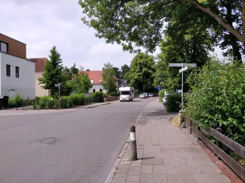
- Street-level photo, StefanS79, CC BY-SA 4.0
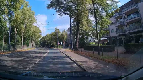
- Street-level photo, mathemann, CC BY-SA 4.0
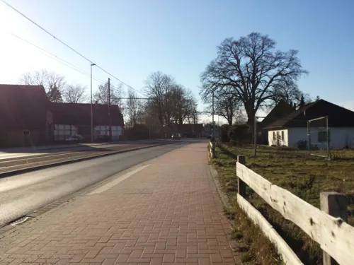
- Street-level photo, StefanS79, CC BY-SA 4.0
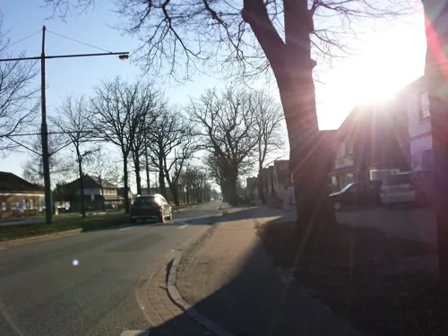
- Street-level photo, geogast, CC BY-SA 4.0
- Street-level photo, geogast, CC BY-SA 4.0
- Street-level photo, hubert87, CC BY-SA 4.0
- Street-level photo, hubert87, CC BY-SA 4.0
- Street-level photo, hubert87, CC BY-SA 4.0
- Street-level photo, hubert87, CC BY-SA 4.0
- Street-level photo, StefanS79, CC BY-SA 4.0
- Street-level photo, jonasver, CC BY-SA 4.0
- Street-level photo, hubert87, CC BY-SA 4.0
- Street-level photo, StefanS79, CC BY-SA 4.0
- Street-level photo, hubert87, CC BY-SA 4.0
- Street-level photo, roadblock, CC BY-SA 4.0
- Street-level photo, jbasic, CC BY-SA 4.0
- Street-level photo, holger999, CC BY-SA 4.0
- Street-level photo, hubert87, CC BY-SA 4.0
- Street-level photo, holger999, CC BY-SA 4.0
- Street-level photo, hubert87, CC BY-SA 4.0
- Street-level photo, hubert87, CC BY-SA 4.0


Page built November 8, 2026. Spotted a mistake? Tell us or suggest a place.