


Marktheidenfeld, Germany
Marktheidenfeld is a town of 11,024 people in Bavaria, Germany.
Why visit Marktheidenfeld
Townapedia lists 473 museums and landmarks, 7 parks and trails, 42 places to eat, 8 places to stay and 14 attractions in and around town.
Highlights include Movie im Luitpoldhaus, Dillberg, Franck-Haus and Museum Obertor-Apotheke.
Weather in Marktheidenfeld
Forecast from MET Norway (CC BY 4.0). Full forecast
About Marktheidenfeld
Marktheidenfeld (German pronunciation: [maʁktˈhaɪdn̩fɛlt] ) is a town in the Main-Spessart district in the Regierungsbezirk of Lower Franconia (Unterfranken) in Bavaria, Germany, and the seat (but not a member) of the Verwaltungsgemeinschaft (municipal association) of Marktheidenfeld. The town has around 11,000 inhabitants.
From the Wikipedia article Marktheidenfeld (this version), under CC BY-SA 4.0.
Things to do14
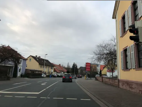

2 more on the map.
Museums and landmarks473


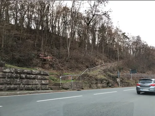
Alte Mainbrücke Marktheidenfeld
Monument and historic site · 0.6 km
Brückenstraße, Marktheidenfeld
24/7

Schauschmiede hinter dem Franck-Haus
Museum
Stiergasse, Marktheidenfeld
We-Sa 14:00-18:00, Su 10:00-18:00

Dreimärker Erlenbach-Karbach-Marktheidenfeld
Monument and historic site · 2.1 km
Kriegerdenkmal
Monument and historic site · 0.7 km
"Den Opfern von Krieg und Gewalt"
461 more on the map.
Parks, trails and playgrounds7




M2 - Bad am Maradies
Sports field and stadium · 1.2 km
8 Am Maradies, Marktheidenfeld

Restaurants and cafes42

Weinhaus Anker
Restaurant · Regional
13 Obertorstraße, Marktheidenfeld
Mo 18:00-22:00; Tu-Su 12:00-14:00,18:00-22:00

Café de mar
Restaurant · Italian
Küche während der Öffnungszeiten durchgehend geöffnet
10 Mainkai
Mo-Fr 17:00-22:00; Sa,Su 11:00-22:00; Mar-Oct: 11:00-22:00
Antik Bistro & Café
Cafe
Dienstags an Feiertagen geöffnet, Do-Sa bis 22/24 Uhr geöffnet
1 Georg-Mayr-Straße, Marktheidenfeld
Mo 09:00-18:00; Tu off; We 09:00-22:00; Th-Sa 09:00-22:00; Su 09:00-21:00
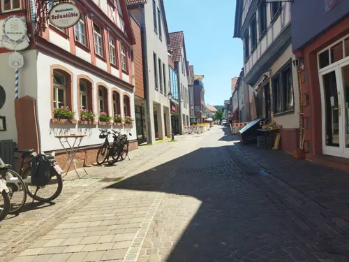
Bräustüble
Restaurant · Regional
1 Mitteltorstraße, Marktheidenfeld
Mo-We 11:00-14:15,17:00-24:00; Fr-Su 11:00-14:00,17:00-24:00
Pomodorino
Restaurant · Italian
16 Petzoltstraße, Marktheidenfeld
Mo-Sa 11:30-15:00,17:00-23:00; Tu off; Su 11:30-22:00


Fischer
Bakery · 2.7 km
19 Hauptstraße
Mo-Fr 06:00-18:00; Sa 06:00-12:30

Johannes Deppisch Weingut & Privatkellerei e.K.
Brewery and winery · 2.3 km
2 An der Röthe, Erlenbach b.Marktheidenfeld
30 more on the map.
History
Heidenfeld may have arisen during the Frankish taking of the land in the early 8th century. Already by 855 a place by that name was mentioned as belonging to the Holzkirchen Monastery, which from this time belonged to the Fulda Abbey. The Counts of Wertheim, who were the monastery's Vögte also managed in the late 13th century to secure the same office over Heidenfeld.
In 1397, Marktheidenfeld was first described as a town (oppidum). Between 1522 and 1530, the Reformation was introduced by Georg II into the County of Wertheim, and thereby also into Marktheidenfeld. After a period in which Catholic and Protestant worship co-existed, the majority turned to Protestantism. The town also experienced an economic boom at that time. However, due to a bad harvest in 1524, a peasant uprising erupted in 1525. Although hesitant at first, the Count of Wertheim supported the local peasants for a while before their army was defeated at Würzburg. In 1556, the line of the Counts of Wertheim died out. Following extended inheritance disputes, Heidenfeld was taken over by the Prince-Bishop of Würzburg in 1612.
From the History section of Marktheidenfeld on Wikipedia, under CC BY-SA 4.0.
Where to stay8
Churches and places of worship8
Shopping14
Gas and EV charging7
Esso Tankstelle Marktheidenfeld
Gas station
18 Würzburger Straße, Marktheidenfeld
Schools, colleges and libraries15
Friedrich-Fleischmann-Volksschule
School · 0.6 km
29 Ludwigstraße, Marktheidenfeld
Kindertagesstätte Lohgraben / St. Kilian-Schule
School
12 Würzburger Straße, Marktheidenfeld
Healthcare5
Map of Marktheidenfeld
250 places. The map loads OpenStreetMap tiles when you open it.
Getting there and nearby towns
Verkehrslandeplatz Giebelstadt (GHF) is the nearest airport with scheduled flights listed in OpenStreetMap, 34 km away.
- Wertheim 12 km southwest, about 12 min by car
- Veitshöchheim 20 km east, about 20 min by car
- Tauberbischofsheim 25 km south, about 25 min by car
- Würzburg 26 km east, about 26 min by car
- Lauda-Königshofen 32 km south, about 32 min by car
- Walldürn 34 km southwest, about 34 min by car
- Ochsenfurt 39 km southeast, about 39 min by car
- Werneck 39 km northeast, about 39 min by car
- Mömbris 40 km northwest, about 40 min by car
- Bad Mergentheim 41 km south, about 41 min by car
Drive times are estimates from straight-line distance, not routes.
Local news
Headlines from INDB.
Reviews, tips and questions
Loading what members have shared...
Sources and licences
- GeoNames (CC BY 4.0): population, coordinates, regions and time zone
- Mapillary (see each image): photos
- OpenStreetMap contributors (ODbL 1.0): places, airports, map data
- Wikidata (CC0 1.0): elevation, founding date, time zone, website, landmarks and historic places
- Wikimedia Commons (see each image): photos
- Wikipedia (CC BY-SA 4.0): overview and history text
Photo credits
- Marktheidenfeld, Dr. Reiner Düren aka RedPiranha, CC BY-SA 3.0 de
- Marktheidenfeld, Schmiedsecke 1 002, Salino01, CC BY-SA 4.0
- Marktheidenfeld, Glasergasse 9, Salino01, CC BY-SA 4.0
- Marktheidenfeld, Obertorstraße 14, Salino01, CC BY-SA 4.0
- Marktheidenfeld, Mitteltorstraße 1, Salino01, CC BY-SA 4.0
- Marktheidenfeld, Marktplatz 11, Salino01, CC BY-SA 4.0
- Marktheidenfeld, Schmiedsecke 1 001, Salino01, CC BY-SA 4.0
- Marktheidenfeld, Untertorstraße 6 (Scheune), Salino01, CC BY-SA 4.0
- Marktheidenfeld, Untertorstraße 6 (Scheune) 01, Salino01, CC BY-SA 4.0
- Marktheidenfeld, Glasergasse 20 001, Salino01, CC BY-SA 4.0
- Marktheidenfeld, Glasergasse 22 001, Salino01, CC BY-SA 4.0
- Marktheidenfeld, Glasergasse 20 002, Salino01, CC BY-SA 4.0
- Marktheidenfeld, Glasergasse 22 002, Salino01, CC BY-SA 4.0
- Marktheidenfeld, Glasergasse-22, Rschuerger, CC BY-SA 4.0
- Main in Marktheidenfeld, Freak-Line-Community, CC BY-SA 4.0
- Kreuzschlepper (Marktheidenfeld) Inschrift 1, Kd6=dra, CC0
- Kreuzschlepper (Marktheidenfeld) Inschrift 2, Kd6=dra, CC0
- Kreuzschlepper (Marktheidenfeld) Christus, Kd6=dra, CC0
- Kreuzschlepper (Marktheidenfeld), Kd6=dra, CC0
- Gartenstraße 11 Triefenstein, Homburg am Main 20180728 001, Tilman2007, CC BY-SA 4.0
- Marktheidenfeld, Obertorstraße 13-002, Tilman2007, CC BY-SA 3.0
- Marktheidenfeld, Untertorstraße 6-001, Tilman2007, CC BY-SA 3.0
- Hafenlohr, MSP - Kirche St Jakobus d Ä v NO, Flodur63, CC BY-SA 4.0
- Marktheidenfelder Kreuzberg Trockenrasen und Weinberg, Uschen, CC BY-SA 4.0
- Glasofen Christuskirche 005, Tilman2007, CC BY-SA 3.0
- Die Mündung des Heubrunnenbachs, CarlFriedrich, CC BY-SA 4.0
- Mündung Erlenbach, CarlFriedrich, CC BY-SA 4.0
- Erlenbachmündung (Main), Freak-Line-Community, CC BY-SA 4.0
- Street-level photo, chuck, CC BY-SA 4.0
- Street-level photo, chuck, CC BY-SA 4.0
- Street-level photo, chuck, CC BY-SA 4.0
- Street-level photo, changchun1, CC BY-SA 4.0
- Street-level photo, chuck, CC BY-SA 4.0
- Street-level photo, mapcreator, CC BY-SA 4.0
- Street-level photo, changchun1, CC BY-SA 4.0
- Street-level photo, changchun1, CC BY-SA 4.0
- Street-level photo, changchun1, CC BY-SA 4.0
- Street-level photo, chuck, CC BY-SA 4.0
- Street-level photo, nickth, CC BY-SA 4.0
- Street-level photo, nickth, CC BY-SA 4.0
- Street-level photo, mapcreator, CC BY-SA 4.0
- Street-level photo, changchun1, CC BY-SA 4.0
- Street-level photo, mapcreator, CC BY-SA 4.0
- Street-level photo, nickth, CC BY-SA 4.0
- Street-level photo, WernerBeckmann, CC BY-SA 4.0
- Street-level photo, nickth, CC BY-SA 4.0
- Street-level photo, nickth, CC BY-SA 4.0


Page built November 8, 2026. Spotted a mistake? Tell us or suggest a place.