


Murnau am Staffelsee, Germany
Murnau am Staffelsee is a town of 11,958 people in Bavaria, Germany.
Why visit Murnau am Staffelsee
Townapedia lists 19 museums and landmarks, 13 parks and trails, 72 places to eat, 26 places to stay and 23 attractions in and around town.
Highlights include Murnau am Staffelsee, Hacklhof Naturkost, Münter-Haus and Schlossmuseum Murnau.
Weather in Murnau am Staffelsee
Forecast from MET Norway (CC BY 4.0). Full forecast
About Murnau am Staffelsee
Murnau am Staffelsee (often shortened to Murnau) is a market town in the district of Garmisch-Partenkirchen, in the Oberbayern region of Bavaria, Germany.
From the Wikipedia article Murnau am Staffelsee (this version), under CC BY-SA 4.0.
Travel tips from other travellers: Murnau am Staffelsee on Wikivoyage (CC BY-SA 4.0).
Things to do23

Murnau am Staffelsee
Monument and historic site
Market municipality in Bavaria, Germany




11 more on the map.
Museums and landmarks19


Staffelseemuseum
Museum · 1.5 km
1 Seestraße, Seehausen a.Staffelsee
Th-Su,PH 14:00-18:00; Mar,Nov,Dec 24,Dec 31 off
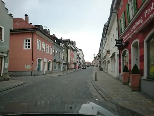
Fotogalerie KISTENBLICK
Museum
38 Untermarkt, Murnau am Staffelsee
Mo-Fr 10:00-13:00; Mo, We, Fr 15:00-18:00; Sa 10:00-15:00


Minigolfclub Murnau am Staffelsee
Monument and historic site · 0.8 km
8 Seestraße, Murnau am Staffelsee

Schloß Neuegling
Monument and historic site · 2.0 km
7 Schloß Neuegling, Murnau am Staffelsee

Seeleiten
Monument and historic site · 2.4 km
1 Seeleiten, Seehausen a.Staffelsee


Vier Linden
Monument and historic site · 0.7 km
Ehemaliger Gerichtsort. Ausrufung der Markrechte für Murnau.
7 more on the map.
Parks, trails and playgrounds13






1 more on the map.
Restaurants and cafes72

Beinhofer
Restaurant · Regional · 1.1 km
30 Seidlstraße, Murnau a. Staffelsee
Mo-Sa 17:00-22:00; Tu,We off; Su 12:00-14:30,17:00-22:00
Burgstüberl
Restaurant · German · 1.8 km
41 Burgweg, Seehausen a.Staffelsee
Tu-Su,PH 10:00-23:00; Mo off
Ähndl
Restaurant · Bavarian · 2.0 km
2, Murnau a. Staffelsee
Jul-Sep Tu-Su 12:00-20:00; Oct We-Su 12:00-20:00; Nov-Feb Th-Su 12:00-20:00
Bombay Indisches Restaurant
Restaurant · Indian · 0.8 km
12 Seidlstraße, Murnau am Staffelsee
11:30-14:30,17:30-23:00

Bäckerei Schröfele
Bakery
8 Schloßbergstraße, Murnau am Staffelsee
Mo-Fr 06:00-18:00

Cafe im Fischerstüberl
Cafe · Cake · 1.8 km
18 Johannisstraße, Seehausen am Staffelsee
Mo-Su,PH 11:00-21:00
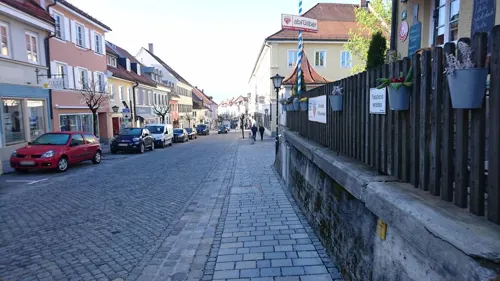
Il Duetto
Restaurant · Italian
46 Obermarkt, Murnau am Staffelsee
Mo-Sa 11:30-14:30,17:30-22:00; Tu off; PH,Su 11:30-21:30
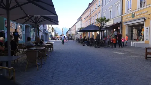
Kaffehaus & Konditorei Krönner
Cafe · Cake, German, Coffee
8 Obermarkt, Murnau am Staffelsee
Mo-Sa 09:00-18:30; Su,PH 10:00-18:30
LION KING
Restaurant · Vietnamese
2 Am Kreuzfeld, Murnau am Staffelsee
Tu-Sa 11:00-14:30,17:00-22:00; PH,Su 11:00-22:00
Landgasthof Post Aidling
Restaurant · Regional · 5.0 km
26 Dorfstraße, Riegsee
Fr-Tu 12:00-14:00; Mo-Tu,Fr-Su 18:00-21:00
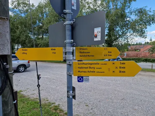


Ristaurante Al Lago
Restaurant · Italian · 1.8 km
9 Am Strandbad, Seehausen am Staffelsee
Mo-Su,PH 11:30-22:00
60 more on the map.
History
The area around Murnau was already settled in pre-Christian times. From the reign of Septimius Severus, a Roman road called Via Raetia led above the Brenner Pass and Seefeld Saddle through the upper Isar-Loisachtal valleys all the way to Augsburg. The road continued under the name Via Imperii as an imperial road and trade route until the 19th century.
Signs of Celtic and Roman settlements have been found on the now-eroded moss area around the Moosberg in the Murnauer Moos.
At that time Murnau was no more than a stopping-off point for travellers, called Murau or Mureau. The name Murnau comes from Mure ("mudslide") and Aue ("meadow"), referring to the Murnauer Moos and Loisachtal.
From the History section of Murnau am Staffelsee on Wikipedia, under CC BY-SA 4.0.
Where to stay26
Churches and places of worship27
St. Agatha
Church · Roman Catholic · 5.4 km
21 Kirchstraße, Uffing am Staffelsee
s`Ähndl St. Georg
Church · Roman Catholic · 2.0 km
1, Murnau a. Staffelsee
St. Afra Spatzenhausen
Church · Roman Catholic · 4.6 km
15 Dorfstraße, Spatzenhausen
St. Anna
Church · Roman Catholic · 2.1 km
12 Partenkirchnerstraße, Murnau am Staffelsee
St. Leonhard
Church · Roman Catholic · 1.7 km
4 Riegseer Straße, Murnau am Staffelsee
Shopping17
Gas and EV charging5
Schools, colleges and libraries11
Healthcare9
Ärzte- und Dialysezentrum
Clinic and pharmacy · 0.9 km
13 James-Loeb-Straße, Murnau am Staffelsee
Map of Murnau am Staffelsee
222 places. The map loads OpenStreetMap tiles when you open it.
Getting there and nearby towns
Sonderflughafen Oberpfaffenhofen (OBF) is the nearest airport with scheduled flights listed in OpenStreetMap, 45 km away.
- Penzberg 15 km northeast, about 15 min by car
- Peißenberg 17 km northwest, about 17 min by car
- Weilheim 18 km north, about 18 min by car
- Peiting 24 km northwest, about 24 min by car
- Schongau 27 km northwest, about 27 min by car
- Wolfratshausen 31 km northeast, about 31 min by car
- Starnberg 37 km north, about 37 min by car
- Oberhaching 48 km northeast, about 48 min by car
- Taufkirchen 51 km northeast, about 51 min by car
- Munich 58 km northeast, about 58 min by car
Drive times are estimates from straight-line distance, not routes.
Local news
Headlines from INDB.
Reviews, tips and questions
Loading what members have shared...
Sources and licences
- GeoNames (CC BY 4.0): population, coordinates, regions and time zone
- Mapillary (see each image): photos
- OpenStreetMap contributors (ODbL 1.0): places, airports, map data
- Wikidata (CC0 1.0): elevation, founding date, time zone, website, landmarks and historic places
- Wikimedia Commons (see each image): photos
- Wikipedia (CC BY-SA 4.0): overview and history text
Photo credits
- Murnau Maria-Hilf 02, ErwinMeier, CC BY-SA 3.0
- Murnau 20130519 Mattes (77), User:Mattes, CC BY 2.0 de
- Kottmuellerallee 6 Muenter-Haus Murnau-3, Rufus46, CC BY-SA 3.0
- Ramsachkircherl outside 20081109, Mike.fabian, CC BY-SA 3.0
- Buchau Staffelsee, burgrain, CC BY 3.0
- Uffing-am-Staffelsee - Kirche St Agatha - 2013-07-31 (2), Johamar, CC BY 3.0
- Musikschule Murnau 3, Ricardalovesmonuments, CC BY 4.0
- Schlossbergstr. 8 Ladenschild Murnau-1, Rufus46, CC BY-SA 3.0
- Murnau 20130519 Mattes (17), User:Mattes, CC BY 2.0 de
- Murnau St. Nikolaus 03, ErwinMeier, CC BY-SA 4.0
- Katholische Filialkirche St. Anna D-1-80-124-119 03, Duddex, CC BY-SA 3.0 de
- St. Leonhard (Froschhausen) 1, Ricardalovesmonuments, CC BY 4.0
- Aerial image of the Froschhauser See (view from the southeast), Carsten Steger, CC BY-SA 4.0
- Murnauer Moos Marsh 3, Richard Bartz , Munich aka Makro Freak, CC BY-SA 2.5
- St Blasius Hagen, Ricardalovesmonuments, CC BY-SA 4.0
- Seehausen a St - Rieden - Schloss v S 02, Flodur63, CC BY-SA 3.0
- Staffelseemuseum, Stefan Karl, CC BY-SA 4.0
- Heimatmuseum Uffing am Staffelsee, Stefan Karl, CC BY-SA 4.0
- Schloss Neuegling GO-1, Gras-Ober, CC BY-SA 3.0
- Spatzenhausen, Pfarrkirche Sankt Afra Bdm 2012-08-16 12.52, Michielverbeek, CC BY-SA 3.0
- Mariensäule, Murnau, Bavaria, Germany, Jebulon, CC0
- Murnau-Weindorf Dorfstr33 StMartin 001, K.Baas, CC BY-SA 4.0
- Riedhausen (Staffelsee) St. Mauritius 01, ErwinMeier, CC BY-SA 4.0
- Froschhauser See-01, FranciscoWelterSchultes, CC0
- Murnauer Moos, No machine-readable author provided. Dark Avenger~commonswiki assumed (based on copyright claims)., CC BY-SA 3.0
- Ramsachkircherl St. Georg 02, Helmlechner, CC0
- Alpen Murnau Mariensäule, Michael Fiegle at German Wikipedia, CC BY-SA 3.0
- Drachenstich-Rundweg (2), Cherubino, CC BY-SA 3.0
- Schloss Seeleiten (Torhaus), Babyauditor, CC BY-SA 4.0
- Street-level photo, soulcover, CC BY-SA 4.0
- Street-level photo, voschix, CC BY-SA 4.0
- Street-level photo, soulcover, CC BY-SA 4.0
- Street-level photo, voschix, CC BY-SA 4.0
- Street-level photo, voschix, CC BY-SA 4.0
- Street-level photo, voschix, CC BY-SA 4.0
- Street-level photo, santon, CC BY-SA 4.0
- Street-level photo, voschix, CC BY-SA 4.0
- Street-level photo, voschix, CC BY-SA 4.0
- Street-level photo, voschix, CC BY-SA 4.0
- Street-level photo, voschix, CC BY-SA 4.0
- Street-level photo, voschix, CC BY-SA 4.0
- Street-level photo, voschix, CC BY-SA 4.0
- Street-level photo, voschix, CC BY-SA 4.0
- Street-level photo, voschix, CC BY-SA 4.0
- Street-level photo, renade, CC BY-SA 4.0
- Street-level photo, renade, CC BY-SA 4.0
- Street-level photo, voschix, CC BY-SA 4.0
- Street-level photo, renade, CC BY-SA 4.0


Page built November 8, 2026. Spotted a mistake? Tell us or suggest a place.