


Neunkirchen am Brand, Germany
Neunkirchen am Brand is a town of 8,243 people in Bavaria, Germany.
Why visit Neunkirchen am Brand
Townapedia lists 31 museums and landmarks, 6 parks and trails, 47 places to eat, 2 places to stay and 15 attractions in and around town.
Highlights include Ökolandbau Schmitt, Gugel, Steinkreuz bei Ebersbach and Steinkreuz in Steinbach.
Weather in Neunkirchen am Brand
Forecast from MET Norway (CC BY 4.0). Full forecast
About Neunkirchen am Brand
Neunkirchen am Brand (German pronunciation: [ˈnɔʏnkɪʁçn̩ ʔam ˈbʁant]) is a municipality in the district of Forchheim in Bavaria in Germany.
From the Wikipedia article Neunkirchen am Brand (this version), under CC BY-SA 4.0.
Things to do15

Ökolandbau Schmitt
Farm and orchard · 1.0 km
1 Baad, Neunkirchen am Brand
Mo-We 18:00-19:00; Th 16:00-19:00; Fr 14:00-19:00; Sa 09:00-13:00

Hof-Lädchen Elsinger
Farm and orchard · 2.2 km
Verkauf von Kartoffeln, Eiern, Äpfel, hausgem. Nudeln, Kirschen
24/7

Milch-Tankstelle
Farm and orchard · 2.9 km
Frische Milch vom Bauernhof aus dem Kühlautomat. 1€/liter Verkauf von Milch, Eiern, Äpfel, Kartoffeln, Zwetschgen, Suppenhühnern,...
06:00-22:00
Hofladen Marsching
Farm and orchard · 2.5 km
Verkauf von Kartoffeln, Zwiebeln, Eiern, Wurst, Fleisch, Nudeln, Eierlikör
Vierchöreblick
Scenic view
Ermöglicht die Chorbauten der Katharinenkapelle, Marienkapelle, Pfarrkirche St. Michael und Augustinuskapelle gleichzeitig zu sehen.
3 more on the map.
Museums and landmarks31





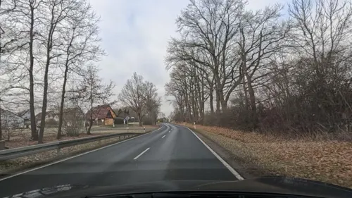

Forchheimer Tor
Monument and historic site
20 Forchheimer Straße, Neunkirchen am Brand

Hasenstein
Monument and historic site · 4.3 km
Der Obelisk, der einen Hasen mit drei Vorderläufen zeigt, wurde hier 1880 am Ende der „Hasensteinlinie“ errichtet. Um das...


19 more on the map.
Parks, trails and playgrounds6

Freibad
Sports field and stadium
2 Brandbachweg, Neunkirchen am Brand
Mo-Su 10:00-19:00



Saint-Grégoire-Platz
Park · 4.1 km
Nach der Partnergemeinde St. Grégoire benannt.
Restaurants and cafes47

Gasthaus zum Grünen Baum
Restaurant · 1.8 km
13 Hauptstraße, Dormitz
We-Fr 11:30-14:00,17:30-23:00; Sa,Su 11:30-21:00

Gasthaus zum Harbach
Restaurant · Regional · 1.0 km
Im Sommer schöner Biergarten
5 Baad, Neunkirchen am Brand
Jun-Sep Mo 17:00+; Jun-Sep We-Su 11:00+; Oct-May Mo 17:00+;...
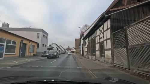
Alexis Zorbas
Restaurant · Greek
7a Forchheimer Straße, Neunkirchen am Brand
Mo 17:00-23:00; We-Sa 17:00-23:00; Su 11:30-14:00,17:00-22:00
Da Marco Pizza e Pasta
Restaurant · Pizza, Italian, Fish, Juice, Salad, Pasta · 0.6 km
1 Henkerstegstraße, Neunkirchen am Brand
Tu-Sa 10:30-20:00
Der Beck
Cafe · German, Coffee Shop, Pastry
23 Erlanger Straße, Neunkirchen am Brand
Mo-Fr 05:30-18:00; Sa 06:00-16:00; Su 07:00-17:00
Gasthaus Zum Schellenberg
Restaurant · Regional · 2.7 km
14 Bergstraße, Kleinsendelbach
We-Th 16:00-23:00; Fr 12:00-23:00; Sa 10:00-23:00; Su 11:00-23:00
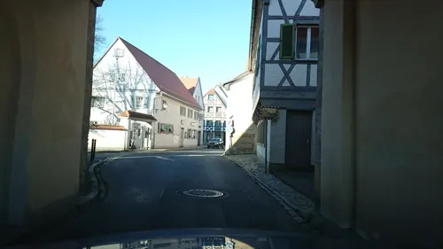
Polsters Klosterhof
Restaurant · German
7 Innerer Markt, Neunkirchen am Brand
Th-Su 17:00-22:00; Su 11:30-14:00
Rundblick
Restaurant · Regional · 4.5 km
41 Breslauer Straße, Uttenreuth
Tu-Sa 17:00-22:00; Mo off; Su,PH 11:00-21:00
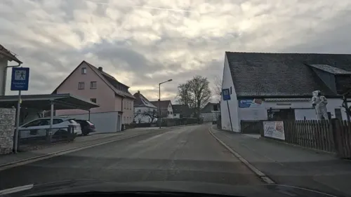
Schwarzer Adler
Restaurant · German · 4.1 km
17 Marloffsteiner Straße, Uttenreuth
Mo 17:00-22:00; Tu-Sa 11:30-14:00,17:00-22:00; Su 11:30-22:00
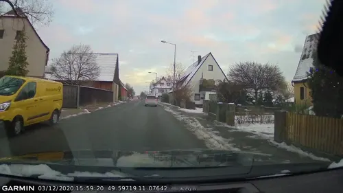
Toscana Uttenreuth
Restaurant · Italian, Noodle, Pizza, Salad · 4.2 km
13 Gräfenberger Straße, Uttenreuth
11:00-22:00
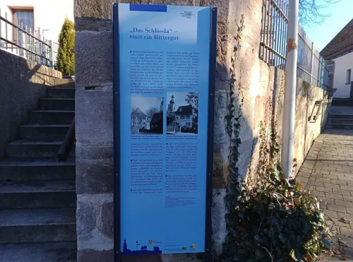


Zum Schlössla
Restaurant · Greek · 4.0 km
22 Esperstraße, Uttenreuth
Mo-Su 11:30-14:30,17:00-23:00; Tu off
35 more on the map.
History
Important dates are the founding of the Canons Regular of Saint Augustine monastery, Neunkirchen am Brand monastery, in 1314 and the conferment of the status as market town in 1410. In 1803 Neunkirchen along with the Prince-Bishopric of Bamberg became part of Bavaria. Between 1886 and 1963 Neunkirchen was located near a train route from Erlangen to Eschenau.
After the Second World War, refugees settled in Neunkirchen and after the establishment of Siemens AG in Erlangen the town experienced a dramatic increase in inhabitants. Numerous suburbs were built around the traditional center of the town.
Neunkirchen is also the home of a number of industrial and trade companies. The largest industrial employer is the axles factory, the Neunkirchener Achsenfabrik (NAF).
From the History section of Neunkirchen am Brand on Wikipedia, under CC BY-SA 4.0.
Where to stay2
Churches and places of worship17
Heilig-Grab-Kapelle
Church · Roman Catholic
11 Großenbucher Straße, Neunkirchen am Brand
Johannes der Täufer
Church · Catholic · 2.3 km
5 Kirchenweg, Neunkirchen am Brand
Maria Königin des Friedens Rödlas
Church · Roman Catholic · 4.4 km
24a Rödlas, Neunkirchen am Brand
St. Michael
Church · Roman Catholic
1 Kirchplatz, Neunkirchen am Brand
Shopping11
Gas and EV charging5
ELO Tankstelle Uttenreuth-Weiher
Gas station · 3.4 km
1 Leitenäckerstraße, Uttenreuth
Schools, colleges and libraries9
Grundschule Dormitz-Hetzles-Kleinsendelbach
School · 1.6 km
5 Schulstraße, Dormitz
Healthcare3
Map of Neunkirchen am Brand
146 places. The map loads OpenStreetMap tiles when you open it.
Getting there and nearby towns
Albrecht Dürer Airport Nuremberg (NUE) is the nearest airport with scheduled flights listed in OpenStreetMap, 13 km away.
- Baiersdorf 8 km northwest, about 8 min by car
- Erlangen 9 km west, about 9 min by car
- Heroldsberg 9 km south, about 9 min by car
- Forchheim 13 km northwest, about 13 min by car
- Heroldsbach 13 km northwest, about 13 min by car
- Lauf an der Pegnitz 16 km southeast, about 16 min by car
- Röthenbach an der Pegnitz 16 km southeast, about 16 min by car
- Schnaittach 16 km east, about 16 min by car
- Nuremberg 18 km south, about 18 min by car
- Fürth 18 km southwest, about 18 min by car
Drive times are estimates from straight-line distance, not routes.
Local news
Headlines from INDB.
Reviews, tips and questions
Loading what members have shared...
Sources and licences
- GeoNames (CC BY 4.0): population, coordinates, regions and time zone
- Mapillary (see each image): photos
- OpenStreetMap contributors (ODbL 1.0): places, airports, map data
- Wikidata (CC0 1.0): elevation, founding date, time zone, website
- Wikimedia Commons (see each image): photos
- Wikipedia (CC BY-SA 4.0): overview and history text
Photo credits
- Neunkirchena-Brand-Kirchplatz, Daniel Arnold, CC BY-SA 3.0
- Neunkirchen am Brand Amtshaus-20210411-RM-170907, Ermell, CC BY-SA 4.0
- Mühlweg 1 (Neunkirchen am Brand), Mikmaq, CC BY-SA 3.0
- Mühlweg 1 (Neunkirchen am Brand) 02, Mikmaq, CC BY-SA 3.0
- Neunkirchen am Brand Kirche-20210411-RM-170842, Ermell, CC BY-SA 4.0
- Neunkirchen am Brand Kriegerdenkmal-20210411-RM-164144, Ermell, CC BY-SA 4.0
- Neunkirchen am Brand Kirche-20210411-RM-164556, Ermell, CC BY-SA 4.0
- Neunkirchen am Brand Kirche-20210411-RM-161219, Ermell, CC BY-SA 4.0
- Neunkirchen am Brand Kirche Fresco-20210411-RM-160829, Ermell, CC BY-SA 4.0
- Neunkirchen am Brand Kirche Fresco-20210411-RM-160944, Ermell, CC BY-SA 4.0
- Neunkirchen am Brand Kirche Fresco-20210411-RM-161443, Ermell, CC BY-SA 4.0
- Neunkirchen am Brand Torhaus-20210411-RM-170650, Ermell, CC BY-SA 4.0
- Neunkirchen am Brand Rathaus Dachreiter-20210411-RM-152842, Ermell, CC BY-SA 4.0
- Neunkirchen am Brand Rathaus Sonnenuhr-20210411-RM-152830, Ermell, CC BY-SA 4.0
- Neunkirchen am Brand Museum-20210411-RM-165357, Ermell, CC BY-SA 4.0
- Neunkirchen am Brand Erlanger Tor-20210411-RM-165912, Ermell, CC BY-SA 4.0
- Neunkirchen am Brand Kirche Innen-20210411-RM-161910, Ermell, CC BY-SA 4.0
- Neunkirchen am Brand Wohnhaus-20210411-RM-165849, Ermell, CC BY-SA 4.0
- Neunkirchen am Brand Rathaus-20210411-RM-152739, Ermell, CC BY-SA 4.0
- Neunkirchen am Brand Kirche-20210411-RM-152955, Ermell, CC BY-SA 4.0
- Neunkirchen am Brand Rathaus-20210411-RM-163807, Ermell, CC BY-SA 4.0
- Neunkirchen am Brand Kirche-20210411-RM-153423, Ermell, CC BY-SA 4.0
- Neunkirchen am Brand Rathaus Dachreiter-20210411-RM-163754, Ermell, CC BY-SA 4.0
- Neunkirchen am Brand Katharinen-Kapelle-20210411-RM-163405, Ermell, CC BY-SA 4.0
- Neunkirchen am Brand St. Michael 01, Spike, CC BY-SA 4.0
- Neunkirchen am Brand Erlanger Tor-20210411-RM-165616, Ermell, CC BY-SA 4.0
- Neunkirchen am Brand Kirche Tür-20210411-RM-152914, Ermell, CC BY-SA 4.0
- Neunkirchen am Brand Kirche Tür-20210411-RM-152910, Ermell, CC BY-SA 4.0
- Neunkirchen am Brand Kirche Tür-20210411-RM-153103, Ermell, CC BY-SA 4.0
- Neunkirchen am Brand Erlanger Tor-20210411-RM-165651, Ermell, CC BY-SA 4.0
- Schafhaus Neunkirchen am Brand, Samiclaus, CC BY-SA 4.0
- Neunkirchen am Brand Scheune-20210411-RM-164823, Ermell, CC BY-SA 4.0
- Alter Bahnhof Neunkirchen am Brand, Samiclaus, CC BY-SA 4.0
- Neunkirchen am Brand Forchheimer Tor-20210411-RM-171733, Ermell, CC BY-SA 4.0
- Kapelle am alten Friedhof Neunkirchen am Brand, Samiclaus, CC BY-SA 4.0
- Neunkirchen am Brand Scheune-20210411-RM-171519, Ermell, CC BY-SA 4.0
- Neunkirchen-am-Brand-St.-Michaelkirche, Daniel Arnold, CC BY-SA 3.0
- 2010 Lindenberg Fränkische Schweiz, ( User:Alma ), CC BY-SA 3.0
- Burgruine Neideck 05112008, pegasus2, Public domain
- Dormitz Hauptstraße 13, Barbaraglessinger, CC BY-SA 4.0
- Großenbuch-Kirche, WMguegafue, CC BY-SA 4.0
- Neunkirchen-am-Brand-Erlanger-Tor, Daniel Arnold, CC BY-SA 3.0
- Neunkirchen am Brand Forchheimer Tor ortseinwärts, Benutzer:Callipides, CC BY-SA 2.0 de
- Neunkirchen am Brand, Kapelle zum Heilihgen Grab, 002, Tilman2007, CC BY-SA 3.0
- Marloffstein Schloss 001, Janericloebe, CC BY 3.0
- Neunkirchen-am-Brand-Christuskirche, Daniel Arnold, CC BY-SA 3.0
- Steinbach (Kleinsendelbach) Steinkreuz 002, Janericloebe, CC BY 3.0
- Kleinsendelbach Steinkreuz D-4-74-144-14 001, Janericloebe, CC BY 3.0
- Buckenhofer Forst Hasenstein 001, Janericloebe, CC BY-SA 3.0
- NSG Laubmischwald am Hetzleser Berg, Michael Hohner, CC BY-SA 3.0
- Uttenreuth St Matthäus 001, Janericloebe, CC BY 3.0
- 20170525 Atzelsberger Strasse 1 Marloffstein DSC 3750 01, Granada, CC BY-SA 3.0
- St. Laurentius in Hetzles, WMguegafue, CC BY-SA 4.0
- Street-level photo, tiefseeaal, CC BY-SA 4.0
- Street-level photo, tiefseeaal, CC BY-SA 4.0
- Street-level photo, Felix23, CC BY-SA 4.0
- Street-level photo, curtisnewton, CC BY-SA 4.0
- Street-level photo, curtisnewton, CC BY-SA 4.0
- Street-level photo, qgeb, CC BY-SA 4.0
- Street-level photo, Felix23, CC BY-SA 4.0
- Street-level photo, curtisnewton, CC BY-SA 4.0
- Street-level photo, curtisnewton, CC BY-SA 4.0
- Street-level photo, curtisnewton, CC BY-SA 4.0
- Street-level photo, tiefseeaal, CC BY-SA 4.0
- Street-level photo, curtisnewton, CC BY-SA 4.0
- Street-level photo, tiefseeaal, CC BY-SA 4.0
- Street-level photo, Felix23, CC BY-SA 4.0
- Street-level photo, qgeb, CC BY-SA 4.0
- Street-level photo, curtisnewton, CC BY-SA 4.0
- Street-level photo, tiefseeaal, CC BY-SA 4.0
- Street-level photo, tiefseeaal, CC BY-SA 4.0


Page built November 9, 2026. Spotted a mistake? Tell us or suggest a place.