


Why visit Forchheim
Townapedia lists 154 museums and landmarks, 32 parks and trails, 197 places to eat, 18 places to stay and 16 attractions in and around town.
Highlights include KinoCenter Forchheim, union apollo domino, Singer's Bauernladen, Ludwig-Donau-Main-Kanal and Heimatmuseum.
Weather in Forchheim
Forecast from MET Norway (CC BY 4.0). Full forecast
About Forchheim
Forchheim (German pronunciation: [ˈfɔʁçhaɪm] ) is a town in Upper Franconia (German: Oberfranken) in northern Bavaria, and also the seat of the administrative district of Forchheim. Forchheim is a former royal city, and is sometimes called the Gateway to the Franconian Switzerland, referring to the region of outstanding natural beauty to the north east of the town. Nowadays Forchheim is most famous for its ten day long beer and music festival (Annafest) which takes place in late July in an idyllic wooded hillside, home to 24 beer gardens, on the outskirts of the town. Forchheim's population, as of December 2013, was 30,705, and its land area is 44.95 square kilometres (17.36 square miles).
From the Wikipedia article Forchheim (this version), under CC BY-SA 4.0.
Travel tips from other travellers: Forchheim on Wikivoyage (CC BY-SA 4.0).
Photos of Forchheim


Things to do16

KinoCenter Forchheim, union apollo domino
Cinema and theater
39 Wiesentstraße, Forchheim
Mo-Fr 15:00-16:00,19:30-21:30; Sa,Su 14:30-22:00

Singer's Bauernladen
Farm and orchard · 3.5 km
42a Heroldsbacher Straße, Hausen
Mo,We-Fr 09:00-12:00,14:00-18:00; Sa 08:00-13:00; Tu off

4 more on the map.
Museums and landmarks154

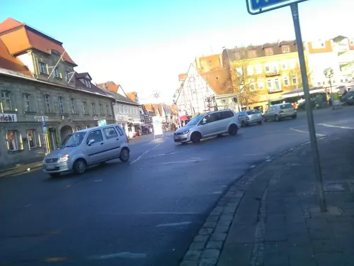


Schleusenwärterhaus 93
Monument and historic site · 0.9 km
Schleusenwärterhaus, Ludwig-Donau-Main-Kanal
52 Bamberger Straße, Forchheim


Bibertsgraben
Monument and historic site · 4.9 km
Grabendurchlass, Ludwig-Donau-Main-Kanal

Historischer Kilometerstein
Monument and historic site · 5.4 km
Kilometerstein an der Straße Forchheim-Bamberg

Jägersburg
Monument and historic site · 3.9 km
1 Fürstenweg, Eggolsheim


142 more on the map.
Parks, trails and playgrounds32





Hafen (Port) Motoryachtclub Forchheim
Marina and boat launch · 3.1 km
Www.myc-forchheim.de Slippen nach Anmeldung möglich

20 more on the map.
Restaurants and cafes197

Brauerei Hebendanz
Brewery and winery
14 Sattlertorstraße, Forchheim
Mo-Fr 07:00-17:00; Sa 07:30-12:00
Brauereigaststätte Neder
Restaurant · Regional
10 Sattlertorstraße, Forchheim
Tu-Sa 10:00-22:00; Su 09:00-13:00
Der Beck
Cafe · German, Coffee Shop, Pastry · 4.5 km
2a Sportplatzstraße, Pinzberg
Mo-Fr 05:30-18:00; Sa 08:00-18:00; Su 06:00-17:00; PH off
Der Beck
Cafe · German, Coffee Shop, Pastry
6 Nürnberger Straße
Mo-Fr 05:30-18:00; Sa 05:30-16:00; Su,PH 07:00-17:00

Brauerei Greif
Brewery and winery · 0.9 km
10 Serlbacher Straße, Forchheim
Mo-Fr 08:00-18:00; Sa 09:00-14:00

Hotel Gasthof Schweizer Grom
Restaurant · Regional · 1.3 km
5 Röthenstraße, Forchheim
Mo-We 06:45-14:00,17:00-20:00; Th 06:45-15:00; Sa-Su...

Der Pilatushof - Erlebnisgastronomie Pilatus
Restaurant · German · 2.2 km
32 Pilatusring, Hausen
Mo-Su 09:00-20:00
185 more on the map.
History
In the 8th century, a royal court and a palace were built in Forchheim.
In 805, the town was mentioned in the Diedenhofener Kapitular, a capitulary (royal order) from Charlemagne forbidding the two towns that it named – Magdeburg was the other – to trade weapons with the Slavs, issued at Diedenhofen (now Thionville, France). This is the first documentary evidence of the town's existence.
In the following centuries, Forchheim saw many imperial diets and princely gatherings. On 10 November, 911, Conrad I was elected and crowned the first "German" king.
On 1 November 1007, Emperor Heinrich II granted Forchheim, then under Crown ownership, the Bishopric of Bamberg. By 1039, however, Emperor Heinrich III had brought the town back under Imperial administration until it was finally made part of the Bishopric of Bamberg on 13 July 1063, a status which lasted up until the secularization in 1802–1803.
In Heinrich IV's time, Rudolf von Rheinfelden was chosen to be the Gegenkönig ("anti-king") on 15 March 1077, in Forchheim.
Sometime between 1200 and 1220, Forchheim was raised to the status of a city, and was granted its current coat of arms.
Read more of the history
Owing to Forchheim's fortifications, it got through the Thirty Years' War without being overrun even once. The Prince-Bishop of Bamberg fled the Swedes in this war, seeking shelter for himself, and also for his cathedral treasure, in the strongly defended fortress town of Forchheim. The Swedes laid siege to the town several times from 1632 to 1634. It was also in this era of Forchheim's history that some of the townsfolk earned the rather unflattering nickname Mauerscheißer ("wall shitters"). This came from their practice of defecating over the city walls during the siege, to demonstrate to the Swedes that there was still enough to eat in the city, and that their siege was ineffective and pointless.
On 6 September 1802, Forchheim was occupied by Bavarian troops and annexed to the Electorate of Bavaria.
In 1889, Forchheim became a kreisfreie Stadt, conferring on it certain enhanced local powers. It lost this status in 1972 under Bavarian regional government reform, and was united with Landkreis Forchheim, the local district.
In 2005, Forchheim celebrated its 1,200th anniversary of first documentary mention, on the occasion of which the Deutsche Post (German Post) issued special commemorative stamps worth 45 cents. In 2004, the city played host to the Bavarian provincial Exhibition. There were about 199,100 visitors.
From the History section of Forchheim on Wikipedia, under CC BY-SA 4.0.
More about Forchheim
Economy
Forchheim's economy is mainly shaped by its proximity to Nuremberg.
In Forchheim, the Siemens company runs a large site for production and development of medical devices, particularly for computed tomography. Together with the company's sites in Erlangen and Nuremberg, it is part of the "Siemens' Medical Valley".
There is a famous pedestrian precinct downtown (see picture above). Plenty of shops, restaurants and cafés can be found there, as well as cultural and architectural artwork.
From the Wikipedia article Forchheim, under CC BY-SA 4.0.
Notable people from Forchheim
 Roberto HilbertGerman footballerPhoto: Fuguito, CC BY-SA 4.0
 Johann Philipp Anton von FrankensteinGerman priest (1695-1753)Photo: Unidentified painter, Public domain
 Lisa BadumGerman politicianPhoto: Bündnis 90/Die Grünen Bundestagsfraktion, CC BY-SA 4.0
 Thorsten GlauberGerman politicianPhoto: Thorsten Glauber, CC BY-SA 3.0
 Hartmut KoschykGerman politicianPhoto: Henning Schacht, CC BY-SA 3.0 de
 Sebastian KörberGerman architect and politicianPhoto: FDP-Fraktion im Bayerischen Landtag, CC BY-SA 4.0
 El HotzoGerman comedian, influencer and podcast producerPhoto: Jan Zappner / re:publica, CC BY-SA 2.0
 Klaus KreuzederGerman saxophonist (1950-2014)Photo: -- Amrei-Marie 23:32, 22. Sep. 2008 (CEST), CC BY-SA 3.0 de
- Hilmar WäckerleCommandant of Dachau concentration camp (1899–1941)
- Mustafa ÖzkanTurkish association football player (born 1975)
- Horst KummethGerman actor
- Hans FlierlGerman politician, jurist and lawyer
Born in Forchheim, according to Wikidata (CC0). Each name links to its Wikipedia article.
Where to stay18
Churches and places of worship57
Katharinenspitalkirche
Church · Catholic
1 Bamberger Straße, Forchheim
Pfarrkirche St. Wolfgang Altbau
Church · Catholic · 3.6 km
6 Wunderburg, Hausen
St. Ottilie
Church · Roman Catholic · 4.0 km
1 St.-Ottilien-Platz, Forchheim
St. Michael
Church · Roman Catholic · 5.2 km
15a Hauptstraße, Heroldsbach
Shopping40
Gas and EV charging23
Schools, colleges and libraries21
Katholische Öffentliche Bücherei St. Anna
Library · 1.3 km
50 Untere Kellerstraße, Forchheim
Healthcare14
Map of Forchheim
250 places. The map loads OpenStreetMap tiles when you open it.
Getting there and nearby towns
Verkehrslandeplatz Burg Feuerstein (URD) is the nearest airport with scheduled flights listed in OpenStreetMap, 10 km away.
- Heroldsbach 5 km southwest, about 5 min by car
- Eggolsheim 6 km north, about 6 min by car
- Baiersdorf 7 km south, about 7 min by car
- Hemhofen 10 km southwest, about 10 min by car
- Ebermannstadt 11 km northeast, about 11 min by car
- Hirschaid 12 km northwest, about 12 min by car
- Neunkirchen am Brand 13 km southeast, about 13 min by car
- Erlangen 15 km south, about 15 min by car
- Strullendorf 15 km northwest, about 15 min by car
- Höchstadt an der Aisch 18 km west, about 18 min by car
Drive times are estimates from straight-line distance, not routes.
Towns near Forchheim


Keep exploring
Local news
Headlines from INDB.
Reviews, tips and questions
Loading what members have shared...
Sources and licences
- GeoNames (CC BY 4.0): population, coordinates, regions and time zone
- Mapillary (see each image): photos
- OpenStreetMap contributors (ODbL 1.0): places, airports, map data
- Wikidata (CC0 1.0): elevation, founding date, time zone, website, landmarks and historic places
- Wikimedia Commons (see each image): photos
- Wikipedia (CC BY-SA 4.0): overview and history text
Photo credits
- Forchheim Hauptstraße, Benreis, CC BY-SA 3.0
- Forchheim Landratsamt Tor 032375, Ermell, CC BY-SA 4.0
- Forchheim St.Martin Turm 032372, Ermell, CC BY-SA 4.0
- Forchheim St.Martin Sonnenuhr 032371, Ermell, CC BY-SA 4.0
- Forchheim St.Martin Tür 032373, Ermell, CC BY-SA 4.0
- Forchheim St.Martin Pieta 032367-HDR, Ermell, CC BY-SA 4.0
- Forchheim St.Martin Kanzel 032362-HDR, Ermell, CC BY-SA 4.0
- Forchheim Martinskirche Judaskuss IMG 20240420 1523, Karlunun, CC0
- Forchheim St.Martin 032277-HDR, Ermell, CC BY-SA 4.0
- Forchheim St.Martin 032287-HDR, Ermell, CC BY-SA 4.0
- Forchheim St.Martin Altar 032295-HDR, Ermell, CC BY-SA 4.0
- Forchheim St.Martin Altar 032292-HDR, Ermell, CC BY-SA 4.0
- Forchheim St.Martin 032282 HDR, Ermell, CC BY-SA 4.0
- Forchheim St.Martin Tür 032276, Ermell, CC BY-SA 4.0
- Forchheim, Innenstadt - panoramio, Vámos Sándor, CC BY-SA 3.0
- Kriegerdenkmal rathausplatz forchheim, Covânt, CC BY-SA 3.0
- Forchheim Kriegerdenkmal 032343, Ermell, CC BY-SA 4.0
- Forchheim Martinskirche W 100 IMG 20240420 1534, Karlunun, CC0
- Forchheim - panoramio, Vámos Sándor, CC BY-SA 3.0
- Forchheim St.Martin 032300, Ermell, CC BY-SA 4.0
- Forchheim Fischkästen 032339, Ermell, CC BY-SA 4.0
- Forchheim Marienkapelle 032299, Ermell, CC BY-SA 4.0
- Forchheim Fischkästen 032338, Ermell, CC BY-SA 4.0
- Forchheim Fischkästen 032332, Ermell, CC BY-SA 4.0
- Forchheim Marienkapelle Tür 032327, Ermell, CC BY-SA 4.0
- Forchheim Marienkapelle Altar 032308-HDR, Ermell, CC BY-SA 4.0
- Forchheim Marienkapelle Tür 032318, Ermell, CC BY-SA 4.0
- Ehrenbürg-Gymnasium Forchheim, Der Tomatengärtner, CC BY-SA 4.0
- Forchheim Kaiserpfalz 032319, Ermell, CC BY-SA 4.0
- Forchheim Kaiserpfalz 032320, Ermell, CC BY-SA 4.0
- Forchheim Kaiserpfalz Wappenrelief 032322, Ermell, CC BY-SA 4.0
- Forchheim Kaiserpfalz Wappenrelief 032325, Ermell, CC BY-SA 4.0
- Burg Forchheim, Altaileopard, Public domain
- Forchheim - Brauerei Hebendanz - 2012, Avda, CC BY-SA 3.0
- Herdergymnasium Forchheim, Lucas Friese, CC BY-SA 3.0
- Forchheim, Spitalkirche, 001, Tilman2007, CC BY-SA 3.0
- Kersbach Kirche Luftbild-20230422-RM-172711, Ermell, CC BY-SA 4.0
- Kirche-in-Pautzfeld-P4184307, Ermell, CC BY-SA 4.0
- Eggolsheim Ludwig-Donau-Main-Kanal Bibertsgraben-Durchlass 002, Janericloebe, CC BY 3.0
- Eggolsheim Schleuse 94 P3RM1497, Ermell, CC BY-SA 4.0
- Ludwig-Donau-Main-Kanal Schleuse 93 Forchheim 002, Janericloebe, CC BY 3.0
- Jägersburg (Eggolsheim), Mikmaq, CC BY-SA 3.0
- Eggolsheim Ludwig-Donau-Main-Kanal 012, Janericloebe, CC BY 3.0
- Schloss Thurn, Heroldsbach 005, Wolkenkratzer, CC BY-SA 4.0
- Eggolsheim Kilometerstein 002, Janericloebe, CC BY 3.0
- Eggolsheim Ludwig-Donau-Main-Kanal 010, Janericloebe, CC BY 3.0
- Hauptstraße 22 (Wiesenthau), Gliwi, CC BY-SA 3.0
- Pinzberg Church St. Nikolaus 01, Spike, CC BY-SA 4.0
- Poxdorf Kirche Mariä Opferung-20200216-RM-173007, Ermell, CC BY-SA 4.0
- Wunderburg 6 Katholische Pfarrkirche St. Wolfgang D-4-74-134-1, Hanniball200, CC BY-SA 3.0
- Kersbach Kirche-20200216-RM-160107, Ermell, CC BY-SA 4.0
- Katholische Pfarrkirche St. Michael Heroldsbach, Ofarts, CC BY-SA 4.0
- Buckenhofen Kapelle, Mikmaq, CC BY-SA 3.0
- Serlbach Kapelle, Mikmaq, CC BY-SA 3.0
- Schloss Thurn 1, MarcelBuehner, CC BY-SA 4.0
- Street-level photo, bernd_niemann, CC BY-SA 4.0
- Street-level photo, curtisnewton, CC BY-SA 4.0
- Street-level photo, bernd_niemann, CC BY-SA 4.0
- Street-level photo, bernd_niemann, CC BY-SA 4.0
- Street-level photo, bernd_niemann, CC BY-SA 4.0
- Street-level photo, bernd_niemann, CC BY-SA 4.0
- Street-level photo, curtisnewton, CC BY-SA 4.0
- Street-level photo, curtisnewton, CC BY-SA 4.0
- Street-level photo, curtisnewton, CC BY-SA 4.0
- Street-level photo, curtisnewton, CC BY-SA 4.0
- Street-level photo, barentz, CC BY-SA 4.0
- Street-level photo, tiefseeaal, CC BY-SA 4.0
- Street-level photo, barentz, CC BY-SA 4.0
- Street-level photo, bernd_niemann, CC BY-SA 4.0
- Street-level photo, curtisnewton, CC BY-SA 4.0
- Street-level photo, barentz, CC BY-SA 4.0
- Street-level photo, curtisnewton, CC BY-SA 4.0
- Street-level photo, zed4000, CC BY-SA 4.0
- Street-level photo, bernd_niemann, CC BY-SA 4.0
- Street-level photo, czmrtn, CC BY-SA 4.0
- Street-level photo, bernd_niemann, CC BY-SA 4.0
- Street-level photo, bernd_niemann, CC BY-SA 4.0
- Street-level photo, bernd_niemann, CC BY-SA 4.0
- Street-level photo, bernd_niemann, CC BY-SA 4.0
- Street-level photo, curtisnewton, CC BY-SA 4.0
- Street-level photo, r66, CC BY-SA 4.0
- Street-level photo, curtisnewton, CC BY-SA 4.0


Page built November 9, 2026. Spotted a mistake? Tell us or suggest a place.