


Why visit Plattling
Townapedia lists 7 museums and landmarks, 13 parks and trails, 40 places to eat, 6 places to stay and 9 attractions in and around town.
Highlights include FOCUS Cinemas Kino Center, Bauernhof Hofmann, Nepumuk Museum and Schloß Isarau.
Weather in Plattling
Forecast from MET Norway (CC BY 4.0). Full forecast
About Plattling
Plattling (German pronunciation: [ˈplatlɪŋ] ) is a town in the district of Deggendorf, Bavaria, Germany, on the river Isar, 9 km southwest of Deggendorf, just before it enters the Danube.
From the Wikipedia article Plattling (this version), under CC BY-SA 4.0.
Things to do9

Bauernhof Hofmann
Farm and orchard · 4.7 km
2 Irlbacher Straße, Deggendorf
Tu-Fr 08:00-18:00; Sa 08:00-13:00

Hofgenuss Ertl
Farm and orchard · 1.4 km
42 Kapellenweg, Plattling
Tu,Sa 07:30-14:00; We-Fr 07:30-18:00
Ittlingers Hofladen
Farm and orchard · 3.4 km
7, Otzing
Mo-Su 07:00-20:00
Loibl's Hofautomat
Farm and orchard · 4.4 km
Regionale Produkte wie Eier Honig Joghurt Käse Grillfleisch Wurst Glaskonserven Marmeladen Liköre uvm aus dem Automaten und in einem...
24/7
Obsthof Dorfmeister
Farm and orchard · 4.4 km
19 Schwaigstraße, Aholming
08:00-20:00
Museums and landmarks7

Nepumuk Museum
Museum · 0.6 km
23a Passauer Straße, Plattling
"Öffnung nach telefonischer Absprache unter +49 9931 2827"




Parks, trails and playgrounds13




Rettenbach Siedlung
Playground · 4.2 km
May-Oct 08:00-21:00; Nov-Apr 08:00-20:00
Sportanlage Haidhof
Playground · 4.8 km
May-Oct 08:00-21:00; Nov-Apr 08:00-20:00

1 more on the map.
Restaurants and cafes40

Alexander
Restaurant
28 Ludwigplatz, Plattling
Tu-Su 11:00-14:00, 17:00-23:00
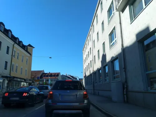
Don Camillo e Peppone
Restaurant · Italian
2 Ludwigplatz, Plattling
Mo 11:00-14:30,16:30-22:30; Tu-Su 11:00-14:30,16:30-23:30

Bäckerei Dischinger
Bakery
21 Preysingplatz, Plattling
Mo-Fr 06:00-18:00; Sa 06:00-12:00; Su 07:30-10:30
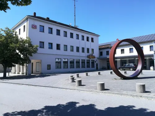
Curry König
Restaurant · Indian · 0.8 km
9 Bahnhofplatz
Tu-Sa 11:00-14:30,17:00-23:00; Su 12:00-23:00; Mo off

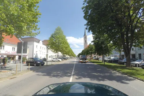

Adria
Restaurant
5 Ludwigplatz, Plattling
Tu-Su 17:00-24:00, Su 11:00-14:30; PH 11:00-14:30,17:00-24:00
Auszeit
Cafe · Snack · 3.9 km
May-Sep Tu-Fr 08:00-20:00; Sa,Su,PH 08:30-18:00; Oct-Apr Tu-Fr...


Emporium
Restaurant
14 Ludwigplatz, Plattling
Tu, We 17:00-23:00; Fr 17:00-01:00; Sa 09:00-14:00, 17:00-01:00;...
28 more on the map.
Where to stay6
Churches and places of worship17
Mariä Heimsuchung
Church · Catholic · 3.7 km
4 Kirchenstraße, Deggendorf
Shopping12
Gas and EV charging6
Schools, colleges and libraries12
Healthcare7
Map of Plattling
129 places. The map loads OpenStreetMap tiles when you open it.
Getting there and nearby towns
Flugplatz Straubing-Wallmühle (RBM) is the nearest airport with scheduled flights listed in OpenStreetMap, 30 km away.
- Straubing 25 km northwest, about 25 min by car
- Regen 28 km northeast, about 28 min by car
- Zwiesel 37 km northeast, about 37 min by car
- Pocking 53 km southeast, about 53 min by car
- Vilsbiburg 53 km southwest, about 53 min by car
- Roding 53 km northwest, about 53 min by car
- Waldkirchen 53 km east, about 53 min by car
- Regensburg 62 km northwest, about 1 h by car
- Regenstauf 66 km northwest, about 1 h by car
- Waldkraiburg 72 km southwest, about 1 h 15 min by car
Drive times are estimates from straight-line distance, not routes.
Local news
Headlines from INDB.
Reviews, tips and questions
Loading what members have shared...
Sources and licences
- GeoNames (CC BY 4.0): population, coordinates, regions and time zone
- Mapillary (see each image): photos
- OpenStreetMap contributors (ODbL 1.0): places, airports, map data
- Wikidata (CC0 1.0): elevation, founding date, time zone, website, landmarks and historic places
- Wikimedia Commons (see each image): photos
- Wikipedia (CC BY-SA 4.0): overview and history text
Photo credits
- Stadtplatz von Plattling, Juli 2010, High Contrast, CC BY 3.0 de
- St. Magdalena in Plattling, High Contrast, CC BY 3.0 de
- Trinkwasser Spender (vor Rathaus Plattling), APneunzehn74, CC0
- Bücherbaum Plattling, APneunzehn74, CC BY-SA 4.0
- Trinkwasser Spender (Ludwigsplatz Plattling), APneunzehn74, CC0
- Gebäude am Stadtplatz von Plattling, High Contrast, CC BY 3.0 de
- Gedenktafel KZ Außenlager Fossenburg (Plattling), APneunzehn74, CC BY-SA 4.0
- FH-Deggendorf-Campus, Technische Hochschule Deggendorf, CC BY 2.5
- Hamburg CityNord Edeka, Staro1 at German Wikipedia, CC BY-SA 3.0
- Mainkofen, Kereul, CC BY-SA 3.0
- Karl-Weinberger-Stadion, Konrad Lackerbeck, CC0
- Schloss Aholming-1, luckyprof, CC BY-SA 3.0
- Kirche Tabertshausen, Dietmar Schmitz www.d-schmitz.homepage.t-online.de, CC BY-SA 3.0 de
- Deggendorf-Rettenbach-Mariä-Heimsuchung, Elcom.stadler, CC BY-SA 4.0
- Evangelische Kirche 1961 Otzing Frühjahr 2014, LoisJAbel, CC BY-SA 3.0
- Kirche St. Ulrich Kleinweichs 06-06-2013, LoisJAbel, CC BY-SA 3.0
- Filialkirche St-Nikolaus Lailling 18-02-2014, LoisJAbel, CC BY-SA 3.0
- Plattling-St-Jakob-aussen, Benutzer:Donaulustig, Public domain
- Ludwigplatz 28 - Plattling, High Contrast, CC BY 3.0 de
- Isarauen bei Neutiefenweg, Rosa-Maria Rinkl, CC BY-SA 4.0
- 20230211 St-Johann-Nepomuk-Museum Plattling 01, Flocci Nivis, CC BY 4.0
- Ablaufsenke zwischen dem äußeren Mühlgraben und dem Kühmoos, Rosa-Maria Rinkl, CC BY-SA 4.0
- Isarmuendung, Archer90, CC0
- Naturschutzgebiet Isaraltwasser bei Neutiefenweg, ArminW, CC BY-SA 4.0
- Isarmuendung 090124-2, Aconcagua ( talk ), CC BY-SA 3.0
- Schloss Aholming-3, luckyprof, CC BY-SA 3.0
- NSG Altlaufsenke, Rosa-Maria Rinkl, CC BY-SA 4.0
- PKW parkt auf Geh und Radweg, APneunzehn74, CC BY-SA 4.0
- Die Geschichte ruht (Ulrike Ströbele) 1, Gerd Fahrenhorst, CC BY 4.0
- Die Geschichte ruht (Ulrike Ströbele) 2, Gerd Fahrenhorst, CC BY 4.0
- Die Geschichte ruht (Ulrike Ströbele) 3, Gerd Fahrenhorst, CC BY 4.0
- Nibelungeneiche (Roger Löcherbach) 3, Gerd Fahrenhorst, CC BY 4.0
- Nibelungeneiche (Roger Löcherbach) 4, Gerd Fahrenhorst, CC BY 4.0
- Nibelungeneiche (Roger Löcherbach) 1, Gerd Fahrenhorst, CC BY 4.0
- Nibelungeneiche (Roger Löcherbach) 2, Gerd Fahrenhorst, CC BY 4.0
- Ent-Rüstung (Maximilian Haller) 3, Gerd Fahrenhorst, CC BY 4.0
- Ent-Rüstung (Maximilian Haller) 2, Gerd Fahrenhorst, CC BY 4.0
- Ent-Rüstung (Maximilian Haller) 1, Gerd Fahrenhorst, CC BY 4.0
- Herr Pilgrim Nr. 1 (Tom Kus) 1, Gerd Fahrenhorst, CC BY 4.0
- Herr Pilgrim Nr. 1 (Tom Kus) 3, Gerd Fahrenhorst, CC BY 4.0
- Plattling Stadtplatz mit ehemaligem Bürgerspital, Harke, CC BY-SA 4.0
- Street-level photo, highwayphotograph, CC BY-SA 4.0
- Street-level photo, wegatest, CC BY-SA 4.0
- Street-level photo, zugnomade, CC BY-SA 4.0
- Street-level photo, highwayphotograph, CC BY-SA 4.0
- Street-level photo, highwayphotograph, CC BY-SA 4.0
- Street-level photo, highwayphotograph, CC BY-SA 4.0
- Street-level photo, czmrtn, CC BY-SA 4.0
- Street-level photo, highwayphotograph, CC BY-SA 4.0
- Street-level photo, wegatest, CC BY-SA 4.0
- Street-level photo, highwayphotograph, CC BY-SA 4.0
- Street-level photo, highwayphotograph, CC BY-SA 4.0
- Street-level photo, soulcover, CC BY-SA 4.0
- Street-level photo, zugnomade, CC BY-SA 4.0
- Street-level photo, highwayphotograph, CC BY-SA 4.0


Page built November 8, 2026. Spotted a mistake? Tell us or suggest a place.