


Why visit Pößneck
Townapedia lists 32 museums and landmarks, 8 parks and trails, 52 places to eat, 8 places to stay and 42 attractions in and around town.
Highlights include Buchenberg, Gamsenberg, Burg Ranis and Schloss Brandenstein.
Weather in Pößneck
Forecast from MET Norway (CC BY 4.0). Full forecast
About Pößneck
Pößneck (German pronunciation: [ˈpœsnɛk] ; also spelled Poessneck) is a town in the Saale-Orla-Kreis district, in Thuringia, Germany. It is situated 19 km (12 miles) east of Rudolstadt, and 26 km (16 miles) south of Jena.
From the Wikipedia article Pößneck (this version), under CC BY-SA 4.0.
Things to do42


30 more on the map.
Museums and landmarks32



Museum642 - Pößnecker Stadtgeschichte
Museum
6-4-2 Klosterplatz, Pößneck
Mo-Sa 11:00-16:00; We off; Th 11:00-18:00; Su 13:00-17:00; PH off

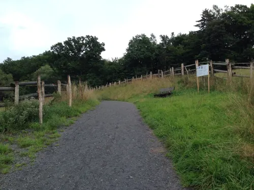


Wasserturm
Monument and historic site · 0.6 km
Wasserturm der Rosenbrauerei Pößneck
Bahnhofstraße, Pößneck
20 more on the map.
Parks, trails and playgrounds8




Restaurants and cafes52
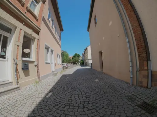
Vaters Gaststätte
Restaurant · Regional
31 Brauhausgasse, Pößneck
Mo 10:00-20:00; Tu off; We-Th 11:00-16:00; Fr-Sa 11:00-20:00; Su...

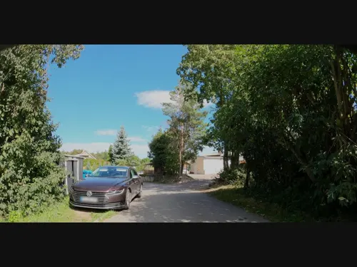
Bergschlößchen Schlettwein
Bar and pub · 1.9 km
28 Krietschenweg, Pößneck
Mo-Su 17:00+; We off; Sa off

Bäckerei Schmidt
Bakery · 3.9 km
41 Blumenstraße, Ranis
Tu-Fr 08:00-17:00; Sa 08:00-11:00; Mo,Su,PH off
Agrofarm Knau Mühlenbäckerei
Bakery
21 Saalfelder Straße, Pößneck
Mo-Fr 07:00-18:30; Sa 07:00-17:00


Bäckermeister Schneider
Bakery · 0.6 km
47 Orlamünder Straße, Pößneck
Mo-Fr 05:00-17:30; Sa 05:00-10:00; Su 07:00-11:00
40 more on the map.
History
Pößneck, which is of Slavonic origin, passed about 1300 to the Landgrave of Thuringia. Later it belonged to Saxony and later still to the duchy of Saxe-Coburg-Saalfeld, passing to Saxe-Meiningen in 1826.
A Gothic church built about 1390 now serves an Evangelical congregation. Pößneck also contains a Gothic town-hall erected during the succeeding century.
From the History section of Pößneck on Wikipedia, under CC BY-SA 4.0.
Where to stay8
Churches and places of worship16
Dorfkirche Gertewitz
Church · Protestant · 3.6 km
Ortsstraße, Gertewitz
Shopping21
Gas and EV charging4
Schools, colleges and libraries11
Staatliche Grundschule Am Rosenhügel
School · 0.8 km
15b Karl-Marx-Straße, Pößneck
Staatliches Förderzentrum Pößneck
School · 1.7 km
25 Julius-Fucik-Straße, Pößneck
Healthcare6
Thüringen-Kliniken "Georgius Agricola" - Standort Pößneck
Hospital
8-10 Hohes Gäßchen, Pößneck
Map of Pößneck
200 places. The map loads OpenStreetMap tiles when you open it.
Getting there and nearby towns
Verkehrslandeplatz Hof-Plauen (HOQ) is the nearest airport with scheduled flights listed in OpenStreetMap, 49 km away.
- Saalfeld 17 km west, about 17 min by car
- Rudolstadt 18 km west, about 18 min by car
- Jena 26 km north, about 26 min by car
- Weimar 37 km northwest, about 37 min by car
- Gera 40 km northeast, about 40 min by car
- Plauen 44 km southeast, about 44 min by car
- Hof 48 km southeast, about 48 min by car
- Sonneberg 47 km southwest, about 47 min by car
- Erfurt 50 km northwest, about 50 min by car
- Reichenbach/Vogtland 51 km east, about 51 min by car
Drive times are estimates from straight-line distance, not routes.
Local news
Headlines from INDB.
Reviews, tips and questions
Loading what members have shared...
Sources and licences
- GeoNames (CC BY 4.0): population, coordinates, regions and time zone
- Mapillary (see each image): photos
- OpenStreetMap contributors (ODbL 1.0): places, airports, map data
- Wikidata (CC0 1.0): elevation, founding date, time zone, website
- Wikimedia Commons (see each image): photos
- Wikipedia (CC BY-SA 4.0): overview and history text
Photo credits
- Fabriken Pößneck, Michael Sander, CC BY-SA 3.0
- Pößneck, Heiligengasse 1, JoeGue, CC BY-SA 4.0
- Pößneck, Kantorgasse 4, JoeGue, CC BY-SA 4.0
- Pößneck, Straße des Friedens 14, JoeGue, CC BY-SA 4.0
- Pößneck, Steinweg 5, JoeGue, CC BY-SA 4.0
- Pößneck, Steinweg 10, JoeGue, CC BY-SA 4.0
- Pößneck, Steinweg 7, JoeGue, CC BY-SA 4.0
- Pößneck, Steinweg 12, JoeGue, CC BY-SA 4.0
- Pößneck, Straße des Friedens 16, JoeGue, CC BY-SA 4.0
- Pößneck, Steinweg 11, JoeGue, CC BY-SA 4.0
- Pößneck, Steinweg 18, JoeGue, CC BY-SA 4.0
- Pößneck, Straße des Friedens 13, JoeGue, CC BY-SA 4.0
- Hotel Posthirsch, Pößneck, 151003, ako, Ansgar Koreng, CC BY 3.0 de
- Pößneck Seitenstraße - panoramio, kasselatze, CC BY-SA 3.0
- Posthirsch Hotel, Pößneck, 151003, ako, Ansgar Koreng, CC BY 3.0 de
- Pößneck, Bahnhofstraße 15, JoeGue, CC BY-SA 4.0
- Pößneck, Bahnhofstraße 18, JoeGue, CC BY-SA 4.0
- Pößneck, Straße des Friedens 15, JoeGue, CC BY-SA 4.0
- Pößneck, Geschwister-Scholl-Straße 2, JoeGue, CC BY-SA 4.0
- Pößneck, Markt 2, JoeGue, CC BY-SA 4.0
- Pößneck Breite Straße, Ansgar Koreng, CC BY-SA 3.0 de
- Pößneck, Denkmalensemble 'Kernstadt' (6), JoeGue, CC BY-SA 4.0
- Pößneck, Denkmalensemble 'Kernstadt' (4), JoeGue, CC BY-SA 4.0
- Pößneck, Markt 3, JoeGue, CC BY-SA 4.0
- Pößneck, Steinweg 13, JoeGue, CC BY-SA 4.0
- Pößneck, Denkmalensemble 'Kernstadt' (5), JoeGue, CC BY-SA 4.0
- Markt, Pößneck, Panorama, 160117, ako, Ansgar Koreng, CC BY-SA 3.0 de
- Pößneck, Stadtkirche (01), Subbass1, CC BY-SA 4.0
- Pößneck, Denkmalensemble 'Kernstadt' (2), JoeGue, CC BY-SA 4.0
- Pößneck, Denkmalensemble 'Kernstadt' (1), JoeGue, CC BY-SA 4.0
- Pößneck, Denkmalensemble 'Kernstadt' (3), JoeGue, CC BY-SA 4.0
- Pößneck, Obere Johannisgasse 1, JoeGue, CC BY-SA 4.0
- Pößneck, Schuhgasse 1, JoeGue, CC BY-SA 4.0
- Pößneck, Kirchplatz 15, JoeGue, CC BY-SA 4.0
- Pößneck, Klostergasse 1, JoeGue, CC BY-SA 4.0
- Pößneck Glockenturm, Ansgar Koreng, CC BY-SA 3.0 de
- Pößneck, Stadtkirche (02), Subbass1, CC BY-SA 4.0
- Pößneck, Stadtkirche (04), Subbass1, CC BY-SA 4.0
- Pößneck, Stadtkirche (03), Subbass1, CC BY-SA 4.0
- Pößneck, Kirchplatz 14, JoeGue, CC BY-SA 4.0
- Burg Ranis, Michael Sander, CC BY-SA 3.0
- SchlossBrandensteinFrontApril13, Huuuuh, CC0
- St.Margarethen-Ranis 2010-02-27 14-40-52, B80, CC0
- Döbritz Dorfkirche, Ansgar Koreng, CC BY-SA 3.0 de
- Gertewitz Dorfkirche (cropped), NoRud, CC BY-SA 4.0
- Kleindembach Kirche, Wikswat, CC BY-SA 3.0
- Nimritz, Dorfkirche (01), Subbass1, CC BY-SA 4.0
- Wernburg St. Ursula, Ansgar Koreng, CC BY-SA 3.0 de
- Nimritz Schloss, NoRud, CC BY-SA 4.0
- Pößneck Marktbrunnen und Kirche, Michael Sander, CC BY-SA 3.0
- Naturschutzgebiet Buchenberg bei Krölpa 2, B80, CC0
- ZechsteinriffPinsenberg, GuidoNaturfotos, CC BY 4.0
- Schweinitz Kirche, Wikswat, CC BY-SA 3.0
- Church Jüdewein 2, Aschroet, CC0
- Ranis, St. Elisabeth (02), Subbass1, CC BY-SA 4.0
- Pößneck Marienkirche, Michael Sander, CC BY-SA 3.0
- Der Gamsenberg, Redo25, CC BY-SA 4.0
- Pößneck, St. Josef (06), Subbass1, CC BY-SA 4.0
- St. Nikolaus Herschdorf, Krölpa 8, Aschroet, CC0
- Den Opfern von Krieg und Gewalt, Huuuuh, CC0
- Street-level photo, 741852963, CC BY-SA 4.0
- Street-level photo, 741852963, CC BY-SA 4.0
- Street-level photo, 741852963, CC BY-SA 4.0
- Street-level photo, 741852963, CC BY-SA 4.0
- Street-level photo, bejotel, CC BY-SA 4.0
- Street-level photo, bbo, CC BY-SA 4.0
- Street-level photo, 741852963, CC BY-SA 4.0
- Street-level photo, 741852963, CC BY-SA 4.0
- Street-level photo, bbo, CC BY-SA 4.0
- Street-level photo, 741852963, CC BY-SA 4.0
- Street-level photo, bbo, CC BY-SA 4.0
- Street-level photo, 741852963, CC BY-SA 4.0
- Street-level photo, 741852963, CC BY-SA 4.0
- Street-level photo, 741852963, CC BY-SA 4.0
- Street-level photo, ramap, CC BY-SA 4.0
- Street-level photo, 741852963, CC BY-SA 4.0
- Street-level photo, 741852963, CC BY-SA 4.0
- Street-level photo, 741852963, CC BY-SA 4.0
- Street-level photo, bejotel, CC BY-SA 4.0
- Street-level photo, bbo, CC BY-SA 4.0
- Street-level photo, bbo, CC BY-SA 4.0
- Street-level photo, bejotel, CC BY-SA 4.0


Page built November 8, 2026. Spotted a mistake? Tell us or suggest a place.