


Why visit Sonneberg
Townapedia lists 56 museums and landmarks, 24 parks and trails, 122 places to eat, 12 places to stay and 46 attractions in and around town.
Highlights include Blößenberg, Eichberg, Deutsches Spielzeugmuseum and Sternwarte Sonneberg.
Weather in Sonneberg
Forecast from MET Norway (CC BY 4.0). Full forecast
About Sonneberg
Sonneberg (German pronunciation: [ˈzɔnəbɛʁk] ) in Thuringia, Germany, is the seat of the Sonneberg district. It is in the Franconian south of Thuringia, neighboring its Upper Franconian twin town Neustadt bei Coburg.
From the Wikipedia article Sonneberg (this version), under CC BY-SA 4.0.
Travel tips from other travellers: Sonneberg on Wikivoyage (CC BY-SA 4.0).
Things to do46

34 more on the map.
Museums and landmarks56



Astronomiemuseum der Sternwarte Sonneberg
Museum · 2.3 km
Dec-Oct Tu-Fr 13:00-17:00; Dec-Oct Su 13:00-17:00; Apr-Oct Sa 13:00-17:00
Bildungsstätte Innerdeutsche Grenze
Museum · 4.7 km
22 Bahnhofstraße, Neustadt bei Coburg
Mo,Th 08:30-12:30,13:30-16:00; Tu 08:30-12:00,14:00-18:00; We...


Deutsches Teddybären Museum
Museum
29 Bahnhofstraße, Sonneberg
Mo,Su off, Tu-Th 10:30-16:00,Fr,Sa 10:30-13:00
Freysoldts-Ruh "Steinsbank"
Monument and historic site · 1.7 km
Die Freysoldts-Ruh, heute auch "Steinsbank" genannt, ist ein Ausflugsziel oberhalb der Sonneberger Altstadt mit schöner Fernsicht. (1925...

44 more on the map.
Parks, trails and playgrounds24

Bademehr Familienbad
Sports field and stadium · 4.3 km
11 Wildenheider Straße, Neustadt bei Coburg
Tu 07:00-12:00,14:00-20:00; Mo off; We 08:00-12:00,14:00-20:00; Th...





12 more on the map.
Restaurants and cafes122
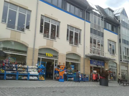
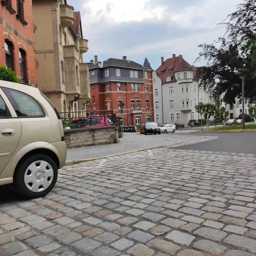
Restaurant Höbi
Restaurant · Ice Cream, German, Steak House, Burger, Regional
19 Juttastraße, Sonneberg
Tu-Su 11:00-22:00

Rhodos
Restaurant · Greek · 1.3 km
82 Bettelhecker Straße, Sonneberg
Mo, We-Su 11:30-14:30, 17:30-00:00
Zum grünen Baum
Cafe · German · 2.5 km
195 Neustadter Straße, Sonneberg
Fr 16:00-21:30; Sa 14:00-21:30; Su 11:00-16:30

Backhaus Nahrstedt
Bakery · 0.9 km
27 Friedrich-Ludwig-Jahn-Straße, Sonneberg
Mo-Sa 07:00-20:00; Su 07:00-10:00; PH off
Berggasthof Blockhütte
Restaurant · 1.2 km
60 Waldstraße, Sonneberg
We,Th 11:00-20:00; Fr,Sa 11:00-24:00; Su 11:00-19:00
Bäckerei Gheorghiu
Bakery · 2.5 km
13 Neuhäuser Straße, Sonneberg
Mo-Fr 06:00-18:00; Sa 06:00-12:00; Su,PH off
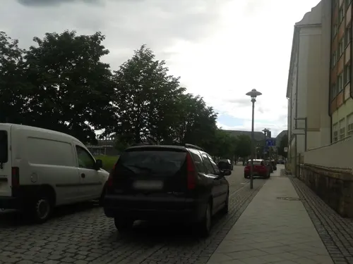



Lutherhaus
Restaurant · German, Italian, Hungarian · 0.7 km
19 Lutherhausweg, Sonneberg
Mo 17:00+, Tu off, We-Su 11:00-23:00, We-Su...
110 more on the map.
History
"The Sonneberg Castle was also called Sonneberg Castle or the Haus zu Sonneberg in old documents. In 480 Süne or Süno, Duke of Franconia, built this castle because of the Thuringian incursions ..." so it says on page 64 in the topography of the Duke of Saxe-Meiningen's share in the Duchy of Coburg from the year 1781. This not uncritical representation is based on the history of the Franks by Abbot Johannes Trithemius from 1514.
The name Sonneberg was first mentioned in documents in 1207. It goes back to the noble family of the Lords of Sonneberg, which is documented in the 12th and 13th centuries and founded a settlement below the Sonneberg Castle, which originally consisted of the estate and two hamlets, the village of "Alt-Rötin, presumed to be in Herrnau "And the" Stätlein zu Rötin under the Sonneberg Castle". The Lords of Sonneberg were ministerials in the service of the Dukes of Andechs-Meranien, who, as a Bavarian noble family, established a lordly administration in the region around Sonneberg and Coburg.
From the History section of Sonneberg on Wikipedia, under CC BY-SA 4.0.
Where to stay12
Churches and places of worship13
Evang.-Luth. Pfarramt Wildenheid-Meilschnitz
Church · Lutheran · 3.6 km
16 Friedensstraße, Neustadt bei Coburg
Michaeliskirche
Church · Protestant · 2.8 km
2 Michaelispark, Sonneberg
St.Ottilia
Church · Roman Catholic · 5.0 km
2a Gabelsbergerstraße, Neustadt bei Coburg
Shopping26
Gas and EV charging8
Schools, colleges and libraries20
Staatliches Gymnasium „Hermann Pistor“ Sonneberg (Schulteil Lohauschule)
School
10 Oberlinder Straße, Sonneberg
Healthcare17
Map of Sonneberg
250 places. The map loads OpenStreetMap tiles when you open it.
Getting there and nearby towns
Verkehrslandeplatz Hof-Plauen (HOQ) is the nearest airport with scheduled flights listed in OpenStreetMap, 49 km away.
- Neustadt bei Coburg 5 km southwest, about 5 min by car
- Rödental 12 km southwest, about 12 min by car
- Kronach 17 km southeast, about 17 min by car
- Coburg 19 km southwest, about 19 min by car
- Lichtenfels 25 km south, about 25 min by car
- Bad Staffelstein 31 km southwest, about 31 min by car
- Kulmbach 35 km southeast, about 35 min by car
- Münchberg 48 km southeast, about 48 min by car
- Hof 53 km east, about 53 min by car
- Bayreuth 54 km southeast, about 54 min by car
Drive times are estimates from straight-line distance, not routes.
Local news
Headlines from INDB.
Reviews, tips and questions
Loading what members have shared...
Sources and licences
- GeoNames (CC BY 4.0): population, coordinates, regions and time zone
- Mapillary (see each image): photos
- OpenStreetMap contributors (ODbL 1.0): places, airports, map data
- Wikidata (CC0 1.0): elevation, founding date, time zone, website
- Wikimedia Commons (see each image): photos
- Wikipedia (CC BY-SA 4.0): overview and history text
Photo credits
- Sonneberg-Hbf1, Störfix, CC BY-SA 3.0
- Sonneberg-Bernhardstr27, Störfix, CC BY-SA 3.0 de
- Neufang-Sternwarte, Störfix, CC BY-SA 3.0 de
- Arnold-Gymnasium, Daniel Mex, CC BY 2.5
- Sonneberg Spielzeugmuseum 01, ErwinMeier, CC BY-SA 4.0
- Muppberg vom Generalsblick aus, Thilo Langbein, CC BY-SA 2.0 de
- Sonneberg-St-Peter, Störfix, CC BY-SA 3.0 de
- Oberlind-Ev-Kirche, Störfix, CC BY-SA 3.0 de
- Gefell-St.Nikolaus, Störfix, CC BY-SA 3.0 de
- Judenbach-Kirche, Störfix, CC BY-SA 3.0
- Steinbach-Ev-Kirche, Störfix, CC BY-SA 3.0 de
- Sonneberg-St-Stephan, Störfix, CC BY-SA 3.0 de
- Neustadt-St.Georg01, Störfix, CC BY-SA 3.0 de
- Wildenheid-Friedenskirche, Störfix, CC BY-SA 3.0 de
- NSG Röthengrund LK Sonneberg (1 von 1), KatrinS83, CC BY-SA 3.0
- Neustadt-bC-kath-Pfarrkirche-Verklärung-Christi, Störfix, CC BY-SA 3.0 de
- Holzfällerdenkmal Sonneberg 1, Volapuko, CC BY 4.0
- Meilschnitzwiesen, Störfix, CC BY-SA 3.0 de
- Sonneberg-St-Peter-01, Störfix, CC BY-SA 3.0 de
- Gefell-Ansicht von Südosten mit Torturm und Kirchhofmauer-29122012, Robert Pietschmann, CC BY-SA 4.0
- Mapillary (msdess) 2023-06-08 16H53M32S000 (1200282894017185 at gvVG6pk7rBm5hnuzEbColq) taken with Xiaomi M2007J17G, msdess, CC BY-SA 4.0
- Mapillary (msdess) 2023-06-08 16H53M28S000 (815912790252665 at gvVG6pk7rBm5hnuzEbColq) taken with Xiaomi M2007J17G, msdess, CC BY-SA 4.0
- Mapillary (msdess) 2023-06-08 16H53M24S000 (563954222617923 at gvVG6pk7rBm5hnuzEbColq) taken with Xiaomi M2007J17G, msdess, CC BY-SA 4.0
- Mapillary (msdess) 2023-06-08 16H53M19S000 (269986732106011 at gvVG6pk7rBm5hnuzEbColq) taken with Xiaomi M2007J17G, msdess, CC BY-SA 4.0
- Mapillary (msdess) 2023-06-08 16H53M15S000 (2306636522841400 at gvVG6pk7rBm5hnuzEbColq) taken with Xiaomi M2007J17G, msdess, CC BY-SA 4.0
- Mapillary (msdess) 2023-06-08 16H53M45S000 (976288673510870 at gvVG6pk7rBm5hnuzEbColq) taken with Xiaomi M2007J17G, msdess, CC BY-SA 4.0
- Mapillary (msdess) 2023-06-08 16H53M11S000 (987887825985307 at gvVG6pk7rBm5hnuzEbColq) taken with Xiaomi M2007J17G, msdess, CC BY-SA 4.0
- Mapillary (msdess) 2023-06-08 16H53M49S000 (984294606353526 at gvVG6pk7rBm5hnuzEbColq) taken with Xiaomi M2007J17G, msdess, CC BY-SA 4.0
- Mapillary (msdess) 2023-06-08 16H53M06S000 (3502514043327894 at gvVG6pk7rBm5hnuzEbColq) taken with Xiaomi M2007J17G, msdess, CC BY-SA 4.0
- Mapillary (msdess) 2023-06-08 16H53M53S000 (638952344486584 at gvVG6pk7rBm5hnuzEbColq) taken with Xiaomi M2007J17G, msdess, CC BY-SA 4.0
- Mapillary (msdess) 2023-06-08 16H53M58S000 (1640510873080165 at gvVG6pk7rBm5hnuzEbColq) taken with Xiaomi M2007J17G, msdess, CC BY-SA 4.0
- Mapillary (msdess) 2023-06-08 16H54M02S000 (958164375396426 at gvVG6pk7rBm5hnuzEbColq) taken with Xiaomi M2007J17G, msdess, CC BY-SA 4.0
- Mapillary (msdess) 2023-06-08 16H53M02S000 (2700627606762565 at gvVG6pk7rBm5hnuzEbColq) taken with Xiaomi M2007J17G, msdess, CC BY-SA 4.0
- Mapillary (msdess) 2023-06-08 16H54M06S000 (275992281508727 at gvVG6pk7rBm5hnuzEbColq) taken with Xiaomi M2007J17G, msdess, CC BY-SA 4.0
- Mapillary (msdess) 2023-06-08 16H54M10S000 (1205256250153164 at gvVG6pk7rBm5hnuzEbColq) taken with Xiaomi M2007J17G, msdess, CC BY-SA 4.0
- Mapillary (msdess) 2023-06-08 16H52M58S000 (768734121464293 at gvVG6pk7rBm5hnuzEbColq) taken with Xiaomi M2007J17G, msdess, CC BY-SA 4.0
- Mapillary (msdess) 2023-06-08 16H52M54S000 (635613878605025 at gvVG6pk7rBm5hnuzEbColq) taken with Xiaomi M2007J17G, msdess, CC BY-SA 4.0
- Mapillary (msdess) 2023-06-08 16H54M19S000 (625950766153648 at gvVG6pk7rBm5hnuzEbColq) taken with Xiaomi M2007J17G, msdess, CC BY-SA 4.0
- Mapillary (msdess) 2023-06-08 16H52M49S000 (715467730352768 at gvVG6pk7rBm5hnuzEbColq) taken with Xiaomi M2007J17G, msdess, CC BY-SA 4.0
- Mapillary (msdess) 2023-06-08 16H52M45S000 (801977664845473 at gvVG6pk7rBm5hnuzEbColq) taken with Xiaomi M2007J17G, msdess, CC BY-SA 4.0
- Sonneberg Altes Rathaus 01, ErwinMeier, CC BY-SA 4.0
- Street-level photo, msdess, CC BY-SA 4.0
- Street-level photo, ramap, CC BY-SA 4.0
- Street-level photo, bernd_niemann, CC BY-SA 4.0
- Street-level photo, ramap, CC BY-SA 4.0
- Street-level photo, bernd_niemann, CC BY-SA 4.0
- Street-level photo, ramap, CC BY-SA 4.0
- Street-level photo, bernd_niemann, CC BY-SA 4.0
- Street-level photo, kay2906, CC BY-SA 4.0
- Street-level photo, ramap, CC BY-SA 4.0
- Street-level photo, ramap, CC BY-SA 4.0
- Street-level photo, ramap, CC BY-SA 4.0
- Street-level photo, ramap, CC BY-SA 4.0


Page built November 8, 2026. Spotted a mistake? Tell us or suggest a place.