


Why visit Hof
Townapedia lists 56 museums and landmarks, 42 parks and trails, 266 places to eat, 20 places to stay and 6 attractions in and around town.
Highlights include Theater Hof, Central Kino Hof, Museum Bayerisches Vogtland and Schloß Döhlau.
Weather in Hof
Forecast from MET Norway (CC BY 4.0). Full forecast
About Hof
Hof (German pronunciation: [hoːf] ) is a town on the banks of the Saale river in the northeastern corner of the Upper Franconia region of the German state of Bavaria. The town lies close to the Czech border and is in the forested Fichtel Mountains and Franconian Forest upland regions.
From the Wikipedia article Hof, Bavaria (this version), under CC BY-SA 4.0.
Travel tips from other travellers: Hof on Wikivoyage (CC BY-SA 4.0).
Photos of Hof


Things to do6

Theater Hof
Cinema and theater · 0.9 km
Theatre and opera house in Hof, Bavaria, Germany
5 Kulmbacher Straße, Hof




Museums and landmarks56


Schloß Döhlau
Monument and historic site · 4.4 km
1 Am Schloss, Döhlau




9. NOV. 1989
Monument and historic site · 0.9 km
Denkmal zur Deutsch/deutschen Wiedervereinigung
Denkmal 1./2. Weltkrieg
Monument and historic site · 3.0 km
Nur Namen des 2. WK genannt.
Erdbebenhäuschen
Monument and historic site · 1.7 km
Historische Erdbebenmessstation
44 more on the map.
Parks, trails and playgrounds42





Botanischer Garten Kinderspielplatz
Playground · 1.9 km
Apr-Sep: 08:00-22:00; Oct-Mar: 08:00-sunset
30 more on the map.
Restaurants and cafes266

Gaststätte Grüne Au
Restaurant · German, Pizza, Noodle · 1.3 km
103 Oelsnitzer Straße, Hof
Mo-Sa 17:00-22:00
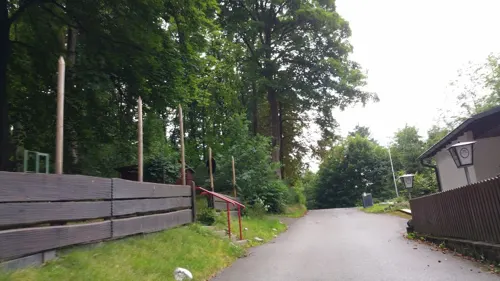
Waldgastätte Friedrichsruh
Restaurant · German · 4.1 km
25 Reuthstraße, Oberkotzau
Su 10:00+; Tu-Sa,PH 14:00+



Reinel
Bakery · 0.6 km
54 Königstraße, Hof
Mo 06:30-14:00; Tu off; We-Fr 06:30-14:00; Sa 06:00-12:00; PH off

254 more on the map.
History
Hof in the Middle Ages was located in the Provincia Variscorum and was known in Latin as Curiae Variscorum or Curiae Nariscorum meaning "Court of the Varisci/Narisci." It is assumed then that Hof was the place where the chief(s) of the Varisci (or Narisci) tribe of the Suebi people held court (and/or perhaps a pagan temple or hall). The Varisci appear briefly in Tacitus' Germania (Chapter 42) as participants in the Marcomannic Wars. Their chief, Valao, was killed during battle around 167 AD and it is possible that these ancient peoples were then transplanted to Italy by Marcus Aurelius and lost their identity. A few centuries later (4th or 5th century) the obscure Armalausi peoples appear where the Varisci once lived, however the Latin name of Varisci stuck to the region. This is evidenced by nearby Plauen being called Plavia Variscorum and Hof: Curia Variscorum. The name Curiae Variscorum has been used to denote the city of Hof in numerous documents and publications throughout the years. This legacy remains even to this day as the word Hof is German for 'court', just as curiae is Latin for 'court'.
Read more of the history
Sometime around the 6th century AD the Slavic Sorbs began arriving near the Saale River which runs through Hof. They are first mentioned in 631 A.D., when Fredegar’s Chronicle described them as "Surbi" and as under the rule of a Dervan, an ally of Samo. The Frankish Kingdom of Charlemagne and his descendants were determined to Christianize the pagan Slavs and various campaigns were waged against them. The Annales Regni Francorum state that in 806 A.D. Sorbian Duke Miliduch fought against the Franks and was killed by Charles the Younger the son of Charlemagne around nearby modern-day Weißenfels.
The region where Hof is located first came under the ecclesiastic control of the Dioceses of Würzburg during this time period. Then in 1007 the region which contains Hof came under the Bishopric of Bamberg which was established out of the Dioceses of Würzburg to further spread Christianity throughout this area.
While the area around Hof remained terra incognita during this time period it was not isolated from the rest of the world. Although not home to a king or prince, Hof was on located on a somewhat protected, and very important trade route; the Via Imperii. This route led from Italy to the Baltic Sea and Hof was well situated to be a place of rest for travelers and traders as the flourishing markets of Leipzig, Zwickau, and Nuremberg began to develop. The budding mining industry of silver and tin from the nearby Ore Mountains would also contribute to the development of trade in this region.
It appears that the missionary efforts of Bamberg were fairly successful in Hof as sometime around 1080 a group of farmers (possibly Sorbish) settled parts of modern-day Hof had built a chapel on Klausenberg an der Saale. They called their settlement "Rekkenze" which appears to be derived from the Western Slavic word Rekavica meaning "river." Rekkenze was first mentioned in a document written by one Pastor Albertus of St. Lorenzkirche in 1214 to the Bishop of Bamberg.
The Slavic language has left many marks on the geography of this region and to this day there are two waterways known as "Regnitz" near Hof: the Upper/Southern Regnitz (which flows in the south of Hof on the east side of the Saale River) and the Lower/Northern Regnitz (which flows in the north and east side of the Saale). Also of note, the area around Hof, the southern Bavarian-Bohemian part of the Vogtland, was known as the Regnitzland.
This Rekkenze settlement, which later became Hof, went by this and many other names through the years. For example, Hof is also called "curia Reckenize" (court of Reckenize) and "schlosz Reckenitz" (Castle Reckenitz) in a document of the Vögte of Weida in the year 1276. It has been suggested that the name "Hof" is the shortened form of Stadt am Regnitzhof meaning "City on the Court at the Regnitz". Other names for Hof have included: Curia Bavarica (Variscorum), Curiae Nariscorum, Curiae Regnitianae, Curiae Regnitianae ad Salam, Curiae Variscorum, Hoff, Hofii, Hof an der Saale, and Hoff im Voitlande to name but a few.
In 1098 Count Berthold II of Andechs inherited his father's lands including those in modern-day Upper Franconia. In the 1130s he built Plassenburg Castle in Kulmbach and from 1137 he styled himself as 'Count of Plassenburg". He thus strengthened his influence in and around the nearby Regnitzland.
Around 1230, Count Berthold's great-grandson, the Crusader Duke Otto I von Andechs-Merania fortified the area north of the Rekkenze farming settlement (Altstadt) at the area downstream now known as Neustadt (New City).
By 1248 the royal house of Andechs-Merania dies out with Duke Otto II. Soon after the Vögte of Weida acquired the Regnitzland including Hof. Vogt Henry VIII of Weida (1258–1279) earned the city of Hof and Regnitzland. He was married to Sophie, daughter of Count Hermann II of Orlamünde and Beatrix of Andechs-Merania (daughter of Count Otto I).
Under the guidance of the Vögte of Weida the first city wall and the foundation of the poor hospital (Armenspitals) were built (c. 1260). Also, in 1270 there is the first mention of a castle at Hof and in 1278 the beginnings of the Klarissenkloster was established under the aid of the Vogt. The convent was blessed by the first Franciscan Pope Nicholas IV in 1291 and came under the Franciscan Monastery of the Holy Cross in 1292.
In 1299 75% of the city (both Old and New Hof) was destroyed by a fire and the population was left destitute. It took over 30 years to rebuild Hof, however during the rebuilding process (1319) the Vogt Heinrich XII the Younger (der Jüngere) of Weida (1302–1324) confirmed traditional rights and privileges upon the City of Hof. These rights officially made Hof a city.
From the History section of Hof, Bavaria on Wikipedia, under CC BY-SA 4.0.
More about Hof
Geography
The town of Hof consists of the following districts in particular:
Hof is located in between the areas of the Franconian Forest, the Fichtel Mountains and the Vogtland.
Hof has an humid continental climate (Köppen: Dfb; Trewartha: Dclo). Hof is located at an altitude of 565.2 metres (1,854 ft), which is much cooler than other areas in Bavaria. The average annual temperature ranges from −1 °C (30 °F) in winter to 17 °C (63 °F) in summer, and the annual precipitation is 712.6 mm (28.06 in).
The Hof weather station has recorded the following extreme values:
Its highest temperature was 35.3 °C (95.5 °F) on 20 July 2022.
Its lowest temperature was −27.0 °C (−16.6 °F) on 10 February 1956.
Its greatest annual precipitation was 1,010.5 mm (39.78 in) in 1995.
Its least annual precipitation was 388.2 mm (15.28 in) in 1953.
Arts and culture
Botanischer Garten der Stadt Hof, a municipal botanical garden and the Hof Zoo, a zoological garden located on the Theresienstein, a hill near the downtown
St Mary's Cathedral, highest church of the town (65 meters high)
Freiheitshalle, the biggest hall for events and concerts in north-east Bavaria, famous for TV shows and trade fairs, with a capacity of more than 6,000 people.
Theater Hof, a multi-purpose theatre, opera house and drama theatre. It hosts also the city's ballet company and a youth theatre. Intendant: Reinhardt Friese.
Hofer Symphoniker, the symphony orchestra of Hof, plays as opera orchestra at the theatre and gives concerts at the Freiheitshalle Hof. Notable is also the Hofer Symphoniker Music School, which is unique among Germany's professional orchestras. Intendant: Ingrid Schrader.
Church music at City churches St Mary's and St Michel's. Music direktors: Ludger Stühlmeyer and Georg Stanek.
International Violin Competition Henri Marteau: Named after the violinist and violin teacher Henri Marteau, the competition takes place under the responsibility of the District of Upper Franconia and organized by Hofer Symphoniker every three years in Lichtenberg and Hof.
Education
Hof is also home to the University of Applied Sciences Hof which has around 3,700 students and the University of Applied Sciences for Administration and Legal Affairs in Bavaria which has around 1,800 students.
From the Wikipedia article Hof, Bavaria, under CC BY-SA 4.0.
Notable people from Hof
 Johann Wolfgang DöbereinerGerman chemistPhoto: Georg Philipp Schmidt, CC BY-SA 4.0
 Mërgim VojvodaKosovan association football playerPhoto: Supporterhéninois, CC0
 Otto von LossowGerman general (1868–1938)Photo: Unknown author Unknown author, Public domain
 Gerhard Hetzswimmer (1942–2012)Photo: Joop van Bilsen for Anefo, CC BY-SA 3.0 nl
 Nikolaus DeciusGerman hymnwriter (1485–1546)Photo: PantheraLeo1359531, CC BY 4.0
 Johann Christian ReinhartGerman painter and engraver (1761-1847)Photo: José de Madrazo y Agudo, Public domain
 Johann Georg August WirthGerman journalist and author (1798-1848)Photo: Olaf Kosinsky, CC BY-SA 3.0 de
 Karl von EnhuberGerman painter (1811–1867)Photo: Karl von Enhuber (1811-1867), Public domain
 Reinhard MerkelGerman swimmerPhoto: Heinrich-Böll-Stiftung, CC BY-SA 2.0
- Lisa KreuzerGerman actress
- Heinrich GerberGerman engineer (1832–1912)
- Klaus WedemeierGerman politician, Mayor of Bremen
Born in Hof, according to Wikidata (CC0). Each name links to its Wikipedia article.
Where to stay20
Churches and places of worship34
Sankt Marien
Church · Roman Catholic
2 Bernhard-Lichtenberg-Platz, Hof
Shopping49
Gas and EV charging24
Ladestation Johann-Christian-Reinhart-Gymnasium
EV charging · 1.2 km
71 Max-Reger-Straße, Hof
Schools, colleges and libraries41
Hochschule für den öffentlichen Dienst in Bayern - Fachbereich Allgemeine Innere Verwaltung
School · 2.2 km
51 Wirthstraße, Hof
Healthcare16
MVZ Hochfranken - Hausärztliche Abteilung Hof
Clinic and pharmacy · 1.4 km
22 Heiligengrabstraße, Hof
MVZ Hochfranken - Zentrum für Innere Medizin & Gynäkologie
Clinic and pharmacy · 1.3 km
16 Heiligengrabstraße, Hof
Map of Hof
250 places. The map loads OpenStreetMap tiles when you open it.
Getting there and nearby towns
Verkehrslandeplatz Hof-Plauen (HOQ) is the nearest airport with scheduled flights listed in OpenStreetMap, 5 km away.
- Oberkotzau 6 km south, about 6 min by car
- Schwarzenbach an der Saale 10 km south, about 10 min by car
- Rehau 11 km southeast, about 11 min by car
- Naila 15 km west, about 15 min by car
- Münchberg 16 km southwest, about 16 min by car
- Helmbrechts 16 km southwest, about 16 min by car
- Oelsnitz 21 km northeast, about 21 min by car
- Selb 22 km southeast, about 22 min by car
- Plauen 26 km northeast, about 26 min by car
- Wunsiedel 31 km south, about 31 min by car
Drive times are estimates from straight-line distance, not routes.
Towns near Hof


Keep exploring
Local news
Headlines from INDB.
Reviews, tips and questions
Loading what members have shared...
Sources and licences
- GeoNames (CC BY 4.0): population, coordinates, regions and time zone
- Mapillary (see each image): photos
- OpenStreetMap contributors (ODbL 1.0): places, airports, map data
- Wikidata (CC0 1.0): elevation, founding date, time zone, website, landmarks and historic places
- Wikimedia Commons (see each image): photos
- Wikipedia (CC BY-SA 4.0): overview and history text
Photo credits
- Hof, HO - Theresienstein - Pavillon - Innenstadt v N 02, Flodur63, CC BY-SA 4.0
- Klosterstraße 20210821 HOF04382 RAW-Export 20220215001412cens, PantheraLeo1359531, CC BY 4.0
- Stau an der Baustelle 20220511 HOF01898 20221201000038cens, PantheraLeo1359531, CC BY 4.0
- Niedergelegtes Verkehrszeichen 20220511 HOF01897 20221201000037, PantheraLeo1359531, CC BY 4.0
- Auto von TV Oberfranken in Hof 20210211 143521 cens, PantheraLeo1359531, CC BY 4.0
- Wertstoffinsel am Q-Bogen 20220704 HOF05663 20230109000754cens, Foto: PantheraLeo1359531 Graffito Frauennotruf: Unbekannt (wenn bekannt, bitte nachtragen), CC BY 4.0
- Gedenktafel Textil-, Bauarbeitergewerkschaft in Marienstraße Hof 20210223 DSC8060, PantheraLeo1359531, CC BY 4.0
- Haus in Ecklage, Münster- und Marienstraße 20230619 HOF00557 RAW-Export cens, PantheraLeo1359531, CC BY 4.0
- Hof Theater, Andreas Praefcke, CC BY 3.0
- Südkante Gebäude B Hochschule Hof 20210815 HOF03601, PantheraLeo1359531, CC BY 4.0
- Zoologischer Garten Hof Eingang 2017, Veliensis, CC BY-SA 4.0
- Auferstehungskirche Hof-Moschendorf 20210524 DSC09796, PantheraLeo1359531, CC BY 4.0
- Bismarckturm Front 20210809 HOF02708, PantheraLeo1359531, CC BY 4.0
- Staatliche Fachoberschule und Berufsschule Hof 20201105 DSC5610, PantheraLeo1359531, CC BY 4.0
- Museum Bayrisches Vogtland Eingang DSC2034, PantheraLeo1359531, CC BY 4.0
- Freiheitshalle Hof 20210812 HOF03248, PantheraLeo1359531, CC BY 4.0
- Hofer Geschichtswege 7 Foto 20220522 HOF02320 20221206000100, Foto: PantheraLeo1359531 😺 ( talk ) Tafel: Lions International Bürgerstiftung Hof Baugenossenschaft Hof Nordoberfränkischer Verein für Natur-, Geschichts- und Landeskunde e.V. Katharina von Kotzau..., CC BY 4.0
- Oberkotzau Schwesnitz, TPO, CC BY-SA 3.0
- Pfarrkirche Trogen 20210825 HOF04551 RAW-Export 20220503002569cens Kopie, PantheraLeo1359531, CC BY 4.0
- Köditz, St. Leonhard (04), Subbass1, CC BY-SA 4.0
- SchlossHofeck006, PeterBraun74, CC BY-SA 3.0
- Schloss Oberkotzau, Aagnverglaser, CC0
- Hof (Saale) St. Lorenz 01, ErwinMeier, CC BY-SA 4.0
- Iglesia de Santa María, Hof, Alemania, 2026-04-30, DD 01, Diego Delso, CC BY-SA 4.0
- St. Michaelis und Kirchplatz 20220325 HOF09908cens, PantheraLeo1359531, CC BY 4.0
- Stadion Gruene Au in Hof, Heini Woldschläger, CC BY-SA 3.0
- Katzenstatue Theresienstein 20210903 HOF05135, Foto: PantheraLeo1359531 Anlage: Verschönerungsverein Hof, CC BY 4.0
- Wartturm Hof HOF07697 RAW-Export 20220509002739, PantheraLeo1359531, CC BY 4.0
- 2026-09-19 Zedtwitz HOF5917 RAW-Export, PantheraLeo1359531, CC BY-SA 4.0
- Stadtbücherei Hof 20220823 HOF04922 RAW-Export cens, PantheraLeo1359531, CC BY 4.0
- Klosterstraße 2, Apotheke 20210821 HOF04365 RAW-Export 20220215001407cens, PantheraLeo1359531, CC BY 4.0
- Freimaurerloge Zum Morgenstern, Restaurant Kreuzsteinstraße 20220413 HOF00267 RAW-Export 20220513002902cens, PantheraLeo1359531, CC BY 4.0
- Lorenzpark 20220413 HOF00193cens, PantheraLeo1359531, CC BY 4.0
- Christuskirche Hof 20220724 HOF07075 RAW-Export, PantheraLeo1359531, CC BY 4.0
- Treiben in der Hofer Altstadt 20210612 DSC00603, PantheraLeo1359531, CC BY 4.0
- SCALA Filmtheater 20211020 HOF07247 RAW-Export 20220629003843cens, PantheraLeo1359531, CC BY 4.0
- Komplex Sana-Klinikum Hof 20210614 DSC01041cens, PantheraLeo1359531, CC BY 4.0
- Front Haupteingang Grundschule Krötenbruck 20210807 HOF02124, PantheraLeo1359531, CC BY 4.0
- FLIMB fun climbing 06, FLIMB fun climbing GmbH / Hans-Peter Schwarzenbach (Schwarzenbach-Fotografie), CC BY-SA 4.0
- Neustädter Grundschule 20220522 HOF02319 20221206000099cens, PantheraLeo1359531, CC BY 4.0
- Evangelisch-methodistische Kirche Paulus-Kapelle 20220522 HOF02361 20221206000117cens, PantheraLeo1359531, CC BY 4.0
- Gaststätte Grüne Au 20220610 HOF04466 20221214000232cens, PantheraLeo1359531, CC BY 4.0
- DoehlauSchloss, PeterBraun74, CC BY-SA 3.0
- Trogen 037, PeterBraun74, CC BY-SA 3.0
- Koeditz Kirche 007, PeterBraun74, CC BY-SA 3.0
- Hof (Saale), Christuskirche (07), Subbass1, CC BY-SA 4.0
- Michaeliskirche-in-Hof, T. E. Ryen, CC BY-SA 3.0
- Hof, St. Marien, 001, Tilman2007, CC BY-SA 3.0
- Kautendorf Kirche 060, PeterBraun74, CC BY-SA 3.0
- Labyrinth am Untreusee 20220510 HOF01771, PantheraLeo1359531, CC BY 4.0
- §28-Infoschild in Botanischer Garten Hof 20200406 01, PantheraLeo1359531, CC BY 4.0
- Städtische Kunsteisbahn Eisteich 20230508 HOF01804 RAW-Export, PantheraLeo1359531, CC BY 4.0
- HOFlaHOPP 20210808 Hof02583 RAW 202111081531cens, PantheraLeo1359531, CC BY 4.0
- Street-level photo, changchun1, CC BY-SA 4.0
- Street-level photo, canislupus, CC BY-SA 4.0
- Street-level photo, b4sti4n, CC BY-SA 4.0
- Street-level photo, SuedOstLink, CC BY-SA 4.0
- Street-level photo, b4sti4n, CC BY-SA 4.0
- Street-level photo, SuedOstLink, CC BY-SA 4.0
- Street-level photo, changchun1, CC BY-SA 4.0
- Street-level photo, changchun1, CC BY-SA 4.0
- Street-level photo, geo, CC BY-SA 4.0
- Street-level photo, changchun1, CC BY-SA 4.0
- Street-level photo, geo, CC BY-SA 4.0
- Street-level photo, canislupus, CC BY-SA 4.0
- Street-level photo, changchun1, CC BY-SA 4.0
- Street-level photo, geo, CC BY-SA 4.0
- Street-level photo, b4sti4n, CC BY-SA 4.0
- Street-level photo, PantheraLeo1359531, CC BY-SA 4.0
- Street-level photo, canislupus, CC BY-SA 4.0
- Street-level photo, b4sti4n, CC BY-SA 4.0
- Street-level photo, b4sti4n, CC BY-SA 4.0
- Street-level photo, b4sti4n, CC BY-SA 4.0
- Street-level photo, geo, CC BY-SA 4.0
- Street-level photo, canislupus, CC BY-SA 4.0
- Street-level photo, geo, CC BY-SA 4.0
- Street-level photo, swalther, CC BY-SA 4.0
- Street-level photo, canislupus, CC BY-SA 4.0
- Street-level photo, changchun1, CC BY-SA 4.0


Page built November 9, 2026. Spotted a mistake? Tell us or suggest a place.