


Why visit Rahden
Townapedia lists 12 museums and landmarks, 29 parks and trails, 88 places to eat, 8 places to stay and 9 attractions in and around town.
Highlights include Hofladen, Hofladen Wehdebrock, Museumshof Rahden and Large Stone.
Weather in Rahden
Forecast from MET Norway (CC BY 4.0). Full forecast
About Rahden
Rahden (German pronunciation: [ˈʁaːdn̩] ; Low German: Roh'n) is a town in the far north of North Rhine-Westphalia between Bielefeld and Bremen and between Hanover and Osnabrück. Rahden is part of the Minden-Lübbecke District in East Westphalia-Lippe.
From the Wikipedia article Rahden (this version), under CC BY-SA 4.0.
Things to do9

Hofladen Wehdebrock
Farm and orchard · 7.6 km
16 Hollweder Straße, Stemwede
We,Th,Fr 13:30-18:00; Sa 10:00-13:00; Mo,Tu,Su,PH off

Neues Theater
Cinema and theater · 5.9 km
1 Trakehner Straße, Espelkamp

Museums and landmarks12




Hochzeitsbahnhof Lavelsloh
Monument and historic site · 8.6 km
3 Am Bahnhof, Diepenau
Parks, trails and playgrounds29




Hallen-, Freibad-Rahden
Sports field and stadium · 0.7 km
24 Am Freibad, Rahden

17 more on the map.
Restaurants and cafes88

Andreas' Grillecke & Restaurant Jasmin
Restaurant · Russian · 5.6 km
36 Gabelhorst, Espelkamp
Th-Su 12:00-14:30, 17:00-22:00

Bäckerei Röbelt
Bakery · 5.9 km
Brot & Brötchen handgemacht!
6 Tannenbergplatz, Espelkamp
Su 08:00-11:00; Mo-Fr 06:15-11:00; Sa 06:00-11:00
Gasthaus Rose, Restaurant, Hotel, Catering
Restaurant · German · 7.8 km
10 Zum Kleihügel, Espelkamp
Th-Sa 17:00-21:00; Su 12:00-21:00
Ludewigs-Landhaus Inh. Heinrich Grundmann
Restaurant · Regional · 6.5 km
17 Barler Straße, Rahden
Th,Fr 17:00+; Sa,Su 10:00+
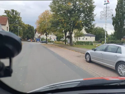
Restaurant Korfu
Restaurant · Greek · 8.7 km
20 Hauptstraße, Diepenau
Tu-Th 17:00-22:30, Fr,Sa 17:00-23:30, Su 12:00-14:00,17:00-23:00
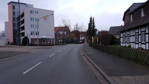
Ristorante - Pizzeria Leonardo
Restaurant · Pizza
1 Osnabrücker Straße, Rahden
We-Su,Mo 12:00-14:00,17:30+
Ristorante Da Michele
Restaurant · Pizza · 7.4 km
50 Lange Straße, Diepenau
Mo, We-Sa 17:30-22:30; Su 12:00-13:30, 17:00-22:30
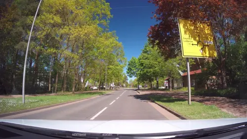
Bäckerei Kölling
Bakery · 5.3 km
21e-21i General-Bishop-Straße, Espelkamp
Mo-Fr 07:30 - 18:00; Sa 07:00 - 13:00


Bäckerei Middelberg
Bakery · 6.4 km
Breslauer Straße, Espelkamp
Mo-Fr 06:00-18:00, Sa 07:00-13:00, Su 08:00-13:00
76 more on the map.
Where to stay8
Wohnmobilstellpatz am "Hochzeitsbahnhof" Diepenauf/Lavelsloh
Campground · 8.7 km
Churches and places of worship20
Freie Evangelische Bibelgemeinde Espelkamp e.V. (FEBG)
Church · Baptist · 4.8 km
52 General-Bishop-Straße, Espelkamp
Shopping30
Gas and EV charging21
Tankstelle am Supermarkt
Gas station · 5.3 km
10 General-Bishop-Straße, Espelkamp
Schools, colleges and libraries22
Berufskolleg Lübbecke Teilstandort Espelkamp
School · 5.8 km
12 Trakehner Straße, Espelkamp
Healthcare11
Panda-Apotheke Inh. Minh Doan-Vu
Clinic and pharmacy · 6.6 km
3 Gerhard-Wetzel-Straße, Espelkamp
Map of Rahden
250 places. The map loads OpenStreetMap tiles when you open it.
Getting there and nearby towns
Flugplatz Bielefeld (BFE) is the nearest airport with scheduled flights listed in OpenStreetMap, 52 km away.
- Rödinghausen 22 km southwest, about 22 min by car
- Sulingen 31 km northeast, about 31 min by car
- Vlotho 34 km southeast, about 34 min by car
- Spenge 34 km south, about 34 min by car
- Vechta 40 km northwest, about 40 min by car
- Obernkirchen 39 km southeast, about 39 min by car
- Osnabrück 42 km southwest, about 42 min by car
- Wallenhorst 42 km west, about 42 min by car
- Rinteln 42 km southeast, about 42 min by car
- Bielefeld 45 km south, about 45 min by car
Drive times are estimates from straight-line distance, not routes.
Local news
Headlines from INDB.
Reviews, tips and questions
Loading what members have shared...
Sources and licences
- GeoNames (CC BY 4.0): population, coordinates, regions and time zone
- Mapillary (see each image): photos
- OpenStreetMap contributors (ODbL 1.0): places, airports, map data
- Wikidata (CC0 1.0): elevation, founding date, time zone, website
- Wikimedia Commons (see each image): photos
- Wikipedia (CC BY-SA 4.0): overview and history text
Photo credits
- Rathaus-rahden, Marcus Pansing, CC BY-SA 3.0 de
- Rahden Museumshof 1, Corradox, CC BY-SA 3.0
- St. Johannis Rahden von Süden, Sonojak, CC BY-SA 4.0
- Brunnen an der Johanniskirche in Rahden, Gerd Fahrenhorst, CC BY 4.0
- Skulptur bei Stadtsparkasse Rahden, Gerd Fahrenhorst, CC BY 4.0
- Stadtsparkasse Rahden mit Skulptur, Gerd Fahrenhorst, CC BY 4.0
- St. Johannis Rahden von Südosten, Sonojak, CC BY-SA 4.0
- Ortseinfahrt Rahden (Westfalen), Ringtonatus, CC BY-SA 4.0
- Marktschänke Rahden von Westen, Sonojak, CC BY-SA 4.0
- Brunnen Marktstraße Rahden 1, Gerd Fahrenhorst, CC BY 4.0
- Brunnen Marktstraße Rahden 2, Gerd Fahrenhorst, CC BY 4.0
- Marktschänke-rahden, Marcus Pansing, CC BY-SA 3.0 de
- Kriegerdenkmal Rahden von Nordwesten, Sonojak, CC BY-SA 4.0
- Kriegerdenkmal Marktstraße Rahden 1, Gerd Fahrenhorst, CC BY 4.0
- Kriegerdenkmal Marktstraße Rahden 2, Gerd Fahrenhorst, CC BY 4.0
- Marktschänke Rahden von Süden, Sonojak, CC BY-SA 4.0
- Kriegerdenkmal Rahden von Südwesten, Sonojak, CC BY-SA 4.0
- Kriegerdenkmal Rahden von Nordosten, Sonojak, CC BY-SA 4.0
- Kriegerdenkmal Rahden von Südosten, Sonojak, CC BY-SA 4.0
- KlinikumRahden1, Ingo2802 23:48, 15. Apr. 2008 (CEST), CC BY-SA 3.0
- Bahnhof Rahden 2, Stefan Flöper, CC BY-SA 4.0
- Bahnhof Rahden, Stefan Flöper, CC BY-SA 4.0
- Eurobahn - Rahden, Bernd NdeM, CC BY-SA 3.0
- 25.05.96 Rahden (Kr Minden-Lübbecke) 628540 (42756828591), Phil Richards from London, UK, CC BY-SA 2.0
- Burg-rahden1, Marcus Pansing, CC BY-SA 3.0 de
- Burg-rahden3, Marcus Pansing, CC BY-SA 3.0 de
- 2019-08-04 Museumshof Rahden 07, YvoBentele, CC BY-SA 4.0
- 2019-08-04 Museumshof Rahden 05, YvoBentele, CC BY-SA 4.0
- 2019-08-04 Museumshof Rahden 06, YvoBentele, CC BY-SA 4.0
- 2019-08-04 Museumshof Rahden 04, YvoBentele, CC BY-SA 4.0
- 2019-08-04 Museumshof Rahden 01, YvoBentele, CC BY-SA 4.0
- 2019-08-04 Museumshof Rahden 03, YvoBentele, CC BY-SA 4.0
- 2019-08-04 Museumshof Rahden 08, YvoBentele, CC BY-SA 4.0
- 2019-08-04 Museumshof Rahden 02, YvoBentele, CC BY-SA 4.0
- Rahden Museumshof 2, Corradox, CC BY-SA 3.0
- Burg-rahden2, Marcus Pansing, CC BY-SA 3.0 de
- Alte Klus (Frotheim), Gerhard Terstegge (www.fototaxis.de), CC BY-SA 3.0
- Tonnenheide Grosser Stein2, Ingo2802, CC BY-SA 3.0
- Museum Foto Wikipedia Teppichmuseum Tönsmann 003, Creius, CC BY-SA 3.0
- Thomaskirche-Espelkamp, Salfahli, CC BY-SA 3.0
- Espelkamp/Westfalen, Gymnasium, Steiner, Egon, CC BY-SA 3.0 de
- RahdenPr.Stroehen1, Ingo2802 00:17, 16. Apr. 2008 (CEST), CC BY-SA 3.0
- Morgengrauen, Fotoscotty, CC BY-SA 3.0
- Weisses Moor Rahden, Stefan Grez, CC BY-SA 4.0
- Rehbock im Osterwald-004, Markus Hallmann, CC BY-SA 4.0
- Street-level photo, rahden39, CC BY-SA 4.0
- Street-level photo, berndgehle1, CC BY-SA 4.0
- Street-level photo, strassenkater-2000, CC BY-SA 4.0
- Street-level photo, Schmarvis, CC BY-SA 4.0
- Street-level photo, spindle, CC BY-SA 4.0
- Street-level photo, spindle, CC BY-SA 4.0
- Street-level photo, spindle, CC BY-SA 4.0
- Street-level photo, spindle, CC BY-SA 4.0
- Street-level photo, spindle, CC BY-SA 4.0
- Street-level photo, strassenkater-2000, CC BY-SA 4.0
- Street-level photo, strassenkater-2000, CC BY-SA 4.0
- Street-level photo, strassenkater-2000, CC BY-SA 4.0


Page built November 8, 2026. Spotted a mistake? Tell us or suggest a place.