


Why visit Ratzeburg
Townapedia lists 47 museums and landmarks, 21 parks and trails, 49 places to eat, 14 places to stay and 13 attractions in and around town.
Highlights include Betriebsgemeinschaft Domäne Fredenburg, Burgtheater Ratzeburg, Kreismuseum Herzogtum Lauenburg and A. Paul Weber Museum.
Weather in Ratzeburg
Forecast from MET Norway (CC BY 4.0). Full forecast
About Ratzeburg
Ratzeburg (German pronunciation: [ˈʁatsəbʊʁk] ; Low German: Ratzborg) is a town in Schleswig-Holstein, Germany. It is surrounded by four lakes, the resulting isthmuses between the lakes form the access lanes to the town. Ratzeburg is the capital of the district Herzogtum Lauenburg.
From the Wikipedia article Ratzeburg (this version), under CC BY-SA 4.0.
Travel tips from other travellers: Ratzeburg on Wikivoyage (CC BY-SA 4.0).
Things to do13

Betriebsgemeinschaft Domäne Fredenburg
Farm and orchard · 4.2 km
1 Domänenweg, Fredeburg
Mo-Fr 09:00-18:30; Sa 09:00-16:00
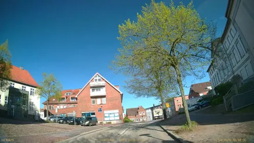
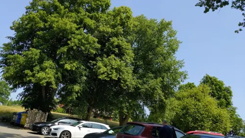




1 more on the map.
Museums and landmarks47

Kreismuseum Herzogtum Lauenburg
Museum
Ehemaliges Herrenhaus der Domprobstei
12 Domhof, Ratzeburg
Tu-Su 10:00-13:00,14:00-17:00


Kamelbrücke
Monument and historic site · 1.0 km
Die Brücke wurde 1908 von dem Unternehmen Wayss & Freytag in der damals innovativen Stahlbetonweise nach dem sogenannten System Monier...


Wasserturm Hindenburghöhe
Monument and historic site · 0.9 km
Ehemaliger Wasserturm auf der Hindenburghöhe in Ratzeburg, stillgelegt 1976

Wasserturm Ratzeburg-St. Georgsberg
Monument and historic site · 1.3 km
Ehemaliger Wasserturm Ratzeburg St. Georgsberg, stillgelegt 1976
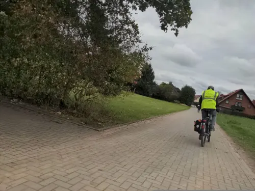

Kriegerdenkmal
Monument and historic site · 3.9 km
Denkmal vom Zaun aus zu erkennen. Tafeln am Boden leider nur zu erahnen.
35 more on the map.
Parks, trails and playgrounds21

Salemer Moor mit angrenzenden Wäldern und Seen
Hiking and trails · 4.9 km





Segler-Gemeinschaft Schwarzenbek - Kalkhütte
Marina and boat launch · 3.1 km



9 more on the map.
Restaurants and cafes49

Gasthaus zur Farchauer Mühle
Restaurant · Regional · 2.6 km
6 Farchauer Mühle, Schmilau
We-Su 11:30-23:00
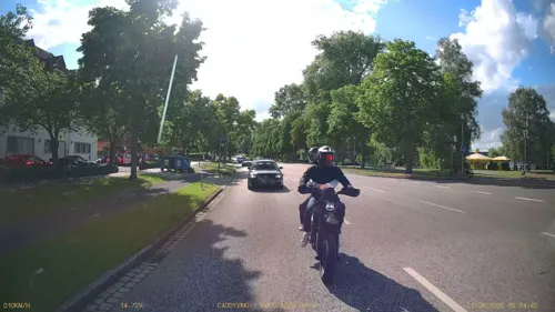




37 more on the map.
History
The town was founded in the 11th century as Racisburg. The name is traditionally derived from the local Wendish ruler, Prince Ratibor of the Polabians, who was nicknamed Ratse. In the year 1044 Christian missionaries under the leadership of the monk Ansverus came into the region and built a monastery. It was destroyed in a pagan rebellion in 1066; the monks were stoned to death. Today monuments to the missionaries in two of the town's churches commemorate these events. Ansverus was canonised in the 12th century and his relics were entombed in the Ratzeburg cathedral.
Henry the Lion became the ruler of the town in 1143 and established a bishopric in 1154. He was also responsible for the construction of the late Romanesque Cathedral (Dom), built in typical north German 'red-brick' style. Henry also prompted the construction of the similar-looking Lübeck Cathedral and Brunswick Collegiate Church with his remains interred in the latter.
Since 1180 part of Ratzeburg diocesan area formed a Prince Bishopric, whose ruler was sovereign and as such had a vote at the Imperial Diet. The Prince-Bishopric of Ratzeburg was the last state in Northern Germany remaining Catholic. After the 1550 death of its ruler Prince-Bishop Georg von Blumenthal, who feuded with Thomas Aderpul, the bishopric converted to Lutheranism in 1554.
From the History section of Ratzeburg on Wikipedia, under CC BY-SA 4.0.
Where to stay14
Churches and places of worship10
Kirche St. Georg auf dem Berge
Church · Lutheran · 0.9 km
10 Wedenberg, Ratzeburg
Freie Evangelische Christus Gemeinde Ratzeburg
Church · Catholic · 2.3 km
7 Robert-Bosch-Straße, Ratzeburg
Shopping17
Gas and EV charging7
Raiffeisen-Tankstelle in Ratzeburg
Gas station · 2.1 km
86 Schweriner Straße, Ratzeburg
Schools, colleges and libraries10
Healthcare7
Map of Ratzeburg
195 places. The map loads OpenStreetMap tiles when you open it.
Getting there and nearby towns
Lübeck Airport (LBC) is the nearest airport with scheduled flights listed in OpenStreetMap, 12 km away.
- Lübeck 20 km north, about 20 min by car
- Stockelsdorf 23 km north, about 23 min by car
- Schwarzenbek 29 km southwest, about 29 min by car
- Scharbeutz 36 km north, about 36 min by car
- Reinbek 40 km southwest, about 40 min by car
- Wentorf bei Hamburg 41 km southwest, about 41 min by car
- Winsen 53 km southwest, about 53 min by car
- Hamburg 54 km west, about 54 min by car
- Lüneburg 55 km southwest, about 55 min by car
- Stelle 56 km southwest, about 56 min by car
Drive times are estimates from straight-line distance, not routes.
Local news
Headlines from INDB.
Reviews, tips and questions
Loading what members have shared...
Sources and licences
- GeoNames (CC BY 4.0): population, coordinates, regions and time zone
- Mapillary (see each image): photos
- OpenStreetMap contributors (ODbL 1.0): places, airports, map data
- Wikidata (CC0 1.0): elevation, founding date, time zone, website
- Wikimedia Commons (see each image): photos
- Wikipedia (CC BY-SA 4.0): overview and history text
Photo credits
- 2023 05 01 Ratzeburg PANO0001, Ralf Roletschek, GFDL 1.2
- 23909 Ratzeburg, Germany - panoramio (38), hh oldman, CC BY 3.0
- Ratzeburg 05, Christian Alexander Tietgen, CC BY 4.0
- 23909 Ratzeburg, Germany - panoramio (39), hh oldman, CC BY 3.0
- Am Markt (Ratzeburg), Wikitarisch, CC BY-SA 4.0
- Ratzeburg Alte Wache 2010-01-25 011, Niteshift ( talk ), CC BY-SA 3.0
- Ratzeburg Ehemaliges Rathaus 2010-01-25 010, Niteshift ( talk ), CC BY-SA 3.0
- Ratzeburger Markt mit parkenden Autos, Wikitarisch, CC BY-SA 4.0
- Ratzeburg 04, Christian Alexander Tietgen, CC BY 4.0
- Ratzeburg 03, Christian Alexander Tietgen, CC BY 4.0
- Ratzeburg Altes Kreishaus 2010-01-25 009, Niteshift ( talk ), CC BY-SA 3.0
- Ratzeburg - panoramio, qwesy qwesy, CC BY 3.0
- St. Petri church in Ratzeburg , Germany, Gumtau, CC BY-SA 3.0
- Ratzeburg Cathedral, Morn the Gorn, CC BY-SA 3.0
- Schlagsdorfkirche01, Kresspahl, Public domain
- Ratzeburg Wasserturm St. Georgsberg, Uwe Barghaan, CC BY 3.0
- Ernstbarlachmuseum, Hans Weingartz ( Leonce49 at de.wikipedia ), CC BY-SA 3.0 de
- Herrenhaus Ratzeburg2, PodracerHH, CC BY 3.0
- Müggenburg 04 von 04, Qwertzu111111, CC BY-SA 4.0
- Sankt Georgsberg aussen, SnowIsWhite, CC BY 3.0
- ChurchZiethen08, Kresspahl, CC BY-SA 3.0
- Ratzeburg Wasserturm 2010-01-25 029, Niteshift ( talk ), CC BY-SA 3.0
- Ansverus kreuz P7240068, Joachim Müllerchen, CC BY-SA 2.0 de
- RZ Burgtheater (1), Uwe Rohwedder, CC BY-SA 4.0
- Schmilau-Kapelle, Matzematik at German Wikipedia, Public domain
- SchlagsdorfGrenzhus, MrsMyer 14:05, 21. Feb. 2009 (CET), CC BY-SA 3.0
- Jugendherberge Ratzeburg, Kresspahl, CC BY-SA 4.0
- Ratzeburg Wasserturm Hindenburghöhe, Oberlausitzerin64, CC BY-SA 4.0
- Ratzeburg Wasserturm St. Georgsberg 1, Oberlausitzerin64, CC BY-SA 4.0
- Uferbewuchs am Garrensee, Pjakobs, CC BY-SA 2.0 de
- Schaalsee 4, Boje2002, CC BY-SA 4.0
- 2021-Mechower Seeufer und angrenzende Flächen (3), Lemke, Martin, CC BY-SA 4.0
- Ostufer RZ See (10), Lemke, Martin, CC BY-SA 4.0
- Herrenhaus Ratzeburg 02, Sebastian Koppehel, CC BY 4.0
- Ostufer RZ See (1), Lemke, Martin, CC BY-SA 4.0
- 2021-Mechower Seeufer und angrenzende Flächen (1), Lemke, Martin, CC BY-SA 4.0
- RZ Töpferstr. 9 (1), Uwe Rohwedder, CC BY-SA 4.0
- RZ Töpferstr. 14, Uwe Rohwedder, CC BY-SA 4.0
- RZ Töpferstr. 10, Uwe Rohwedder, CC BY-SA 4.0
- RZ Töpferstr. 9 (2), Uwe Rohwedder, CC BY-SA 4.0
- Barlachblick - Ratzeburger See im Winter - panoramio, Martin Haeusler, CC BY-SA 3.0
- Kamelbrücke Ratzeburg (2009), Gerd-HH, CC BY-SA 4.0
- Street-level photo, DruideBizeps, CC BY-SA 4.0
- Street-level photo, DruideBizeps, CC BY-SA 4.0
- Street-level photo, DruideBizeps, CC BY-SA 4.0
- Street-level photo, DruideBizeps, CC BY-SA 4.0
- Street-level photo, DruideBizeps, CC BY-SA 4.0
- Street-level photo, rasmustravemnd, CC BY-SA 4.0
- Street-level photo, rasmustravemnd, CC BY-SA 4.0
- Street-level photo, hotteliene, CC BY-SA 4.0
- Street-level photo, DruideBizeps, CC BY-SA 4.0
- Street-level photo, rasmustravemnd, CC BY-SA 4.0
- Street-level photo, TechniPorter, CC BY-SA 4.0
- Street-level photo, rasmustravemnd, CC BY-SA 4.0
- Street-level photo, rasmustravemnd, CC BY-SA 4.0
- Street-level photo, rasmustravemnd, CC BY-SA 4.0
- Street-level photo, DruideBizeps, CC BY-SA 4.0


Page built November 8, 2026. Spotted a mistake? Tell us or suggest a place.