


Why visit Remagen
Townapedia lists 181 museums and landmarks, 38 parks and trails, 155 places to eat, 24 places to stay and 23 attractions in and around town.
Highlights include Wildlife park "swan pond", Felten Turm, Willy-Brandt-Forum and Friedensmuseum Brücke von Remagen.
Weather in Remagen
Forecast from MET Norway (CC BY 4.0). Full forecast
About Remagen
Remagen (German pronunciation: [ˈʁeːmaːɡn̩] ) is a town in Germany in the state of Rhineland-Palatinate, and district of Ahrweiler. It is about a one-hour drive from Cologne, just south of Bonn, the former West German seat of government, on the left (western) bank of the river Rhine. There is a ferry across the Rhine from Remagen every 10–15 minutes in the summer. Remagen has many notable and well-maintained buildings, churches, castles and monuments.
From the Wikipedia article Remagen (this version), under CC BY-SA 4.0.
Travel tips from other travellers: Remagen on Wikivoyage (CC BY-SA 4.0).
Things to do23








11 more on the map.
Museums and landmarks181

Willy-Brandt-Forum
Museum · 2.5 km
WiFi AC-Point for free Wifi without password
5 Willy-Brandt-Platz, Unkel
Tu-Su,PH 11:15-17:00; easter -52 days off; Dec 24-26,31 off; Jan 01 off

Friedensmuseum Brücke von Remagen
Museum · 1.2 km
May-Oct: 10:00-18:00; Mar 07-Apr 30: 10:00-17:00; Nov 01-15:...

Rheintor
Monument and historic site · 3.9 km
1 Burgplatz, Linz am Rhein

Bad Breisig
Monument and historic site · 6.8 km
Archaeological site in Germany


HeimatMuseum
Museum · 3.9 km
35 Barbarossastraße
Apr-Oct Th 14:00-17:00, Apr-Oct Fr 13:00-17:00, Apr-Oct Sa-Su...

Obere Burg
Monument and historic site · 4.2 km
Ortsgemeinde Rheinbreitbach
7a Schulstraße, Rheinbreitbach


169 more on the map.
Parks, trails and playgrounds38

Bürgerpark Unkel
Park · 2.0 km
Ehemaliges Freibad
25 Linzer Straße, Unkel
Jan,Dec: Mo-Su,PH 10:00-18:00; Feb,Nov: Mo-Su,PH 09:00-18:00;...






26 more on the map.
Restaurants and cafes155
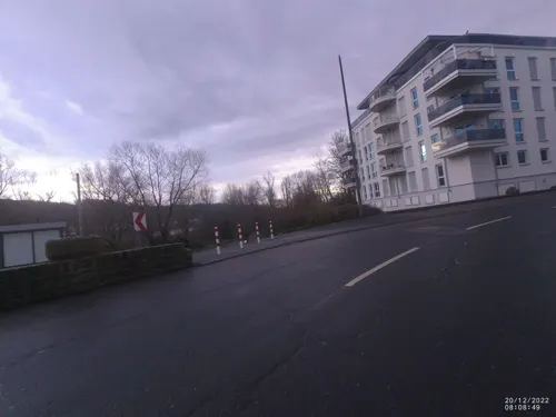
RheinHotel ARTE
Restaurant · International · 3.9 km
3 Rheinallee, Remagen
Mo-Fr 07:00-10:00, 17:00-21:00; Sa, Su 07:00-11:00, 17:00-21:00
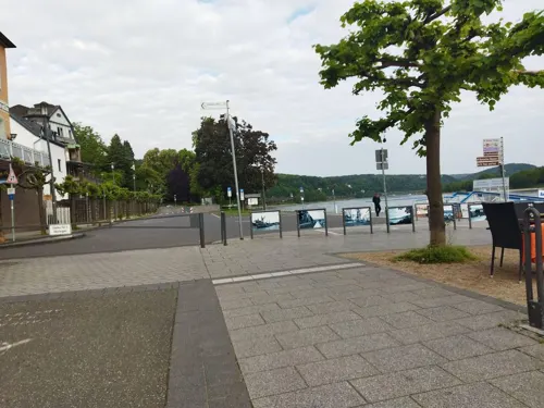
Casa Antonio Lopez
Restaurant · Spanish
1 Apollinarisberg, Remagen
Mo-Sa 18:00-23:00; Tu off; Su 17:30-22:00

Fra Bartolo
Restaurant · 2.5 km
WiFi AC-Point for free Wifi without password
44 Frankfurter Straße, Unkel
11:00-14:30, 17:00-00:00
Goldteig
Restaurant · Pizza · 2.4 km
100 Hauptstraße, Bad Bodendorf
Mo-Fr 11:30-14:00,17:00-21:30; Sa 17:00-21:30; Su 14:00-21:00
Goretti
Restaurant · Pizza · 3.1 km
7 Kirchstraße, Bruchhausen
Mo-Su 11:00-14:00,16:30-22:15; Sa 16:30-22:15; PH open
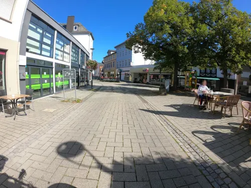
Kanpa's
Cafe · Turkish, Coffee Shop, Brunch, Cake, Dessert, Pastry, Soup, Middle Eastern, Salad, Bagel, Tea, Breakfast, Pancake · 4.2 km
1a Ausdorferstraße, Sinzig
Mo-Su 08:30-19:00
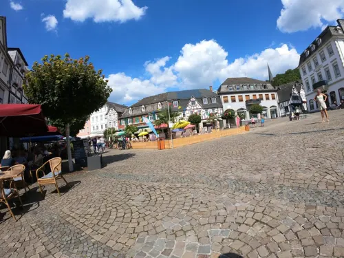


Om Maat
Restaurant · German · 1.0 km
6 Marktplatz, Erpel
We-Fr 11:00-14:00, 17:00-22:00; Sa-Su 11:00-22:00
Pizzeria & Restaurante Franco
Restaurant · Italian · 4.2 km
2 Vor dem Leetor, Linz am Rhein
We-Su 11:30-14:00,18:00-22:00; Mo,Tu off
143 more on the map.
History
The Roman Empire built a border fort at Rigomagus (or Ricomagus), west of the Rhine. This was about 12 miles north of the site of the first bridge ever built across the Rhine (at Neuwied). This bridge fought the river current by being built on timbers which were driven into the bed at a slant. Caesar's troops spent nearly three weeks on the east side of the river, then crossed back over, destroying the bridge to prevent its use by German raiders. A second bridge was likewise destroyed by the builders once they were through with it.
The fort was one of a series built by Drusus, commander of the Roman army along the Rhine. Other Roman construction survived the centuries, including a gateway and Remagen became a tourist destination, popular with history buffs. Remagen appears on the 4th century Peutinger Map.
Local legend says that a ship carrying various relics from Milan to Cologne was stopped in the river in 1164, unable to move despite the strong current, until it mysteriously edged in toward the shore. The remains of Saint Apollinaris were put ashore, and the ship was then able to sail onward. These remains were interred in a chapel which had been part of the Roman fort, which became the basis for a church which bore his name, and was rebuilt several times over the years.
From the History section of Remagen on Wikipedia, under CC BY-SA 4.0.
Where to stay24
Churches and places of worship49
ehem. kath. Filialkirche St. Simeon
Church · Catholic · 3.3 km
62 Linzhausenstraße, Linz
Sankt Johannes Nepomuk
Church · Roman Catholic · 3.7 km
71 Quellenstraße, Remagen
Shopping44
Gas and EV charging12
Schools, colleges and libraries22
Healthcare14
Map of Remagen
250 places. The map loads OpenStreetMap tiles when you open it.
Getting there and nearby towns
Cologne Bonn Airport (CGN) is the nearest airport with scheduled flights listed in OpenStreetMap, 33 km away.
- Sinzig 4 km south, about 4 min by car
- Bad Honnef 7 km north, about 7 min by car
- Königswinter 11 km north, about 11 min by car
- Wachtberg 11 km northwest, about 11 min by car
- Meckenheim 15 km west, about 15 min by car
- Bonn 20 km northwest, about 20 min by car
- Rheinbach 20 km west, about 20 min by car
- Sankt Augustin 22 km north, about 22 min by car
- Hennef (Sieg) 22 km north, about 22 min by car
- Alfter 23 km northwest, about 23 min by car
Drive times are estimates from straight-line distance, not routes.
Local news
Headlines from INDB.
Reviews, tips and questions
Loading what members have shared...
Sources and licences
- GeoNames (CC BY 4.0): population, coordinates, regions and time zone
- Mapillary (see each image): photos
- OpenStreetMap contributors (ODbL 1.0): places, airports, map data
- Wikidata (CC0 1.0): elevation, founding date, time zone, website, landmarks and historic places
- Wikimedia Commons (see each image): photos
- Wikipedia (CC BY-SA 4.0): overview and history text
Photo credits
- Apollinariskirche Remagen nachts, Gernot Ingo Vazquez Vazquez, CC BY 3.0
- Remagen Drususplatz 3, Schattenweid, CC BY-SA 3.0 de
- Remagen Stadtmauer, Schattenweid, CC BY-SA 3.0 de
- Remagen Milchgasse 8, Schattenweid, CC BY-SA 3.0 de
- Stolperstein Sophia Levy, Bachstraße 19, Remagen, Josef 'Jupp' Schugt (aka 'Penpen'), CC BY 4.0
- Stolperstein Jonas Levy, Bachstraße 19, Remagen, Josef 'Jupp' Schugt (aka 'Penpen'), CC BY 4.0
- Stolperstein Henriette Wolffs, Bachstraße 19, Remagen, Josef 'Jupp' Schugt (aka 'Penpen'), CC BY 4.0
- Remagen, Straßenbaudenkmal von 1768, Manfred Schröter, Berga, CC BY-SA 4.0
- Remagen Bachstraße 13, Schattenweid, CC BY-SA 3.0 de
- 2022-07-30 Pilgrimage to Remagen foto-20, Velopilger, CC BY-SA 4.0
- Remagen Pfarrhoftor romanisch Detail 315 IMG 20240205 2205, Karlunun, CC0
- Remagen Pfarrhof Pforte romanisch 15 IMG 20240205 2206, Karlunun, CC0
- Remagen Pfarrhoftor romanisch 15 IMG 20240205 2204, Karlunun, CC0
- Remagen Pfarrhof Pforte romanisch Detail 15 IMG 20240205 2206, Karlunun, CC0
- Remagen - St. Peter und Paul, Hochaltar (2006-04-01 Sp), Spurzem, CC BY-SA 4.0
- Remagen - St. Peter und Paul, Detail Seitenaltar Flucht nach Ägypten (2006-04-01 Sp), Spurzem, CC BY-SA 4.0
- Remagen Kirchstraße 13, Schattenweid, CC BY-SA 3.0 de
- Remagen Kirchstraße 5, Schattenweid, CC BY-SA 3.0 de
- Remagen Kirchstraße 7, Schattenweid, CC BY-SA 3.0 de
- Remagen-Rheinpromenade 53, Schattenweid, CC BY-SA 3.0 de
- Remagen Milchgasse 9, Schattenweid, CC BY-SA 3.0 de
- Remagen-Rheinpromenade 42, Schattenweid, CC BY-SA 3.0 de
- Remagen - panoramio - Jakkes (1), Jakkes, CC BY-SA 3.0
- Marienbrunnen und Rathaus in Remagen, Gerd Fahrenhorst, CC BY 4.0
- Remagen Rudolf Caracciola Denkmal, Oliver Rockstedt, CC BY 4.0
- 53424 Remagen, Germany - panoramio, Stuart Locke, CC BY-SA 3.0
- Remagen Wegkreuz Deichweg, Schattenweid, CC BY-SA 3.0 de
- Remagen Am Spich 8, Schattenweid, CC BY-SA 3.0 de
- Remagen Stadtmauer 02, Schattenweid, CC BY-SA 3.0 de
- Motorschiff Deo Gratias - ENI 02330219 - auf dem Rhein vor Remagen-4798, Raimond Spekking, CC BY-SA 4.0
- Ausflugsschiff Godesia - ENI 04306090 - auf dem Rhein vor Remagen-4794, Raimond Spekking, CC BY-SA 4.0
- Ausflugsschiff Godesia - ENI 04306090 - auf dem Rhein vor Remagen-4796, Raimond Spekking, CC BY-SA 4.0
- Koppelverband Deo Gratias - ENI 02330219 und 02330542 - auf dem Rhein vor Remagen-4792, Raimond Spekking, CC BY-SA 4.0
- Bolkow Bo 209 Monsun 150FF - D-EAAT - over Remagen-4768, Raimond Spekking, CC BY-SA 4.0
- Ludendorff Bridge from Erpeler Ley, U.S. Army Signal Corps, National Archives, Public domain
- Apollinariskirche, IllusionFactory, CC BY-SA 3.0
- Schloss Marienfels, Tohma ( talk ), CC BY-SA 4.0
- Sinzig church, Doris Antony , Berlin, CC BY-SA 3.0
- Bad Bodendorf Burg586, GFreihalter, CC BY-SA 3.0
- Sankt Severinus Erpel-2, Sankt_Severinus_Erpel.jpg : Tohma derivative work: Rabanus Flavus ( talk ), CC BY-SA 3.0
- Kripp(Remagen)St.Johannes Nepomuk785, GFreihalter, CC BY-SA 3.0
- Stux Unkel, Thomas Wolf ( Der Wolf im Wald ), CC0
- Untere Burg Rheinbreitbach 2, Tohma ( talk ), CC BY-SA 4.0
- Sankt Pantaleon Unkel, Tohma ( talk ), CC BY-SA 4.0
- Martinus-Gymnasium, Thomas Wolf ( Der Wolf im Wald ), CC BY-SA 3.0
- Willy-Brandt-Forum Außenansicht, Nicolas17, CC BY-SA 3.0 de
- FRIEDENSMUSEUM Brücke von Remagen Juli 2024, MeCorbeau, CC0
- Evangelische Kirche, Oberwinter-5708, Raimond Spekking, CC BY-SA 4.0
- Sinzig Feltenturm, Doris Antony , Berlin, CC BY-SA 3.0
- Servitessenkirche Linz Stadtarchiv, Tohma, CC BY-SA 4.0
- Linzhausenstraße 62,, Gisela Görgens, CC0
- Tier- und Naturfreunde Schwanenteich, Sanqui, CC0
- Rheintor Linz am Rhein, Tohma ( talk ), CC BY-SA 4.0
- Neutor Linz am Rhein 2009, Tohma ( talk ), CC BY-SA 4.0
- Pulverturm Linz am Rhein, Dr. Eugen Lehle, CC BY-SA 3.0
- Erpeler Ley 001, Кузнецов Сергей Михайлович (Kusnezow Sergej), CC BY-SA 3.0
- Ahr, Mündung, Wolkenkratzer, CC BY-SA 3.0
- Wohnmobilstellplatz Goldene Meile, Remagen-090439, Raimond Spekking, CC BY-SA 4.0
- Remagen, Kapelle Schwarze Madonna, Manfred Schröter, Berga, CC BY-SA 4.0
- Unkel Henkel-Park 518, Reinhardhauke, CC BY-SA 3.0
- Rheinbreitbach Koppel Schneise, Leit, CC BY-SA 4.0
- Blick vom Kaiserberg in Linz am Rhein auf die Ahrmündung, Geysirius, CC BY-SA 4.0
- Street-level photo, VIA_CH, CC BY-SA 4.0
- Street-level photo, bernd1960, CC BY-SA 4.0
- Street-level photo, changchun1, CC BY-SA 4.0
- Street-level photo, derzornigemarkus, CC BY-SA 4.0
- Street-level photo, raymond, CC BY-SA 4.0
- Street-level photo, Lowiekse, CC BY-SA 4.0
- Street-level photo, raymond, CC BY-SA 4.0
- Street-level photo, VIA_CH, CC BY-SA 4.0
- Street-level photo, bernd1960, CC BY-SA 4.0
- Street-level photo, bernd1960, CC BY-SA 4.0
- Street-level photo, kalcaaro, CC BY-SA 4.0
- Street-level photo, bernd1960, CC BY-SA 4.0
- Street-level photo, bernd1960, CC BY-SA 4.0
- Street-level photo, bernd1960, CC BY-SA 4.0
- Street-level photo, wolly79, CC BY-SA 4.0
- Street-level photo, schwing, CC BY-SA 4.0
- Street-level photo, bernd1960, CC BY-SA 4.0
- Street-level photo, bernd1960, CC BY-SA 4.0
- Street-level photo, VIA_CH, CC BY-SA 4.0
- Street-level photo, bernd1960, CC BY-SA 4.0
- Street-level photo, bernd1960, CC BY-SA 4.0
- Street-level photo, bernd1960, CC BY-SA 4.0
- Street-level photo, stili, CC BY-SA 4.0
- Street-level photo, bernd1960, CC BY-SA 4.0
- Street-level photo, mfa, CC BY-SA 4.0
- Street-level photo, VIA_CH, CC BY-SA 4.0


Page built November 8, 2026. Spotted a mistake? Tell us or suggest a place.