


Why visit Sinzig
Townapedia lists 184 museums and landmarks, 37 parks and trails, 166 places to eat, 20 places to stay and 22 attractions in and around town.
Highlights include Wildlife park "swan pond", Felten Turm, Schloss Arenfels and Friedensmuseum Brücke von Remagen.
Weather in Sinzig
Forecast from MET Norway (CC BY 4.0). Full forecast
About Sinzig
Sinzig (German pronunciation: [ˈzɪntsɪç] ) is a town in the district of Ahrweiler, in Rhineland-Palatinate, Germany. It is situated on the river Rhine, about 5 km south-east of Remagen and 25 km south-east of Bonn, and it has approximately 20,000 inhabitants (2004).
From the Wikipedia article Sinzig (this version), under CC BY-SA 4.0.
Things to do22








10 more on the map.
Museums and landmarks184

Schloss Arenfels
Monument and historic site · 4.9 km
0 Schloss Arenfels, Bad Hönningen
Apr-Oct Su 11:30-15:00

Friedensmuseum Brücke von Remagen
Museum · 3.8 km
May-Oct: 10:00-18:00; Mar 07-Apr 30: 10:00-17:00; Nov 01-15:...

Rheintor
Monument and historic site · 3.3 km
1 Burgplatz, Linz am Rhein

Bad Breisig
Monument and historic site · 3.2 km
Archaeological site in Germany


HeimatMuseum
Museum
35 Barbarossastraße
Apr-Oct Th 14:00-17:00, Apr-Oct Fr 13:00-17:00, Apr-Oct Sa-Su...


172 more on the map.
Parks, trails and playgrounds37
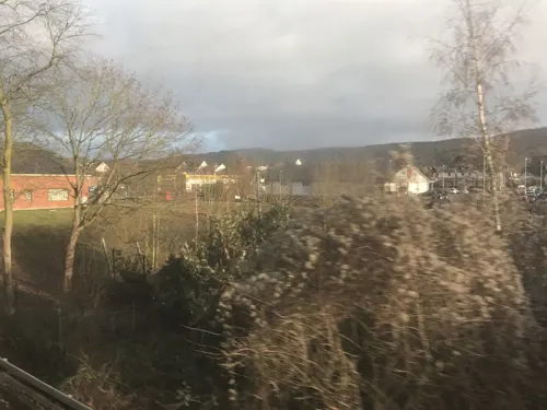
Märchenwald Bad Breisig
Sports field and stadium · 4.5 km
Eingang an der Straße
Am Kesselberg, Bad Breisig
Apr-Jun: Sa,Su,PH 10:00-18:00; Jul-Aug Mo-Su 10:00-18:00; Sep-Oct...






25 more on the map.
Restaurants and cafes166
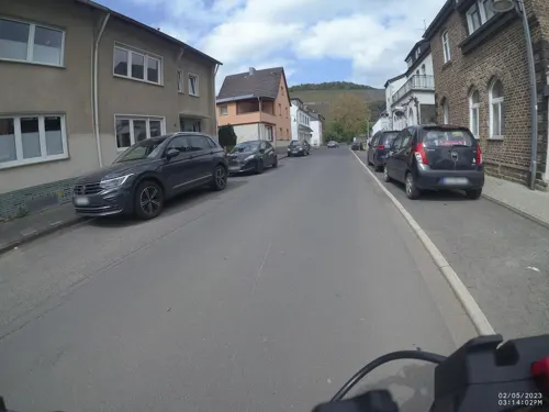
Nelles Winery
Brewery and winery · 4.8 km
13a Göppinger Straße, Bad Neuenahr-Ahrweiler
Mo-Fr 09:00-12:00,14:00-17:00; Sa 10:00-14:00
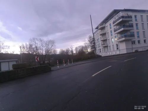
RheinHotel ARTE
Restaurant · International · 2.8 km
3 Rheinallee, Remagen
Mo-Fr 07:00-10:00, 17:00-21:00; Sa, Su 07:00-11:00, 17:00-21:00
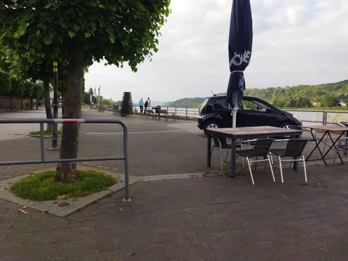
Altes Zollhaus
Restaurant · German · 5.2 km
16 Rheinufer, Bad Breisig
Mo,Tu off; We-Su 17:00+; PH 17:00+
Casa Antonio Lopez
Restaurant · Spanish · 4.4 km
1 Apollinarisberg, Remagen
Mo-Sa 18:00-23:00; Tu off; Su 17:30-22:00

Goldteig
Restaurant · Pizza · 2.5 km
100 Hauptstraße, Bad Bodendorf
Mo-Fr 11:30-14:00,17:00-21:30; Sa 17:00-21:30; Su 14:00-21:00
Kanpa's
Cafe · Turkish, Coffee Shop, Brunch, Cake, Dessert, Pastry, Soup, Middle Eastern, Salad, Bagel, Tea, Breakfast, Pancake
1a Ausdorferstraße, Sinzig
Mo-Su 08:30-19:00


Min An
Restaurant · Vietnamese · 5.1 km
4 Landskroner Straße, Bad Neuenahr-Ahrweiler
Tu-Fr 11:00-14:30,17:00-21:30; Sa-Su,PH 12:30-21:30
Om Maat
Restaurant · German · 4.4 km
6 Marktplatz, Erpel
We-Fr 11:00-14:00, 17:00-22:00; Sa-Su 11:00-22:00
154 more on the map.
History
Sinzig received its first official recognition in 762 A.D. On 10 July that year, King Pippin the Younger, the father of Charlemagne, presented a certificate of his decree in the Palace of Sinzig (Sentiaco Palacio), officially recognizing the town as "Sentiacum."
Abraham of Augsburg; a convert to Judaism, along with 61 other Jews, was slain in a pogrom in Sinzig in 1265.
Sinzig first received its rights as a town on 9 October 1267.
Because of the influence Emperor Frederick Barbarossa had on the town, it is nicknamed a "Barbarossa town". Ivan Turgenev immortalized the town in his 1857 novella Asya.
Twice, the medieval town, which since 1300 has been protected by a massive wall, was almost entirely destroyed by fires, one in 1583 and another in 1758. Little of the wall now remains, as industrialization and urban development led to its nearly complete loss at the end of the 19th century. After World War II, Sinzig experienced a population explosion and soon evolved into an industrial town.
With the district reform of 1969, Bad-Bodendorf, Franken, Koisdorf, Löhndorf, and Westum became provinces of Sinzig. Today, Sinzig, together with the town of Remagen, have developed a modern consumer centre, with multiple schools and shopping centres.
From the History section of Sinzig on Wikipedia, under CC BY-SA 4.0.
Where to stay20
Churches and places of worship51
Apollinariskirche
Church · Roman Catholic · 4.5 km
4 Apollinarisberg, Remagen
ehem. kath. Filialkirche St. Simeon
Church · Catholic · 3.6 km
62 Linzhausenstraße, Linz
Sankt Johannes Nepomuk
Church · Roman Catholic · 2.4 km
71 Quellenstraße, Remagen
Shopping44
Gas and EV charging12
Schools, colleges and libraries21
Healthcare13
Map of Sinzig
250 places. The map loads OpenStreetMap tiles when you open it.
Getting there and nearby towns
Cologne Bonn Airport (CGN) is the nearest airport with scheduled flights listed in OpenStreetMap, 37 km away.
- Bad Honnef 11 km north, about 11 min by car
- Wachtberg 14 km northwest, about 14 min by car
- Königswinter 15 km north, about 15 min by car
- Meckenheim 18 km northwest, about 18 min by car
- Rheinbach 23 km northwest, about 23 min by car
- Bonn 24 km northwest, about 24 min by car
- Sankt Augustin 26 km north, about 26 min by car
- Hennef (Sieg) 26 km north, about 26 min by car
- Alfter 27 km northwest, about 27 min by car
- Siegburg 29 km north, about 29 min by car
Drive times are estimates from straight-line distance, not routes.
Local news
Headlines from INDB.
Reviews, tips and questions
Loading what members have shared...
Sources and licences
- GeoNames (CC BY 4.0): population, coordinates, regions and time zone
- Mapillary (see each image): photos
- OpenStreetMap contributors (ODbL 1.0): places, airports, map data
- Wikidata (CC0 1.0): elevation, founding date, time zone, website, landmarks and historic places
- Wikimedia Commons (see each image): photos
- Wikipedia (CC BY-SA 4.0): overview and history text
Photo credits
- Sinzig Schloss, Tohma ( talk ) / Doris Antony , Berlin, CC BY-SA 3.0
- Sinzig Haus Ausdorferstraße 9, Oliver Rockstedt, CC BY 4.0
- Sinzig Haus Mühlenbachstraße 32, Oliver Rockstedt, CC BY 4.0
- Sinzig Haus Eulengasse 2, Oliver Rockstedt, CC BY 4.0
- Sinzig Haus Mühlenbachstraße 31, Oliver Rockstedt, CC BY 4.0
- Sinzig Haus Eulengasse 4, Oliver Rockstedt, CC BY 4.0
- Sinzig Haus Mühlenbachstraße 1, Oliver Rockstedt, CC BY 4.0
- Sinzig Haus Ausdorferstraße 3, Oliver Rockstedt, CC BY 4.0
- Sinzig Kreuz Koisdorfer Straße, Oliver Rockstedt, CC BY 4.0
- Sinzig Haus Bachovenstraße 6, Oliver Rockstedt, CC BY 4.0
- Sinzig Rudi Altig Denkmal Le Roi du Peloton, Oliver Rockstedt, CC BY 4.0
- Sinzig Friedhofskapelle Herrental, Oliver Rockstedt, CC BY 4.0
- Sinzig Haus Bachovenstraße 8, Oliver Rockstedt, CC BY 4.0
- Sinzig Trierer Hof, Oliver Rockstedt, CC BY 4.0
- Sinzig Haus Schloßstraße 4, Oliver Rockstedt, CC BY 4.0
- Sinzig Haus Renngasse 17, Oliver Rockstedt, CC BY 4.0
- Sinzig Villa Kölner Straße 8, Oliver Rockstedt, CC BY 4.0
- Bb1124 0313 schloss sinzig, Michael papenberg, CC BY-SA 4.0
- Sinzig Haus Tuchergasse 14, Oliver Rockstedt, CC BY 4.0
- Sinzig St Peter, Doris Antony , Berlin, CC BY-SA 3.0
- Sinzig Rathaus, Doris Antony , Berlin, CC BY-SA 3.0
- Sinzig Kirchplatz Rathaus St. Peter, Tohma ( talk ), CC BY-SA 4.0
- Rathaus Sinzig, Tohma ( talk ), CC BY-SA 4.0
- St. Peter Sinzig 02, Tohma ( talk ), CC BY-SA 4.0
- St. Peter Sinzig 01, Tohma ( talk ), CC BY-SA 4.0
- Stephan Maria Glöckner Sinziger Weinsommer 2017, Oliver Rockstedt, CC BY-SA 4.0
- Sinzig Haus Kirchgasse 7, Oliver Rockstedt, CC BY 4.0
- Sinzig Weyerburg Rheinstraße 47, Oliver Rockstedt, CC BY 4.0
- Sinzig StPeter v S, Beckstet, CC BY-SA 3.0
- Sinzig StPeter Pieta, Beckstet, CC BY-SA 3.0
- Sinzig StPeter n O2, Beckstet, CC BY-SA 3.0
- Sinzig, Heiliges Grab, Rolf Kranz, CC BY-SA 4.0
- Sinzig StPeter Chor, Beckstet, CC BY-SA 3.0
- Sinzig Haus Kirchgasse 18, Oliver Rockstedt, CC BY 4.0
- Sinzig StPeter Madonna, Beckstet, CC BY-SA 3.0
- Sinzig St. Peter Triptychon, Beckstet, CC BY-SA 3.0
- Sinzig, St. Peter - Blick auf den Chor 20200810 174108, Hannibal34, CC BY-SA 4.0
- Sinzig, St. Peter - Gewölbe der Vierung und der Seitenschiffe 20200810 174200, Hannibal34, CC BY-SA 4.0
- Sinzig StPeter Vierung, Beckstet, CC BY-SA 3.0
- Ludendorff Bridge from Erpeler Ley, U.S. Army Signal Corps, National Archives, Public domain
- Bad Hoenningen Arenfels, Doris Antony , Berlin, CC BY-SA 3.0
- Apollinariskirche, IllusionFactory, CC BY-SA 3.0
- Sinzig church, Doris Antony , Berlin, CC BY-SA 3.0
- Bad Bodendorf Burg586, GFreihalter, CC BY-SA 3.0
- Sankt Severinus Erpel-2, Sankt_Severinus_Erpel.jpg : Tohma derivative work: Rabanus Flavus ( talk ), CC BY-SA 3.0
- Kripp(Remagen)St.Johannes Nepomuk785, GFreihalter, CC BY-SA 3.0
- Erpel - Erpeler Ley, Wolkenkratzer, CC BY-SA 3.0
- Martinus-Gymnasium, Thomas Wolf ( Der Wolf im Wald ), CC BY-SA 3.0
- FRIEDENSMUSEUM Brücke von Remagen Juli 2024, MeCorbeau, CC0
- Sinzig Feltenturm, Doris Antony , Berlin, CC BY-SA 3.0
- Friedenskirche Remagen-4801, Raimond Spekking, CC BY-SA 4.0
- Servitessenkirche Linz Stadtarchiv, Tohma, CC BY-SA 4.0
- Linzhausenstraße 62,, Gisela Görgens, CC0
- Tier- und Naturfreunde Schwanenteich, Sanqui, CC0
- Rheintor Linz am Rhein, Tohma ( talk ), CC BY-SA 4.0
- Neutor Linz am Rhein 2009, Tohma ( talk ), CC BY-SA 4.0
- Pulverturm Linz am Rhein, Dr. Eugen Lehle, CC BY-SA 3.0
- Schloss Ahrenthal Luftbild 01, MFSG, CC BY-SA 3.0
- Erpeler Ley 001, Кузнецов Сергей Михайлович (Kusnezow Sergej), CC BY-SA 3.0
- Ahr, Mündung, Wolkenkratzer, CC BY-SA 3.0
- Wohnmobilstellplatz Goldene Meile, Remagen-090439, Raimond Spekking, CC BY-SA 4.0
- Remagen, Kapelle Schwarze Madonna, Manfred Schröter, Berga, CC BY-SA 4.0
- Kapelle Ockenfels, Tohma ( talk ), CC BY-SA 4.0
- Blick vom Kaiserberg in Linz am Rhein auf die Ahrmündung, Geysirius, CC BY-SA 4.0
- Wallgraben Bad Breisig Auf dem Hahn B2, JS Lonscet, CC BY-SA 4.0
- Street-level photo, VIA_CH, CC BY-SA 4.0
- Street-level photo, VIA_CH, CC BY-SA 4.0
- Street-level photo, changchun1, CC BY-SA 4.0
- Street-level photo, bernd1960, CC BY-SA 4.0
- Street-level photo, bernd1960, CC BY-SA 4.0
- Street-level photo, kalcaaro, CC BY-SA 4.0
- Street-level photo, bernd1960, CC BY-SA 4.0
- Street-level photo, Lowiekse, CC BY-SA 4.0
- Street-level photo, VIA_CH, CC BY-SA 4.0
- Street-level photo, raymond, CC BY-SA 4.0
- Street-level photo, bernd1960, CC BY-SA 4.0
- Street-level photo, raymond, CC BY-SA 4.0
- Street-level photo, changchun1, CC BY-SA 4.0
- Street-level photo, wolly79, CC BY-SA 4.0
- Street-level photo, derzornigemarkus, CC BY-SA 4.0
- Street-level photo, miguel_andrade, CC BY-SA 4.0
- Street-level photo, bitnapper, CC BY-SA 4.0
- Street-level photo, derzornigemarkus, CC BY-SA 4.0
- Street-level photo, Lowiekse, CC BY-SA 4.0
- Street-level photo, bernd1960, CC BY-SA 4.0
- Street-level photo, VIA_CH, CC BY-SA 4.0
- Street-level photo, bernd1960, CC BY-SA 4.0
- Street-level photo, bernd1960, CC BY-SA 4.0
- Street-level photo, bernd1960, CC BY-SA 4.0
- Street-level photo, bernd1960, CC BY-SA 4.0
- Street-level photo, bernd1960, CC BY-SA 4.0
- Street-level photo, bernd1960, CC BY-SA 4.0
- Street-level photo, bernd1960, CC BY-SA 4.0
- Street-level photo, VIA_KK, CC BY-SA 4.0
- Street-level photo, derzornigemarkus, CC BY-SA 4.0
- Street-level photo, raymond, CC BY-SA 4.0


Page built November 8, 2026. Spotted a mistake? Tell us or suggest a place.