


Rheinstetten, Germany
Rheinstetten is a town of 20,378 people in Baden-Wurttemberg, Germany.
Why visit Rheinstetten
Townapedia lists 31 museums and landmarks, 79 parks and trails, 139 places to eat, 9 places to stay and 2 attractions in and around town.
Highlights include Hofladen Gebrüder Kless, Naturschutzzentrum Rappenwört, Friedrich Weick and Allmendäcker.
Weather in Rheinstetten
Forecast from MET Norway (CC BY 4.0). Full forecast
About Rheinstetten
Rheinstetten (German pronunciation: [ʁaɪnˈʃtɛtn̩] ; South Franconian: Rhoischdedde) is a town in the west of Baden-Württemberg on the border to Rhineland-Palatinate. It is situated to the south-west of Karlsruhe and belongs to the rural district of Karlsruhe. The city has fewer inhabitants than Bruchsal, Ettlingen, Bretten and Stutensee and is therefore the fifth largest city in the district of Karlsruhe. Since 2005 it has formed part of a regional organization for economy, science, culture and administration, the Technologieregion Karlsruhe.
From the Wikipedia article Rheinstetten (this version), under CC BY-SA 4.0.
Things to do2

Hofladen Gebrüder Kless
Farm and orchard
6 Karlsruher Straße, Rheinstetten
Mo-Sa 08:00-12:30, Mo-Fr 16:00-18:00

Museums and landmarks31

Naturschutzzentrum Rappenwört
Museum · 3.1 km
47 Hermann-Schneider-Allee, Karlsruhe
Apr-Sep Tu-Fr 12:00-17:00; Su, PH 11:00-17:00; Jan-Mar, Oct-Dec...




19 more on the map.
Parks, trails and playgrounds79




Rheinniederung zwischen Au am Rhein, Durmersheim und Rheinstetten
Hiking and trails · 3.3 km

Rheinstrandbad Rappenwört
Sports field and stadium · 3.6 km
54 Hermann-Schneider-Allee, Karlsruhe
Mo-Su 09:00-20:00


67 more on the map.
Restaurants and cafes139
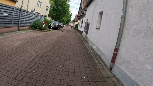
Akropolis
Restaurant · Greek · 1.3 km
3 Forchheimer Straße, Rheinstetten
Tu-Su 11:30-14:00,17:30-24:00; Sa 17:30-24:00

Aroy Aroy
Restaurant · Thai · 5.0 km
5a Joachim-Kurzaj-Weg, Karlsruhe
Mo-Fr 11:00-22:00; Sa,Su,PH 12:00-22:00
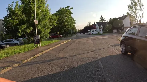
Badische Backstub'
Bakery · 4.3 km
52 Turnerstraße
Mo-Fr 06:00-13:00; Sa 06:00-13:00; PH,Su 07:00-13:00
Beim Bruderbund
Restaurant · Regional · 1.5 km
3 Jakobstraße, Rheinstetten
Mo-Fr 17:00-23:00; We off; Sa,Su 11:00-14:00,17:00-21:00
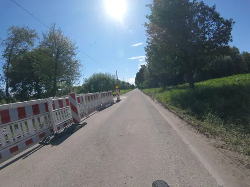
Beim Jannis
Restaurant · Greek · 2.5 km
101 Keplerstraße, Rheinstetten
Mo,Tu,Th-Sa 17:00-22:00; Su,PH 12:00-15:00,16:30-22:00; We off
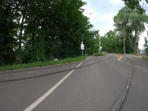
Casa Rustika
Restaurant · Italian · 4.1 km
3 Herman-Schneider-Allee, Karlsruhe
Mo,We-Fr 11:30-14:30,18:00-21:30; Sa 17:00-21:30; PH,Su 11:30-21:00
Da Gino
Restaurant · Italian · 1.4 km
53 Rheinaustraße, Rheinstetten
Tu-Fr 11:30-14:30,17:00-23:30; Sa 17:00-23:30; Su 11:30-14:30,17:00-22:00
Dubbegadde
Restaurant · Regional · 3.4 km
49d Hermann-Schneider-Allee, Karlsruhe
Mar-Oct: Tu-Su 11:30-20:30; Nov-Feb: We,Fr,Sa 11:30-20:30; Su 11:30-20:00
Fashion Asia Grill
Restaurant · Asian · 5.0 km
125 Daxlander Straße, Karlsruhe
Mo 11:30-15:00,17:30-22:00; Tu off; We-Su 11:30-15:00,17:30-22:00
Food Factory
Restaurant · Pizza, Turkish · 1.5 km
13 Große Kirchenstraße, Rheinstetten
Tu-Th 11:30-21:00; Fr-Su 11:30-22:00
Gaststätte TSV Grünwinkel
Restaurant · German, Mediterranean · 4.8 km
81a Durmersheimer Straße, Karlsruhe
Mo off; Tu-Sa 11:30-14:30, 17:00-23:00; Su,PH 11:30-23:00


Giebelstuben
Restaurant
2 Maxauer Straße, Rheinstetten
We-Fr 17:00-22:00, Sa 14:00-22:00, Su 17:00-22:00
127 more on the map.
History
Rheinstetten was founded on 1 January 1975, in the course of the reformation of municipalities in Baden-Württemberg. Three communities, Forchheim, Mörsch and Neuburgweier merged to form the district of Rheinstetten. By 1993 Rheinstetten had 23,000 inhabitants. It was thus the largest municipality of Baden-Württemberg in the 1990s without town privileges, and so it received these on 1 January 2000. Despite its size, the city did not apply to become a district seat until 2004. Then, on 14 September 2004, it was decided that Rheinstetten became a district seat of 2005, by the order of the Baden-Württemberg Council of Ministers.
From the History section of Rheinstetten on Wikipedia, under CC BY-SA 4.0.
Where to stay9
Churches and places of worship29
Maria Bickesheim
Church · Roman Catholic · 4.2 km
147 Hauptstraße, Durmersheim
Shopping32
Gas and EV charging11
Schools, colleges and libraries28
Healthcare11
Apotheke am Bickesheimer Platz
Clinic and pharmacy · 4.3 km
133 Hauptstraße, Durmersheim
Map of Rheinstetten
250 places. The map loads OpenStreetMap tiles when you open it.
Getting there and nearby towns
Airport Karlsruhe/Baden-Baden (FKB) is the nearest airport with scheduled flights listed in OpenStreetMap, 27 km away.
- Durmersheim 5 km southwest, about 5 min by car
- Karlsruhe 8 km northeast, about 8 min by car
- Ettlingen 8 km southeast, about 8 min by car
- Malsch 10 km south, about 10 min by car
- Rastatt 14 km southwest, about 14 min by car
- Eggenstein-Leopoldshafen 15 km northeast, about 15 min by car
- Gaggenau 19 km south, about 19 min by car
- Linkenheim-Hochstetten 20 km northeast, about 20 min by car
- Gernsbach 22 km south, about 22 min by car
- Baden-Baden 24 km south, about 24 min by car
Drive times are estimates from straight-line distance, not routes.
Local news
Headlines from INDB.
Reviews, tips and questions
Loading what members have shared...
Sources and licences
- GeoNames (CC BY 4.0): population, coordinates, regions and time zone
- Mapillary (see each image): photos
- OpenStreetMap contributors (ODbL 1.0): places, airports, map data
- Wikidata (CC0 1.0): elevation, founding date, time zone, website, landmarks and historic places
- Wikimedia Commons (see each image): photos
- Wikipedia (CC BY-SA 4.0): overview and history text
Photo credits
- St Ulrich - Mörsch -060, DALIBRI, CC BY-SA 4.0
- 20240728 Rheinstetten-Mörsch Rösselsbrünnle, Bussteig B, Mkkagain, CC0
- 20240728 Rheinstetten-Mörsch Rösselsbrünnle, Streckensignal S 72, Mkkagain, CC0
- 20240728 Rheinstetten-Mörsch Rösselsbrünnle, Gleis 1, Mkkagain, CC0
- 20240728 Rheinstetten-Mörsch, VBK Weiche 405, Mkkagain, CC0
- 20240728 VBK Einsystemstraßenbahn 307 an der Narzissenstraße, Rheinstetten-Mörsch, Mkkagain, CC0
- 20240728 Rheinstetten-Mörsch Narzissenstraße, Gleis 2, Mkkagain, CC0
- 20240728 Rheinstetten Mörsch Narzissenstraße, Gleis 1, Mkkagain, CC0
- 20240728 Rheinstetten Mörsch, Fahrschule Neu Außenansicht, Mkkagain, CC0
- Rheinstetten 92 P1220420, Robert Hösle, CC BY-SA 4.0
- 20240728 Rheinstetten-Forchheim Hauptstraße, Bussteig B, Mkkagain, CC0
- 20240728 Rheinstetten-Forchheim Hauptstraße, Bussteig A und VBK Streckensignal S 74, Mkkagain, CC0
- 20240728 Rheinstetten-Forchheim Hauptstraße, Gleis 1 und 2, Mkkagain, CC0
- Rheinstetten 92 P1220419, Robert Hösle, CC BY-SA 4.0
- Rheinstetten - Forchheim - panoramio (1), Baden de, CC BY 3.0
- Rheinstetten, Rathausstraße - panoramio, Baden de, CC BY 3.0
- Rheinstetten - Dammfeld - panoramio, Baden de, CC BY 3.0
- Rheinstetten - Forchheim - panoramio, Baden de, CC BY 3.0
- Zoo de Karlsruhe - Entrée, Root66, CC BY-SA 3.0
- Staatliche Akademie der Bildenden Kunste I, Martin Dürrschnabel, Public domain
- Portal-HKA-verhuellt2021, HsKAgoem, CC BY-SA 4.0
- Colonelkarlsruhe, Cindybeau, CC BY-SA 3.0
- Fritschlach NSG BW KA a, Günter Josef Radig, CC BY-SA 3.0
- Sandgrube im Dreispitz Mörsch NSG BW KA h, Günter Josef Radig, CC BY-SA 3.0
- Allmendäcker NSG BW KA d, Günter Josef Radig, CC BY-SA 3.0
- Kiesgrube am Hardtwald Durmersheim NSG BW KA b, Günter Josef Radig, CC BY-SA 3.0
- Altrhein Neuburgweier NSG BW KA Bellenkopf, Günter Josef Radig, CC BY-SA 3.0
- Rheinniederung zwischen Au am Rhein Durmersheim und Rheinstetten NSG BW KA b, Günter Josef Radig, CC BY-SA 3.0
- Bremengrund NSG BW KA a, Günter Josef Radig, CC BY-SA 3.0
- Kloster Maria Bickesheim, Gerhard Alberts, CC BY 2.5
- St Ulrich - Mörsch -001, DALIBRI, CC BY-SA 4.0
- St Ursula - Neuburgweier - alte Kirche 000, DALIBRI, CC BY-SA 4.0
- St Ursula - Neuburgweier - kath Pfarrkirche 001, DALIBRI, CC BY-SA 4.0
- Thomaskirche (Karlsruhe), Beate Gottwald, CC0
- Philippuskirche in Daxlanden - geo.hlipp.de - 18266, Harald Kucharek on geo.hlipp.de, CC BY-SA 2.0
- St. Martin (Forchheim), Rheinstetten, CC BY-SA 4.0
- Stolperstein für Friedrich Weick (Karlsruhe), Francisco Peralta Torrejón, CC BY-SA 4.0
- Stolperstein für Hermann Müller-Würtz (Karlsruhe) Römerstraße 2, Stolpersteineuploader, CC0
- Stolperstein für Ludwig Brieskorn (Karlsruhe) Durmersheimer Straße 77, Stolpersteineuploader, CC0
- NSG Goldgrund, Goldkehle, Hozro, CC0
- NSG Stixwörth, Hagenbacher Altrhein (3), Hozro, CC0
- Ettlinger Linie Stich 1857 nach Riecke 1734, „L. K.“, Public domain
- PAMINA - Hardtmuseum - panoramio, DURMERSHEIM, CC BY 3.0
- Rheinstrandbad Rappenwört - panoramio (1), Baden de, CC BY 3.0
- Street-level photo, mfa, CC BY-SA 4.0
- Street-level photo, marwe, CC BY-SA 4.0
- Street-level photo, marwe, CC BY-SA 4.0
- Street-level photo, changchun1, CC BY-SA 4.0
- Street-level photo, marwe, CC BY-SA 4.0
- Street-level photo, dns_vlpt, CC BY-SA 4.0
- Street-level photo, marwe, CC BY-SA 4.0
- Street-level photo, mfa, CC BY-SA 4.0
- Street-level photo, pic_nick, CC BY-SA 4.0
- Street-level photo, masterofnoroad, CC BY-SA 4.0
- Street-level photo, mathe-hilde, CC BY-SA 4.0
- Street-level photo, mathe-hilde, CC BY-SA 4.0
- Street-level photo, mfa, CC BY-SA 4.0
- Street-level photo, nvbwseifert, CC BY-SA 4.0
- Street-level photo, masterofnoroad, CC BY-SA 4.0
- Street-level photo, nakaner, CC BY-SA 4.0
- Street-level photo, marwe, CC BY-SA 4.0
- Street-level photo, marwe, CC BY-SA 4.0
- Street-level photo, mfa, CC BY-SA 4.0
- Street-level photo, marwe, CC BY-SA 4.0
- Street-level photo, marwe, CC BY-SA 4.0
- Street-level photo, marwe, CC BY-SA 4.0
- Street-level photo, morwas, CC BY-SA 4.0


Page built November 8, 2026. Spotted a mistake? Tell us or suggest a place.