


Eggenstein-Leopoldshafen, Germany
Eggenstein-Leopoldshafen is a town of 15,189 people in Baden-Wurttemberg, Germany.
Why visit Eggenstein-Leopoldshafen
Townapedia lists 26 museums and landmarks, 28 parks and trails, 87 places to eat, 4 places to stay and 6 attractions in and around town.
Highlights include Biolandhof Ritz, Erdbeer- und Spargelhof Markus Leicht, Heimatmuseum Leopoldshafen and Heimathaus Eggenstein.
Weather in Eggenstein-Leopoldshafen
Forecast from MET Norway (CC BY 4.0). Full forecast
About Eggenstein-Leopoldshafen
Eggenstein-Leopoldshafen is a municipality of almost 17,000 inhabitants located in the federal state of Baden-Württemberg in the Federal Republic of Germany. It lies about 12 km north of Karlsruhe and is the site of the northern campus of the research centre Karlsruhe Institute of Technology (with the former Forschungsreaktor 2 (FR2). In the west, Eggenstein-Leopoldshafen borders on the Rhine River and in the east it is connected with the Bundesstraße 36.
From the Wikipedia article Eggenstein-Leopoldshafen (this version), under CC BY-SA 4.0.
Things to do6

Biolandhof Ritz
Farm and orchard · 3.7 km
36 Bahnhofstraße, Linkenheim-Hochstetten
Tu-Fr 10:00-12:00; Fr 15:00-18:00; Sa 09:00-12:30
Erdbeer- und Spargelhof Markus Leicht
Farm and orchard · 0.6 km
21 Landstraße, Eggenstein-Leopoldshafen
Mo-Sa 08:00-19:00; Su 08:00-14:00; PH 08:00-14:00


Museums and landmarks26


Heimathaus Eggenstein
Museum · 1.3 km
8 Ankerberg, Eggenstein-Leopoldshafen
Su 11:00-16:00


Jagdgedenkstein: Ludwig Wilhelm von Baden 1885
Monument and historic site · 4.0 km
Projekt Venezuela
Monument and historic site · 3.8 km
Stadtattrappe im 2. Weltkrieg https://web.archive.org/web/20181116043303/https://www.landesarchiv-bw.de/web/45655
14 more on the map.
Parks, trails and playgrounds28



16 more on the map.
Restaurants and cafes87
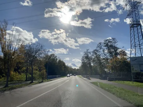

Chang Tong
Restaurant · Thai · 2.0 km
13 Sportplatzweg, Eggenstein-Leopoldshafen
Tu-Sa 17:00-22:00;Su,PH 11:00-15:00,17:00-22:00;Mo off
Deutscher Kaiser
Restaurant · German, Regional · 4.2 km
30 Teutschneureuter Straße, Karlsruhe
Th-Mo 17:30-24:00, Su 11:30-15:00,17:30-24:00
Gaststätte Vogelpark
Restaurant · Greek · 4.4 km
Bachenweg, Karlsruhe
We-Sa 17:00-21:00; Su 12:00-15:00,17:00-20:00; Mo,Tu off
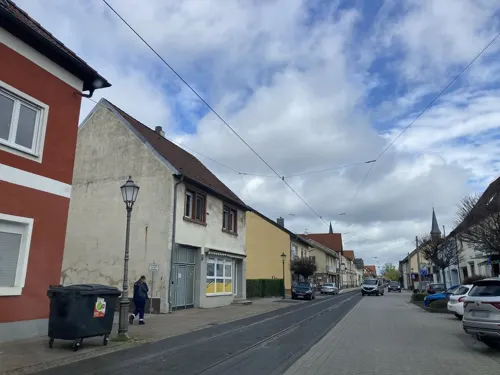
Grüner Baum
Restaurant · Greek · 3.6 km
15 Karlsruher Straße, Linkenheim-Hochstetten
Mo 17:00-23:00; We-Fr 17:00-23:00; Sa 16:00-23:00; Su,PH 12:00-21:00
Kaori
Restaurant · Sushi, Asian, Vietnamese · 4.7 km
3 Carré am Markt, Linkenheim-Hochstetten
Tu-Su 11:30-14:00, 17:00-22:00
Marianne's Flammkuchen
Restaurant · Regional · 3.7 km
8 Friedrichstaler Straße, Linkenheim-Hochstetten
Mo off; Tu-Sa 17:00+; Su, PH 16:00+
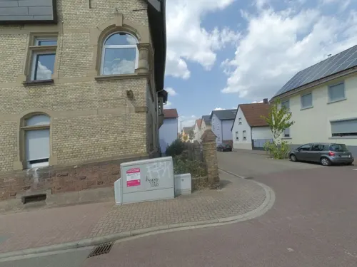
Mille Stelle
Restaurant · Italian · 1.7 km
21 Moltkestraße, Eggenstein-Leopoldshafen
Mo-Sa 17:00-22:00; Su,PH 16:30-22:00
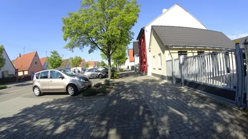


Nagels Kranz
Restaurant · 4.6 km
Reservierung erforderlich
210 Neureuter Hauptstraße, Karlsruhe
Tu-Sa 18:00-21:30; We,Th 12:00-14:00,18:00-21:30
Pizzeria Sofia
Restaurant · Pizza · 1.0 km
17 Heidelberger Straße, Eggenstein-Leopoldshafen
Mo-Su 16:00-22:00
75 more on the map.
Where to stay4
Churches and places of worship13
Evangelische Kirche Leopoldshafen
Church · Protestant · 1.0 km
10 Tullastraße, Eggenstein-Leopoldshafen
Evangelische Kirche Linkenheim
Church · Protestant · 3.9 km
66 Karlsruher Straße, Linkenheim-Hochstetten
St. Antonius
Church · Catholic · 1.8 km
9 Friedrichstraße, Eggenstein-Leopoldshafen
Liebenzeller Gemeinschaft Eggenstein
Church · Protestant · 1.7 km
22 A Luisenstraße, Eggenstein-Leopoldshafen
Shopping19
Selak Delikatessen
Grocery · 0.8 km
1 Mannheimer Straße, Eggenstein-Leopoldshafen
Gas and EV charging7
Schools, colleges and libraries18
Christliche Schule Hardt
School · Protestant · 4.6 km
8 Albert-Schweitzer-Straße, Linkenheim-Hochstetten
Grundschule Christliche Schule Hardt
School · Protestant · 3.8 km
49 Karlsruher Straße, Linkenheim-Hochstetten
Healthcare5
Curie Apotheke
Clinic and pharmacy · 0.8 km
15 Hardtstraße, Eggenstein-Leopoldshafen
Map of Eggenstein-Leopoldshafen
213 places. The map loads OpenStreetMap tiles when you open it.
Getting there and nearby towns
Airport Karlsruhe/Baden-Baden (FKB) is the nearest airport with scheduled flights listed in OpenStreetMap, 42 km away.
- Karlsruhe 9 km south, about 9 min by car
- Ettlingen 17 km south, about 17 min by car
- Philippsburg 16 km north, about 16 min by car
- Waghäusel 20 km northeast, about 20 min by car
- Malsch 23 km south, about 23 min by car
- Östringen 27 km northeast, about 27 min by car
- Rastatt 29 km southwest, about 29 min by car
- Hockenheim 28 km northeast, about 28 min by car
- Walldorf 30 km northeast, about 30 min by car
- Pforzheim 32 km southeast, about 32 min by car
Drive times are estimates from straight-line distance, not routes.
Local news
Headlines from INDB.
Reviews, tips and questions
Loading what members have shared...
Sources and licences
- GeoNames (CC BY 4.0): population, coordinates, regions and time zone
- Mapillary (see each image): photos
- OpenStreetMap contributors (ODbL 1.0): places, airports, map data
- Wikidata (CC0 1.0): elevation, founding date, time zone, website, landmarks and historic places
- Wikimedia Commons (see each image): photos
- Wikipedia (CC BY-SA 4.0): overview and history text
Photo credits
- Eggensteinbf, User Antifaschist 666 on de.wikipedia, CC BY-SA 3.0
- Karlsruhe Uni Hauptgebaeude, AlterVista at German Wikipedia, CC BY-SA 3.0
- Altrhein Kleiner Bodensee NSG BW KA d, Günter Josef Radig, CC BY-SA 3.0
- Landappbw 760881 1820 Ev. Pfarrkirche Eggenstein, Martin Hahn, CC0
- Leopoldshafen Evangelische Kirche 004, fl.schmitt, CC BY-SA 3.0
- Leopoldshafen Katholische Kirche Albertus Magnus 002, fl.schmitt, CC BY-SA 3.0
- EggLeo Heimatmuseum 1, fl.schmitt, CC0
- Eggenstein Katholische Kirche Antonius 002, fl.schmitt, CC BY-SA 3.0
- Vogelpark Neureut - panoramio (1), Baden de, CC BY 3.0
- Heimathaus - Eggenstein-Leopoldshafen 01, H. Zell, CC BY-SA 3.0
- Street-level photo, dns_vlpt, CC BY-SA 4.0
- Street-level photo, morwas, CC BY-SA 4.0
- Street-level photo, tasmaniadevil, CC BY-SA 4.0
- Street-level photo, tasmaniadevil, CC BY-SA 4.0
- Street-level photo, tasmaniadevil, CC BY-SA 4.0
- Street-level photo, mapper999, CC BY-SA 4.0
- Street-level photo, mfa, CC BY-SA 4.0
- Street-level photo, tasmaniadevil, CC BY-SA 4.0
- Street-level photo, tasmaniadevil, CC BY-SA 4.0
- Street-level photo, ebel, CC BY-SA 4.0
- Street-level photo, morwas, CC BY-SA 4.0
- Street-level photo, tasmaniadevil, CC BY-SA 4.0
- Street-level photo, wegavision, CC BY-SA 4.0
- Street-level photo, tasmaniadevil, CC BY-SA 4.0
- Street-level photo, tasmaniadevil, CC BY-SA 4.0
- Street-level photo, tasmaniadevil, CC BY-SA 4.0
- Street-level photo, tasmaniadevil, CC BY-SA 4.0
- Street-level photo, nakaner, CC BY-SA 4.0
- Street-level photo, wegavision, CC BY-SA 4.0
- Street-level photo, wegavision, CC BY-SA 4.0
- Street-level photo, wegavision, CC BY-SA 4.0
- Street-level photo, tasmaniadevil, CC BY-SA 4.0
- Street-level photo, drktfl, CC BY-SA 4.0
- Street-level photo, tasmaniadevil, CC BY-SA 4.0
- Street-level photo, tasmaniadevil, CC BY-SA 4.0
- Street-level photo, tasmaniadevil, CC BY-SA 4.0

Page built November 8, 2026. Spotted a mistake? Tell us or suggest a place.