


Why visit Rosenheim
Townapedia lists 51 museums and landmarks, 20 parks and trails, 267 places to eat, 14 places to stay and 10 attractions in and around town.
Highlights include Kinopolis, BEIM KERNER - Hofladen Kernerhof, Lokschuppen and Holztechnisches Museum.
Weather in Rosenheim
Forecast from MET Norway (CC BY 4.0). Full forecast
About Rosenheim
Rosenheim (German pronunciation: [ˈʁoːzn̩ˌhaɪm] ) is a city in Bavaria, Germany. It is an independent city located in the centre of the district of Rosenheim in Upper Bavaria, and is also the seat of its administration. It is located on the west bank of the Inn at the confluence of the rivers Inn and Mangfall, in the Bavarian Alpine Foreland. It is the third-largest city in Upper Bavaria with over 64,000 inhabitants.
From the Wikipedia article Rosenheim (this version), under CC BY-SA 4.0.
Travel tips from other travellers: Rosenheim on Wikivoyage (CC BY-SA 4.0).
Things to do10

Kinopolis
Cinema and theater · 0.7 km
Eingang: stufenlos Türbreite: > 90 cm Räume innerhalb: nicht alle Räume zugänglich
34 Kufsteiner Straße, Rosenheim
Mo-Th 13:30-21:00; Fr-Sa 13:30-23:30; Su 10:00-21:00

BEIM KERNER - Hofladen Kernerhof
Farm and orchard · 2.9 km
130 Vierzehnheiligenstraße, Stephanskirchen
Mo 13:00-18:00; Tu-Sa 08:00-18:00
Thanner Forellen
Farm and orchard · 2.9 km
111 Innleitenstraße, Stephanskirchen
Fr 08:00-12:00,13:00-18:00; Sa 08:00-12:00

Museums and landmarks51


Evangelisch-Lutherisches Pfarramt
Monument and historic site · Protestant · 0.7 km
23 Königstraße, Rosenheim



Bergmeisterhaus
Monument and historic site
Ehemaliger Pfarrhof
15 Max-Josefs-Platz, Rosenheim

Fortnerhaus
Monument and historic site
Vermutlich ältestes Gebäude in Rosenheim (13-14. Jahrhundert)
20 Max-Josefs-Platz, Rosenheim


Mittertor
Monument and historic site
Das Mittertor (das einzig erhaltene Markttor Rosenheims) war vor 1350 das Osttor des Marktes, der damals von einem doppelten Graben...
26 Ludwigsplatz, Rosenheim

Pumpenhaus
Monument and historic site
Ehemaliges Pumpenhaus der Salzsoleleitung
20 Kufsteiner Straße, Rosenheim
39 more on the map.
Parks, trails and playgrounds20



City Golf Rosenheim
Golf course · 2.8 km
Mehr als 30 Abschlagplätze (7 davon beleuchtet und überdacht) großzügiger Kurzspielbereich 9 LOCH Kurzplatz (Längen zwischen 60 und 140...
1 Moosbachstraße, Rosenheim






Am Graben
Playground · 3.4 km
Mar Su[-1]-Oct Su[-1] -1 day Mo-Su,PH 08:00-20:00, Oct Su[-1]-Mar...
8 more on the map.
Restaurants and cafes267

Athos
Restaurant · Greek · 1.5 km
1 Hofaustraße, Stephanskirchen
Mo-Su 11:30-14:30,17:00-23:00; Sa 17:00-23:00

Felice - Trattoria Pizzeria
Restaurant · Pizza, Italian · 1.1 km
Das Lokal "La Famiglia" (Eröffnung 12.06.2023) hat zum 21.12.2025 geschlossen - seit 06.01.2026 ist dort nun "Felice" (vorher...
18z Klepperstraße, Rosenheim
We-Su 11:00-14:00,17:00-22:00
Pomodoro - Cucina Siciliana
Restaurant · Pizza, Italian · 1.1 km
Das Lokal "Bistro Felice" ist umgezogen: Seit 06.01.2026 Klepperstraße 18z, RO / OSM-node 11327869822). Öffnungszeiten "neuer Name" lt....
7 Schießstattstraße, Rosenheim
Tu-Su 11:00-14:00,17:00-22:00
Amici
Restaurant · Italian
1 Gillitzerstraße, Rosenheim
Mo-Sa 11:30-14:30, 17:30-23:30; Su 17:00-23:30
Cochin 2 – Vietnamese Dining
Restaurant · Vietnamese
17 Kaiserstraße, Rosenheim
Mo,Tu,Th 17:30-22:30; We off; Fr,Sa 17:30-02:00; Su 16:30-22:00
DAS FAERBER - Tagesbar / Vinothek / Esszimmer
Restaurant
Café und Deli
4 Färberstraße, Rosenheim
Mo-Fr 08:00-18:30; Sa 09:00-18:00; Su 10:00-17:00
Da Mario e Claudia
Restaurant · Pizza · 1.1 km
25 Jahnstraße, Rosenheim
We-Fr 18:00-21:45; Sa-Su 17:00-21:45
Die Kunstmühle X Chiara e Francesco
Restaurant · Italian · 1.2 km
12a Kunstmühlstraße, Rosenheim
We-Fr 09:00-14:30,17:30-22:00; Sa-Su 09:00-22:00
Enchilada
Restaurant · Mexican
18 Schmettererstraße, Rosenheim
Su-Th 17:00-23:00; Fr 07:00-01:00; Sa 13:00-01:00
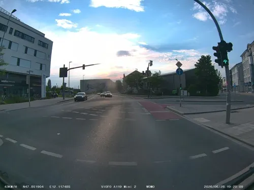


Jadevie Cuisine
Restaurant · Asian, Sushi · 0.6 km
74 Münchener Straße, Rosenheim
Tu-Su 11:30-14:30, 17:00-23:00
255 more on the map.
History
Rosenheim's development can be traced from its location on intersecting major trade routes. Even in early times, the town's intersecting traffic stimulated its development as a market town. It subsequently evolved from a market to a salt trade and then railway town to today's wood and college city.
From the History section of Rosenheim on Wikipedia, under CC BY-SA 4.0.
Where to stay14
Churches and places of worship43
St. Georg
Church · Roman Catholic · 1.9 km
16 Salzburger Straße, Stephanskirchen
Christkönig
Church · Roman Catholic · 0.6 km
8 Kardinal-Faulhaber-Platz, Rosenheim
Heilig-Geist-Kirche
Church · Roman Catholic
1 Heilig-Geist-Straße, Rosenheim
Shopping89
Gas and EV charging19
Schools, colleges and libraries39
Healthcare24
OPTYMED Apotheke im Kaufland
Clinic and pharmacy · 2.5 km
100 Äußere Münchener Straße, Rosenheim
Map of Rosenheim
250 places. The map loads OpenStreetMap tiles when you open it.
Getting there and nearby towns
Munich International Airport (MUC) is the nearest airport with scheduled flights listed in OpenStreetMap, 61 km away.
- Wasserburg am Inn 23 km north, about 23 min by car
- Traunreut 37 km east, about 37 min by car
- Vaterstetten 38 km northwest, about 38 min by car
- Traunstein 39 km east, about 39 min by car
- Taufkirchen 43 km northwest, about 43 min by car
- Waldkraiburg 44 km northeast, about 44 min by car
- Unterhaching 44 km northwest, about 44 min by car
- Munich 51 km northwest, about 51 min by car
- Unterföhring 52 km northwest, about 52 min by car
- Wolfratshausen 53 km west, about 53 min by car
Drive times are estimates from straight-line distance, not routes.
Local news
Headlines from INDB.
Reviews, tips and questions
Loading what members have shared...
Sources and licences
- GeoNames (CC BY 4.0): population, coordinates, regions and time zone
- Mapillary (see each image): photos
- OpenStreetMap contributors (ODbL 1.0): places, airports, map data
- Wikidata (CC0 1.0): elevation, founding date, time zone, website, landmarks and historic places
- Wikimedia Commons (see each image): photos
- Wikipedia (CC BY-SA 4.0): overview and history text
Photo credits
- Rosenheim Hl.-Geist-2010, G.Piezinger, CC BY-SA 3.0
- Rosenheim - Samerstraße, Tiia Monto, CC BY 4.0
- Prinzregentenstr 14 Rosenheim, Ricardalovesmonuments, CC BY-SA 4.0
- Rosenheim, Am Roßacker 2, Brauerei Steegmüller, 4, Renardo la vulpo, CC BY-SA 4.0
- Rosenheim, Prinzregentenstr 14 v SW, 3, Renardo la vulpo, CC BY-SA 4.0
- Rosenheim, Stollstr 1, Volkshochschule v SW, 1, Renardo la vulpo, CC BY-SA 4.0
- Prinzregentenstr 32 Rosenheim, Ricardalovesmonuments, CC BY-SA 4.0
- Heilig Geist Str Rosenheim, Allie Caulfield, CC BY 2.0
- Hl-GeistStr 48 Rosenheim 1, Ricardalovesmonuments, CC BY-SA 4.0
- Hl-GeistStr 48 Rosenheim 2, Ricardalovesmonuments, CC BY-SA 4.0
- Rosenheim 7, Tiia Monto, CC BY 4.0
- Gillitzerblock Rosenheim 1.2, Ricardalovesmonuments, CC BY-SA 4.0
- Gillitzerblock Rosenheim 1.4, Ricardalovesmonuments, CC BY-SA 4.0
- Gillitzerblock Rosenheim 1.3, Ricardalovesmonuments, CC BY-SA 4.0
- Gillitzerblock Rosenheim 1.1, Ricardalovesmonuments, CC BY-SA 4.0
- Kgl Filialbank Rosenheim, Allie Caulfield, CC BY 2.0
- Rosenheim, die Münchner Straße, Dguendel, CC BY 3.0
- Heilig-Geist-Kirche (Rosenheim) 1, Ricardalovesmonuments, CC BY-SA 4.0
- Heilig-Geist-Kirche (Rosenheim) 2, Ricardalovesmonuments, CC BY-SA 4.0
- Gillitzerblock Rosenheim 1.5, Ricardalovesmonuments, CC BY-SA 4.0
- Rosenheim, Häuserzeile in der Münchner Straße, Dguendel, CC BY 3.0
- Muenchner Str Rosenheim, Allie Caulfield, CC BY 2.0
- Rosenheim 6, Tiia Monto, CC BY 4.0
- Atrium Rosenheim, Allie Caulfield, CC BY 2.0
- Rosenheim, Salingarten, Kriegsgefangenendenkmal, Karsten Ratzke, CC0
- Max-Josefs-Platz Rosenheim 03, H.Helmlechner, CC BY-SA 4.0
- Schmettererstr 20 Rosenheim, Ricardalovesmonuments, CC BY-SA 4.0
- Gillitzerblock Rosenheim 1.6, Ricardalovesmonuments, CC BY-SA 4.0
- Rosenheim – Schmettererstr. 20 (Gasthof Mail Keller), User:Mattes, CC BY-SA 2.0
- Gillitzerblock Rosenheim 2, Allie Caulfield, CC BY 2.0
- Rosenheim, das Holztechnische Museum, Dguendel, CC BY 3.0
- Rosenheim, Haus Max-Josefs-Platz 4, Dguendel, CC BY 3.0
- Münchener Str 11 Rosenheim 1, Ricardalovesmonuments, CC BY-SA 4.0
- 27.08.2015. Rosenheim, Deutschland - panoramio (21), Sandor Bordas, CC BY-SA 3.0
- Max Josefs Platz Rosenheim 5, Allie Caulfield, CC BY 2.0
- Rosenheim, Haus Max-Josefs-Platz 8, Dguendel, CC BY 3.0
- Rosenheim (12907817435), Stefan Jurca from Munich, Germany, CC BY-SA 2.0
- Rosenheim (12907925393), Stefan Jurca from Munich, Germany, CC BY-SA 2.0
- Rosenheim (12907861485), Stefan Jurca from Munich, Germany, CC BY-SA 2.0
- Rosenheim (12908239814), Stefan Jurca from Munich, Germany, CC BY-SA 2.0
- Ausstellungszentrum Lokschuppen - Aussenansicht, Bernhard Müller, CC BY-SA 3.0
- Finsterwalder Gymnasium Ansicht1, Ian Anders, CC0
- Rosenheim —— Inn-Museum, Gebäude, Außenansicht 2014, User:Mattes, CC BY-SA 2.0
- Ignaz-Guenther-Gymnasium-Rosenheim 5, Hg6996, CC BY-SA 3.0
- Rosenheim mittertor, G.Piezinger (Gerhard Piezinger) at de.wikipedia, CC BY-SA 3.0
- Rosenheim, St. Nikolaus (25), Subbass1, CC BY-SA 4.0
- ROFA-Stadion Rosenheim, Huaba, CC BY-SA 4.0
- Rosenheim-Rossackerkapelle-1, Rufus46, CC BY-SA 3.0
- RO HeiligGeist A 2013-04, Bbb-Commons, CC BY-SA 3.0
- Rosenheim Innstrasse St. Josef-1, Rufus46, CC BY-SA 3.0
- Christkoenigkirche Rosenheim-2, Rufus46, CC BY-SA 3.0
- Koenigstr. 1 Rosenheim-1, Rufus46, CC BY-SA 3.0
- Koenigstr. 21 Erloeserkirche Rosenheim-2, Rufus46, CC BY-SA 3.0
- Koenigstr. 23 Rosenheim-1, Rufus46, CC BY-SA 3.0
- Kufsteiner Str. 20 Rosenheim-2, Rufus46, CC BY-SA 3.0
- Max-Josefs-Platz 15 Rosenheim-1, Rufus46, CC BY-SA 3.0
- Max-Josefs-Platz 20 Rosenheim-1, Rufus46, CC BY-SA 3.0
- Fürstätt, Kirche Rosenkranzkönigin, 1, Renardo la vulpo, CC BY-SA 4.0
- StephanskirchenHofaustrasse1 4, Hg6996, CC BY-SA 4.0
- Salzburger Str. 16 St. Georg Schlossberg Stephanskirchen-1, Rufus46, CC BY-SA 3.0
- Max-Josefs-Platz 4 Rosenheim-4, Rufus46, CC BY-SA 3.0
- Max-Bram-Platz 2, 2a Staedtische Galerie Rosenheim-2, Rufus46, CC BY-SA 3.0
- Max-Josefs-Platz Mittertor Rosenheim-1, Rufus46, CC BY-SA 3.0
- Apostelkirche Herderstr. Rosenheim-4, Rufus46, CC BY-SA 3.0
- Heilige Familie Kastenau Rosenheim-1, Rufus46, CC BY-SA 4.0
- Versoehnungskirche Severinstr. Rosenheim-4, Rufus46, CC BY-SA 3.0
- Luitpoldpark Rosenheim-10, Rufus46, CC BY-SA 4.0
- Sankt Nikolaus Riedergarten Rosenheim-11, Rufus46, CC BY-SA 3.0
- Salingarten Rosenheim-5, Rufus46, CC BY-SA 3.0
- Hohenzollernpark Rosenheim-8, Rufus46, CC BY-SA 4.0
- Mangfallpark Sued Rosenheim-1, Rufus46, CC BY-SA 3.0
- Eingang des Karolinen-Gymnasiums Rosenheim, AnonymousGuy2.0, CC BY 4.0
- Street-level photo, maturion, CC BY-SA 4.0
- Street-level photo, stefanro74, CC BY-SA 4.0
- Street-level photo, maturion, CC BY-SA 4.0
- Street-level photo, omba, CC BY-SA 4.0
- Street-level photo, morray, CC BY-SA 4.0
- Street-level photo, soulcover, CC BY-SA 4.0
- Street-level photo, morray, CC BY-SA 4.0
- Street-level photo, springer55, CC BY-SA 4.0
- Street-level photo, stefanro74, CC BY-SA 4.0
- Street-level photo, soulcover, CC BY-SA 4.0


Page built November 8, 2026. Spotted a mistake? Tell us or suggest a place.