


Schneverdingen, Germany
Schneverdingen is a town of 19,199 people in Lower Saxony, Germany.
Why visit Schneverdingen
Townapedia lists 122 museums and landmarks, 30 parks and trails, 118 places to eat, 86 places to stay and 45 attractions in and around town.
Highlights include Heide Park, Soltau, Pult- und Federkielmuseum Insel and Wassermühle Eggersmühlen.
Weather in Schneverdingen
Forecast from MET Norway (CC BY 4.0). Full forecast
About Schneverdingen
Schneverdingen (German pronunciation: [ˈʃneːvɐdɪŋən] ; Low German: Snevern) is a town in the northern part of the district of Heidekreis, in Lower Saxony, Germany. It is located in the area known as Lüneburg Heath.
From the Wikipedia article Schneverdingen (this version), under CC BY-SA 4.0.
Travel tips from other travellers: Schneverdingen on Wikivoyage (CC BY-SA 4.0).
Things to do45

Heide Park
Monument and historic site · 11.8 km
Theme park in Soltau, Lower Saxony, Germany

Soltau
Monument and historic site · 15.2 km
Town in Heidekreis District, in Lower Saxony, Germany





33 more on the map.
Museums and landmarks122

Pult- und Federkielmuseum Insel
Museum · 3.8 km
2 An der Schule, Schneverdingen
May-Oct: Tu,We,Sa,Su 14:00-17:00


Gedenkstein für unbekannte Opfer eines KZ-Zuges
Monument and historic site · 8.4 km
Opferstätte von 156 unbekannten Opfern einnes KZ-Zuges

Kriegsgräberstätte Wintermoor
Monument and historic site · 8.4 km
Kriegerdenkmal

Kriegsgräberstätte Wintermoor Feld B1
Monument and historic site · 8.4 km
Kriegsgräberstätte von russischen und unbekannten Soldaten

Kriegsgräberstätte Wintermoor Feld B2
Monument and historic site · 8.4 km
Kriegsopferstätte von namenlosen russischen Kriegsgefangenen zum Bau des Ausweichkrankenhaus Wintermoor

Kriegsopfergräberstätte Wintermoor Feld A1
Monument and historic site · 8.4 km
Kriegsopferstätte des Ausweichkrankenhaus Wintermoor

Kriegsopfergräberstätte Wintermoor Feld A2
Monument and historic site · 8.3 km
Kriegsopferstätte von 480 namenlose Kriegsopfer aus dem Ausweichkrankenhaus Wintermoor

Kunstverein und Stiftung Springhornhof e.V.
Museum · 10.9 km
4 Tiefe Straße, Neuenkirchen
Tu-Su 14:00-18:00

Wassermühle Lünzen
Monument and historic site · 6.9 km
1 Lünzmühlen, Schneverdingen

110 more on the map.
Parks, trails and playgrounds30


Lüneburger Heide
Park · 11.4 km
Nature reserve in Lower Saxony, Germany


18 more on the map.
Restaurants and cafes118
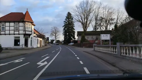
Da Toni
Restaurant · Italian · 11.0 km
1 Frielinger Straße
Tu-Sa 12:00-14:30,18:00-23:00; Su 12:00-14:30,17:30-22:00; Mo off
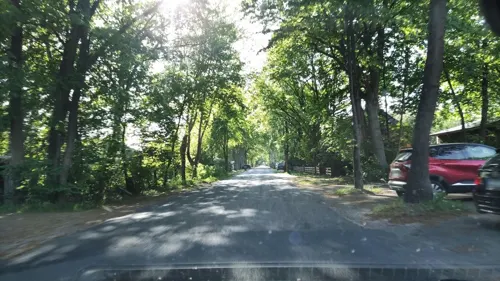
Landgasthaus Wesseloh Zum Müden
Restaurant · German · 8.1 km
29 Wesseloher Straße, Schneverdingen
We-Sa 17:00-23:00; Su 10:00-23:00

Restaurant "Auf dem Simpel"
Restaurant · German · 11.3 km
Das Restaurant "Auf dem Simpel" befindet sich auf dem gleichnamigen Campingplatz "Auf dem Simpel" und bietet gute deutsche Küche. Von...
1 Auf dem Simpel, Soltau
Mo 17:00-22:00, Tu off, We-Su 17:00-22:00

Eggershof-Café
Cafe · 10.8 km
Café-Garten, Heu-Hotel, Pension, hausgemachter Kuchen, Terrasse, Streichelzoo (Nutztiere)
15 Ellingen, Soltau
We-Su 14:00-18:00
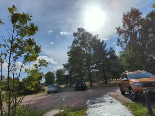
Gasthaus Camp Reinsehlen
Restaurant · Regional · 3.7 km
1 Camp Reinsehlen, Schneverdingen
Mo-Su 07:00-22:00
Ginato
Restaurant · Pizza, Italian, Pasta · 1.2 km
6 Hansahlener Dorfstraße, Schneverdingen
Mo 17:00-22:00; Tu-Sa 12:00-14:00,17:00-22:00; Su 12:00-22:00
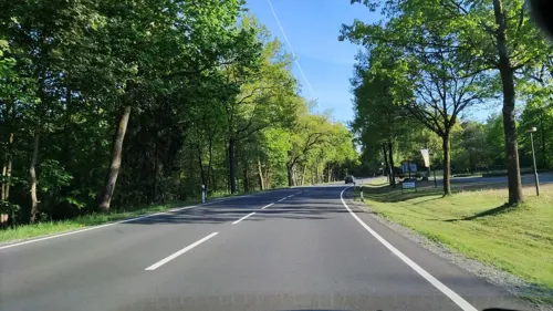


Restaurant Findlinger im Schnuck
Restaurant · German · 0.9 km
55 Osterwaldweg, Schneverdingen
Mo-Su 07:00-10:30,12:00-14:00,18:00-22:00
Restaurant Hof Tütsberg
Restaurant · Regional · 8.3 km
Hof Tütsberg, Schneverdingen
Mo 12:00-20:30; We-Su 12:00-20:30
106 more on the map.
History
The oldest document in which Schneverdingen was mentioned was written in 1231. The place was mentioned under the name "Snewordinge".
Schneverdingen belonged to the Prince-Bishopric of Verden, established in 1180. In 1648 the Prince-Bishopric was transformed into the Principality of Verden, which was first ruled in personal union by the Swedish Crown - interrupted by a Danish occupation (1712–1715) - and from 1715 on by the Hanoverian Crown. The Kingdom of Hanover incorporated the Principality in a real union and the Princely territory, including Schneverdingen, became part of the new Stade Region, established in 1823. At the beginning of the 20th century it had 1.747 inhabitants. In 1976 Schneverdingen obtained municipal status as a "town".
From the History section of Schneverdingen on Wikipedia, under CC BY-SA 4.0.
Where to stay86
Churches and places of worship23
Gemeindehaus ev.-luth. Kirchengemeinde Peter und Paul
Church · Lutheran
3 Friedenstraße, Schneverdingen
Freie evangelische Bibelgemeinde Schneverdingen
Church · Protestant
33b Harburger Straße, Schneverdingen
Semkye Ling Buddhistisches Mediationshaus
Place of worship · Tibetan · 6.9 km
4 Lünzener Straße, Schneverdingen
Shopping38
Gas and EV charging15
Schools, colleges and libraries13
Healthcare5
Map of Schneverdingen
250 places. The map loads OpenStreetMap tiles when you open it.
Getting there and nearby towns
Hamburg Finkenwerder Airport (XFW) is the nearest airport with scheduled flights listed in OpenStreetMap, 47 km away.
- Soltau 15 km south, about 15 min by car
- Tostedt 18 km north, about 18 min by car
- Visselhövede 20 km southwest, about 20 min by car
- Walsrode 31 km southwest, about 31 min by car
- Seevetal 33 km north, about 33 min by car
- Stelle 36 km northeast, about 36 min by car
- Kirchlinteln 37 km southwest, about 37 min by car
- Winsen 39 km northeast, about 39 min by car
- Zeven 40 km northwest, about 40 min by car
- Hamburg 50 km north, about 50 min by car
Drive times are estimates from straight-line distance, not routes.
Local news
Headlines from INDB.
Reviews, tips and questions
Loading what members have shared...
Sources and licences
- GeoNames (CC BY 4.0): population, coordinates, regions and time zone
- Mapillary (see each image): photos
- OpenStreetMap contributors (ODbL 1.0): places, airports, map data
- Wikidata (CC0 1.0): elevation, founding date, time zone, website, landmarks and historic places
- Wikimedia Commons (see each image): photos
- Wikipedia (CC BY-SA 4.0): overview and history text
Photo credits
- Heidegarten Ortswappen, Axel Hindemith, CC BY 3.0
- Schneverdingen Harburger Straße 10 202003, Uwe Barghaan, CC BY-SA 3.0
- Schneverdingen Verdener Straße 4 202003, Uwe Barghaan, CC BY-SA 3.0
- Schneverdingen Peter Paul Kirche 09, Jan-Herm Janßen, CC BY-SA 4.0
- Schneverdingen Peter Paul Kirche 08, J.-H. Janßen, CC BY-SA 4.0
- Schneverdingen - Grabstein Carl Conrad Meyer, ChristianSW, CC0
- Kanzelaltar von Peter und Paul in Schneverdingen, Unknown artist Unknown artist, Public domain
- Uhrwerk der Peter-und-Paul-Kirche in Schneverdingen, Unknown author, Public domain
- Schneverdingen Peter und Paul 12, J.-H. Janßen, CC BY-SA 4.0
- Schneverdingen Peter und Paul Orgel 01, J.-H. Janßen, CC BY-SA 4.0
- Grabplatte Galle Berger, Unknown artist Unknown artist, Public domain
- St. Ansgar Schneverdingen, ChristianSW, CC0
- Soltaualtesrathaus, Etmot ( talk ) 12:58, 8 September 2009 (UTC) ~, Public domain
- Heide Park Eingang, Stefan Scheer, GFDL
- Lüneburger Heide bei Wilsede, Daniel Ossenkop, CC BY-SA 3.0
- Schweizer Bobbahn Heidepark, User:Coaster J, CC BY-SA 3.0
- Böhmetal bei Huckenrieth, 2018-11 VI, ChristianSW, CC0
- Finteler Wacholderlandschaft 001, Smarties, CC BY-SA 4.0
- Eine-Welt-Kirche Schneverdingen IMG 2059, losch, Attribution
- Heilig-Geist-Kirche-in-Wolterdingen-(Soltau)-002-a, Heilig-Geist-Kirche_in_Wolterdingen_(Soltau)_IMG_6002.jpg : Losch derivative work: dontworry ( talk ), CC BY-SA 3.0
- Alte Schule Schneverdingen, 2023-01 II, ChristianSW, CC0
- Schneverdingen Wesseloh - Wassermühle Eggersmühlen ex 02 ies, Frank Vincentz, CC BY-SA 3.0
- 120827 GS Lünzen 2, Hasob, CC BY-SA 3.0
- Schneverdingen Insel - Schulmuseum 01 ies, Frank Vincentz, CC BY-SA 3.0
- Friedenskirche in Heber (Schneverdingen) IMG 1539, Losch, CC BY-SA 3.0
- Wilseder Berg 006, Willow, CC BY 2.5
- Schneverdingen Wesseloh - Wassermühle Eggersmühlen ex 05 ies, Frank Vincentz, CC BY-SA 3.0
- Neuenkirchen (LH) Sprengel - Sprengeler Mühle 03 ies, Frank Vincentz, CC BY-SA 3.0
- Wintermoor Friedhof KZ-Zug-Opfer2, smarties, CC BY-SA 3.0
- Kriegerdenkmal Wintermoor, smarties, CC BY-SA 3.0
- Wintermoor Friedhof Feld B1, smarties, CC BY-SA 4.0
- Wintermoor Friedhof Feld A1, smarties, CC BY-SA 4.0
- Wintermoor Friedhof Feld A2, smarties, CC BY-SA 4.0
- Lünzen Wassermühle 2011 03, Axel Hindemith, CC BY 3.0
- Schnevedingen Theeshof Heimathaus, AxelHH, CC BY 3.0
- Birkensee im Naturschutzgebiet, Gerhard kemme, CC0
- Bank im Böhmetal bei Huckenrieth, AndiAndreas, CC BY-SA 4.0
- Große Aue am Ehbläcksmoor, ChristianSW, CC0
- Heidemoor bei Ottermoor, smarties, CC BY-SA 3.0
- Bäume in der Hügelgräberheide bei Langeloh, AndiAndreas, CC BY-SA 4.0
- Lüneburger Heide 072, Willow, CC BY 2.5
- NSG Moor bei Osterwede, smarties, CC BY-SA 4.0
- Fintau, smarties, CC BY-SA 3.0
- Friedhofskapelle Schneverdingen IMG 2081, losch, Attribution
- Schneverdingen Kirche Ansgar, Kirchenfan, CC0
- Peter-und-Paul-Kirche IMG 2066, losch, Attribution
- Fintel, 2014 – Birken auf dem Osterberg, Florian Kluge, CC BY-SA 3.0
- Street-level photo, hotteliene, CC BY-SA 4.0
- Street-level photo, StefanS79, CC BY-SA 4.0
- Street-level photo, tknaack, CC BY-SA 4.0
- Street-level photo, hotteliene, CC BY-SA 4.0
- Street-level photo, hotteliene, CC BY-SA 4.0
- Street-level photo, hotteliene, CC BY-SA 4.0
- Street-level photo, hotteliene, CC BY-SA 4.0
- Street-level photo, tian, CC BY-SA 4.0
- Street-level photo, tian, CC BY-SA 4.0
- Street-level photo, hoeckie1975, CC BY-SA 4.0
- Street-level photo, ente, CC BY-SA 4.0
- Street-level photo, hotteliene, CC BY-SA 4.0
- Street-level photo, hotteliene, CC BY-SA 4.0
- Street-level photo, hotteliene, CC BY-SA 4.0
- Street-level photo, hotteliene, CC BY-SA 4.0
- Street-level photo, tian, CC BY-SA 4.0
- Street-level photo, hotteliene, CC BY-SA 4.0
- Street-level photo, hotteliene, CC BY-SA 4.0
- Street-level photo, hotteliene, CC BY-SA 4.0


Page built November 8, 2026. Spotted a mistake? Tell us or suggest a place.