


Why visit Spalt
Townapedia lists 30 museums and landmarks, 22 parks and trails, 67 places to eat, 23 places to stay and 37 attractions in and around town.
Highlights include Aurachtal-Alpakas, Ameisenbühl, HopfenBierGut and Steinkreuz.
Weather in Spalt
Forecast from MET Norway (CC BY 4.0). Full forecast
About Spalt
Spalt (German pronunciation: [ʃpalt] ; Franconian dialect: Schbåld) is a town in the district of Roth, in Bavaria, Germany. It is situated 19 km southwest of Schwabach. Spalt is famous for growing hops for brewing beer.
From the Wikipedia article Spalt (this version), under CC BY-SA 4.0.
Things to do37


25 more on the map.
Museums and landmarks30



Abenteuerwald Enderndorf
Monument and historic site · 3.3 km
Reservierung erforderlich! Entweder online auf https://abenteuer-wald.com/klettern-preise/online-reservierung/ oder per Telefon.
Mo-Su 10:00-16:00 - Reservierung online oder per Telefon...




18 more on the map.
Parks, trails and playgrounds22
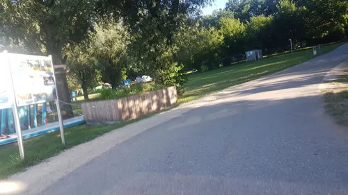
Wakepark Brombachsee
Sports field and stadium · 5.4 km
Wakeboardanlage
7 Badehalbinsel, Absberg
Mo 12:30-19:00; Tu-Fr 14:00-20:00; Sa,Su 12:30-20:00







10 more on the map.
Restaurants and cafes67

Cafe Tasse
Cafe · Coffee Shop
13 Bahnhofstraße, Spalt
Mo-Th 10:30-22:00; Fr off; Sa 13:00-19:00; Su 10:00-19:00
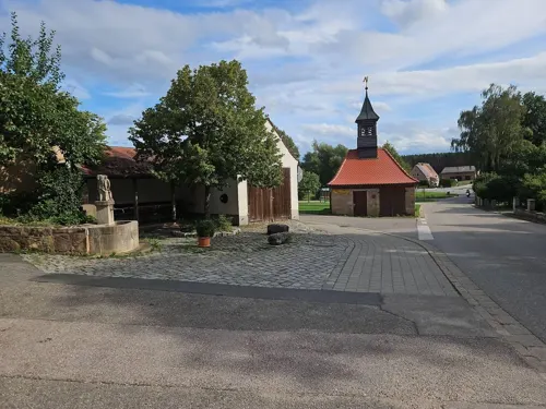
Gasthaus Grossberger
Restaurant · Regional · 5.3 km
4, Georgensgmünd
Th 17:00-22:00; Fr-Su 11:00-14:00,17:00-22:00

Gasthof Blumenthal
Restaurant · Regional · 3.6 km
42 Stiegelmühle, Spalt
We-Fr 11:30-14:30,17:00-22:00, Sa 11:30-22:00, Su 11:00-21:00
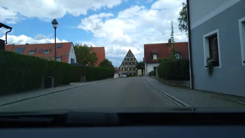
Landgasthaus Jägerhof
Restaurant · Regional · 4.5 km
4 Deutschordenstraße, Absberg
Mo-Su 12:00-20:00; We off; Th 17:00-20:00
Müßighof-Bistro
Cafe · Regional · 6.4 km
3 Müßighof, Absberg
Tu-Fr 09:00-16:30; Sa 09:00-14:00; PH off
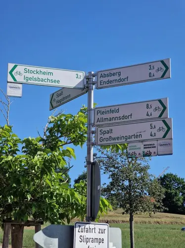
Schwarzer Adler
Restaurant · Regional · 5.3 km
21 Hauptstraße, Pleinfeld
We,Fr,Sa 11:00-13:30,17:00-21:00; PH,Su 11:00-15:00,17:00-21:00
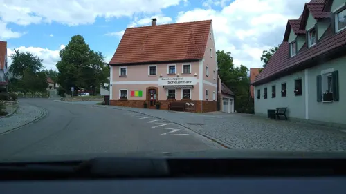


Café Bäckerei Herzog
Cafe · 4.8 km
11 Hauptstraße, Absberg
Mo 06:00-11:00; Tu-Sa 06:00-17:00; Su,PH 07:00-10:00
55 more on the map.
Where to stay23
Churches and places of worship31
Christkönig
Church · Roman Catholic · 4.9 km
B16 Obersteinbach B, Abenberg
Gedächtniskapelle
Church · Lutheran · 4.8 km
B8 Obersteinbach B, Abenberg
Heiligste Dreifaltigkeit
Church · Roman Catholic · 6.5 km
2 Am Schwarzenberg, Röttenbach
Shopping9
Gas and EV charging4
Schools, colleges and libraries6
Grund- und Mittelschule Abenberg, Schulgebäude Wassermungenau
School · 5.4 km
47 Hauptstraße, Abenberg
Healthcare1
Map of Spalt
230 places. The map loads OpenStreetMap tiles when you open it.
Getting there and nearby towns
Albrecht Dürer Airport Nuremberg (NUE) is the nearest airport with scheduled flights listed in OpenStreetMap, 38 km away.
- Windsbach 11 km northwest, about 11 min by car
- Gunzenhausen 14 km southwest, about 14 min by car
- Roth 15 km northeast, about 15 min by car
- Weißenburg in Bayern 16 km south, about 16 min by car
- Schwabach 19 km northeast, about 19 min by car
- Hilpoltstein 19 km east, about 19 min by car
- Treuchtlingen 25 km south, about 25 min by car
- Roßtal 25 km north, about 25 min by car
- Thalmässing 24 km southeast, about 24 min by car
- Wendelstein 26 km northeast, about 26 min by car
Drive times are estimates from straight-line distance, not routes.
Local news
Headlines from INDB.
Reviews, tips and questions
Loading what members have shared...
Sources and licences
- GeoNames (CC BY 4.0): population, coordinates, regions and time zone
- Mapillary (see each image): photos
- OpenStreetMap contributors (ODbL 1.0): places, airports, map data
- Wikidata (CC0 1.0): elevation, founding date, time zone, website, landmarks and historic places
- Wikimedia Commons (see each image): photos
- Wikipedia (CC BY-SA 4.0): overview and history text
Photo credits
- St. Nikolaus (Spalt) D-5-76-147-145 01, Derzno, CC BY-SA 3.0
- Spalt 01 St. Nikolaus 01, H.Helmlechner, CC BY-SA 4.0
- Spalt 01 St. Nikolaus 02, H.Helmlechner, CC BY-SA 4.0
- Gänsgasse 49, Spalt, H.Helmlechner, CC BY-SA 4.0
- Spalt St. Emmeram 01, H.Helmlechner, CC BY-SA 4.0
- SpaltStNikolaus, Hubert Berberich ( HubiB ), CC BY 3.0
- Josefplatz 3, Spalt, H.Helmlechner, CC BY-SA 4.0
- Reifenturm Spalt, H.Helmlechner, CC BY-SA 4.0
- Fröschau 18, Spalt, H.Helmlechner, CC BY-SA 4.0
- Fröschau 16, Spalt, H.Helmlechner, CC BY-SA 4.0
- Schäferturm Spalt, H.Helmlechner, CC BY-SA 4.0
- Spalatin monument label QS:Len,"Spalatin monument" label QS:Lde,"Spalatin-Denkmal", Hubert Berberich ( HubiB ), CC BY 3.0
- Spalt Gasse panorma, Derzno, CC BY-SA 3.0
- Spalt St. Emmeram 02, H.Helmlechner, CC BY-SA 4.0
- Rathaus Spalt, H.Helmlechner, CC BY-SA 4.0
- Fröschau 17, Spalt, H.Helmlechner, CC BY-SA 4.0
- SpaltRezatHB01, Hubert Berberich ( HubiB ), CC BY 3.0
- Hopfengut Mühlreisig Spalt 01, H.Helmlechner, CC BY-SA 4.0
- Kornhaus Spalt, H.Helmlechner, CC BY-SA 4.0
- Franken, Spalt - geo.hlipp.de - 5027, Udo und Joan Fugel on geo.hlipp.de, CC BY-SA 2.0
- SpaltKornhaus, Hubert Berberich ( HubiB ), CC BY 3.0
- Oberes Tor Spalt, H.Helmlechner, CC BY-SA 4.0
- Brombachmoor-Übersicht, Archaecopteryx, CC BY-SA 4.0
- Kalbensteinberg - Rieterkirche, Technokrat, CC BY-SA 2.0 de
- Kirche Ramsberg, mef.ellingen, CC BY-SA 3.0
- Schlosskapelle außen, Rensi, CC0
- Spalt St. Emmeram 8370, Reinhardhauke, CC BY-SA 3.0
- Pleinfeld Allmannsdorf St. Laurentius Kirche, G8w, CC BY-SA 3.0
- Obersteinbach,Gedächtniskapelle, Bertramz, CC BY-SA 3.0
- Spalt, Ev. Kirche, 001, Tilman2007, CC BY-SA 3.0
- Spalt, Spitzenberg 16, 001, Tilman2007, CC BY-SA 3.0
- Grossweingarten1, Mef.ellingen, CC BY-SA 3.0
- Obersteinbach,Filialkirche Christkönig, Bertramz, CC BY-SA 3.0
- Steinkreuze (D-5-76-147-79) 06, Derzno, CC BY-SA 3.0
- Spalt, Hauptstraße 27, 001, Tilman2007, CC BY-SA 3.0
- Mühlstetten Filialkirche Heilige Dreifaltigkeit 2012 01 26, G8w, CC BY-SA 3.0
- Spalt, Kornhaus 1, 001, Tilman2007, CC BY-SA 3.0
- Steinkreuze (D-5-76-147-79) 03, Derzno, CC BY-SA 3.0
- Kreuzstein D-5-76-147-158 03, Derzno, CC BY 3.0
- Steinkreuz Hagsbronn 04, Derzno, CC BY 3.0
- Steinkreuz D-5-76-147-186 02, Derzno, CC BY 3.0
- Totenleuchte-Spalt, lutzto, CC BY-SA 3.0
- Steinkreuz Ottmannsberg 02, Derzno, CC BY 3.0
- NSG Grafenmühle 02, Derzno, CC BY 3.0
- NSG Halbinsel im Kleinen Brombachsee 02, Derzno, CC BY 3.0
- NSG Sägmühle 02, Derzno, CC BY-SA 3.0
- Stauwurzel des Igelsbachsees 01, Derzno, CC BY 3.0
- Spalt, Hagsbronn, Kath. Filialkirche St. Ägidius, 001, Tilman2007, CC BY-SA 3.0
- D-5-76-147-25 01, Derzno, CC BY-SA 3.0
- Street-level photo, santon, CC BY-SA 4.0
- Street-level photo, mike409, CC BY-SA 4.0
- Street-level photo, bigbug21, CC BY-SA 4.0
- Street-level photo, mike409, CC BY-SA 4.0
- Street-level photo, mike409, CC BY-SA 4.0
- Street-level photo, changchun1, CC BY-SA 4.0
- Street-level photo, mike409, CC BY-SA 4.0
- Street-level photo, santon, CC BY-SA 4.0
- Street-level photo, mike409, CC BY-SA 4.0
- Street-level photo, czmrtn, CC BY-SA 4.0
- Street-level photo, changchun1, CC BY-SA 4.0


Page built November 9, 2026. Spotted a mistake? Tell us or suggest a place.