


Why visit Stendal
Townapedia lists 114 museums and landmarks, 29 parks and trails, 178 places to eat, 46 places to stay and 24 attractions in and around town.
Highlights include Tiergarten Stendal, Theater der Altmark, Winckelmann Museum and Bismarckmuseum.
Weather in Stendal
Forecast from MET Norway (CC BY 4.0). Full forecast
About Stendal
Stendal (German pronunciation: [ˈʃtɛndaːl] ), officially the Hanseatic City of Stendal (German: Hansestadt Stendal), is a town in Saxony-Anhalt, Germany. It is the capital of the Stendal District and the unofficial capital of the Altmark region.
From the Wikipedia article Stendal (this version), under CC BY-SA 4.0.
Travel tips from other travellers: Stendal on Wikivoyage (CC BY-SA 4.0).
Photos of Stendal


Things to do24

Tiergarten Stendal
Zoo and aquarium · 1.3 km
13 Uchtewall, Stendal
Nov-Feb Mo-Su 09:00-16:00; Mar-Apr,Oct Mo-Su 09:00-17:00; May-Sep...




12 more on the map.
Museums and landmarks114


Bismarckmuseum
Museum · 12.1 km
Schloss Schönhausen I Bismarckstraße 2 in Schönhausen (Elbe)
5 Kirchberg, Schönhausen (Elbe)
Tu-Su 10:00-16:00

Burgmuseum Schloßfreiheit
Museum · 10.4 km
5 Schloßfreiheit, Tangermünde
Jul-Oct: Tu,Fr-Su 13:00-17:00


Eulenturm
Monument and historic site · 10.4 km
Eulenturm, Turm der nicht mehr vorhandenen Doppeltoranlage Hünerdorfer Tor, Lange Straße in Tangermünde

Gefängnisturm
Monument and historic site · 10.5 km
Gefängnisturm Burg Tangermünde

Kaiser Karl IV
Monument and historic site · 10.6 km
Statue Kaiser Karl IV auf dem Burgberg in Tangermünde

Kapitelturm
Monument and historic site · 10.5 km
Kapitelturm, (Wehrturm, Bergfried) der Burg Tangermünde

Kaufhaus Ramelow
Monument and historic site
20-21 Breite Straße, Stendal

Neustädter Tor
Monument and historic site · 10.3 km
Neustädter Tor in Tangermünde

Landesfeuerwehrmuseum Sachsen Anhalt
Museum · 1.0 km
146A Arneburger Straße, Stendal
Tu,Th,Sa 09:00-16:00
102 more on the map.
Parks, trails and playgrounds29

Freibad Tangermünde
Sports field and stadium · 9.5 km
24 Friedensstraße, Tangermünde
Jun-Aug: Tu-Su, PH 13:00-20:00; Jun-Aug: SH 11:00-20:00
Altmark Oase
Sports field and stadium · 2.3 km
2 Schillerstraße, Stendal
Tu 06:30-08:00,10:00-22:00; We,Fr-Su 10:00-22:00; Th...





17 more on the map.
Restaurants and cafes178

Zecherei Sankt Nikolai
Restaurant · German · 10.3 km
1 Lange Straße, Tangermünde
Mo-Su 11:30-21:00; Fr 16:00-21:00
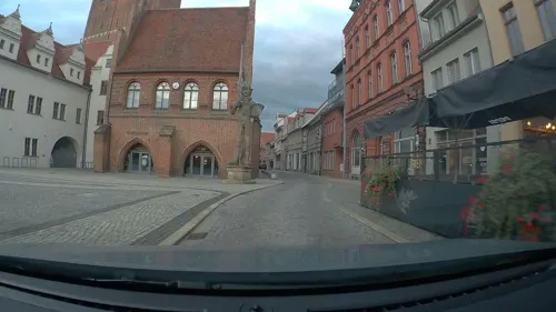
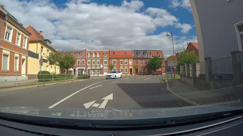
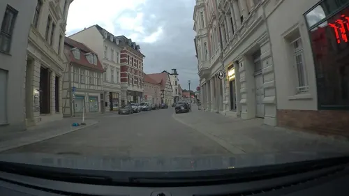
Dolce Vita
Restaurant · Italian
48 Breite Straße, Stendal
Mo-Th 12:00-22:00; Fr,Sa 12:00-23:00; Su 17:00-22:00
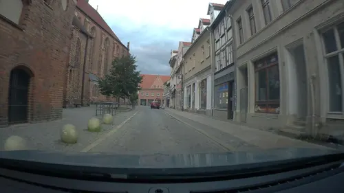
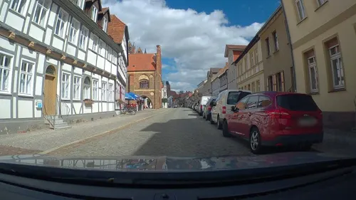
Kroatisches Restaurant Adii
Restaurant · Croatian · 10.3 km
70 Lange Straße, Tangermünde
Mo-Su 11:00-22:00
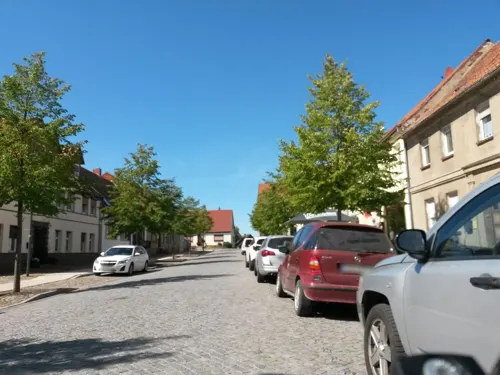


Megas Alexandros
Restaurant · Greek
18 Schadewachten, Stendal
Tu-We,Fr-Sa 17:30-22:30; Th,Su 11:30-14:00,17:30-22:30; PH 11:30-14:00
Restaurant & Gelateria Italia
Restaurant · Italian
5 Breite Straße, Stendal
Mo-Sa 10:00-22:00; Su,PH 11:00-21:00
166 more on the map.
History
A settlement named Steinedal in the Eastphalian Balsamgau of Saxony, then a possession of Saint Michael’s Abbey in Hildesheim, was mentioned in a deed allegedly issued by Emperor Henry II in 1022. However, the entry has proven to be a 12th-century forgery, as the original document contained no such record. The fortified town near the Elbe crossing at Tangermünde was actually founded and granted Magdeburg rights by the first Brandenburg margrave Albert the Bear about 1160.
The parish church of St Mary's was first mentioned in 1283. Stendal quickly prospered as a centre of commerce and trade; it received city walls about 1300, the citizens joined the Hanseatic League in 1358 and purchased the privilege of minting from the Brandenburg margraves in 1369. A Latin school is documented from 1338. In 1456 the Hohenzollern elector Frederick II Irontooth founded a convent of Augustinian nuns, which today is the site of a museum. In 1502 his descendant Elector Joachim I Nestor married Princess Elizabeth of Denmark at Stendal. Several churches, the town hall and the two remaining city gates show Stendal's wealth in the period.
Read more of the history
The Stendal citizens turned Protestant in 1539, with the reformator Konrad Cordatus serving as superintendent. In the 1680s and 1690s, Waldensian, Palatine and Swiss religious refugees settled in the town. For centuries part of the Margraviate of Brandenburg, Stendal with the Altmark region passed to the Prussian Province of Saxony after the Napoleonic Wars. A Prussian garrison town since the 17th century, it hosted the 10th (Magdeburg) Hussars regiment from 1884.
Stendal was the site of a Luftwaffe airfield in World War II, which had been the site of the first German Fallschirmjäger training school from 1936; the boxer Max Schmeling was trained as a paratrooper here in 1940/41. The town suffered from strategic bombing. Stendal was hit by 10 air raids, and more than 300 civilians died when Röxe, a residential area in the southern part of the town, was devastated by bombs. The Cathedral and various historical buildings were heavily damaged by bombs. In April 1945, the aerodrome served as starting place of the Sonderkommando Elbe unit, only a few days before the local authorities surrendered to the US Army. On May 4, the commander of the Wehrmacht 12th Army, General Maximilian von Edelsheim, signed the capitulation document at the Stendal town hall. In July 1945, Stendal was handed over to Soviet occupation.
From 1949 until German reunification in 1990, the town belonged to East Germany, part of Bezirk Magdeburg from 1952. Until 1994, the Stendal barracks served as home base for a riflemen division of the Soviet 2nd Guards Tank Army. In 1974 the construction of the Stendal Nuclear Power Plant was begun north of the town, but abandoned after reunification. In 2009 the Stendal citizens voted for the prefix Hansestadt ("Hanseatic City").
On 1 January 2010, the town Stendal absorbed the former municipalities Buchholz, Groß Schwechten, Heeren, Möringen, Nahrstedt, Staats, Uchtspringe, Uenglingen, Volgfelde, and Wittenmoor. On 29 April 2010, it absorbed Vinzelberg, and on 1 September 2010 Dahlen and Insel.
From the History section of Stendal on Wikipedia, under CC BY-SA 4.0.
More about Stendal
Geography
Situated west of the Elbe valley, the Stendal town centre is located some 125 km (78 mi) west of Berlin, around 170 km (110 mi) east of Hanover, and 55 km (34 mi) north of the state capital Magdeburg. Stendal is the seat of a University of Applied Sciences (Fachhochschule) and preserves a picturesque old town including a historic market and several churches. The nearby village Uchtspringe is home to a psychiatric rehabilitation clinic.
The town Stendal consists of Stendal proper and the following 18 Ortschaften or municipal divisions:
Education
The Magdeburg-Stendal University of Applied Sciences was founded in 1991 and has around 50 study programmes taught at three departments in Magdeburg and two departments in Stendal. There are approximately 130 professors with around 3,700 students in Magdeburg and 1,800 in Stendal.
From the Wikipedia article Stendal, under CC BY-SA 4.0.
Notable people from Stendal
 Johann Joachim WinckelmannGerman art historian and archaeologist, and conservator of the Vatican Library (1717–1768)Photo: Anton Raphael Mengs, Public domain
 Jochen BorchertGerman politicianPhoto: StagiaireMGIMO, CC BY-SA 4.0
 Marcus FaberGerman politicianPhoto: privat, CC BY-SA 4.0
 Ludwig TurekGerman screenwriter and writer (1898–1975)Photo: Köhler, Gustav, CC BY-SA 3.0 de
 Rudolf DulonGerman revolutionary (1807–1870)Photo: Friedrich Jentzen, Public domain
- Leo August PochhammerGerman mathematician (1841–1920)
- Otto SchoetensackGerman paleoanthropologist (1850–1912)
- Irina KorschunowGerman writer (1925–2013)
- Gerd GiesGerman politician
- Kurt LiebrechtGerman association football player (1936–2022)
- Heinz-Ulrich WaltherGerman pair skater, judge and technical controller
- Wilfried Klingbielfootball player
Born in Stendal, according to Wikidata (CC0). Each name links to its Wikipedia article.
Where to stay46
Churches and places of worship67
Dreifaltigkeitskirche
Church · Catholic · 10.3 km
118 Arneburger Straße, Tangermünde
St. Marien und Willebrord
Church · Lutheran · 12.1 km
3 Kirchberg, Schönhausen (Elbe)
Shopping54
Gas and EV charging17
Schools, colleges and libraries32
Healthcare16
Johanniter-Zentren für Medizinische Versorgung in der Altmark
Clinic and pharmacy · 1.1 km
24 Bahnhofstraße, Stendal
Map of Stendal
250 places. The map loads OpenStreetMap tiles when you open it.
Getting there and nearby towns
Magdeburg-Cochstedt Airport (CSO) is the nearest airport with scheduled flights listed in OpenStreetMap, 89 km away.
- Genthin 30 km southeast, about 30 min by car
- Rathenow 32 km east, about 32 min by car
- Gardelegen 33 km west, about 33 min by car
- Premnitz 34 km east, about 34 min by car
- Burg bei Magdeburg 37 km south, about 37 min by car
- Wolmirstedt 43 km south, about 43 min by car
- Wittenberge 44 km north, about 44 min by car
- Brandenburg an der Havel 51 km southeast, about 51 min by car
- Perleberg 52 km north, about 52 min by car
- Magdeburg 55 km south, about 55 min by car
Drive times are estimates from straight-line distance, not routes.
Towns near Stendal


Keep exploring
Local news
Headlines from INDB.
Reviews, tips and questions
Loading what members have shared...
Sources and licences
- GeoNames (CC BY 4.0): population, coordinates, regions and time zone
- Mapillary (see each image): photos
- OpenStreetMap contributors (ODbL 1.0): places, airports, map data
- Wikidata (CC0 1.0): elevation, founding date, time zone, website, landmarks and historic places
- Wikimedia Commons (see each image): photos
- Wikipedia (CC BY-SA 4.0): overview and history text
Photo credits
- Stendal Markt, The original uploader was Björn Gäde at German Wikipedia ., CC BY-SA 3.0
- Stendal Breite Strasse 20-21 2011-09-16, Schiwago, CC BY-SA 3.0
- Stendal Marienkirche Relief 2 2011-09-16, Schiwago, CC BY-SA 3.0
- Stendal Marienkirche Steinkreuz IV, Radler59, CC BY-SA 3.0
- Stendal Marienkirche-01, Radler59, CC BY-SA 4.0
- Stendal Winckelmann, Ludwig Wilhelm Wichmann, CC BY 3.0
- Stendal Johann Joachim Winckelmann Denkmal, Florian Hoffmann, CC BY-SA 3.0
- Stendal, das Winckelmann-Denkmal, Dguendel, CC BY 4.0
- St Marien Stendal 06, Clemensfranz, CC BY-SA 4.0
- St Marien Stendal 05, Clemensfranz, CC BY-SA 4.0
- Stendal Denkmal Winckelmann-01, Radler59, CC BY-SA 4.0
- Stendal Denkmal Winckelmann-02, Radler59, CC BY-SA 4.0
- Stendal-Winckelmannplatz-mit-Denkmal-und-St-Marien-IMG 5331-12x3B-360Gx180G-PanoS-19-05-2023, Joachim Köhler, CC BY-SA 4.0
- Stendal Denkmal Winckelmann 2011-09-16, Schiwago, CC BY-SA 3.0
- Stendal Marienkirche Relief 2011-09-16, Schiwago, CC BY-SA 3.0
- Stendal Marienkirche Suehnestein 2011-09-16, Schiwago, CC BY-SA 3.0
- Winckelmann-Denkmal Stendal, Olaf Meister, CC BY-SA 4.0
- Stendal Breite Straße 18 09417951, RentWerner, CC BY-SA 4.0
- Stendal-St-Marien-innen-Chor-IMG 5181-9x3B-360Gx180G-PanoS-v22-19-05-2023, Joachim Köhler, CC BY-SA 4.0
- Stendal Marienkirche Wasserspeier 1 2011-09-17, Schiwago, CC BY-SA 3.0
- St Marien Stendal 07, Clemensfranz, CC BY-SA 4.0
- Stendal Marienkirche Steinkreuz I, Radler59, CC BY-SA 3.0
- St Marien Stendal 04, Clemensfranz, CC BY-SA 4.0
- Stendal Marienkirche Wasserspeier 2 2011-09-17, Schiwago, CC BY-SA 3.0
- Stendal Kornmarkt 1 09476328, RentWerner, CC BY-SA 4.0
- Statue Winckelmannplatz (Stendal) Johann Joachim Winckelmann, OTFW , Berlin, CC BY-SA 3.0
- St Marien Stendal 01, Clemensfranz, CC BY-SA 4.0
- Stendal, Kirche St.Marien, Altar, Teilansicht-5, Dguendel, CC BY 4.0
- Stendal, St Mary's Church, the pipe organ, Dguendel, CC BY 4.0
- Stendal, Kirche St.Marien, Altar, Teilansicht-10, Dguendel, CC BY 4.0
- Stendal, Kirche St.Marien, Epitaph-11, Dguendel, CC BY 4.0
- Stendal, Kirche St.Marien, Epitaph-8, Dguendel, CC BY 4.0
- Stendal, Kirche St.Marien, Altar, Teilansicht-4, Dguendel, CC BY 4.0
- Stendal, Kirche St.Marien, Altar, Teilansicht-2, Dguendel, CC BY 4.0
- Stendal, Kirche St.Marien, die Orgel, Dguendel, CC BY 4.0
- Stendal, Kirche St.Marien, Altar, Teilansicht-7, Dguendel, CC BY 4.0
- Stendal, Kirche St.Marien, Epitaph-5, Dguendel, CC BY 4.0
- Stendal, Kirche St.Marien, Altar, Teilansicht-6, Dguendel, CC BY 4.0
- Christuskirche Wahrburg, Olaf Meister, CC BY-SA 3.0
- Dahlen Dorfkirche, No machine-readable author provided. Olaf2 assumed (based on copyright claims)., CC BY-SA 3.0
- Gohre Dorfkirche2, No machine-readable author provided. Olaf2 assumed (based on copyright claims)., CC BY-SA 3.0
- Gutshaus Döbbelin, Olaf Meister, CC BY-SA 3.0
- Gutskirche Schönfeld (Bismark) P1790288, Worldfootage, CC BY-SA 4.0
- Stendal Dom 2011-09-16, Schiwago, CC BY-SA 3.0
- Salzkirche, Olaf Meister, CC BY-SA 3.0
- Stendal Marienkirche 2011-09-17, Schiwago, CC BY-SA 3.0
- Tangermuende St Stephan, TeWeBs, CC BY-SA 4.0
- Stadtbibliothek Stendal 2013, RentWerner, CC BY-SA 4.0
- Tangermuende kath 2015-4, Kirchenfan, CC0
- Tangermuende Neustaedter Tor-02, Radler59, CC BY-SA 4.0
- Stendal Kornmarkt 8 Hotel 2 2011-09-17, Schiwago, CC BY-SA 3.0
- Tangermuende Museum, TeWeBs, CC BY-SA 4.0
- Borstel Dorfkirche, User Björn Gäde, CC BY-SA 3.0
- Eichstedt St. Katharinen-01, Radler59, CC BY-SA 4.0
- Stendal Winckelmann-Schule 2011-09-17, Schiwago, CC BY-SA 3.0
- Tangermuende Burg Kapitelturm-01, Radler59, CC BY-SA 4.0
- Tangermuende Gefaengnisturm 2, TeWeBs, CC BY-SA 4.0
- Denkmal Karls in Tangermünde, Olaf Meister, CC BY-SA 4.0
- Diesterwegschule in Tangermünde 01, Olaf Meister, CC BY-SA 4.0
- Tangermuende Lange Strasse 1 Zecherei St-Nikolai 2011-09-18, Schiwago, CC BY-SA 3.0
- Stendal Winckelmannstrasse 36 2011-09-17, Schiwago, CC BY-SA 3.0
- Schoenhausen Schloss I-02, Radler59 ( talk ), CC BY-SA 4.0
- Tangermuende Eulenturm-01, Radler59, CC BY-SA 4.0
- Schoenhausen Kirche St. Maria, Radler59 ( talk ), CC BY-SA 4.0
- Eingang Tiergarten Stendal 2009, Nutzer-- de:Benutzer:Sportfreund.php 12:49, 27. Nov. 2009 (CET), CC BY-SA 3.0 de
- Stendal TdA, Nutzer-- de:Benutzer:Sportfreund.php 15:11, 24. Mai 2009 (CEST), CC BY-SA 3.0 de
- Street-level photo, yieldmapper, CC BY-SA 4.0
- Street-level photo, poxonline, CC BY-SA 4.0
- Street-level photo, poxonline, CC BY-SA 4.0
- Street-level photo, poxonline, CC BY-SA 4.0
- Street-level photo, poxonline, CC BY-SA 4.0
- Street-level photo, poxonline, CC BY-SA 4.0
- Street-level photo, poxonline, CC BY-SA 4.0
- Street-level photo, poxonline, CC BY-SA 4.0
- Street-level photo, poxonline, CC BY-SA 4.0
- Street-level photo, poxonline, CC BY-SA 4.0
- Street-level photo, moenk, CC BY-SA 4.0
- Street-level photo, poxonline, CC BY-SA 4.0
- Street-level photo, poxonline, CC BY-SA 4.0
- Street-level photo, poxonline, CC BY-SA 4.0
- Street-level photo, hotteliene, CC BY-SA 4.0
- Street-level photo, poxonline, CC BY-SA 4.0
- Street-level photo, rausk, CC BY-SA 4.0
- Street-level photo, poxonline, CC BY-SA 4.0
- Street-level photo, poxonline, CC BY-SA 4.0
- Street-level photo, poxonline, CC BY-SA 4.0
- Street-level photo, poxonline, CC BY-SA 4.0
- Street-level photo, poxonline, CC BY-SA 4.0
- Street-level photo, poxonline, CC BY-SA 4.0
- Street-level photo, poxonline, CC BY-SA 4.0
- Street-level photo, poxonline, CC BY-SA 4.0
- Street-level photo, poxonline, CC BY-SA 4.0


Page built November 9, 2026. Spotted a mistake? Tell us or suggest a place.