


Why visit Wolmirstedt
Townapedia lists 17 museums and landmarks, 8 parks and trails, 62 places to eat, 16 places to stay and 3 attractions in and around town.
Highlights include Magdeburg Canal Bridge, Museum Wolmirstedt, Kriegerdenkmal and Zoologischer Garten Magdeburg.
Weather in Wolmirstedt
Forecast from MET Norway (CC BY 4.0). Full forecast
About Wolmirstedt
Wolmirstedt (German pronunciation: [ˈvɔlmɪʁˌʃtɛt] ) is a town in the Börde district in Saxony-Anhalt, Germany. It is located 14 km north of Magdeburg, on the river Ohre. The town consists of Wolmirstedt proper and the Ortschaften (municipal divisions) Elbeu, Farsleben, Glindenberg, and Mose.
From the Wikipedia article Wolmirstedt (this version), under CC BY-SA 4.0.
Things to do3

Magdeburg Canal Bridge
Bridge · 5.0 km
Large navigable aqueduct over the Elbe near Magdeburg, Saxony-Anhalt, central Germany


Museums and landmarks17

Museum Wolmirstedt
Museum
4 Schloßdomäne, Wolmirstedt
Tu-Th 09:00-12:00,13:00-17:00; Fr 09:00-12:00; Su 13:00-17:00



Preußischer Meilenstein
Monument and historic site · 3.4 km
Preußischer Rundsockelstein zwischen Barleben und Elbeu, an der K 1177, Abzweig Breiteweg, gut erhalten

Preußischer Meilenstein
Monument and historic site · 6.3 km
Preußischer Rundsockelstein bei Colbitz, an der L 29, kurz vor dem Abzweig K 1173 nach Lindhorst
5 more on the map.
Parks, trails and playgrounds8






Restaurants and cafes62

Landhotel Trogbrücke
Restaurant · German · 5.5 km
6d Elbstraße, Möser
Apr-Sep:Tu-Su 11:00-22:00;Oct-Mar:Tu-Su 11:30-20:30

CAPpuccino Bahnhof Wolmirstedt
Cafe · Coffee Shop
17 Bahnhofstraße, Wolmirstedt
Mo-Fr 06:00-18:00, Sa-Su 08:00-18:00
Eiscafé Cassuhn
Cafe · Cake, Coffee Shop · 0.6 km
10 Elbeuer Straße, Wolmirstedt
Mo 11:00-18:00; We 11:00-19:00; Th 11:00-19:00; Fr 11:00-19:00; Sa...
Landhaus Auerbachs Mühle
Restaurant · 1.4 km
2 An der Mühle, Wolmirstedt
Mo-Th 17:00-22:00; Sa 11:30-22:00; Su 11:30-15:00
Pizzahaus Barleben
Restaurant · Pizza · 5.7 km
5-6 Olvenstedter Weg, Barleben
Mo-Fr 11:00-21:00; Sa 16:00-21:00; Su, PH 16:30-21:00
Reataurant Glindenberger Hof
Restaurant · German · 3.6 km
3 Wolmirstedter Straße
Tu-Sa 11:30-13:30, 17:30-20:30; Mo 17:30-20:30
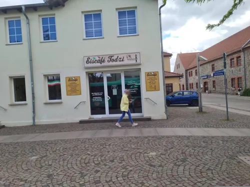
Restaurant Syrtaki
Restaurant · Greek · 5.1 km
147 Breiteweg, Barleben
Tu-Su,PH 11:30-14:30,17:30-23:00; Mo off
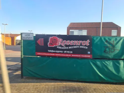



50 more on the map.
History
1300–750 BC: Late Bronze Age settlement that included a weaving house.
1009: First mentioned in 1009 in the chronicle of Thietmar of Merseburg.
1348: Charles IV, Holy Roman Emperor stays in town; issues decree releasing the burghers of Pritzwalk, Havelberg, Perleberg, and Kyritz from their feudal duty to Louis IV, Holy Roman Emperor.
1475: The men of the robber baron Dietrich von Quitzow raid the town.
1480: Castle chapel completed in 1480 under Archbishop Ernst II of Saxony.
Wolmirstedt was the district town of the Wolmirstedt District until 1994, when the districts Haldensleben and Wolmirstedt were merged to form the Ohrekreis, with the seat of administration in Haldensleben. In 2007, the Ohrekreis was merged with the Bördekreis district to form the Börde district.
From the History section of Wolmirstedt on Wikipedia, under CC BY-SA 4.0.
Where to stay16
Churches and places of worship12
Sankt Peter und Paul
Church · Protestant · 4.8 km
10 Alte Kirchstraße, Barleben
Shopping21
Gas and EV charging13
Schools, colleges and libraries16
Healthcare6
Map of Wolmirstedt
174 places. The map loads OpenStreetMap tiles when you open it.
Getting there and nearby towns
Magdeburg-Cochstedt Airport (CSO) is the nearest airport with scheduled flights listed in OpenStreetMap, 46 km away.
- Magdeburg 13 km south, about 13 min by car
- Helmstedt 42 km west, about 42 min by car
- Zerbst 44 km southeast, about 44 min by car
- Schöningen 47 km west, about 47 min by car
- Königslutter am Elm 55 km west, about 55 min by car
- Premnitz 58 km northeast, about 58 min by car
- Wolfsburg 61 km west, about 1 h by car
- Rathenow 62 km northeast, about 1 h by car
- Brandenburg an der Havel 65 km east, about 1 h by car
- Braunschweig 75 km west, about 1 h 15 min by car
Drive times are estimates from straight-line distance, not routes.
Local news
Headlines from INDB.
Reviews, tips and questions
Loading what members have shared...
Sources and licences
- GeoNames (CC BY 4.0): population, coordinates, regions and time zone
- Mapillary (see each image): photos
- OpenStreetMap contributors (ODbL 1.0): places, airports, map data
- Wikidata (CC0 1.0): elevation, founding date, time zone, website, landmarks and historic places
- Wikimedia Commons (see each image): photos
- Wikipedia (CC BY-SA 4.0): overview and history text
Photo credits
- August-Bebel-Straße 20 Wolmirstedt, Clemensfranz, CC BY-SA 3.0
- August-Bebel-Straße 50 Wolmirstedt, Clemensfranz, CC BY-SA 3.0
- 39326 Wolmirstedt, Germany - panoramio - Marc Dorendorf (15), Marc Dorendorf, CC BY-SA 3.0
- 39326 Wolmirstedt, Germany - panoramio - Marc Dorendorf (6), Marc Dorendorf, CC BY-SA 3.0
- Friedenstraße 5 Wolmirstedt, Clemensfranz, CC BY-SA 3.0
- Farsleber Straße 15 Wolmirstedt, Clemensfranz, CC BY-SA 3.0
- 39326 Wolmirstedt, Germany - panoramio - Marc Dorendorf (8), Marc Dorendorf, CC BY-SA 3.0
- 39326 Wolmirstedt, Germany - panoramio - Marc Dorendorf (3), Marc Dorendorf, CC BY-SA 3.0
- Friedenstraße 7 Wolmirstedt, Clemensfranz, CC BY-SA 3.0
- Friedenstraße 57 Wolmirstedt, Clemensfranz, CC BY-SA 3.0
- 39326 Wolmirstedt, Germany - panoramio - Marc Dorendorf (19), Marc Dorendorf, CC BY-SA 3.0
- Bahnhofstraße 5 Wolmirstedt, Clemensfranz, CC BY-SA 3.0
- Bahnhofstraße 9 Wolmirstedt, Clemensfranz, CC BY-SA 3.0
- 39326 Wolmirstedt, Germany - panoramio - Marc Dorendorf (14), Marc Dorendorf, CC BY-SA 3.0
- 39326 Wolmirstedt, Germany - panoramio - Marc Dorendorf (11), Marc Dorendorf, CC BY-SA 3.0
- Ehemaliges Postamt - Bahnhofstraße Wolmirstedt - panoramio, Marc Dorendorf, CC BY-SA 3.0
- 39326 Wolmirstedt, Germany - panoramio - Marc Dorendorf (20), Marc Dorendorf, CC BY-SA 3.0
- Fischerufer Wolmirstedt, Clemensfranz, CC BY-SA 3.0
- 39326 Wolmirstedt, Germany - panoramio - Marc Dorendorf (1), Marc Dorendorf, CC BY-SA 3.0
- 39326 Wolmirstedt, Germany - panoramio - Marc Dorendorf, Marc Dorendorf, CC BY-SA 3.0
- Magdeburg Kanalbrücke aerial view 13, Olivier Cleynen, CC BY 4.0
- Eingang Zoo Magdeburg, Torsten Maue, CC BY-SA 2.0
- Wolmirstedt Kirche Josef, Kirchenfan, CC0
- Elbeu Kirche, Olaf Meister, CC BY-SA 3.0
- Dorfkirche Farsleben2, Olaf Meister, CC BY-SA 3.0
- Nicolaikirche Glindenberg, Olaf2, CC BY-SA 3.0
- Kjfg, Unknown author Unknown author, CC BY-SA 3.0
- Sankt-Katharina-Kirche Wolmirstedt, Olaf Meister ( Olaf2 ), CC BY-SA 3.0
- Dorfkirche Zielitz1, No machine-readable author provided. Olaf2 assumed (based on copyright claims)., CC BY-SA 3.0
- Barleben St Peter und Paul, Olaf Meister, CC BY-SA 3.0
- Kirche in Jersleben, Olaf Meister, CC BY-SA 3.0
- Samswegen Kirche (1), Reise Reise, CC BY-SA 4.0
- Wolmirstedt - Schloss Wolmirstedt - 20220331115251, Jojoo64, CC BY-SA 4.0
- Kriegerdenkmal Hohenwarthe 2, Adnon, CC BY-SA 4.0
- Scheune Wolmirstedt Schloss, Olaf Meister ( Olaf2 ), CC BY-SA 3.0
- Dorfkirche Hohenwarthe3, Olaf Meister, CC BY-SA 4.0
- Burgenser Straße in Barleben 02, Olaf Meister, CC BY-SA 4.0
- Kriegerdenkmal Kirchhof Seeweg Farsleben-1, Datenralfi, CC BY-SA 4.0
- Flugsandkuppe Taufwiesenberge, Emillam, CC BY-SA 4.0
- Schlosswolmirstedt, The original uploader was Toolittle at German Wikipedia ., CC BY-SA 3.0
- BCF Glückauf an Schleuse Rothensee 2, Gerd Fahrenhorst, CC BY 4.0
- Dorfkirche Hohenwarthe 2, Adnon, CC BY-SA 4.0
- Street-level photo, nabamb, CC BY-SA 4.0
- Street-level photo, nabamb, CC BY-SA 4.0
- Street-level photo, hotteliene, CC BY-SA 4.0
- Street-level photo, sunnyteater, CC BY-SA 4.0
- Street-level photo, nabamb, CC BY-SA 4.0
- Street-level photo, nabamb, CC BY-SA 4.0
- Street-level photo, nabamb, CC BY-SA 4.0
- Street-level photo, nabamb, CC BY-SA 4.0
- Street-level photo, poxonline, CC BY-SA 4.0
- Street-level photo, nabamb, CC BY-SA 4.0
- Street-level photo, moenk, CC BY-SA 4.0


Page built November 8, 2026. Spotted a mistake? Tell us or suggest a place.