


Sülldorf, Germany
Bahnhof Sülldorf
Sülldorf is a town of 9,430 people in Hamburg, Germany, founded in 1883.
Why visit Sülldorf
Townapedia lists 38 museums and landmarks, 13 parks and trails, 69 places to eat, 8 places to stay and 11 attractions in and around town.
Highlights include Blankeneser Kino, Blankenese Low Lighthouse, Goßlerhaus and Villa Jako.
Weather in Sülldorf
Forecast from MET Norway (CC BY 4.0). Full forecast
About Sülldorf
Sülldorf railway station in Hamburg, Germany, is located on the extended Altona-Blankenese line and is served by the trains of the Hamburg S-Bahn.
From the Wikipedia article Sülldorf station (this version), under CC BY-SA 4.0.
Things to do11


Blankenese Low Lighthouse
Lighthouse · 2.3 km
Lighthouse in Hamburg, Germany

Blankenese Upper Lighthouse (1984)
Lighthouse · 2.7 km
Former lighthouse in Hamburg, Germany




Museums and landmarks38

Goßlerhaus
Monument and historic site · 1.6 km
1 Goßlers Park, Hamburg

Villa Jako
Monument and historic site · 1.9 km
17 Wilmans Park, Hamburg


Jenisch House
Museum · 5.2 km
Classicist manor house in Hamburg-Othmarschen, now a museum




Hamburger Golf-Club Falkenstein
Monument and historic site · 1.9 km
59 In de Bargen, Hamburg

Wasserwerk Altona
Monument and historic site · 2.2 km
Ehem. Pumpwerk mit Maschinen- und Kesselhaus als Teil des Wasserwerkes Altona
40 Falkensteiner Ufer, Hamburg
26 more on the map.
Parks, trails and playgrounds13







1 more on the map.
Restaurants and cafes69
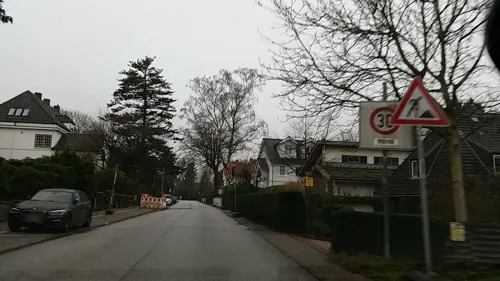
Athen Pallas
Restaurant · Greek · 1.3 km
1 Rissener Landstraße, Hamburg
Mo-Sa 17:00-23:00; Su,PH 12:00-22:30

Boca Restaurant & Bar
Restaurant · Italian · 2.3 km
420C Sackgasse Alte Sülldorfer Landstraße
We-Su 12:00-22:00
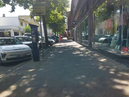
Dat Backhus
Bakery · 2.2 km
27 Blankeneser Bahnhofstraße
Mo-Fr 07:00-18:00; Sa 07:00-16:00; Su 08:00-17:00
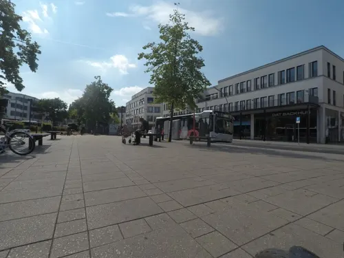
Süllberg Alm
Restaurant · International · 2.1 km
12 Süllbergsterrasse, Hamburg
Mo-Th 17:30-22:00; Fr-Su,PH 12:00-22:00
Tibet
Restaurant · Asian · 0.6 km
230 Sülldorfer Landstraße, Hamburg
Mo off; Tu-Fr 17:00-22:30; Sa-Su,PH 12:00-15:00,17:00-22:30


57 more on the map.
History
When the steam railway line to Wedel was opened on 1 December 1883, also a station in the small farmer's village of Sülldorf was established. It was then also used for freight traffic and had 3 tracks. After electrification of the line to Sülldorf, which was completed on 14 May 1950, the third track north of the station was removed. The platform was fully renovated in 2013.
From the History section of Sülldorf station on Wikipedia, under CC BY-SA 4.0.
Where to stay8
Hotel-Pension Gabriele Wiechmann
Motel and hotel · 2.0 km
52 Simrockstraße, Hamburg
Churches and places of worship7
Maria Grün
Church · Roman Catholic · 2.5 km
3 Schenefelder Landstraße, Hamburg
Martin-Luther-Kirche
Church · Lutheran · 1.6 km
202 Schenefelder Landstraße, Hamburg
Shopping21
Gas and EV charging4
Schools, colleges and libraries16
Healthcare12
Atlasprofilax-Praxis Flick
Clinic and pharmacy · 1.8 km
19 Blankeneser Landstraße, Hamburg
Map of Sülldorf
199 places. The map loads OpenStreetMap tiles when you open it.
Getting there and nearby towns
Hamburg Finkenwerder Airport (XFW) is the nearest airport with scheduled flights listed in OpenStreetMap, 5 km away.
- Wedel 7 km west, about 7 min by car
- Halstenbek 7 km northeast, about 7 min by car
- Rellingen 8 km north, about 8 min by car
- Pinneberg 9 km north, about 9 min by car
- Jork 9 km southwest, about 9 min by car
- Hamburg 13 km east, about 13 min by car
- Neu Wulmstorf 13 km south, about 13 min by car
- Buxtehude 14 km southwest, about 14 min by car
- Tornesch 14 km north, about 14 min by car
- Uetersen 15 km northwest, about 15 min by car
Drive times are estimates from straight-line distance, not routes.
Local news
Headlines from INDB.
Reviews, tips and questions
Loading what members have shared...
Sources and licences
- GeoNames (CC BY 4.0): population, coordinates, regions and time zone
- Mapillary (see each image): photos
- OpenStreetMap contributors (ODbL 1.0): places, airports, map data
- Wikidata (CC0 1.0): elevation, founding date, time zone, website, landmarks and historic places
- Wikimedia Commons (see each image): photos
- Wikipedia (CC BY-SA 4.0): overview and history text
Photo credits
- Sülldorfer S-Bahnhof mit Zug, flamenc, CC BY-SA 3.0
- Michaelskirche sülldorf süd 02, Dirtsc, CC BY-SA 4.0
- Michaelskirche sülldorf südtür, Dirtsc, CC BY-SA 4.0
- Michaelskirche sülldorf süd 01, Dirtsc, CC BY-SA 4.0
- Michaelskirche sülldorf relief, Dirtsc, CC BY-SA 4.0
- Michaelskirche sülldorf südwest, Dirtsc, CC BY-SA 4.0
- Michaelskirche sülldorf west 03, Dirtsc, CC BY-SA 4.0
- Michaelskirche sülldorf giebel, Dirtsc, CC BY-SA 4.0
- Michaelskirche sülldorf turmkreuz, Dirtsc, CC BY-SA 4.0
- Sülldorf, Hamburg, Germany - panoramio (2), hh oldman, CC BY 3.0
- Kriegerdenkmal in Hamburg-Sülldorf, flamenc, CC BY-SA 3.0
- Sülldorf, Hamburg, Germany - panoramio (3), hh oldman, CC BY 3.0
- Sülldorf, Hamburg, Germany - panoramio (6), hh oldman, CC BY 3.0
- Michaelskirche sülldorf west 02, Dirtsc, CC BY-SA 4.0
- Michaelskirche sülldorf west 01, Dirtsc, CC BY-SA 4.0
- Sülldorf, Hamburg, Germany - panoramio (5), hh oldman, CC BY 3.0
- Kirche Sülldorf-Iserbrook - panoramio, hh oldman, CC BY 3.0
- Kirche Sülldorf - panoramio, hh oldman, CC BY 3.0
- Sülldorf, Hamburg, Germany - panoramio (4), hh oldman, CC BY 3.0
- Hamburg-Sülldorf Heidhofsweg 2, flamenc, CC BY-SA 3.0
- Blankenese-Leuchtturm Unterfeuer (1), Dkvtig, CC BY-SA 4.0
- Hh-ernst-barlach-haus, The original uploader was Staro1 at German Wikipedia ., CC BY-SA 3.0
- Jenisch-Haus (Hamburg-Othmarschen).1.18006.ajb, Ajepbah, CC BY-SA 3.0 de
- Bornpark (2) in HH-Osdorf, Pauli-Pirat, CC BY-SA 4.0
- Jenischpark Hamburg, Alstersegler, CC BY-SA 4.0
- MFG 0749-Schnaakenmoor, Malte, CC BY 3.0
- Ensemble-Evangelische-Kirche-Blankenese, Fotogreif, CC BY-SA 3.0
- Hessepark, Gerhard Kemme, Public domain
- Kirche Maria Grün Hamburg-Blankenese1, Rmw73, CC BY-SA 3.0
- WW Altona GS, No machine-readable author provided. Karlderkahle assumed (based on copyright claims)., CC BY-SA 3.0
- Blankenese Blick auf den Süllberg, Jan Peer Baumann, CC BY-SA 3.0
- Blankeneser Kino, Photographed by User:Bullenwächter, CC BY-SA 4.0
- Villa Jako, Wilmans Park 05.21 122 4504, Ferdinand Graf Luckner, CC BY-SA 4.0
- Michaels-Kirche, Hinnerk11, CC BY-SA 3.0
- Goßlerhaus, Rsswjesus, CC BY-SA 3.0
- Stolperstein Hasenhöhe 95 (Alma del Banco) in Hamburg-Blankenese, Hinnerk11, CC BY-SA 4.0
- Stolperstein Rissener Landstraße 231 (Gerda Nagel) in Hamburg-Rissen, Hinnerk11, CC BY-SA 4.0
- Stolperstein Potosistraße 31 (Hans Teppich) in Hamburg-Blankenese, Hinnerk11, CC BY-SA 4.0
- Stolperstein Simrockstraße 143 (Kurt Garbarini) in Hamburg-Iserbrook, Hinnerk11, CC BY-SA 4.0
- Stolperstein Caprivistraße 53 (Lothar Buchbinder) in Hamburg-Blankenese, Hinnerk11, CC BY-SA 4.0
- Hh-falckensteinerufer-wasserwerk, Selbst, CC BY-SA 3.0
- Römischer Garten Blankenese 01, Punktional, CC BY-SA 3.0
- Maria Grün Front 2, Dirtsc, CC BY-SA 3.0
- Kirche St. Michael in Hamburg-Sülldorf 2009, Rmw73, CC BY-SA 3.0
- Asklepius Westklinikum Hamburg, Gerhard kemme, CC0
- Goßlers Park Hamburg-Blankenese (1), Pauli-Pirat, CC BY-SA 4.0
- Marion-Dönhoff-Gymnasium in Hamburg, 2019, Minderbinder, CC BY-SA 4.0
- Hamburg, Goßlers Park 1, Agrewe, CC BY-SA 3.0
- Street-level photo, tian, CC BY-SA 4.0
- Street-level photo, tian, CC BY-SA 4.0
- Street-level photo, tian, CC BY-SA 4.0
- Street-level photo, tian, CC BY-SA 4.0
- Street-level photo, mjay, CC BY-SA 4.0
- Street-level photo, tian, CC BY-SA 4.0
- Street-level photo, changchun1, CC BY-SA 4.0
- Street-level photo, tian, CC BY-SA 4.0
- Street-level photo, tian, CC BY-SA 4.0
- Street-level photo, tian, CC BY-SA 4.0
- Street-level photo, tian, CC BY-SA 4.0
- Street-level photo, zugnomade, CC BY-SA 4.0
- Street-level photo, veloroute_hamburg, CC BY-SA 4.0
- Street-level photo, tian, CC BY-SA 4.0
- Street-level photo, tian, CC BY-SA 4.0
- Street-level photo, changchun1, CC BY-SA 4.0
- Street-level photo, tian, CC BY-SA 4.0
- Street-level photo, Natrium11, CC BY-SA 4.0
- Street-level photo, tian, CC BY-SA 4.0
- Street-level photo, changchun1, CC BY-SA 4.0
- Street-level photo, tian, CC BY-SA 4.0
- Street-level photo, veloroute_hamburg, CC BY-SA 4.0


Page built November 9, 2026. Spotted a mistake? Tell us or suggest a place.