


Why visit Tholey
Townapedia lists 103 museums and landmarks, 19 parks and trails, 116 places to eat, 14 places to stay and 33 attractions in and around town.
Highlights include Krummer Stein, Wildgehege Nahe Quelle, Museum Theulegium and Tholey Abbey.
Weather in Tholey
Forecast from MET Norway (CC BY 4.0). Full forecast
About Tholey
Tholey (German pronunciation: [ˈtoːlaɪ]) is a municipality in the district of Sankt Wendel, in Saarland, Germany. It is situated approximately 10 kilometres (6.2 mi) west of Sankt Wendel, and 30 kilometres (19 mi) north of Saarbrücken.
From the Wikipedia article Tholey (this version), under CC BY-SA 4.0.
Things to do33

Krummer Stein
Scenic view · 5.9 km
Naturdenkmal und Aussichtspunkt "Krummer Stein"


21 more on the map.
Museums and landmarks103



The Philippi Collection
Museum
Private collection of religious headgear

Vicus Wareswald
Monument and historic site · 1.9 km
Archaeological site in St. Wendel, Germany


Thaler-Kreuz
Monument and historic site · Catholic · 1.7 km
Der polygonale, mit rahmendem Randschlag versehene Sockel ist möglicherweise barocken Ursprungs. Die Altarplatte und das...


91 more on the map.
Parks, trails and playgrounds19
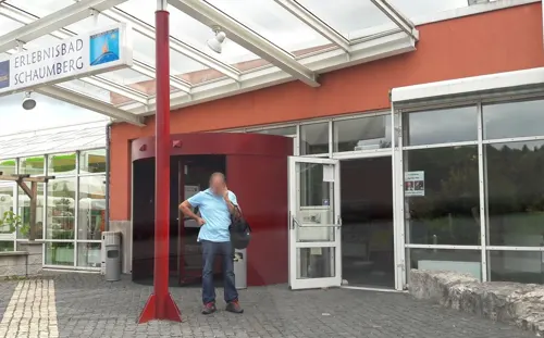
Erlebnisbad Schaumberg
Sports field and stadium · 0.9 km
Mo 13:00-22:00, Tu-Th 10:00-22:00, Fr 10:00-23:00, Sa,Su,PH...



7 more on the map.
Restaurants and cafes116


Botanico Finkenrech
Restaurant · Regional, German · 6.4 km
50 Tholeyer Straße
We-Sa 12:00-22:00;Su 12:00-18:00;Mo,Tu off
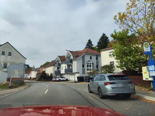
Alexandros
Restaurant · Greek · 5.5 km
31 Im Oberdorf, Marpingen
Tu-Sa 17:30-24:00; PH,Su 11:30-14:00,17:30-24:00; Mo off
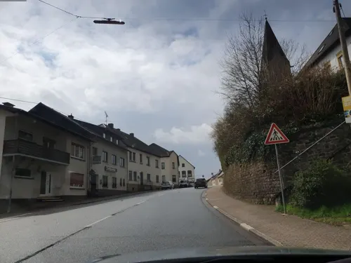
Calabria
Restaurant · Italian · 5.5 km
Mo-Sa 17:30-24:00; PH,Su 11:30-14:00,17:30-24:00



104 more on the map.
Where to stay14
Churches and places of worship32
Abteikirche St. Mauritius
Church · Roman Catholic
11 Im Kloster, Tholey
Pfarrkirche Heilige Familie
Church · Catholic · 4.9 km
2 Poststraße, Sankt Wendel
Shopping19
Gas and EV charging9
Schools, colleges and libraries12
Healthcare10
Map of Tholey
250 places. The map loads OpenStreetMap tiles when you open it.
Getting there and nearby towns
Saarbrücken Airport (SCN) is the nearest airport with scheduled flights listed in OpenStreetMap, 30 km away.
- Marpingen 4 km southeast, about 4 min by car
- Oberthal 5 km northeast, about 5 min by car
- Wadern 13 km northwest, about 13 min by car
- Saarbrücken 28 km south, about 28 min by car
- Wadgassen 30 km southwest, about 30 min by car
- Zweibrücken 36 km southeast, about 36 min by car
- Überherrn 36 km southwest, about 36 min by car
- Trier 42 km northwest, about 42 min by car
- Wittlich 57 km north, about 57 min by car
- Geisenheim 87 km northeast, about 1 h 30 min by car
Drive times are estimates from straight-line distance, not routes.
Local news
Headlines from INDB.
Reviews, tips and questions
Loading what members have shared...
Sources and licences
- GeoNames (CC BY 4.0): population, coordinates, regions and time zone
- Mapillary (see each image): photos
- OpenStreetMap contributors (ODbL 1.0): places, airports, map data
- Wikidata (CC0 1.0): elevation, founding date, time zone, website, landmarks and historic places
- Wikimedia Commons (see each image): photos
- Wikipedia (CC BY-SA 4.0): overview and history text
Photo credits
- Benediktinerkloster Tholey, LoKiLeCh, CC BY-SA 4.0
- Weiher Tholey, Flocci Nivis, CC BY 4.0
- Tholey, Römerstraße 2025a, Cayambe, CC BY 4.0
- Tholey, Römerstraße 2025ba, Cayambe, CC BY 4.0
- Tholey mai 2016 0002, Klaus Graf, CC BY-SA 3.0
- Tholey mai 2016 0003, Klaus Graf, CC BY-SA 3.0
- Tholey mai 2016 0004, Klaus Graf, CC BY-SA 3.0
- Tholey Marktplatz 2020-05, Chrisu2019, CC BY-SA 4.0
- Tholey mai 2016 0005, Klaus Graf, CC BY-SA 3.0
- Benediktinerkloster Tholey 9, LoKiLeCh, CC BY-SA 4.0
- Benediktinerkloster Tholey 11, LoKiLeCh, CC BY-SA 4.0
- Benediktinerkloster Tholey 13, LoKiLeCh, CC BY-SA 4.0
- Abteikirche Tholey renoviert 2020 - Didas, Chrisu2019, CC BY-SA 4.0
- Benediktinerkloster Tholey 4, LoKiLeCh, CC BY-SA 4.0
- Benediktinerkloster Tholey 2, LoKiLeCh, CC BY-SA 4.0
- Tholey mai 2016 0006, Klaus Graf, CC BY-SA 3.0
- Tholey mai 2016 0007, Klaus Graf, CC BY-SA 3.0
- Benediktinerkloster Tholey 10, LoKiLeCh, CC BY-SA 4.0
- Tholey mai 2016 0001, Klaus Graf, CC BY-SA 3.0
- Tholey mai 2016 0009, Klaus Graf, CC BY-SA 3.0
- Benediktinerkloster Tholey 12, LoKiLeCh, CC BY-SA 4.0
- Benediktinerkloster Tholey 5, LoKiLeCh, CC BY-SA 4.0
- Benediktinerkloster Tholey 8, LoKiLeCh, CC BY-SA 4.0
- Benediktinerkloster Tholey 7, LoKiLeCh, CC BY-SA 4.0
- Benediktinerkloster Tholey 6, LoKiLeCh, CC BY-SA 4.0
- Benediktinerkloster Tholey 3, LoKiLeCh, CC BY-SA 4.0
- Sammlung Philippi Stuecke, Dieter Philippi, CC BY-SA 3.0
- Ausgrabungsstaette Wareswald, Pascal Dihé, CC BY-SA 4.0
- Tholey2, { Xocolatl, Public domain
- Blasiuskapelle, Oxirion, CC BY 3.0
- Bliesen St. Remigius 07, atreyu, CC BY-SA 3.0
- Jüdischer Friedhof Tholey im Saarland, L.Sieht, CC BY-SA 3.0
- Goettelborn Schaumberg, LoKiLeCh, CC BY-SA 3.0
- Steinbach St. Aloysius 02, atreyu, CC BY-SA 3.0
- Sotzweiler St. Mauritius 05, atreyu, CC BY-SA 3.0
- Urexweiler St. Franziskus 04, atreyu, CC BY-SA 3.0
- Winterbach Heilige Familie 01, atreyu, CC BY-SA 3.0
- Oberthal, St. Stephanus (2), Cmcmcm1, CC BY-SA 3.0
- Dörsdorf, Maria Königin (10), Cmcmcm1, CC BY-SA 3.0
- 20200607Schaumberg14, Flocci Nivis, CC BY 4.0
- Gronig, St. Donatus (42), Cmcmcm1, CC BY-SA 3.0
- Jüdischer Friedhof Tholey, L.Sieht, CC BY-SA 3.0
- Grenzstein Urexweiler 34, Pelayo 08, CC BY-SA 4.0
- Grenzstein-Urexweiler-37, Thomas Besse, Riegelsberg, CC0
- Grenzstein-Urexweiler-38, Thomas Besse, Riegelsberg, CC0
- Grenzstein-Urexweiler-39, Thomas Besse, Riegelsberg, CC0
- Wegkreuz Tholey 03, Pelayo 08, CC BY-SA 4.0
- Grenzstein-Sotzweiler-19, Thomas Besse, Riegelsberg, CC0
- Grenzstein-Sotzweiler-20, Thomas Besse, Riegelsberg, CC0
- Street-level photo, teddy73, CC BY-SA 4.0
- Street-level photo, teddy73, CC BY-SA 4.0
- Street-level photo, teddy73, CC BY-SA 4.0
- Street-level photo, teddy73, CC BY-SA 4.0
- Street-level photo, teddy73, CC BY-SA 4.0
- Street-level photo, teddy73, CC BY-SA 4.0
- Street-level photo, teddy73, CC BY-SA 4.0
- Street-level photo, teddy73, CC BY-SA 4.0
- Street-level photo, teddy73, CC BY-SA 4.0
- Street-level photo, teddy73, CC BY-SA 4.0
- Street-level photo, changchun1, CC BY-SA 4.0
- Street-level photo, teddy73, CC BY-SA 4.0
- Street-level photo, teddy73, CC BY-SA 4.0
- Street-level photo, teddy73, CC BY-SA 4.0
- Street-level photo, teddy73, CC BY-SA 4.0
- Street-level photo, teddy73, CC BY-SA 4.0
- Street-level photo, teddy73, CC BY-SA 4.0
- Street-level photo, teddy73, CC BY-SA 4.0
- Street-level photo, changchun1, CC BY-SA 4.0
- Street-level photo, teddy73, CC BY-SA 4.0
- Street-level photo, teddy73, CC BY-SA 4.0


Page built November 8, 2026. Spotted a mistake? Tell us or suggest a place.