


Zweibrücken, Germany
Zweibrücken is a town of 35,221 people in Rheinland-Pfalz, Germany.
Why visit Zweibrücken
Townapedia lists 25 museums and landmarks, 27 parks and trails, 159 places to eat, 11 places to stay and 26 attractions in and around town.
Highlights include Festhalle, Klosterberg, Römermuseum Schwarzenacker and Klosterruine Wörschweiler.
Weather in Zweibrücken
Forecast from MET Norway (CC BY 4.0). Full forecast
About Zweibrücken
Zweibrücken (German: [ˈtsvaɪˌbʁʏkŋ̍] ; French: Deux-Ponts [dø pɔ̃]; Palatine German: Zweebrigge [ˈtsʋeːbʁɪgə]; literally translated as "Two Bridges") is a town in Rhineland-Palatinate, Germany, on the Schwarzbach River.
From the Wikipedia article Zweibrücken (this version), under CC BY-SA 4.0.
Photos of Zweibrücken


Things to do26




Wahlbacherhof - Naturkost Hofladen Nafziger
Farm and orchard · 6.6 km
1 Wahlbacherhof, Contwig
We 14:00-18:00, Fr 10:00-18:00, Sa 09:00-13:00

14 more on the map.
Museums and landmarks25


Stadtmuseum Zweibrücken
Museum · 0.8 km
9 Herzogstraße, Zweibrücken




WH 114a/119a
Monument and historic site · 5.9 km
Wehrmachtsstollen, spätere US-Nutzung
13 more on the map.
Parks, trails and playgrounds27




Freibad Zweibrücken
Sports field and stadium · 0.9 km
111 Landauer Straße, Zweibrücken

15 more on the map.
Restaurants and cafes159

Alter Bahnhof
Restaurant · German · 2.0 km
2 Tschifflick, Zweibrücken
Mo-Tu off, We-Sa 17:30-22:30; Su,PH 11:00-14:30,17:00-22:00
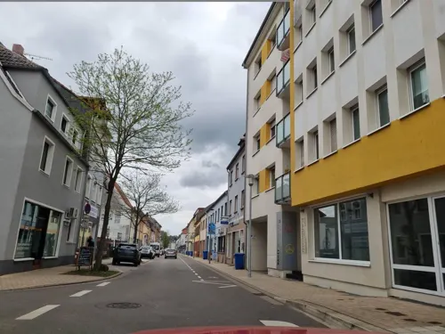
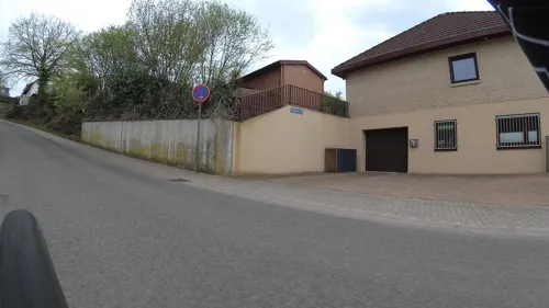
Pfälzer Hof
Restaurant · German · 0.9 km
92 Oselbachstraße, Zweibrücken
Mo-Fr,Su,PH 11:30-14:00,17:30-24:00; Sa 17:30-24:00
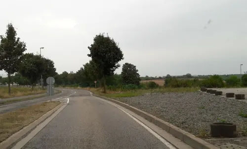
Trattoria la Calabria
Restaurant · Italian, Pizza, Pasta · 3.3 km
21 Straßburger Ring, Zweibrücken
Mo off; Tu 17:30-22:00; We-Fr 11:30-14:00,17:30-22:00; Sa...
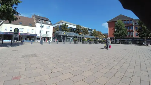
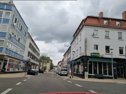
Cafe Pastis
Cafe
11 Maxstraße, Zweibrücken
Mo-Th 07:30-14:00,16:00-19:00; Fr 07:30-14:00,16:00-00:00; Sa...


147 more on the map.
History
The town was the capital of the former Imperial State of Palatine Zweibrücken owned by the House of Wittelsbach. The ducal castle is now occupied by the high court of the Palatinate (Oberlandesgericht). There is a fine Gothic Protestant church, Alexander's church, founded in 1493 and rebuilt in 1955.
From the end of the 12th century, Zweibrücken was the seat of the County of Zweibrücken, the counts being descended from Henry I, youngest son of Simon I, Count of Saarbrücken (d. 1182). The line became extinct on the death of Count Eberhard II (1394), who in 1385 had sold half his territory to the Count Palatine of the Rhine, and held the other half as his feudal domain. Louis (d. 1489), son of Stephen, founded the line of the House of Palatinate-Zweibrücken. In 1533, Wolfgang, Count Palatine of Zweibrücken converted Palatine Zweibrücken to the new Protestant faith. In 1559, Wolfgang founded the earliest grammar school in the town (Herzog-Wolfgang-Gymnasium), which lasted until 1987.
When Charles X Gustav, the son of John Casimir, Count Palatine of Kleeburg, succeeded his cousin, Queen Christina of Sweden, on the Swedish throne, Palatinate-Zweibrücken was in personal union with Sweden, a situation that lasted until 1718.
Read more of the history
Starting in 1680, Louis XIV's Chambers of Reunion awarded Zweibruecken and other localities to France, but under the 1697 Treaty of Rijswijk, "The Duchy of Zweibruecken was restored to the King of Sweden, as Count Palatine of the Rhine."
In 1731, Palatinate-Zweibrücken passed to the Palatinate-Birkenfeld-Zweibrücken branch of the counts palatine, from where it came under the sway of Bavaria in 1799. It was occupied by France in 1793 and on 4 November 1797, Zweibrücken became a canton centre in department of Mont Tonnerre. At the Peace of Lunéville in 1801, the French annexation of Zweibrücken was confirmed; on its reunion with Germany in 1814 the greater part of the territory was given to Bavaria, the remainder to Oldenburg and Prussia. The town of Zweibrücken became part of the Palatine region of the Kingdom of Bavaria.
At the ducal printing office at Zweibrücken the fine series of the classical editions known as the Bipontine Editions was published (1779 sqq.).
The last prominent social event before the First World War was the inauguration of the Rosengarten (rose garden) by Princess Hildegard of Bavaria in June 1914. As a consequence of the First World War, Zweibrücken was occupied by French troops between 1918 and 1930. In the course of the Kristallnacht in 1938, Zweibrücken's synagogue was destroyed. On the outbreak of the World War II, the town was evacuated in 1939–1940, as it lay in the "Red Zone" on the fortified Siegfried Line. Shortly before the end of the war, on 14 March 1945, the town was nearly destroyed in an air raid by the Royal Canadian Air Force, with the loss of more than 200 lives. On 20 March, American ground troops reached Zweibrücken. The town became part of the new state of Rhineland-Palatinate after the war.
In 1993, the town underwent a major change. With the departure of the Americans, the military area became free, which corresponded altogether to a third of the entire urban area. Unemployment increased to approximately 21%, leading to a decrease in demand in the retail trade of approximately 25%.
From the History section of Zweibrücken on Wikipedia, under CC BY-SA 4.0.
More about Zweibrücken
Geography
Zweibrücken is in the Southwestern portion of the Western Palatinate, bordering the state of Saarland. It is about 26 kilometres (16 mi) from Pirmasens, 40 kilometres (25 mi) from Saarbrücken and 55 kilometres (34 mi) from Kaiserslautern. The town stretches about 15 kilometres (9.3 mi) north to south and about 10 kilometres (6.2 mi) east-west.
Economy
Weaving, brewing and the manufacture of machinery, chicory, cigars, malt, boots, furniture and soap were the chief industries before World War II. Nowadays, Terex cranes and bulldozers and John Deere harvesting equipment are the chief industries.
The Hochschule Kaiserslautern [1], one of the largest universities in the Rhineland-Palatinate with about 6,300 students, has one of its three campuses in Zweibrücken.
Arts and culture
The city of Zweibrücken is represented at various cultural events by the Rose Queen, who is elected every two years.
Zweibrücken has one of the largest Rosariums in the World with 45000 Plants and 1500 Species. It consists of 2 gardens with the main garden having an area of 50.000 square meters. The second, smaller garden is accessible without an entry fee and is located at the Fasanerie and contains Wild Rose plants. The city is sometimes known as the "Rose City".
The Zweibrücken City Museum has a permanent exhibition in the former residence of court gardener Ernst August Bernhard Petri, documenting the eventful history of Zweibrücken. In addition, special exhibitions take place regularly, e.g. on the occasion of the 200th anniversary of the State Stud.
From the Wikipedia article Zweibrücken, under CC BY-SA 4.0.
Notable people from Zweibrücken
 Philip Louis, Count Palatine of NeuburgCount Palatine of Neuburg and Count Palatine of Sulzbach (1547-1614)Photo: The Brunswick-Lüneburg Court miniaturist, Public domain
 John Casimir, Count Palatine of Kleeburgfather of King Charles X of Sweden (1589-1652)Photo: Attributed to David Beck, Public domain
 Wolfgang, Count Palatine of ZweibrückenCount Palatine of ZweibrückenPhoto: unbekannter Künstler, Public domain
 Christin MaurerGerman athletics competitor (1994-)Photo: Ailura, CC BY-SA 3.0 at
 Wilhelm FahrmbacherGerman general (1888–1970)Photo: Jesse, CC BY-SA 3.0 de
- Philipp Ludwig von SeidelGerman mathematician, optician and astronomer (1821-1896)
- Peter FleischmannGerman film director (1937–2021)
- Louis II, Count Palatine of ZweibrückenDuke of Zweibrücken from 1514 to 1532
- Rupert, Count Palatine of VeldenzCount Palatine of Veldenz
- Friedrich Wilhelm SchultzGerman pharmacist (1804-1876)
- Carl Heinrich 'Bipontinus' SchultzGerman physician and botanist (1805-1867)
- Frederick, Count Palatine of ZweibrückenGerman noble
Born in Zweibrücken, according to Wikidata (CC0). Each name links to its Wikipedia article.
Where to stay11
Churches and places of worship40
Maria Königin der Engel
Church · Roman Catholic · 6.7 km
25 Dellfelder Straße, Contwig
Shopping36
Gas and EV charging11
Globus Tankstelle Zweibrücken
Gas station · 1.4 km
38 Gottlieb-Daimler-Straße, Zweibrücken
Schools, colleges and libraries29
Diätschule, Lehranstalt für med. techn. Labor-Assistenten (Geb. 21)
School · 7.1 km
21 Universitätsklinikum, Homburg
Healthcare18
Augenklinik (Geb. 22)
Clinic and pharmacy · 7.1 km
22 Universitätsklinikum, Homburg
Map of Zweibrücken
250 places. The map loads OpenStreetMap tiles when you open it.
Getting there and nearby towns
Zweibruecken Airport (ZQW) is the nearest airport with scheduled flights listed in OpenStreetMap, 5 km away.
- Contwig 5 km east, about 5 min by car
- Blieskastel 8 km west, about 8 min by car
- Homburg 9 km north, about 9 min by car
- Kirkel 11 km west, about 11 min by car
- Bexbach 14 km northwest, about 14 min by car
- Waldmohr 15 km north, about 15 min by car
- Bruchmühlbach-Miesau 16 km north, about 16 min by car
- Gersheim 16 km southwest, about 16 min by car
- Neunkirchen 18 km northwest, about 18 min by car
- Pirmasens 18 km east, about 18 min by car
Drive times are estimates from straight-line distance, not routes.
Towns near Zweibrücken


Keep exploring
Local news
Headlines from INDB.
Reviews, tips and questions
Loading what members have shared...
Sources and licences
- GeoNames (CC BY 4.0): population, coordinates, regions and time zone
- Mapillary (see each image): photos
- OpenStreetMap contributors (ODbL 1.0): places, airports, map data
- Wikidata (CC0 1.0): elevation, founding date, time zone, website, landmarks and historic places
- Wikimedia Commons (see each image): photos
- Wikipedia (CC BY-SA 4.0): overview and history text
Photo credits
- Zweibrücken, Mühlgasse, Ansichtskarte, Unknown author Unknown author, Public domain
- Zweibrücken Finanzamt Gymnasiumstr 4 (2), TeKaBe, CC BY-SA 4.0
- Zweibrücken Maxstraße 12-18, TeKaBe, CC BY-SA 4.0
- Zweibrücken Finanzamt Gymnasiumstr 4, TeKaBe, CC BY-SA 4.0
- Zweibrücken Maxstraße 13-19, TeKaBe, CC BY-SA 4.0
- Zweibrücken Verbandsgemeinde VGZWLand - Bücherschrank, TeKaBe, CC BY-SA 4.0
- Zweibrücken, Europas Rosengarten-07, Dguendel, CC BY 4.0
- Zweibrücken, Europas Rosengarten-04, Dguendel, CC BY 4.0
- Zweibrücken, Europas Rosengarten-05, Dguendel, CC BY 4.0
- Zweibrücken, die Alexanderskirche, Dguendel, CC BY 4.0
- Zweibrücken, Europas Rosengarten-06, Dguendel, CC BY 4.0
- Zweibrücken, das Schloss, Büste von Maximilian, Dguendel, CC BY 4.0
- Zweibrücken, das Schloss, die Skulptur "Friedenstor", Dguendel, CC BY 4.0
- Zweibrücken, Residenzschloss v S, 15, Renardo la vulpo, CC BY-SA 4.0
- Zweibrücken, Alexanderkirche v N, 3, Renardo la vulpo, CC BY-SA 4.0
- Zweibrücken, Fußgängerzone Hauptstraße, Dguendel, CC BY 4.0
- Zweibrücken, Alexanderkirche v SSW, 1, Renardo la vulpo, CC BY-SA 4.0
- Zweibrücken, Cadillac Oldtimer vor der Alexanderkirche, Dguendel, CC BY 4.0
- Zweibrücken, Europas Rosengarten, Rose im Regen-03, Dguendel, CC BY 4.0
- Zweibrücken, Europas Rosengarten, Rose im Regen-05, Dguendel, CC BY 4.0
- Zweibrücken, Europas Rosengarten, Rose im Regen-04, Dguendel, CC BY 4.0
- Zweibrücken, Europas Rosengarten, Rose im Regen-02, Dguendel, CC BY 4.0
- Zweibrücken, Rose im Regen-01, Dguendel, CC BY 4.0
- Zweibrücken, Europas Rosengarten-03, Dguendel, CC BY 4.0
- Zweibrücken, Europas Rosengarten-08, Dguendel, CC BY 4.0
- Blieskastel Heilig-Kreuz-Kapelle 02, atreyu, CC BY-SA 3.0
- Karlskirche Zweibruecken 01, Immanuel Giel, Public domain
- Schloss Zweibrücken, TeKaBe, CC BY-SA 4.0
- Kletterrose Rosengarten ZW, Akinom, Public domain
- Kloster woerschweiler front, Unknown author, CC BY-SA 2.0 de
- Bibliotheca Bipontina, The original uploader was BausHirz at German Wikipedia ., CC BY-SA 2.0 de
- Schwarzenacker Kirche, Lokilech, CC BY-SA 3.0
- Stambach Katholische Kirche, atreyu, CC BY-SA 3.0
- Johanneum Homburg, TeKaBe, CC BY-SA 4.0
- Zweibrücken Heilig Kreuz 01, atreyu, CC BY-SA 3.0
- Helmholtz-Gymnasium Zweibrücken, Gripweed, CC BY-SA 3.0
- Klinikkirche Homburg mit Turm, Lantus, CC BY-SA 3.0
- Hornbach Protestantische Kirche 01, atreyu, CC BY-SA 3.0
- Zweibrücken Alexanderskirche 02, atreyu, CC BY-SA 3.0
- Schwarzbachtalbahn-24, Pimvantend, CC BY-SA 3.0
- Petrihaus Zweibrücken, TeKaBe, CC BY-SA 4.0
- 20150531Orchis x hybrida1, AnRo0002, CC0
- Neubau der Klinik für Innere Medizin, Homburg, Victormayer, CC BY-SA 4.0
- Zweibrücken Festhalle 01, atreyu, CC BY-SA 3.0
- Outlet Center Zweibrücken pic1, Alf van Beem, Public domain
- Wildrosengarten Zweibrücken, Wilrooij, CC BY-SA 4.0
- Bubenhausen St. Pirmin 01, atreyu, CC BY-SA 3.0
- 20210703 Schule Einöd Homburg 02, Flocci Nivis, CC BY 4.0
- 20180812 Waldgebiet Wörschweiler 01, Flocci Nivis, CC BY 4.0
- 20210703 Edelhof Schwarzenacker 05, Flocci Nivis, CC BY 4.0
- 20210703 Klosterberg Blieskastel, Flocci Nivis, CC BY 4.0
- Protestantische Kirche Rimschweiler 01, Immanuel Giel, CC BY-SA 4.0
- Katholische Kirche Rimschweiler 01, Immanuel Giel, CC BY-SA 4.0
- Alte Tongrube, TeKaBe, CC BY-SA 4.0
- Schwarzenacker Gallo Römischer Tempel innen-2, Lokilech, CC BY-SA 3.0
- Street-level photo, teddy73, CC BY-SA 4.0
- Street-level photo, teddy73, CC BY-SA 4.0
- Street-level photo, b166er, CC BY-SA 4.0
- Street-level photo, teddy73, CC BY-SA 4.0
- Street-level photo, teddy73, CC BY-SA 4.0
- Street-level photo, teddy73, CC BY-SA 4.0
- Street-level photo, teddy73, CC BY-SA 4.0
- Street-level photo, b166er, CC BY-SA 4.0
- Street-level photo, teddy73, CC BY-SA 4.0
- Street-level photo, teddy73, CC BY-SA 4.0
- Street-level photo, teddy73, CC BY-SA 4.0
- Street-level photo, teddy73, CC BY-SA 4.0
- Street-level photo, teddy73, CC BY-SA 4.0
- Street-level photo, teddy73, CC BY-SA 4.0
- Street-level photo, teddy73, CC BY-SA 4.0
- Street-level photo, teddy73, CC BY-SA 4.0
- Street-level photo, teddy73, CC BY-SA 4.0
- Street-level photo, teddy73, CC BY-SA 4.0
- Street-level photo, b166er, CC BY-SA 4.0
- Street-level photo, teddy73, CC BY-SA 4.0
- Street-level photo, teddy73, CC BY-SA 4.0
- Street-level photo, teddy73, CC BY-SA 4.0


Page built November 9, 2026. Spotted a mistake? Tell us or suggest a place.