


Why visit Tönning
Townapedia lists 16 museums and landmarks, 13 parks and trails, 38 places to eat, 18 places to stay and 2 attractions in and around town.
Highlights include Multimar Wattforum, Historisches Packhaus & Museum, Dithmarscher Eidervorland mit Watt and Grüne Insel mit Eiderwatt.
Weather in Tönning
Forecast from MET Norway (CC BY 4.0). Full forecast
About Tönning
Tönning (German pronunciation: [ˈtœnɪŋ] ; Low German: Tünn, Tönn or Tönnen; Danish: Tønning; North Frisian: Taning) is a town in the district of Nordfriesland in the German state of Schleswig-Holstein.
From the Wikipedia article Tönning (this version), under CC BY-SA 4.0.
Travel tips from other travellers: Tönning on Wikivoyage (CC BY-SA 4.0).
Photos of Tönning


Things to do2

Kiek ut
Scenic view · 4.7 km
Aussichtsplattform die rund um den ehemaligen Wasserturm der Viehtränke auf dem "Schafsberg" gebaut wurde

Museums and landmarks16


Herrenhaus Hoyerswort
Museum · 4.6 km
2 Kotzenbüller Chaussee, Oldenswort
Feb 21-Jan 06 We-Mo, PH 11:00-18:00; Jan 07-Feb 20 Sa-Su, PH...


Alter Hafenkran
Monument and historic site
Hafenkran von 1935, Am Eiderdeich in Tönning

Sühnestein des Peter Swyn
Monument and historic site · 5.6 km
Sühnestein,gut erhalten,Süd-Westlich der Kirche auf dem Lundener Geschlechterfriedhof


4 more on the map.
Parks, trails and playgrounds13

Dithmarscher Eidervorland mit Watt
Park · 4.9 km
Nature reserve in Schleswig-Holstein, Germany





Freibad Lunden
Sports field and stadium · 5.8 km
68 Brunnenstraße, Lunden
1 more on the map.
Restaurants and cafes38
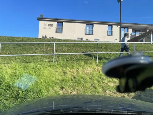
Restaurant tween
Restaurant · German, French, Brasserie, Modern · 1.0 km
3 Strandweg, Tönning
07:30-10:30,13:00-22:00
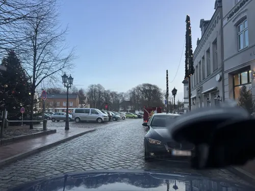
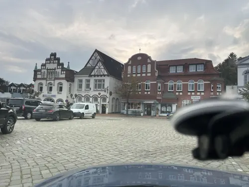

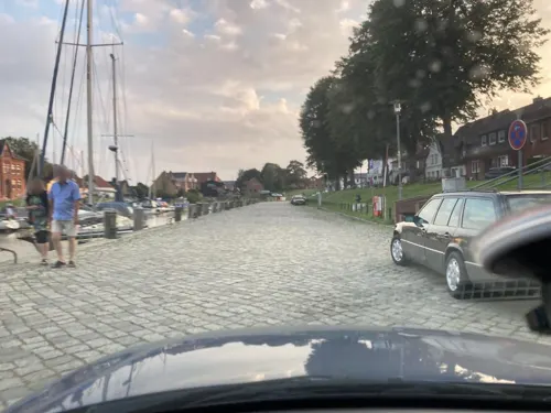

Dreilande
Restaurant · German, Regional
17 Westerstraße, Tönning
We-Fr 11:30-14:00,17:00-21:30; Sa 17:00-18:00+; Su,PH...
Krabben & Fischhandel Tönning
Restaurant · Fish
12 Am Eiderdeich, Tönning
Mo-Fr 08:00-18:00; Sa 08:00-13:00

Liebevoll hinterm Deich
Cafe · 4.6 km
1 Lundenerkoog, Lehe
Mo, Tu off; We-Fr 09:00-13:00;Sa,Su 09:00-18:00
26 more on the map.
History
Tönning was destroyed in the Burchardi flood in 1634. During the Great Northern War, (1700–1721), Tönning was besieged twice.
From the History section of Tönning on Wikipedia, under CC BY-SA 4.0.
More about Tönning
Geography
It is located on the northern bank of the Eider river, approximately eight kilometers away from its mouth at the North Sea. Tönning has a population of some 5,000 people.
From the Wikipedia article Tönning, under CC BY-SA 4.0.
Notable people from Tönning
 Friedrich von EsmarchGerman academic (1823-1908)Photo: Unknown author, CC BY 4.0
 Jürgen OvensDutch painter (1623-1678)Photo: Jürgen Ovens, CC BY-SA 4.0
- Kurt ThomasGerman composer, conductor, music educator (1904–1973)
- Marcus MeibomiusDanish classical scholar, music theorist, mathematician and bibliocarian
- Johann Friedrich AlbertiGerman composer and organist
- Fanny SuenssenDanish novelist
- Teckla JuelDanish writer and song composer (1834-1904)
- Rudolph LexowAmerican editor
Born in Tönning, according to Wikidata (CC0). Each name links to its Wikipedia article.
Where to stay18
Churches and places of worship4
Shopping12
Gas and EV charging4
Schools, colleges and libraries7
Healthcare2
Map of Tönning
116 places. The map loads OpenStreetMap tiles when you open it.
Getting there and nearby towns
Verkehrslandeplatz St. Peter Ording (PSH) is the nearest airport with scheduled flights listed in OpenStreetMap, 17 km away.
- Heide 17 km southeast, about 17 min by car
- Husum 20 km north, about 20 min by car
- Schleswig 46 km northeast, about 46 min by car
- Rendsburg 47 km east, about 47 min by car
- Westerrönfeld 46 km east, about 46 min by car
- Brunsbüttel 48 km south, about 48 min by car
- Büdelsdorf 47 km east, about 47 min by car
- Cuxhaven 52 km south, about 52 min by car
- Itzehoe 58 km southeast, about 58 min by car
- Flensburg 61 km northeast, about 1 h by car
Drive times are estimates from straight-line distance, not routes.
Towns near Tönning


Keep exploring
Local news
Headlines from INDB.
Reviews, tips and questions
Loading what members have shared...
Sources and licences
- GeoNames (CC BY 4.0): population, coordinates, regions and time zone
- Mapillary (see each image): photos
- OpenStreetMap contributors (ODbL 1.0): places, airports, map data
- Wikidata (CC0 1.0): elevation, founding date, time zone, website, landmarks and historic places
- Wikimedia Commons (see each image): photos
- Wikipedia (CC BY-SA 4.0): overview and history text
Photo credits
- Tönning, Laurentiuskirche, Triumpfkreuz, Dguendel, CC BY 3.0
- Tönning, Laurentiuskirche, Orgel und Kronleuchter, Dguendel, CC BY 3.0
- Tönning, Laurentiuskirche, Innenansicht, Dguendel, CC BY 3.0
- Tönning, Laurentiuskirche, Altar und Taufbecken, Dguendel, CC BY 3.0
- Laurentiuskirche Tönning 2025 Lettner, Hans G. Oberlack, CC BY 4.0
- Laurentiuskirche Tönning 2025 Lesepult, Hans G. Oberlack, CC BY 4.0
- Laurentiuskirche Tönning 2025 Leuchter, Hans G. Oberlack, CC BY 4.0
- Laurentiuskirche Tönning 2025 Bankreihen, Hans G. Oberlack, CC BY 4.0
- Laurentiuskirche Tönning 2025 Fußboden, Hans G. Oberlack, CC BY 4.0
- St. Laurentius (Tönning) jm21950, joergens.mi, CC BY-SA 3.0
- St. Laurentius (Tönning) jm21980, joergens.mi, CC BY-SA 3.0
- St. Laurentius (Tönning) jm21957, joergens.mi, CC BY-SA 3.0
- St. Laurentius (Tönning) jm22005, joergens.mi, CC BY-SA 3.0
- St. Laurentius (Tönning) jm21901, joergens.mi, CC BY-SA 3.0
- St. Laurentius (Tönning) jm21975, joergens.mi, CC BY-SA 3.0
- St. Laurentius (Tönning) jm21945, joergens.mi, CC BY-SA 3.0
- St. Laurentius (Tönning) jm21918, joergens.mi, CC BY-SA 3.0
- St. Laurentius (Tönning) jm21966, joergens.mi, CC BY-SA 3.0
- St. Laurentius (Tönning) jm22026, joergens.mi, CC BY-SA 3.0
- St. Laurentius (Tönning) jm21972, joergens.mi, CC BY-SA 3.0
- St. Laurentius (Tönning) jm22010, joergens.mi, CC BY-SA 3.0
- St. Laurentius (Tönning) jm22002, joergens.mi, CC BY-SA 3.0
- St. Laurentius (Tönning) jm21904, joergens.mi, CC BY-SA 3.0
- St. Laurentius (Tönning) jm22031, joergens.mi, CC BY-SA 3.0
- St. Laurentius (Tönning) jm22015, joergens.mi, CC BY-SA 3.0
- St. Laurentius (Tönning) jm21990, joergens.mi, CC BY-SA 3.0
- St. Laurentius (Tönning) jm21995, joergens.mi, CC BY-SA 3.0
- St. Laurentius (Tönning) jm21913, joergens.mi, CC BY-SA 3.0
- St. Laurentius (Tönning) jm21916, joergens.mi, CC BY-SA 3.0
- St. Laurentius (Tönning) jm21960, joergens.mi, CC BY-SA 3.0
- St. Laurentius (Tönning) jm21987, joergens.mi, CC BY-SA 3.0
- St. Laurentius (Tönning) jm21906, joergens.mi, CC BY-SA 3.0
- St. Laurentius (Tönning) jm21910, joergens.mi, CC BY-SA 3.0
- St. Laurentius (Tönning) jm21892, joergens.mi, CC BY-SA 3.0
- St. Laurentius (Tönning) jm21888, joergens.mi, CC BY-SA 3.0
- Tönning, Löwenskulptur an der Laurentiuskirche, Dguendel, CC BY 3.0
- St. Laurentius (Tönning) jm21885, joergens.mi, CC BY-SA 3.0
- St. Laurentius (Tönning) jm21882, joergens.mi, CC BY-SA 3.0
- Tönning jm21880, joergens.mi, CC BY-SA 3.0
- Multimar eingang, Dirk Ingo Franke, CC BY-SA 2.0 de
- Kotzenbuell Kirche, Photo by User ES01 – de.wikipedia.org, CC BY-SA 3.0
- Laurentiuskirche Kating 2025 ESE, Hans G. Oberlack, CC BY 4.0
- Katinger Watt Kiek ut-02, Radler59 ( talk ), CC BY-SA 4.0
- Hoyerswort Herrenhaus, Oberlausitzerin64, CC BY-SA 4.0
- Schifferhaus Tönning, Dirk Ingo Franke, CC BY-SA 2.0 de
- Toenning Kanalpackhaus, Radler59 ( talk ), CC BY-SA 4.0
- Toenning Hafenkran, Radler59 ( talk ), CC BY-SA 4.0
- Lunden Suehnestein Peter Swyn, Radler59, CC BY-SA 3.0
- Dithmarscher eiderwatt 13.11.2012 14-51-57, Dirk Ingo Franke, CC BY 3.0
- Brandgänse am Eiderwatt Tönning 01, Pit-SH, CC BY-SA 4.0
- Oldensworter Vorland (Rothenspieker 2), KarolaWiebner, CC BY-SA 3.0
- Toenning St. Laurentius-02, Radler59 ( talk ), CC BY-SA 4.0
- Lunden St. Laurentiuskirche von Nordosten, An-d, CC BY-SA 3.0
- 2015 12 29 Tönning Werft 3 IMG 5686 k, Dr. Karl-Heinz Hochhaus, CC BY 3.0
- Gedenkstein Carl Friedrich Vollertsen Toenning, JuTe CLZ, CC BY-SA 4.0
- Am Gehölz 15 lunden 2020-08-10 2, Z thomas, CC BY-SA 4.0
- Street-level photo, robffm, CC BY-SA 4.0
- Street-level photo, veloroute_hamburg, CC BY-SA 4.0
- Street-level photo, robffm, CC BY-SA 4.0
- Street-level photo, robffm, CC BY-SA 4.0
- Street-level photo, robffm, CC BY-SA 4.0
- Street-level photo, robffm, CC BY-SA 4.0
- Street-level photo, veloroute_hamburg, CC BY-SA 4.0
- Street-level photo, robffm, CC BY-SA 4.0
- Street-level photo, robffm, CC BY-SA 4.0
- Street-level photo, robffm, CC BY-SA 4.0
- Street-level photo, veloroute_hamburg, CC BY-SA 4.0
- Street-level photo, robffm, CC BY-SA 4.0
- Street-level photo, robffm, CC BY-SA 4.0
- Street-level photo, matapiet, CC BY-SA 4.0
- Street-level photo, robffm, CC BY-SA 4.0
- Street-level photo, veloroute_hamburg, CC BY-SA 4.0
- Street-level photo, robffm, CC BY-SA 4.0
- Street-level photo, veloroute_hamburg, CC BY-SA 4.0


Page built November 9, 2026. Spotted a mistake? Tell us or suggest a place.