


Ludweiler-Warndt, Germany
Ludweiler
Ludweiler-Warndt is a town of 5,922 people in Saarland, Germany.
Why visit Ludweiler-Warndt
Townapedia lists 73 museums and landmarks, 5 parks and trails, 59 places to eat, 5 places to stay and 7 attractions in and around town.
Highlights include Hühnerscheerberg, Eichenkopf, Völklingen Ironworks and Carreau Wendel Museum.
Weather in Ludweiler-Warndt
Forecast from MET Norway (CC BY 4.0). Full forecast
Photos of Ludweiler-Warndt


Things to do7



Museums and landmarks73

Völklingen Ironworks
Museum · 3.9 km
75-79 Rathausstraße, Völklingen
Mar 25-Nov 04: 10:00-19:00; Nov 05-Apr 13: 10:00-18:00

Kanalstollen
Monument and historic site · 3.2 km
Ab 1955 zum Luftschutzstollen umgebaut

Berta Bermann-Keller
Monument and historic site
Betrieb hier eine Scheiderei. Nach Schutzhaft kam er ins KZ Dachau, flüchtete 139 mit seiner Frau nach Holland. Von dort verschleppt...

Wilhelm Bermann
Monument and historic site
Betrieb hier eine Scheiderei. Nach Schutzhaft kam er ins KZ Dachau, flüchtete 139 mit seiner Frau nach Holland. Von dort verschleppt...

Umwelt- u Grünflächenamt
Monument and historic site · 3.4 km
Ehem. kath. Pfarramt
7 Eimersbergstraße, Wadgassen
Mo-Fr 08:00-12:00, Mo-Th 14:00-16:00; PH off
St. Wendalinus
Monument and historic site · Catholic · 1.3 km
Kath. Kapelle St. Wendalinus, 1898–99 nach den Plänen von Reinhold Wirtz
ehem. Bahnhof
Monument and historic site · 3.7 km
24 Mittelwiesenstraße, Wadgassen

Handwerker- und Vereinsbaum der IG Wehren
Monument and historic site · 3.3 km
Schaffhauser Straße, Völklingen
61 more on the map.
Parks, trails and playgrounds5




Restaurants and cafes59
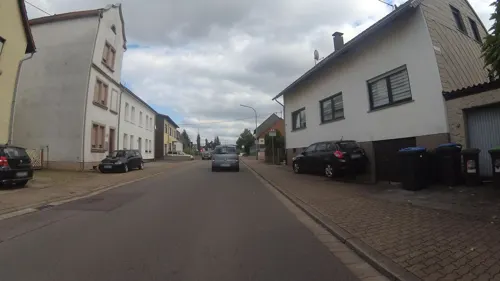
Gio
Restaurant · Italian · 4.2 km
76 Schulstraße, Wadgassen
We-Mo 12:00-14:00,18:00-22:00;Sa18:00-22:00
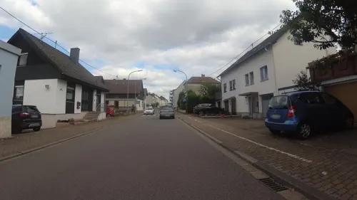
Bisttalstube
Restaurant · German · 3.9 km
32 Am Rothenberg, Wadgassen
Tu-Su 11:30-14:30,18:00-22:00
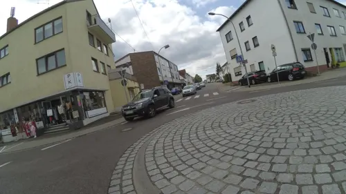
Gudd Stubb
Restaurant · Regional · 4.2 km
Mo-Sa 11:30-24:00; Su 17:00-24:00
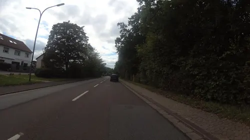
Adolphs Brotladen
Bakery · 3.6 km
1 Robert-Koch-Straße, Großrosseln
Mo-Fr 06:00-18:00; Sa 06:00-12:00; Su,PH 06:00-11:00
Alter Bahnhof
Restaurant · 4.1 km
We-Sa 17:30-22:00; Su 11:30-14:30,17:30-22:00; PH,Mo-Tu closed

Reiterklause
Restaurant · Regional · 3.0 km
1 In der Waldwiesdell, Wadgassen
Mo,Tu,Th-Sa 16:00-24:00; Su 10:00-13:00,16:00-24:00; We off
Kebab Sarya
Restaurant · Kebab · 2.8 km
195 Rue du Général de Gaulle, Petite-Rosselle
Mo-Su 11:00-23:00
Pizzeria Romantika
Restaurant · Italian · 3.4 km
46 Kleine Bergstraße, Völklingen
We-Mo 16:00-23:00
da Mario
Restaurant · Italian · 3.7 km
134 Provinzialstraße, Wadgassen
Tu-Su 18:00-22:30; We-Su 12:00-14:30

Na Sowas
Restaurant · 4.2 km
74 Provinzialstraße
Mo-Th 16:00-01:00;Fr 14:00-03:00;Sa 11:00-03:00
Da Mario
Restaurant · Pizza, Italian · 2.9 km
171 Rue du Général de Gaulle, Petite-Rosselle
47 more on the map.
Where to stay5
Churches and places of worship18
Auferstehungskirche
Church · Protestant · 2.9 km
62 Ludweilerstraße, Völklingen
Pfarrkirche Mariä Himmelfahrt
Church · Catholic · 2.5 km
1 Im Kirchenfeld, Völklingen
Shopping15
Globus Markthalle Völklingen
Shopping center · 4.2 km
53 Rathausstraße, Völklingen
Gas and EV charging8
Schools, colleges and libraries12
Healthcare6
Map of Ludweiler-Warndt
208 places. The map loads OpenStreetMap tiles when you open it.
Getting there and nearby towns
Saarbrücken Airport (SCN) is the nearest airport with scheduled flights listed in OpenStreetMap, 22 km away.
- Großrosseln 3 km southeast, about 3 min by car
- Völklingen 5 km northeast, about 5 min by car
- Wadgassen 6 km north, about 6 min by car
- Bous 6 km north, about 6 min by car
- Überherrn 9 km west, about 9 min by car
- Schwalbach 9 km north, about 9 min by car
- Püttlingen 9 km northeast, about 9 min by car
- Ensdorf 9 km north, about 9 min by car
- Saarlouis 11 km northwest, about 11 min by car
- Riegelsberg 12 km northeast, about 12 min by car
Drive times are estimates from straight-line distance, not routes.
Towns near Ludweiler-Warndt


Keep exploring
Local news
Headlines from INDB.
Reviews, tips and questions
Loading what members have shared...
Sources and licences
- GeoNames (CC BY 4.0): population, coordinates, regions and time zone
- Mapillary (see each image): photos
- OpenStreetMap contributors (ODbL 1.0): places, airports, map data
- Wikidata (CC0 1.0): elevation, founding date, time zone, website, landmarks and historic places
- Wikimedia Commons (see each image): photos
Photo credits
- MUSEE WENDEL, Alain meier, CC0
- Ludweiler, Jean-Marc Pascolo, CC BY-SA 3.0
- Aerial image of the Völklingen Ironworks (view from the south), Carsten Steger, CC BY-SA 4.0
- Schaffhausen (Saar) Schutzengelkirche 01, atreyu, CC BY-SA 3.0
- Geislautern Mariä Himmelfahrt 01, atreyu, CC BY-SA 3.0
- Werbeln St. Antonius 05, atreyu, CC BY-SA 3.0
- Differten St. Gangolf 03, atreyu, CC BY-SA 3.0
- Wehrden, Evangelische Kirche (8), Cmcmcm1, CC BY-SA 3.0
- Wehrden (Saar) Josefskirche 02, atreyu, CC BY-SA 4.0
- 20210821 Hühnerscheer Berg, Flocci Nivis, CC BY 4.0
- Petite-Rosselle Église Saint-Joseph, Aimelaime, CC BY-SA 4.0
- Petite-Rosselle Urselsbach Chapelle Sainte-Marie-Madeleine, Aimelaime, CC BY-SA 4.0
- 20210711 Blasting hall of Völklingen Ironworks, Flocci Nivis, CC BY 4.0
- 20210711 St. Hedwig Wehrden Saar 03, Flocci Nivis, CC BY 4.0
- 20201105 Selimiye Moschee Völklingen, Flocci Nivis, CC BY 4.0
- Kanalstollen, Zecke64, CC BY-SA 3.0
- VH Eingang pano, Lokilech Basispreis Das kann, CC BY-SA 3.0
- Stolperstein Wilhelm Bermann und Berta Bermann-Keller (Völklinger Straße 60, 66333 Völklingen Ludweiler), MilanConad, CC BY-SA 4.0
- Warndtgymnasium B-Gebäude (Juni 2021), Saar-Seb, CC BY-SA 4.0
- Stolpersteine Familie Bermann (Völklinger Straße 61, 66333 Völklingen Ludweiler), MilanConad, CC BY-SA 4.0
- Stolperstein Philipp Kaufmann, MilanConad, CC BY-SA 4.0
- Warndtgymnasium A-Gebäude (Juni 2021), Saar-Seb, CC BY-SA 4.0
- Warndtgymnasium C-Gebäude (Juni 2021), Saar-Seb, CC BY-SA 4.0
- Warndtgymnasium Panorama (Juni 2021), Saar-Seb, CC BY-SA 4.0
- 20260428 Grube Velsen 02, Flocci Nivis, CC BY-SA 4.0
- 20260428 Grube Velsen 03, Flocci Nivis, CC BY-SA 4.0
- 20260428 Grube Velsen 01, Flocci Nivis, CC BY-SA 4.0
- Borne sur le Chemin des Huguenots à Ludweiler en Sarre, Marie-Walt, CC BY-SA 4.0
- 20260428 Grube Velsen 04, Flocci Nivis, CC BY-SA 4.0
- 20260428 Grube Velsen 05, Flocci Nivis, CC BY-SA 4.0
- 20260428 Grube Velsen 11, Flocci Nivis, CC BY-SA 4.0
- 20260428 Grube Velsen 08, Flocci Nivis, CC BY-SA 4.0
- 20260428 Grube Velsen 07, Flocci Nivis, CC BY-SA 4.0
- Street-level photo, teddy73, CC BY-SA 4.0
- Street-level photo, teddy73, CC BY-SA 4.0
- Street-level photo, teddy73, CC BY-SA 4.0
- Street-level photo, teddy73, CC BY-SA 4.0
- Street-level photo, teddy73, CC BY-SA 4.0
- Street-level photo, teddy73, CC BY-SA 4.0
- Street-level photo, teddy73, CC BY-SA 4.0
- Street-level photo, teddy73, CC BY-SA 4.0
- Street-level photo, chuck, CC BY-SA 4.0


Page built November 9, 2026. Spotted a mistake? Tell us or suggest a place.