


Why visit Wahlstedt
Townapedia lists 8 museums and landmarks, 7 parks and trails, 7 places to eat, 4 places to stay and 1 attraction in and around town.
Highlights include Theater Wahlstedt, Dokumentationszentrum "Marineartilleriearsenal Wahlstedt", Großsteingrab Fahrenkrug and Wittenborner Heide.
Weather in Wahlstedt
Forecast from MET Norway (CC BY 4.0). Full forecast
About Wahlstedt
Wahlstedt (German pronunciation: [ˈvaːlʃtɛt] ; Low German: Wohlsteed) is a town in the district of Segeberg in Schleswig-Holstein, Germany.
From the Wikipedia article Wahlstedt (this version), under CC BY-SA 4.0.
Photos of Wahlstedt


Things to do1
Museums and landmarks8


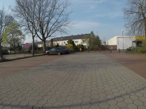
Dokumentationszentrum "Marineartilleriearsenal Wahlstedt"
Museum · 1.1 km
101 Waldstraße, Wahlstedt
"nach Vereinbarung"

Parks, trails and playgrounds7


Aqua Fun
Sports field and stadium · 0.6 km
2 Scharnhorststraße
Tu,Th 06:00-08:00, Tu,Fr 09:00-20:00, We,Th 09:00-21:00, Sa,Su...
Frei- und Hallenbad Wahlstedt
Sports field and stadium · 0.6 km
Mo-Fr 14:00-19:00; Sa,Su 10:00-17:00

Restaurants and cafes7
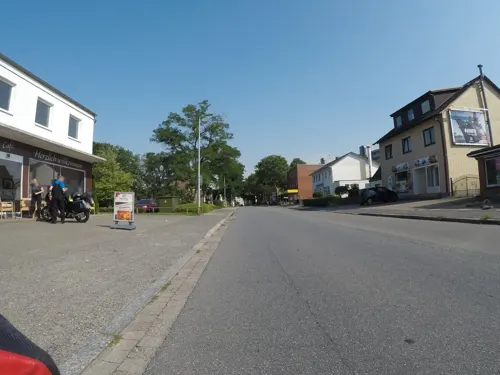
Vu‘s Cuisine
Restaurant · Asian
12 Neumünsterstraße, Wahlstedt
Tu-Su 11:00-21:00
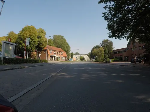
Restaurant Hellas
Restaurant · Greek
Mo-Sa 17:30-23:00; Su 12:00-23:00



More about Wahlstedt
Geography
The town lies about 50 km north of Hamburg, 40 km south of Kiel and 30 km west of Lübeck. It is about seven kilometers west of Bad Segeberg on the edge of the Segeberg Forest.
From the Wikipedia article Wahlstedt, under CC BY-SA 4.0.
Notable people from Wahlstedt
- Manon BornholdtGerman pentathlete, long jumper and hurdler
Born in Wahlstedt, according to Wikidata (CC0). Each name links to its Wikipedia article.
Where to stay4
Churches and places of worship3
Shopping8
Gas and EV charging6
Schools, colleges and libraries3
Healthcare2
Map of Wahlstedt
49 places. The map loads OpenStreetMap tiles when you open it.
Getting there and nearby towns
Flugplatz Neumünster (EUM) is the nearest airport with scheduled flights listed in OpenStreetMap, 22 km away.
- Bad Segeberg 6 km east, about 6 min by car
- Neumünster 20 km northwest, about 20 min by car
- Bad Oldesloe 19 km southeast, about 19 min by car
- Kaltenkirchen 21 km southwest, about 21 min by car
- Bad Bramstedt 22 km west, about 22 min by car
- Zarpen 22 km southeast, about 22 min by car
- Bargteheide 25 km south, about 25 min by car
- Plön 27 km northeast, about 27 min by car
- Lübeck 32 km east, about 32 min by car
- Norderstedt 31 km southwest, about 31 min by car
Drive times are estimates from straight-line distance, not routes.
Towns near Wahlstedt


Keep exploring
Local news
Headlines from INDB.
Reviews, tips and questions
Loading what members have shared...
Sources and licences
- GeoNames (CC BY 4.0): population, coordinates, regions and time zone
- Mapillary (see each image): photos
- OpenStreetMap contributors (ODbL 1.0): places, airports, map data
- Wikidata (CC0 1.0): elevation, founding date, time zone, website
- Wikimedia Commons (see each image): photos
- Wikipedia (CC BY-SA 4.0): overview and history text
Photo credits
- Aerial image of the Wahlstedt airfield, Carsten Steger, CC BY-SA 4.0
- Hundewald Wahlstedt entrance, Elgaard, CC BY-SA 4.0
- Schleswig-Holstein, Bark, Wittenborner Heide NIK 6039, -- Nightflyer ( talk ) 21:01, 11 May 2017 (UTC), CC BY 4.0
- ASW 15B, FlyingElmo, CC BY-SA 4.0
- Wittenborn 03, Christian Alexander Tietgen, CC BY 4.0
- Wittenborn 01, Christian Alexander Tietgen, CC BY 4.0
- Schleswig-Holstein, Bark, Wittenborner Heide NIK 6060, -- Nightflyer ( talk ) 21:35, 11 May 2017 (UTC), CC BY 4.0
- Schleswig-Holstein, Bark, Wittenborner Heide NIK 6058, -- Nightflyer ( talk ) 21:33, 11 May 2017 (UTC), CC BY 4.0
- Schleswig-Holstein, Bark, Wittenborner Heide NIK 6073, -- Nightflyer ( talk ) 21:50, 11 May 2017 (UTC), CC BY 4.0
- Schleswig-Holstein, Bark, Wittenborner Heide NIK 6057, -- Nightflyer ( talk ) 21:30, 11 May 2017 (UTC), CC BY 4.0
- Schleswig-Holstein, Bark, Wittenborner Heide NIK 6061, -- Nightflyer ( talk ) 21:37, 11 May 2017 (UTC), CC BY 4.0
- Schleswig-Holstein, Bark, Wittenborner Heide NIK 6070, -- Nightflyer ( talk ) 21:48, 11 May 2017 (UTC), CC BY 4.0
- Schleswig-Holstein, Bark, Wittenborner Heide NIK 6064, -- Nightflyer ( talk ) 21:42, 11 May 2017 (UTC), CC BY 4.0
- Schleswig-Holstein, Wittenborn, Ehrenmal NIK 6000, Nightflyer, CC BY 4.0
- Street-level photo, thewizard, CC BY-SA 4.0
- Street-level photo, veloroute_hamburg, CC BY-SA 4.0
- Street-level photo, veloroute_hamburg, CC BY-SA 4.0
- Street-level photo, veloroute_hamburg, CC BY-SA 4.0
- Street-level photo, veloroute_hamburg, CC BY-SA 4.0
- Street-level photo, veloroute_hamburg, CC BY-SA 4.0
- Street-level photo, veloroute_hamburg, CC BY-SA 4.0
- Street-level photo, veloroute_hamburg, CC BY-SA 4.0
- Street-level photo, mapnerd_dk, CC BY-SA 4.0
- Street-level photo, mapnerd_dk, CC BY-SA 4.0
- Street-level photo, veloroute_hamburg, CC BY-SA 4.0
Page built November 9, 2026. Spotted a mistake? Tell us or suggest a place.