


Why visit Waldkappel
Townapedia lists 88 museums and landmarks, 19 parks and trails, 23 places to eat, 7 places to stay and 52 attractions in and around town.
Highlights include Bergwildpark Meißner, Pionierturm, Junkerhof and Kloster Germerode.
Weather in Waldkappel
Forecast from MET Norway (CC BY 4.0). Full forecast
About Waldkappel
Waldkappel (German pronunciation: [ˈvaltˌkapl̩] ) is a small town in the Werra-Meißner-Kreis district in northern Hesse, Germany.
From the Wikipedia article Waldkappel (this version), under CC BY-SA 4.0.
Things to do52

Bergwildpark Meißner
Zoo and aquarium · 5.3 km
1 Wildpark, Meißner
Jan-Mar: Sa-Su,PH 10:00-17:00; Apr-Oct: 10:00-18:00; Nov-Dec:...

Pionierturm
Scenic view · 1.4 km
Stahlgittermast, besteigbar, Stand 2020-04: mit Turm-Gästebuch!

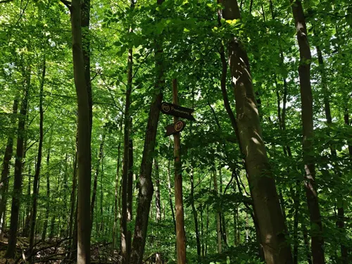


40 more on the map.
Museums and landmarks88


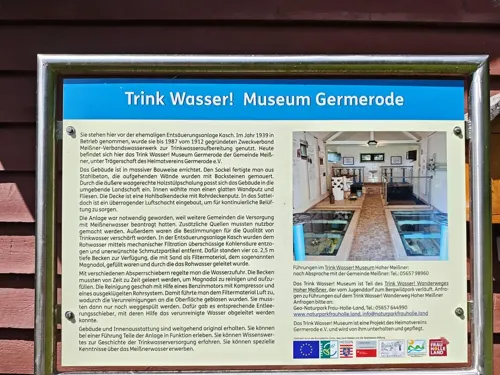

Friedhof Schwalbenthal
Cemetery · 7.0 km
Friedhof der ehemaligen Bergbauansiedlung - Schwalbenthal in der Zeit von ca. 1650 - 1886




76 more on the map.
Parks, trails and playgrounds19

Meißner
Hiking and trails · 8.0 km
Hänge und Teile des Hochplateaus des Hohen Meißner, das NSG besteht aus insgesamt 8 Teilflächen.

Reichenbacher Kalkberge
Hiking and trails · 7.9 km
Kalkbuchenwälder und Kalkmagerrasen bei Reichenbach, das NSG besteht aus 2 Teilflächen.

Trimberg bei Reichensachsen
Hiking and trails · 6.6 km
Laubwald um den Gipfel des Trimberg mit Grünland und Tümpeln im Südteil, westlich von Reichensachsen.

Weißbachtal bei Reichenbach
Hiking and trails · 6.9 km
Wiesen mit kleinem Sumpfgebiet, Sträuchern und Bäumen, nördlich von Reichenbach.


7 more on the map.
Restaurants and cafes23

Dorfladen
Bakery · 5.9 km
2 Neuer Weg, Meißner
Mo 07:00-13:00; Tu-Fr 07:00-13:00,14:30-18:00; Sa 07:00-13:00; Su...

Mohntenne
Restaurant · 6.4 km
Geöffnet in der Zeit der Mohnblüte, die von Jahr zu Jahr von Mitte Juni bis Ende Juli gewisse zeitliche Unterschiede aufweist
Jun-Jul: Mo-Fr 11:00-18:00; Sa-Su 10:00-18:00
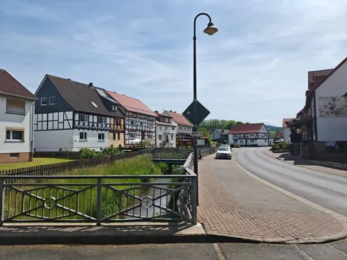
Naturfreundehaus-Meißnerhaus
Restaurant · German · 7.5 km
4 Regina-Fahrenbach-Straße, Hessisch Lichtenau

Eiscafe Meißner-Eis
Ice cream · 6.9 km
2 Große Steine Weg
Fr-Su 11:30-19:00
Kaffeestübchen
Cafe
55 Leipziger Straße, Waldkappel
Tu-Fr 06:00-13:00; Sa 06:00-12:00; Su 07:30-11:00
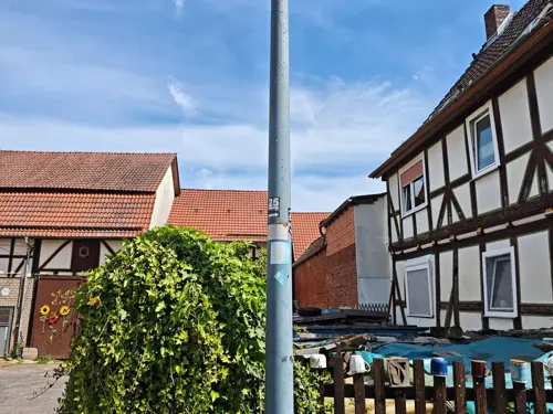



Sommergarten
Cafe · 6.9 km
Bier- und Kaffeegarten
8 Fuhrgraben, Wehretal
11 more on the map.
History
Waldkappel was first officially mentioned in 1226 and was granted town rights in 1414.
The town experienced its economic heyday in the Late Middle Ages from lying on the old trade road durch die langen Hessen, which ran from the Wetterau to Thuringia and on to Leipzig. Bearing witness to the town’s earlier, wealthier times is a Late Gothic church standing in the middle of the community.
The Thirty Years' War put an abrupt end to Waldkappel’s prosperity; the town could never again reach its former importance.
In the course of municipal reform, the communities of Waldkappel, Bischhausen, Burghofen, Friemen, Gehau, Kirchhosbach, Mäckelsdorf, Rechtebach, Rodebach and Schemmern from the former Eschwege district merged. They were joined by Harmuthsachsen and Hasselbach from the former Witzenhausen district, as well as by Stolzhausen from the Melsungen district. In 1974, the greater community reached its full extent with the amalgamation of Eltmannsee and Hetzerode.
From the History section of Waldkappel on Wikipedia, under CC BY-SA 4.0.
Where to stay7
Churches and places of worship27
Evangelische Kirche Rodebach
Church · Protestant · 3.5 km
7a Amselweg, Waldkappel
Evangelische Kirche
Church · Protestant · 7.4 km
4 Am Metzberg, Hessisch Lichtenau
Evangelische Kirche Küchen
Church · Protestant · 5.5 km
1 Meißnerstraße, Hessisch Lichtenau
Kirche Rechtebach
Church · Protestant · 3.2 km
8 Haselweg, Waldkappel
Shopping1
Gas and EV charging4
Schools, colleges and libraries3
Healthcare1
Map of Waldkappel
225 places. The map loads OpenStreetMap tiles when you open it.
Getting there and nearby towns
Fritzlar Air Base (FRZ) is the nearest airport with scheduled flights listed in OpenStreetMap, 41 km away.
- Hessisch Lichtenau 13 km northwest, about 13 min by car
- Eschwege 13 km east, about 13 min by car
- Rotenburg an der Fulda 20 km southwest, about 20 min by car
- Bebra 20 km south, about 20 min by car
- Witzenhausen 22 km north, about 22 min by car
- Melsungen 23 km west, about 23 min by car
- Kaufungen 24 km northwest, about 24 min by car
- Lohfelden 28 km northwest, about 28 min by car
- Kassel 32 km northwest, about 32 min by car
- Bad Hersfeld 33 km south, about 33 min by car
Drive times are estimates from straight-line distance, not routes.
Local news
Headlines from INDB.
Reviews, tips and questions
Loading what members have shared...
Sources and licences
- GeoNames (CC BY 4.0): population, coordinates, regions and time zone
- Mapillary (see each image): photos
- OpenStreetMap contributors (ODbL 1.0): places, airports, map data
- Wikidata (CC0 1.0): elevation, founding date, time zone, website
- Wikimedia Commons (see each image): photos
- Wikipedia (CC BY-SA 4.0): overview and history text
Photo credits
- Bilsteinstraße 38, 1, Harmuthsachsen, Waldkappel, Werra-Meißner-Kreis, GeorgDerReisende, CC BY-SA 4.0
- Stolperstein Berthold Haller, 1, Bilsteinstraße 38, Harmuthsachsen, Waldkappel, Werra-Meißner-Kreis, GeorgDerReisende, CC BY-SA 4.0
- Stolpersteinlage, 1, Bilsteinstraße 38, Harmuthsachsen, Waldkappel, Werra-Meißner-Kreis, GeorgDerReisende, CC BY-SA 4.0
- Stolperstein Emma Haller, 1, Bilsteinstraße 38, Harmuthsachsen, Waldkappel, Werra-Meißner-Kreis, GeorgDerReisende, CC BY-SA 4.0
- Stolperstein Ruth Haller, 1, Bilsteinstraße 38, Harmuthsachsen, Waldkappel, Werra-Meißner-Kreis, GeorgDerReisende, CC BY-SA 4.0
- Stolpersteinlage, 2, Bilsteinstraße 38, Harmuthsachsen, Waldkappel, Werra-Meißner-Kreis, GeorgDerReisende, CC BY-SA 4.0
- Bilsteinstraße 13, 1, Harmuthsachsen, Waldkappel, Werra-Meißner-Kreis, GeorgDerReisende, CC BY-SA 4.0
- Stolpersteinlage, 2, Bilsteinstraße 13, Harmuthsachsen, Waldkappel, Werra-Meißner-Kreis, GeorgDerReisende, CC BY-SA 4.0
- Stolperstein Hedwig Hammerschlag, 1, Bilsteinstraße 13, Harmuthsachsen, Waldkappel, Werra-Meißner-Kreis, GeorgDerReisende, CC BY-SA 4.0
- Stolperstein Max Hammerschlag, 1, Bilsteinstraße 13, Harmuthsachsen, Waldkappel, Werra-Meißner-Kreis, GeorgDerReisende, CC BY-SA 4.0
- Stolperstein Gretel Hammerschlag, 1, Bilsteinstraße 13, Harmuthsachsen, Waldkappel, Werra-Meißner-Kreis, GeorgDerReisende, CC BY-SA 4.0
- Stolpersteinlage, 1, Bilsteinstraße 13, Harmuthsachsen, Waldkappel, Werra-Meißner-Kreis, GeorgDerReisende, CC BY-SA 4.0
- Stolperstein Adolf Hammerschlag, 1, Bilsteinstraße 13, Harmuthsachsen, Waldkappel, Werra-Meißner-Kreis, GeorgDerReisende, CC BY-SA 4.0
- Stolperstein Heinz Lorge, 1, Bilsteinstraße 30, Harmuthsachsen, Waldkappel, Werra-Meißner-Kreis, GeorgDerReisende, CC BY-SA 4.0
- Stolpersteinlage, 1, Bilsteinstraße 30, Harmuthsachsen, Waldkappel, Werra-Meißner-Kreis, GeorgDerReisende, CC BY-SA 4.0
- Stolperstein Julian Lorge, 1, Bilsteinstraße 30, Harmuthsachsen, Waldkappel, Werra-Meißner-Kreis, GeorgDerReisende, CC BY-SA 4.0
- Stolperstein Jenny Lorge, 1, Bilsteinstraße 30, Harmuthsachsen, Waldkappel, Werra-Meißner-Kreis, GeorgDerReisende, CC BY-SA 4.0
- Stolpersteinlage, 2, Bilsteinstraße 30, Harmuthsachsen, Waldkappel, Werra-Meißner-Kreis, GeorgDerReisende, CC BY-SA 4.0
- Sontra-Wichmannshausen im nordhessischen Werra-Meißner-Kreis. 04, Heinz K. S., CC BY-SA 4.0
- Eisberg (Stölzinger Gebirge), Jörg Braukmann, CC BY-SA 3.0
- KlosterGermerodeKonvent, YPS, CC BY-SA 3.0
- Meissner aussicht kalbe d schmidt 06 2007, Dirk Schmidt (Celsius auf Wikivoyage), CC BY-SA 3.0
- Kitzkammer-07, Francisco Welter-Schultes, CC0
- Hoher Meißner 009, Willow, CC BY 2.5
- Friemen im nordhessischen Werra-Meißner-Kreis - Die evangelische Pfarrkirche, Heinz K. S., CC BY-SA 4.0
- Kirche Rodebach, Hydro, CC BY-SA 4.0
- Küchen Ortsteil Heli1, A1973 andreas Andreas Rehbein Hessisch Lichtenau, CC BY-SA 3.0
- Evangelische Kirche Alberode im Werra-Meißner-Kreis (1), Heinz K. S., CC BY-SA 4.0
- Junkerhof in Bischhausen (2), Heinz K. S., CC BY-SA 4.0
- Friedhof Schwalbenthal, Robert Wiegand, CC BY-SA 4.0
- Pionierturm Mäuseberg 2020-04-16 a, Baummapper, CC BY-SA 3.0 de
- Ziegenküppel - Knots Keller 2020-04-17, Baummapper, CC BY-SA 3.0 de
- NSG 1636031 Reichenbacher Kalkberge 2020-02-15 b, Baummapper, CC BY-SA 3.0 de
- NSG 1636024 Trimberg bei Reichensachsen 2022-05-06 e, Baummapper, CC BY-SA 3.0 de
- NSG 1636010 Weißbachtal bei Reichenbach 2021-05-14 e, Baummapper, CC BY-SA 3.0 de
- Friemen - Kirche 2020-04-17 a, Baummapper, CC BY-SA 3.0 de
- Burghofen - Kirche 2020-04-17 b, Baummapper, CC BY-SA 3.0 de
- Hollstein Kirche, Meloe, CC BY-SA 4.0
- Rechtebach - Kirche 2020-04-16 d, Baummapper, CC BY-SA 3.0 de
- Landstraße 16, 1, Bischhausen, Waldkappel, Werra-Meißner-Kreis, GeorgDerReisende, CC BY-SA 4.0
- Street-level photo, VIA_AE, CC BY-SA 4.0
- Street-level photo, VIA_AE, CC BY-SA 4.0
- Street-level photo, gisjam, CC BY-SA 4.0
- Street-level photo, ber319, CC BY-SA 4.0
- Street-level photo, plexi32, CC BY-SA 4.0
- Street-level photo, ber319, CC BY-SA 4.0
- Street-level photo, ber319, CC BY-SA 4.0
- Street-level photo, ber319, CC BY-SA 4.0
- Street-level photo, nakaner, CC BY-SA 4.0
- Street-level photo, s3bax, CC BY-SA 4.0
- Street-level photo, nakaner, CC BY-SA 4.0
- Street-level photo, ber319, CC BY-SA 4.0
- Street-level photo, ber319, CC BY-SA 4.0
- Street-level photo, VIA_AE, CC BY-SA 4.0
- Street-level photo, ber319, CC BY-SA 4.0
- Street-level photo, ber319, CC BY-SA 4.0
- Street-level photo, ber319, CC BY-SA 4.0
- Street-level photo, ber319, CC BY-SA 4.0
- Street-level photo, ber319, CC BY-SA 4.0
- Street-level photo, ber319, CC BY-SA 4.0


Page built November 9, 2026. Spotted a mistake? Tell us or suggest a place.