


Weißwasser, Germany
Weißwasser/O.L.
Weißwasser is a town of 15,002 people in Saxony, Germany.
Why visit Weißwasser
Townapedia lists 18 museums and landmarks, 26 parks and trails, 45 places to eat, 10 places to stay and 16 attractions in and around town.
Highlights include Rakotzbrücke, Aussichtsturm am Schweren Berg, Glasmuseum Weißwasser and Schloss Kromlau.
Weather in Weißwasser
Forecast from MET Norway (CC BY 4.0). Full forecast
About Weißwasser
Weißwasser (German pronunciation: [ˈvaɪsˌvasɐ] ; Upper Sorbian: Běła Woda [ˈbʲɪwa ˈwɔda] ; all of them lit. 'White Water') is a town in Upper Lusatia in eastern Saxony, Germany.
From the Wikipedia article Weißwasser (this version), under CC BY-SA 4.0.
Things to do16


Bad Muskau
Monument and historic site · 7.5 km
Municipality of Germany

Hofladen Starik
Farm and orchard · 5.6 km
45 Alte Dorfstraße, Trebendorf
Fr 09:00-18:00; Sa 08:00-12:00; Mo-Th,Su,PH off


Eichenhügel
Scenic view · 3.3 km
Der Eichenhügel ist die höchste Erhebung im Kromlauer Park. Er wurde mit den Erdmassen einiger ausgehobener Gieser künstlich angelegt.
4 more on the map.
Museums and landmarks18


Kavalierhaus
Monument and historic site · 3.7 km
Das Kavalierhaus ließ Friedrich Hermann Rötschke um 1850 im Schweizer Landhausstil errichten. Es ist mit Wandmalereien von Erhard Ludwig...
6 Halbendorfer Straße, Gablenz


Ehemaliges Jagdschloss Weißwasser
Monument and historic site · 5.5 km


Pückler-Stele
Monument and historic site · 6.6 km
Zur Erinnerung an die Feuersbrunst von 1786

Waldeisenbahn Muskau
Monument and historic site · 4.5 km
Historisches Gesamtnetz Waldeisenbahn Muskau

6 more on the map.
Parks, trails and playgrounds26

Tierpark Weißwasser
Park · 1.0 km
56 Teichstraße, Weißwasser/O.L.
Apr-Oct 09:00-18:00; Nov-Feb 09:00-16:00; Mar 09:00-17:00


Muskau Park
Park · 7.5 km
Landscape park in the Upper Lusatia region of Germany and Poland





Spielplatz Kohlestaubplatz
Playground · 0.7 km
Name des gesamten Areals stammt aus der Historie der Stadt, als der Platz noch als Rangierplatz für die damalige Schmalspurbahn (heute...

14 more on the map.
Restaurants and cafes45
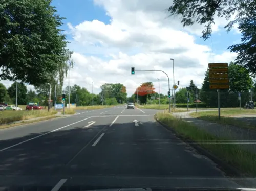
Gasthaus zur Linde
Restaurant · Regional · 4.1 km
26 Bautzener Straße, Krauschwitz
Mo-Su 11:00-14:00,17:00-22:00

Athos
Restaurant · Greek
3 Straße des Friedens, Weißwasser/O.L.
Mo,We-Fr 12:00-15:00, 17:00-23:00, Sa 12:00-23:00, Su,PH...
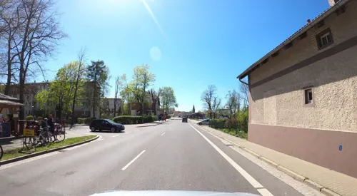
Habermann's
Restaurant · Regional, Ice Cream · 0.7 km
104 Muskauer Straße, Weißwasser/O.L.
Tu-Su 11:00-18:00; PH off
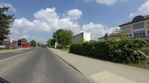
Bäckerei Raddatz
Bakery · 1.0 km
70 Lutherstraße, Weißwasser/O.L.
Mo-Fr 07:00-20:00; Sa 07:00-18:00; PH,Su off
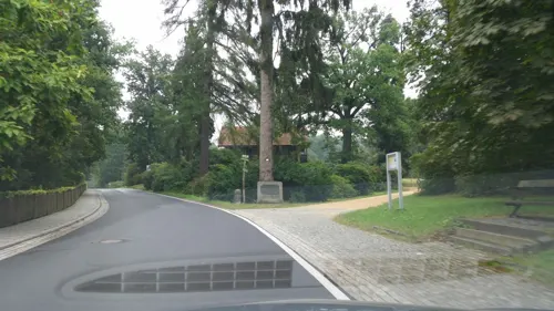

Zu den Prinzen
Bar and pub · 4.9 km
121 Geschwister-Scholl-Straße, Krauschwitz
Mo-Fr 10:00-18:00, Su 10:00-12:00; PH off


33 more on the map.
History
Weißwasser was mentioned for the first time on 8 June 1552, when it was part of the Lands of the Bohemian Crown in the Holy Roman Empire. The town's name means "white water". In 1635 it passed to the Electorate of Saxony, and following the Napoleonic Wars, in 1815 it fell to the Kingdom of Prussia and was included within the Province of Silesia. In the 19th and 20th centuries, Weißwasser was the European centre of glass production. It became part of the Prussian Province of Lower Silesia in 1919.
Weißwasser received its town charter on 28 August 1935. During World War II, the Nazis established and operated the FAL Weisswasser subcamp of the Gross-Rosen concentration camp, whose prisoners were mainly Jewish women. In the Second World War, 40% of the town was destroyed. With the dissolution of Prussia resulting from the war, the town became part of Saxony from 1945–52. It was then part of communist East Germany from 1952–90 and administered within Bezirk Cottbus. Many enterprises had to close during the communist regime. After the fall of the Berlin Wall, only a few enterprises were left. It was included within a restored Saxony after German reunification.
From the History section of Weißwasser on Wikipedia, under CC BY-SA 4.0.
Where to stay10
Churches and places of worship5
Shopping11
Gas and EV charging3
Schools, colleges and libraries12
Healthcare8
Apotheke am Eisstadion
Clinic and pharmacy · 1.1 km
71 Lutherstraße, Weißwasser/O.L.
Map of Weißwasser
154 places. The map loads OpenStreetMap tiles when you open it.
Getting there and nearby towns
Dresden Airport (DRS) is the nearest airport with scheduled flights listed in OpenStreetMap, 73 km away.
- Niesky 27 km southeast, about 27 min by car
- Cottbus 35 km northwest, about 35 min by car
- Kolkwitz 38 km northwest, about 38 min by car
- Senftenberg 44 km west, about 44 min by car
- Großräschen 44 km west, about 44 min by car
- Guben 50 km north, about 50 min by car
- Bischofswerda 53 km southwest, about 53 min by car
- Lauchhammer 61 km west, about 1 h by car
- Neustadt in Sachsen 60 km southwest, about 1 h by car
- Lubnjow 62 km northwest, about 1 h by car
Drive times are estimates from straight-line distance, not routes.
Local news
Headlines from INDB.
Reviews, tips and questions
Loading what members have shared...
Sources and licences
- GeoNames (CC BY 4.0): population, coordinates, regions and time zone
- Mapillary (see each image): photos
- OpenStreetMap contributors (ODbL 1.0): places, airports, map data
- Wikidata (CC0 1.0): elevation, founding date, time zone, website, landmarks and historic places
- Wikimedia Commons (see each image): photos
- Wikipedia (CC BY-SA 4.0): overview and history text
Photo credits
- Weißwasser - City - panoramio, G.Elser, CC BY 3.0
- Weißwasser, Güterstraße 1 (3), Tommes, CC BY-SA 4.0
- Weißwasser, Güterstraße 1 (4), Tommes, CC BY-SA 4.0
- Weißwasser, Güterstraße 1 (6), Tommes, CC BY-SA 4.0
- Weißwasser, Güterstraße 1 (5), Tommes, CC BY-SA 4.0
- Weißwasser, Güterstraße 2 (2), Tommes, CC BY-SA 4.0
- Weißwasser, Güterstraße 1 (2), Tommes, CC BY-SA 4.0
- Weißwasser, Güterstraße 1 (1), Tommes, CC BY-SA 4.0
- Bahnhof Weißwasser 12, Derbrauni, CC BY 4.0
- Weißwasser, Güterstraße 3 (1), Tommes, CC BY-SA 4.0
- Weißwasser, Güterstraße 3 (2), Tommes, CC BY-SA 4.0
- Weißwasser Bahnhofstraße 12 Sparkasse, Tommes, CC BY-SA 4.0
- Weißwasser Bahnhofstraße 14, Tommes, CC BY-SA 4.0
- Weißwasser, Güterstraße 2 (1), Tommes, CC BY-SA 4.0
- Weißwasser, Germany - panoramio (3), Saibot Deluxe, CC BY-SA 3.0
- Weißwasser, Germany - panoramio (4), Saibot Deluxe, CC BY-SA 3.0
- Weißwasser, Güterstraße 4 (3), Tommes, CC BY-SA 4.0
- Weißwasser, Güterstraße 4 (1), Tommes, CC BY-SA 4.0
- Weißwasser, Güterstraße 4 (2), Tommes, CC BY-SA 4.0
- Weißwasser, Güterstraße 5 (1), Tommes, CC BY-SA 4.0
- Weißwasser, Güterstraße 5 (2), Tommes, CC BY-SA 4.0
- Weißwasser, Germany - panoramio (9), Saibot Deluxe, CC BY-SA 3.0
- Weißwasser, Güterstraße 5 (3), Tommes, CC BY-SA 4.0
- Weißwasser, Güterstraße 5 (4), Tommes, CC BY-SA 4.0
- Walter Bullert 1955 Arbeiter der Glasindustrie Weißwasser 3 Vertrieb, Tommes derivative work: MagentaGreen, CC0
- Walter Bullert 1955 Arbeiter der Glasindustrie Weißwasser 1 Produktion, Tommes derivative work: MagentaGreen, CC0
- Walter Bullert 1955 Arbeiter der Glasindustrie Weißwasser 2 Forschung, Tommes derivative work: MagentaGreen, CC0
- Walter Bullert 1955 Arbeiter der Glasindustrie Weißwasser 2, Tommes, CC0
- Walter Bullert 1955 Arbeiter der Glasindustrie Weißwasser 6, Tommes, CC0
- Walter Bullert 1955 Arbeiter der Glasindustrie Weißwasser 8, Tommes, CC0
- Walter Bullert 1955 Arbeiter der Glasindustrie Weißwasser 5, Tommes, CC0
- Walter Bullert 1955 Arbeiter der Glasindustrie Weißwasser 4, Tommes, CC0
- Walter Bullert 1955 Arbeiter der Glasindustrie Weißwasser 4 Steinkreis, Tommes derivative work: MagentaGreen, CC0
- Das neue Schloss im Fürst- Pückler-Park. IMG 9474WI, Kora27, CC BY-SA 4.0
- 1024 2012-1-sept-5088, Hedwig Storch, CC BY-SA 3.0
- Glasmuseum Weißwasser, 32X, CC BY 2.5
- Puente Rakotz, Sajonia, Alemania, 2026-05-01, DD 67, Diego Delso, CC BY-SA 4.0
- Gablenzer Kirche, Deutschland - panoramio, zpunout, CC BY-SA 3.0
- Schloss Kromlau-Rückansicht 090708 1, Mike Krüger, CC BY-SA 3.0
- Kromlau-Rhododendronpark-Richterstuhl 20240520 124622, Rigorius, CC BY-SA 4.0
- Kromlau-Rhododendronpark-Himmel 20240520 122729, Rigorius, CC BY-SA 4.0
- Aussichtsturm am Schweren Berg Weißwasser, ubahnverleih, CC0
- Kromlau-Rhododendronpark-Eichenhgügel 20240520 102034, Rigorius, CC BY-SA 4.0
- Kavaliershaus Kromlau, 32X, CC BY-SA 3.0
- Pueckler-Stele Halbendorf2, Lutz Lange, CC BY-SA 4.0
- Krauschwitz Wasserturm Barbaraturm, Oberlausitzerin64, CC BY-SA 4.0
- NSG Altes Schleifer Teichgelände - Wehr, René Mettke, CC BY-SA 3.0
- NSG Hermannsdorf (1), Tommes, CC BY-SA 4.0
- Keulaer Tiergarten (5), Tommes, CC BY-SA 4.0
- Kromlau-Rhododendronpark-Azaleenschlucht 20240520 105731, Rigorius, CC BY-SA 4.0
- Katholische Kirche Weißwasser, 32X, CC BY 3.0
- EV-Kirche Weißwasser, Dergenaue, CC BY-SA 3.0
- Kirche Gablenz 5371, W.ewert, CC BY-SA 4.0
- Rakotzbrücke, A.Landgraf, CC BY-SA 4.0
- Berlin Friedrichsfelde Zentralfriedhof - Grab Helmut Just DSC064651a1, ViennaUK, CC BY-SA 4.0
- JagdschlossWWGedenkstein, Seile1, CC BY-SA 3.0
- Eingang Tierpark Weißwasser, Frank Lehmann, CC BY-SA 4.0
- Street-level photo, atze02, CC BY-SA 4.0
- Street-level photo, km2bp, CC BY-SA 4.0
- Street-level photo, masterofnoroad, CC BY-SA 4.0
- Street-level photo, ubahnverleih, CC BY-SA 4.0
- Street-level photo, moenk, CC BY-SA 4.0
- Street-level photo, tian, CC BY-SA 4.0
- Street-level photo, vorwaertsimmer, CC BY-SA 4.0
- Street-level photo, moenk, CC BY-SA 4.0
- Street-level photo, ber319, CC BY-SA 4.0
- Street-level photo, tian, CC BY-SA 4.0
- Street-level photo, vorwaertsimmer, CC BY-SA 4.0
- Street-level photo, atze02, CC BY-SA 4.0
- Street-level photo, km2bp, CC BY-SA 4.0
- Street-level photo, masterofnoroad, CC BY-SA 4.0
- Street-level photo, vorwaertsimmer, CC BY-SA 4.0
- Street-level photo, moenk, CC BY-SA 4.0
- Street-level photo, moenk, CC BY-SA 4.0
- Street-level photo, masterofnoroad, CC BY-SA 4.0
- Street-level photo, ubahnverleih, CC BY-SA 4.0
- Street-level photo, masterofnoroad, CC BY-SA 4.0
- Street-level photo, km2bp, CC BY-SA 4.0
- Street-level photo, vorwaertsimmer, CC BY-SA 4.0
- Street-level photo, vorwaertsimmer, CC BY-SA 4.0
- Street-level photo, moenk, CC BY-SA 4.0
- Street-level photo, vorwaertsimmer, CC BY-SA 4.0


Page built November 8, 2026. Spotted a mistake? Tell us or suggest a place.