


Dinslaken, Germany
Dinslaken is a town of 66,993 people in North Rhine-Westphalia, Germany.
Why visit Dinslaken
Townapedia lists 100 museums and landmarks, 53 parks and trails, 201 places to eat, 8 places to stay and 13 attractions in and around town.
Highlights include Hof Vahnenbruck, Burgtheater Dinslaken, Mühlenmuseum Hiesfeld and Kastell Holten.
Weather in Dinslaken
Forecast from MET Norway (CC BY 4.0). Full forecast
About Dinslaken
Dinslaken (German pronunciation: [ˈdɪnsˌlaːkn̩] ) is a town in the district of Wesel, in North Rhine-Westphalia, Germany. It is known for its harness racing track, its now closed coal mine in Lohberg and its wealthy neighborhoods Hiesfeld and Eppinghoven.
From the Wikipedia article Dinslaken (this version), under CC BY-SA 4.0.
Photos of Dinslaken


Things to do13
Hof Vahnenbruck
Farm and orchard · 1.3 km
Eier, Erdbeeren, Frischmilch, Gänse, Honig, Kartoffeln, Maronen, Milch, Milchprodukte, Obst, Spargel, Walnüsse
54 Konrad-Adenauer-Straße, Dinslaken
Tu-We 08:30-12:30,14:00-18:30; Th 08:30-12:30; Fr 08:00-18:30; Sa...

Burgtheater Dinslaken
Cinema and theater · 0.8 km
Theatre in Dinslaken, North Rhine-Westphalia, Germany
Köstershof und Hofladen
Farm and orchard · 5.4 km
71 Gabelstraße, Oberhausen
Mo-Fr 09:00-18:30, Sa 09:00-16:30

Gärtnerhof Drießen
Farm and orchard · 5.7 km
Vielfalt aus unserem Garten und von den DeichHühnern. Frisches Gemüse und Obst nach Saison, frische Eier und vieles mehr!
7 Drießen, Rheinberg
Th-Tu 08:00-20:00
Hofladen Bellingröhr
Farm and orchard · 2.2 km
Obst und Gemüse, frische Eier und Kartoffeln. Saisonal Erdbeeren und Spargel
40 Rotbachstraße, Dinslaken


1 more on the map.
Museums and landmarks100


Kastell Holten
Monument and historic site · 4.8 km
56 Kastellstraße, Oberhausen




Stadtinformation am Rittertor
Monument and historic site · 0.8 km
1 Ritterstraße, Dinslaken
Mo off; Tu-Fr 10:00-13:00,14:00-17:00; Sa 10:00-13:00; PH off
Niederrheinisches Karnevalsmuseum
Museum · 5.0 km
45 Wehofer Straße, Duisburg
Tu 15:00-18:00; Su 10:00-13:00
Johannahaus
Monument and historic site · 0.7 km
34-36 Duisburger Straße, Dinslaken
Judenkarren
Monument and historic site · 0.7 km
Der Judenkarren erinnert an die Schandtat vom 10. November 1938. Eine Horde uniformierter Nationalsozialisten überfiel das jüdische...
88 more on the map.
Parks, trails and playgrounds53



Niederrhein-Therme
Sports field and stadium · 5.1 km
42 Wehofer Straße, Duisburg
Mo-Su 08:30-23:00; Dec 24 off; Dec 31 off



Am Talgraben
Playground · 1.5 km
unknown "bis Einbruch der Dunkelheit, spätestens bis 19:00h"
41 more on the map.
Restaurants and cafes201
Casa Nostra
Restaurant · Italian · 4.0 km
145a Rahmstraße, Voerde (Niederrhein)
Mo off, Tu-Su 12:00-22:00
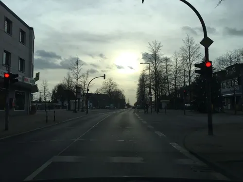
Kornbäcker
Bakery · 5.7 km
4 Dudelerstraße, Oberhausen
Mo-Sa 06:00-18:00;Sa 06:00-13:00;Su 08:00-11:00,14:00-16:00
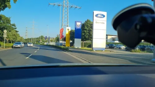
Swingerclub Escándalo
Bar and pub · 0.9 km
Club befindet sich direkt über dem Spielcasino Vulkan Stern.
8 Hanielstraße, Dinslaken
Mo-We 16:00-22:00, Fr,Sa 20:00-01:00, Th[-1] 10:00-15:00
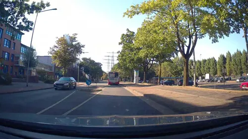
Walsumer Brauhaus Urfels
Restaurant · German · 4.5 km
109 Römerstraße, Duisburg
Tu-Th 11:30-21:00; Fr-Sa 11:30-22:00, Su,PH 10:30-22:00
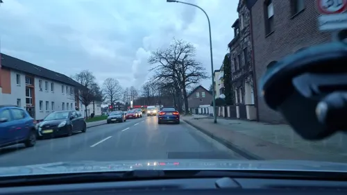
Athos
Restaurant · Greek · 3.9 km
397 Dr.-Wilhelm-Roelen-Straße, Duisburg
17:00-24:00;Sa,Su,PH 12:00-15:00

Mammas Simple Food
Restaurant · Pizza · 1.0 km
42 Otto-Lilienthal-Straße, Dinslaken
Mo-Sa 12:00-14:30,17:30-22:00; Su 16:30-22:00
Ming
Restaurant · Chinese · 1.3 km
7 Am Alten Drahtwerk, Dinslaken
Mo-Sa 12:00-15:00,17:30-23:00; PH,Su 12:15-23:00
Soul Sushi Dinslaken
Restaurant · Sushi
64 Neustraße, Dinslaken
Mo-Th 11:00-21:30; Fr 11:00-22:00; Sa,Su 12:00-22:00
ZELOH
Restaurant · International · 2.5 km
9 Energiering, Dinslaken
Fr 17:30-22:00; Sa 10:00-22:00; Su,PH 10:00-18:00
189 more on the map.
More about Dinslaken
Geography
Dinslaken is a city of the Lower Rhine region and situated at the northwestern margin of the Ruhr area, approx. 15 kilometres (9 miles) north of Duisburg.
From the Wikipedia article Dinslaken, under CC BY-SA 4.0.
Notable people from Dinslaken
 Linda DallmannGerman association football playerPhoto: Steffen Prößdorf, CC BY-SA 4.0
 Wolfgang de BeerGerman footballer (1964–2024)Photo: Helmut S. Otto, Public domain
 Paula KalenbergGerman actress (born 1986)Photo: Martin Kraft, CC BY-SA 4.0
 Thomas HoerenGerman jurisprudent (Information and Media Law)Photo: Wolfgang Borrs, CC BY-SA 4.0
 Katrin HimmlerGerman writer and the great-niece of Heinrich HimmlerPhoto: Matthias Süßen, CC BY-SA 4.0
 Michael WendlerGerman singerPhoto: Michael Schilling, CC BY-SA 3.0
 Ralf KellenersGerman racing driverPhoto: Hans J E, CC BY-SA 2.0
 Wolfgang Strengmann-KuhnGerman politician and economistPhoto: Foto-AG Gymnasium Melle, CC BY 3.0
- Serkan ÇalıkTurkish association football player (born 1986)
- August DickmannGerman conscientious objector
- Dietrich BarfurthGerman anatomist (1849–1927)
- Friedrich AlthoffGerman public servant and politician (1839-1908)
Born in Dinslaken, according to Wikidata (CC0). Each name links to its Wikipedia article.
Where to stay8
Churches and places of worship37
Shopping62
Gas and EV charging23
Freie Tankstelle
Gas station · 3.5 km
234 Dinslakener Straße, Voerde (Niederrhein)
Schools, colleges and libraries51
Städt. Gemeinschaftsgrundschule am Rheinbogen (Teilstandort Orsoy)
School · 5.6 km
2 Nordwall, Rheinberg
Healthcare30
Map of Dinslaken
250 places. The map loads OpenStreetMap tiles when you open it.
Getting there and nearby towns
Flughafen Essen-Mülheim (ESS) is the nearest airport with scheduled flights listed in OpenStreetMap, 22 km away.
- Voerde 6 km northwest, about 6 min by car
- Hünxe 9 km north, about 9 min by car
- Rheinberg 10 km west, about 10 min by car
- Grafenwald 12 km east, about 12 min by car
- Oberhausen 12 km southeast, about 12 min by car
- Bottrop 13 km east, about 13 min by car
- Duisburg 15 km south, about 15 min by car
- Moers 14 km southwest, about 14 min by car
- Wesel 14 km northwest, about 14 min by car
- Kamp-Lintfort 15 km southwest, about 15 min by car
Drive times are estimates from straight-line distance, not routes.
Towns near Dinslaken


Keep exploring
Local news
Headlines from INDB.
Reviews, tips and questions
Loading what members have shared...
Sources and licences
- GeoNames (CC BY 4.0): population, coordinates, regions and time zone
- Mapillary (see each image): photos
- OpenStreetMap contributors (ODbL 1.0): places, airports, map data
- Wikidata (CC0 1.0): elevation, founding date, time zone, website, landmarks and historic places
- Wikimedia Commons (see each image): photos
- Wikipedia (CC BY-SA 4.0): overview and history text
Photo credits
- Loesch, Hannes Gerwers, CC BY-SA 3.0
- Lage Stolperstein Heinrichstr 10 Dinslaken (Brzechwa), Makrameus, CC0
- Stolperstein Heinrichstraße 10 Dinslaken Johann Brzechwa, Makrameus, CC0
- Dinslaken, Germany - panoramio (4), enonim, CC BY-SA 3.0
- Stolperstein Dinslaken Wielandstraße 1a Mendel Heilbronn, Makrameus, CC0
- Stolperstein Dinslaken Wielandstraße 1a Helene Heilbronn, Makrameus, CC0
- Stolperstein Bahnstraße 3 Dinslaken Sofie Stahl, Makrameus, CC0
- Stolperstein Bahnstraße 3 Dinslaken Sally Stahl, Makrameus, CC0
- Stolperstein Bahnstraße 3 Dinslaken Ilse Stahl-Spier, Makrameus, CC0
- Lage Stolpersteine Neustraße 7 Dinslaken (Salmon), Makrameus, CC0
- Stolperstein Bahnstraße 15 Dinslaken Hugo Cohen, Makrameus, CC0
- Stolperstein Bahnstraße 15 Dinslaken Bernd Cohen, Makrameus, CC0
- Stolperstein Bahnstraße 15 Dinslaken Selma de Jonge, Makrameus, CC0
- Stolperstein Bahnstraße 15 Dinslaken Leopold Werner Cohen, Makrameus, CC0
- Stolperstein Bahnstraße 15 Dinslaken Heinz Cohen, Makrameus, CC0
- Stolperstein Bahnstraße 15 Dinslaken Else Cohen, Makrameus, CC0
- Gasometer Stadtwerke Dinslaken Gerhard-Malina-Straße, Makrameus, CC0
- Stolperstein Neustraße 43 Dinslaken Oskar Steuer, Makrameus, CC0
- Stolperstein Neustraße 43 Dinslaken Regina Garbownik, Makrameus, CC0
- Stolperstein Neustraße 43 Dinslaken Ruth Frohmann, Makrameus, CC0
- Stolperstein Neustraße 43 Dinslaken Max Steuer, Makrameus, CC0
- Stolperstein Neustraße 43 Dinslaken Günther Nussbaum, Makrameus, CC0
- Stolperstein Neustraße 43 Dinslaken Lieselotte Frohmann, Makrameus, CC0
- Stolperstein Neustraße 43 Dinslaken Paula Minna Getzler, Makrameus, CC0
- Stolperstein Neustraße 43 Dinslaken Fritz Ehrlich, Makrameus, CC0
- Stolperstein Neustraße 43 Dinslaken Franziska Garbownik, Makrameus, CC0
- Stolperstein Neustraße 43 Dinslaken Auguste Getzler, Makrameus, CC0
- Stolperstein Neustraße 43 Dinslaken Heinz Eschwege, Makrameus, CC0
- Lage Stolpersteine Neustraße 43 Dinslaken, Makrameus, CC0
- Stolperstein Wilhelm-Lantermann-Straße 47 Dinslaken Dagobert Isaacson, Makrameus, CC0
- Stolperstein Wilhelm-Lantermann-Straße 47 Dinslaken Anna Isaacson, Makrameus, CC0
- Lage Stolpersteine Wilhelm-Lantermann-Straße 47 Dinslaken (Isaacson), Makrameus, CC0
- Stolperstein Wilhelm-Lantermann-Straße 51 Dinslaken Sarah Mahnke, Makrameus, CC0
- Stolperstein Wilhelm-Lantermann-Straße 56 Dinslaken Anita Isaacson, Makrameus, CC0
- Stolperstein Wilhelm-Lantermann-Straße 56 Dinslaken Hedwig Isaacson, Makrameus, CC0
- Stolperstein Wilhelm-Lantermann-Straße 56 Dinslaken Emma Isaacson, Makrameus, CC0
- Burghofbuehne Dinslaken, Daniel Ullrich Threedots, CC BY-SA 3.0
- Kastell Holten (2), B. Gutleben, CC BY-SA 3.0
- Dinslaken, Burg Dinslaken, 2011-05 CN-01 retouched, kaʁstn Disk / Cat, CC BY-SA 3.0 de
- NRW, Dinslaken - Evangelische Stadtkirche 01, Островский Александр, Киев, CC BY-SA 3.0
- HausWatereck1680, Dusdia, CC0
- Revierpark Mattlerbusch, Trimmpfad, Krd, CC BY-SA 3.0
- Dinslaken, Theodor-Heuss-Gymnasium, 2011-05 CN-01, kaʁstn Disk / Cat, CC BY-SA 3.0 de
- Dinslaken, Mühlenmuseum, 2011-05 CN-03, kaʁstn Disk / Cat, CC BY-SA 3.0 de
- Neutor Galerie Dinslaken, Martin Rybka, CC BY-SA 4.0
- Dinslaken Walsum Rheinaue Rheindeich 7448 201704, Matthias Nonnenmacher, CC BY-SA 4.0
- Duisburg, Aldenrade, St. Josef, 2012-05 CN-01, kaʁstn Disk / Cat, CC BY-SA 3.0 de
- Kolonie Lohberg82260, Rainer Halama, CC BY-SA 3.0
- Kopernikus-Gymnasium Walsum B Gebäude, Kantul, CC BY-SA 3.0
- St. Ludgerus, Duisburg-Aldenrade, Thomas Dodt, CC BY-SA 4.0
- Johann-Baptist-Sterkrade, Anne-theater, CC BY-SA 3.0
- St. Elisabeth, Duisburg-Vierlinden, Thomas Dodt, CC BY-SA 3.0
- EvKircheHolten, SilvioMartin, CC BY-SA 4.0
- Evangelische Kirche Kempkenstraße, Kempken46147, CC BY-SA 4.0
- Herz Jesu, Duisburg-Overbruch, Thomas Dodt, CC BY-SA 4.0
- Im Fort (OB-003) Oberhausen, NRW, D, Blick westlich der Fortstrasse Richtung BAB A3, Grüpla, CC BY-SA 3.0
- Rheinaue-2, Unknown author, CC BY-SA 3.0
- Street-level photo, diecookieente, CC BY-SA 4.0
- Street-level photo, poxonline, CC BY-SA 4.0
- Street-level photo, poxonline, CC BY-SA 4.0
- Street-level photo, poxonline, CC BY-SA 4.0
- Street-level photo, klimakas, CC BY-SA 4.0
- Street-level photo, poxonline, CC BY-SA 4.0
- Street-level photo, poxonline, CC BY-SA 4.0
- Street-level photo, wladimir, CC BY-SA 4.0
- Street-level photo, LouCipher, CC BY-SA 4.0
- Street-level photo, diecookieente, CC BY-SA 4.0
- Street-level photo, uwekoch, CC BY-SA 4.0
- Street-level photo, diecookieente, CC BY-SA 4.0
- Street-level photo, poxonline, CC BY-SA 4.0
- Street-level photo, poxonline, CC BY-SA 4.0
- Street-level photo, poxonline, CC BY-SA 4.0
- Street-level photo, LouCipher, CC BY-SA 4.0
- Street-level photo, diecookieente, CC BY-SA 4.0
- Street-level photo, LouCipher, CC BY-SA 4.0
- Street-level photo, geogladbecker, CC BY-SA 4.0


Page built November 9, 2026. Spotted a mistake? Tell us or suggest a place.